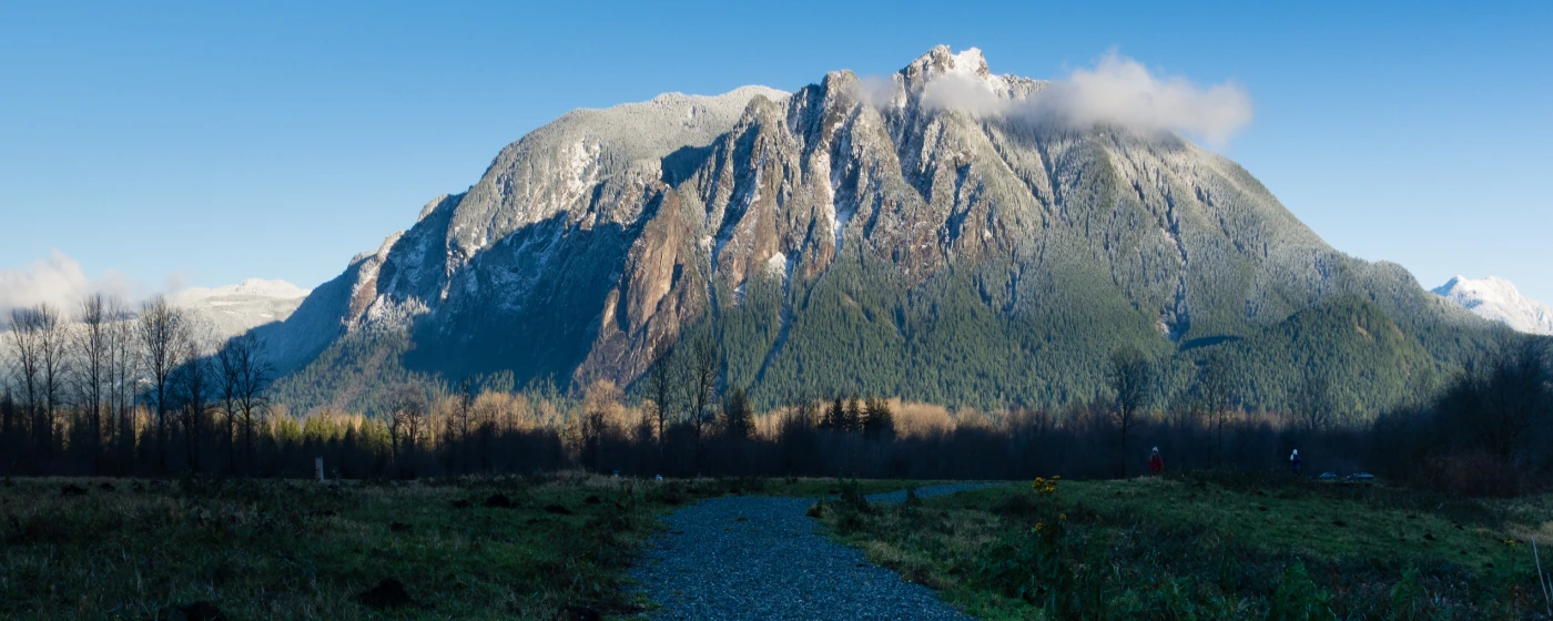
People move to North Bend for a lot of reasons — the I-90 corridor, the relative affordability compared to Bellevue, the small-town feel. But the thing that surprises most newcomers after six months isn't any of that. It's realizing that the outdoor recreation here isn't a weekend amenity — it's the organizing principle of daily life. Your neighbors aren't talking about brunch spots; they're talking about whether the trail conditions on Si are icy above 2,500 feet. The mountains aren't a backdrop. They're the whole point.
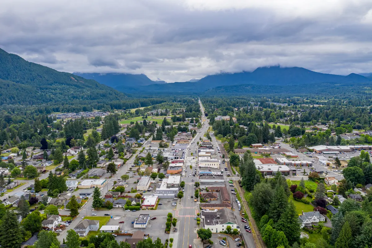
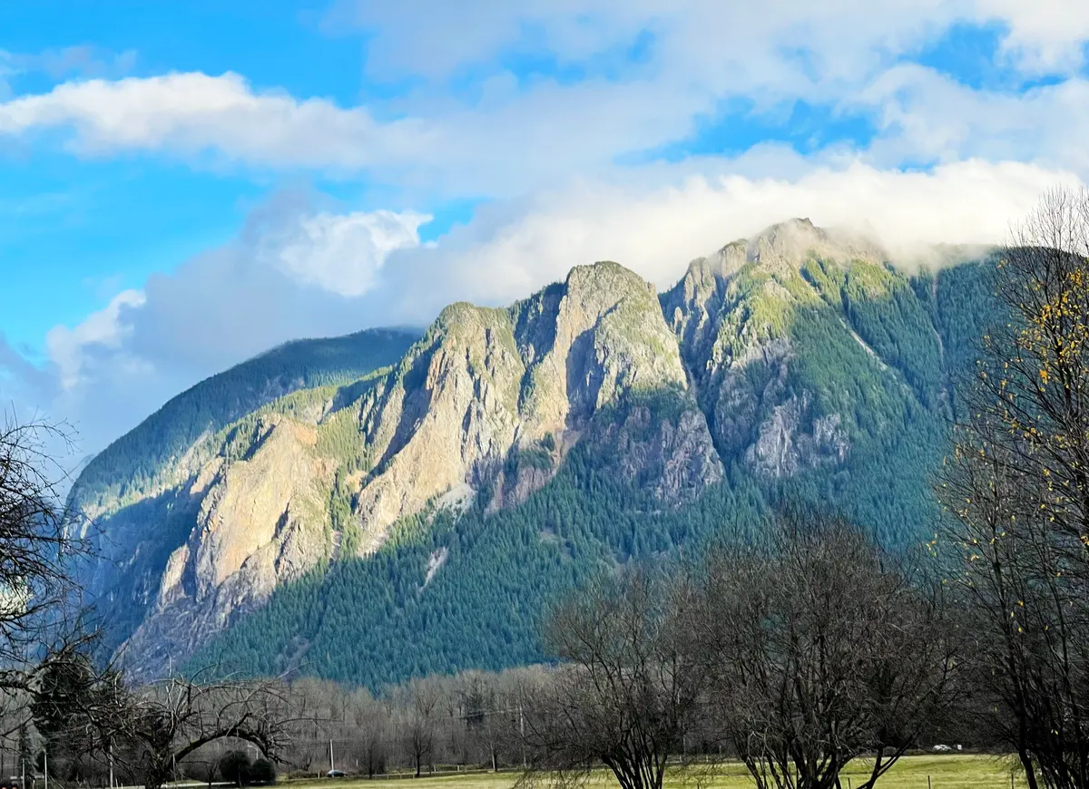
North Bend sits in the upper Snoqualmie Valley at the base of the Cascade Range, where I-90 begins its serious climb toward Snoqualmie Pass. Mount Si rises directly above the town's eastern edge — on clear mornings you can read its ridgeline from the parking lot of the North Bend Premium Outlets. The Snoqualmie River bends through the valley floor, and within a ten-minute drive of downtown you can access Washington State's most-hiked trail, a National Recreation Trail that once carried Milwaukee Road trains, and a DNR-managed scenic area with viewpoints that stop hikers mid-step. This concentration of access, at this price point, is genuinely unusual for the Seattle metro.
The Si View Metropolitan Park District — formed in 2003 specifically to keep the community pool open when King County planned to close it — now manages nearly 900 acres of parkland and runs more than $2,400 recreation programs per year. That's a meaningful local institution for a city of 8,268 people. The district's main campus at Si View Park on SE Orchard Drive anchors the social calendar with free summer concerts on Thursdays, Movies in the Park, and the Festival at Mt. Si every August. Youth sports registration fills fast; the schools page has more on organized youth activities in the area.
This guide covers the signature trails, the park system, water and seasonal recreation, and the practical details — trailhead passes, closures, transit access, and what each option actually demands of you — so you can calibrate whether North Bend's outdoor life matches how you actually want to spend your weekends.
Mount Si, Little Si, and the Trailhead That Defines the Town
Washington's most-hiked trail begins at the end of Mount Si Road, less than three miles from downtown North Bend. That proximity is the whole story — there is no other city of 8,000 people in the state where the most-trafficked trail in Washington is a five-minute drive from the grocery store.
Main Si: The Real Climb
The main Mount Si trail covers 8.1 miles out and back, gaining approximately 3,150 to 3,317 feet of elevation before topping out near 3,900 to 4,000 feet. The views from the summit area take in the Snoqualmie River Valley below, the Cascade Range to the east, and Mount Rainier on clear days to the south. More than 100,000 visitors make this hike annually — a figure that explains the packed parking lot at 7 a.m. on summer Saturdays and the genuine mud problem on the lower trail after rain.
Plan for four to six hours round-trip if you're fit; longer if you're bringing kids or new hikers. The upper mile, which scrambles up to the Haystack summit block, requires comfortable exposure to steep terrain. Many hikers turn around at the main viewpoint below the Haystack — that's still a full day and a significant workout.
Little Si: The Smarter Weekend Option
Little Si shares the same Natural Resources Conservation Area and offers a 4.7-mile round-trip option — including the Boulder Garden Loop — with roughly 1,182 feet of elevation gain. Families with younger children default to Little Si for exactly the right reasons: it delivers genuine mountain terrain and real elevation without committing to a full day. The trailhead access is the same area, and the crowds are noticeably lighter than on the main trail.
The Practical Details
A Washington State Discover Pass is required at the Mount Si trailhead — don't skip it, enforcement is active on weekends. If you're coming from Seattle without a car, King County's Trailhead Direct bus service runs on weekends and designated holidays, connecting directly from Capitol Hill light rail station to the Mount Si trailhead at regular King County Metro fares. It's one of the few major Cascade Range trailheads genuinely accessible by transit.
One thing locals learn fast: don't attempt main Si on a holiday weekend without arriving before 8 a.m. The lot fills completely, and parking on Mount Si Road creates a genuine bottleneck. Mid-week mornings in summer are a different experience entirely — the trail empties out and the lower forest section, draped in old-growth Douglas fir, feels like the mountain belongs to you.
Best for: Serious hikers, runners, and anyone who wants the bragging rights of Washington's defining day hike in their backyard.
Rattlesnake Ledge and the Palouse to Cascades Trail
Two of the most-visited trail experiences near North Bend operate at completely opposite ends of the difficulty spectrum — and both start from the same stretch of Cedar Falls Road SE.
Rattlesnake Ledge: The Valley's Most Rewarding Short Hike
The Rattlesnake Ledge Trail climbs 1,000 to 1,160 feet over 2 miles to reach a viewpoint at roughly 2,078 to 2,100 feet elevation — not technical, not long, but the payoff is outsized. From the ledge you're looking directly across at Mount Si, down at Rattlesnake Lake, and out over the Cedar River Watershed toward Mailbox Peak. The Washington Department of Natural Resources manages the area as part of Rattlesnake Mountain Scenic Area. Dogs are welcome on leash, which makes this one of the more dog-friendly destination hikes in the county.
The 4-mile round-trip distance is genuinely accessible for most fitness levels, which is why Rattlesnake Ledge sees enormous weekend crowds. First-time visitors who show up at 10 a.m. on a Sunday in July will find the ledge standing-room only. The solution is the same as Si: earlier is better, and the trail itself is beautiful enough that a 7 a.m. start feels like a reward rather than a sacrifice. A Discover Pass is required at the Rattlesnake Lake trailhead.
Palouse to Cascades: Flat, Long, and Historically Loaded
The Palouse to Cascades State Park Trail — formerly known as the Iron Horse or John Wayne Pioneer Trail — is a rail-trail that runs more than 285 miles from Cedar Falls near North Bend all the way to the Idaho border. Its western trailhead sits at the Rattlesnake Lake Recreation Area on Cedar Falls Road SE, approximately 35 miles from downtown Seattle. The trail follows the original right-of-way of the Milwaukee Road railroad, which operated from 1908 until 1980, and maintains a grade of 2.2% or less across its entire western hundred-mile stretch.
That gentle grade is the point. Cyclists, equestrians, and families with kids can cover serious distance on the Palouse to Cascades without the relentless climbing that defines most Cascade Range terrain. The trail was designated a National Recreation Trail in 2002. Its signature feature — the 2.3-mile Snoqualmie Tunnel near Hyak — runs through a dark, renovated railroad bore at roughly 2,600 feet elevation, with a concrete lining and a new walking surface. Bring a headlamp; the tunnel is cold and completely lightless at its center even in summer.
Current Closure — Check Before You Go
As of December 2025, two segments of the Palouse to Cascades trail are closed due to storm damage and washouts: the stretch from Cedar Falls Trailhead to the Snoqualmie Tunnel, and the section from Hyak to Easton. Verify current conditions directly with Washington State Parks before planning any trip into those segments — conditions in the Cascade Range change faster than most trail apps update.
| Trail | Distance (RT) | Elevation Gain | Difficulty | Pass Required |
|---|---|---|---|---|
| Mount Si (Main) | 8.1 mi | ~3,150–3,317 ft | Strenuous | Discover Pass |
| Little Si | 4.7 mi | ~1,182 ft | Moderate | Discover Pass |
| Rattlesnake Ledge | 4.0 mi | ~1,000–1,160 ft | Moderate | Discover Pass |
| Palouse to Cascades (flat rail-trail) | Varies (285+ mi total) | ≤2.2% grade | Easy–Moderate | Discover Pass |
| Mt. Si VK (race, Oct) | 2.9 mi | ~3,300 ft | Extreme | Race entry |
| Rattlesnake Mountain (full ridge) | ~12 mi | ~2,600 ft | Strenuous | Discover Pass |
* Trail conditions and closures change seasonally — always verify with Washington Trails Association or Washington State Parks before departure.
Best for: Anyone who wants a realistic cross-section of the area's trail options, from a first hike with visiting family to a weekend ride covering 30 flat miles on the rail-trail.
Si View Park and the Community Recreation Layer
Not everyone who moves to North Bend is training for a vertical kilometer race. The community's everyday recreational life centers on Si View Park at 400 SE Orchard Drive — a 10.7-acre site that functions as the town's living room.
What Si View Actually Offers
The park's centerpiece is a historic community center with a 15,000-square-foot indoor swimming pool — the facility the Si View Metropolitan Park District was literally created to save when King County threatened closure in 2003. Alongside the pool, the building holds a gymnasium with basketball courts and classrooms. Outside, the campus includes youth baseball fields, soccer and football fields, playgrounds, picnic tables, and a covered shelter.
The district now manages nearly 900 acres of parkland and open space across the upper Snoqualmie Valley and runs more than $2,400 recreation programs annually. That's a serious local infrastructure for a small city — and it's why families with school-age children often cite the park district as one of the first things they researched before moving here.
The Social Calendar Runs Through Here
Si View Park hosts the North Bend Farmers Market and free Summer Concerts on Thursday evenings from June through September. The Festival at Mt. Si lands on the second weekend of August — a full community event with live music and local vendors that draws the whole valley. The Si View Harvest Festival, Movies in the Park, and Family Fun Days fill out the rest of the calendar.
This is where North Bend families actually gather. Thursday concert nights in July, with the outline of Mount Si still lit at 8 p.m., are one of those genuinely local experiences that don't photograph well but stick with people for years after they move here. New residents who skip these events in their first summer sometimes regret it — it takes longer to feel rooted when you're not showing up to the places where the community already is.
The Race Culture Side
North Bend Trail Fest hosts the annual Mt. Si VK — a Vertical Kilometer race covering 2.9 miles with approximately 3,300 feet of elevation gain straight up the Old Si Trail. The 2026 edition is scheduled for October 3rd. It's one of the few true VK races in the United States and draws serious mountain runners from across the region. If you're a trail runner considering a move here, this event alone signals how the town positions itself relative to the broader running community. After the race, Volition Brewing Co. on W North Bend Way is the natural landing spot — a local taproom within the walkable downtown strip.
Best for: Families Transit Residents who want organized recreation, community events, and a pool without driving to a gym in Issaquah.
Looking to buy in North Bend? Estimate your payment.
Enter your numbers to see an estimated monthly mortgage payment.
Estimate only. Excludes HOA fees and mortgage insurance. The interest rate above is a starting point, not a quoted rate — replace it with your own to see real numbers. Insurance is a flat placeholder, not a North Bend quote.
Water, Seasons, and What Recreation Looks Like Year-Round
North Bend's outdoor calendar doesn't pause in November. It just shifts — which is either appealing or alarming depending on where you're moving from.
The Snoqualmie River
The Snoqualmie River moves through the valley floor below town and is the backdrop for much of the riverfront green space in the Riverbend and Si View neighborhoods. Fishing and wildlife watching along the river corridor are genuine local activities, not tourism-brochure fictions. The river runs cold year-round — swimming in the main channel is less common than in drier parts of the state — but the river access points and adjacent open space give the valley a different pace than the mountain trail experience.
What Happens in Winter
Snoqualmie Pass sits roughly 30 minutes east on I-90, which means North Bend residents have ski area access that most Seattle-area neighborhoods can only approximate with a much longer drive. The Palouse to Cascades rail-trail is also open to snowshoers in winter, and the lower sections of the Mount Si trail see snowshoe traffic on the right conditions. The upper trail accumulates real snow by December and holds it into spring — experienced hikers and snowshoers know this well; newcomers who don't check conditions sometimes turn a moderate hike into a survival exercise.
The Rain Reality
The upper Snoqualmie Valley receives more precipitation than Seattle proper — the foothills lift and squeeze moisture out of Pacific systems more aggressively than the lowlands. The trails here are muddy in ways that surprise people used to drier mountain ranges. The lower Mount Si trail churns into a serious boot-sucker from October through April. This isn't a reason not to move here — most long-term residents simply own the right footwear and keep hiking — but it is the seasonal quirk that no one from Arizona fully anticipates in their first winter.
What the Recreation Picture Adds Up To
| Season | Primary Activities | Local Notes |
|---|---|---|
| Spring (Mar–May) | Lower trail hiking, cycling, river walks | Mud season on Si; snowpack lingers above 3,000 ft through May |
| Summer (Jun–Aug) | Full Si hike, Rattlesnake Ledge, rail-trail cycling, Si View events | Trailhead lots full by 8 a.m. on weekends; Thursday concerts at Si View |
| Fall (Sep–Nov) | Trail running, Mt. Si VK (Oct), snowshoe prep | Crowds thin dramatically after Labor Day; best trail conditions of the year |
| Winter (Dec–Feb) | Snowshoeing, skiing at Snoqualmie Pass, pool at Si View | Upper Si trail requires microspikes or snowshoes by December most years |
Fall is the open secret. September and October bring the lightest trail crowds of the year, the sharpest air, and the clearest views from Rattlesnake Ledge and the Si summit area. Residents who discover this in their first autumn tend to restructure their entire hiking calendar around it going forward.
Best for: Nature Quiet Anyone willing to own waterproof boots and accept that outdoor life here requires showing up regardless of what the forecast says.
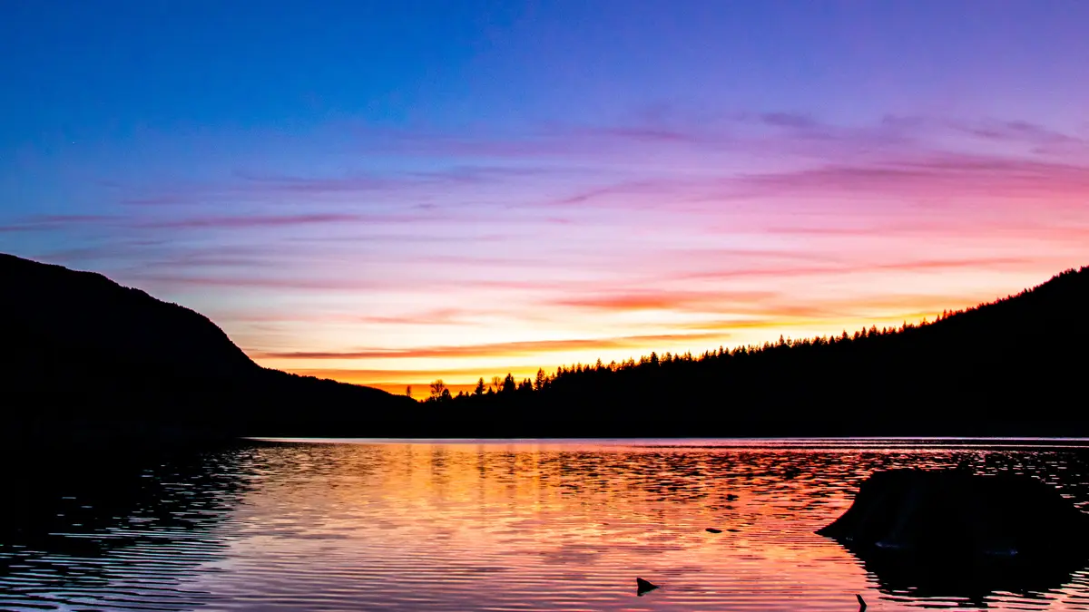
Local Expert Takeaway: The outdoor access in North Bend is not a feature of living here — it's the reason living here makes sense at the price point. You are paying for proximity to Washington's most-hiked trail, a flat rail-trail that stretches to Idaho, a DNR scenic area with ledge views 2,000 feet above the valley, and a park district that runs an indoor pool and $2,400 programs a year from a 10.7-acre campus on SE Orchard Drive. The catch is real: trailhead parking fills fast, rain turns lower Si into boot-deep mud for half the year, and sections of the Palouse to Cascades trail are closed due to storm damage — check Washington State Parks before you drive to Cedar Falls. But if you move here and only use Si View Park for Thursday summer concerts and show up on Rattlesnake Ledge on a Tuesday morning in October, you will immediately understand why people who leave North Bend almost always say they miss the trails first.
Quick Takeaways & FAQs
✅ Mount Si — the most-hiked trail in Washington State — is a five-minute drive from downtown North Bend, with a transit connection via King County's Trailhead Direct bus from Capitol Hill light rail.
⚠️ The Palouse to Cascades trail has active closures between Cedar Falls and the Snoqualmie Tunnel as of December 2025 — confirm current conditions with Washington State Parks before making the drive.
📍 A Washington State Discover Pass is required at both the Mount Si trailhead and the Rattlesnake Lake trailhead; budget for an annual pass ($35) if you plan to hike here regularly.
Do I need a pass to hike Mount Si or Rattlesnake Ledge near North Bend?
How hard is the Mount Si hike, and is it appropriate for kids?
Is the Palouse to Cascades trail open near North Bend right now?
What does Si View Metropolitan Park District offer for residents?
Can I get to Mount Si from Seattle without a car?
Moving to Washington?
Tell us what you need help with and we'll connect you with local resources.
