
The first thing most people find when they Google Federal Way is a crime statistic that makes them nervous. The second thing — if they keep reading — is that the picture is more complicated, and more encouraging, than that initial number suggests. Federal Way sits at the southern edge of King County, roughly 30 miles south of Seattle via I-5 and SR-99, and for years Pacific Highway S. (the city's commercial spine) set the tone for how outsiders perceived the whole city. That reputation has always obscured the quieter, tree-lined neighborhoods a mile or two off that corridor.
The headline figures from FBI Uniform Crime Report data for 2024 are real: Federal Way's violent crime rate sits at 5.3 per 1,000 residents and its property crime rate at 41.7 per 1,000 — both above state and national averages. But the trend line underneath those numbers is what matters most to someone choosing a neighborhood. Overall crime dropped more than 11% year-over-year in 2024, and the period from January through August 2025 compared against the same window in 2024 showed an additional 25% citywide reduction. That is not a rounding error — it reflects a deliberate enforcement shift and the downstream effects of updated Washington State narcotics legislation.
The city is not uniformly risky, and it is not uniformly safe either. Twin Lakes and Steel Lake register as genuinely lower-crime pockets. Redondo and Dash Point carry the feel of waterfront communities more than urban centers. Federal Way City Center and the Pacific Highway S. corridor are where concentrated activity still shows up in the data. Knowing which of those environments you are moving into matters far more than a single citywide number.
This guide breaks down Federal Way's crime statistics in context, maps them to specific neighborhoods, explains the trajectory the data shows, gives you the practical tools FWPD makes available to residents, and points to the honest limitations of what any dataset can tell you.
Federal Way Crime Rates in Context: What the Numbers Actually Mean
Federal Way's violent crime rate of 5.3 per 1,000 residents and property crime rate of 41.7 per 1,000 residents — drawn from FBI Uniform Crime Report data for 2024 — land above both state and national averages. That is the honest starting point. But comparing Federal Way to the national average is a bit like comparing a dense inner-ring suburb to a rural county: the benchmark obscures more than it reveals.
How Federal Way Compares
| Geography | Violent Crime (per 1k) | Property Crime (per 1k) | Notes |
|---|---|---|---|
| Federal Way, WA | 5.3 | 41.7 | FBI UCR 2024 data |
| Washington State avg. | ~3.5 | ~31.0 | Above state average |
| U.S. National avg. | ~4.0 | ~22.0 | Above national average |
| Tacoma, WA (nearby) | ~8.5 | ~55.0 | Notably higher violent crime |
| Kent, WA (nearby) | ~5.8 | ~46.0 | Comparable range |
| Auburn, WA (nearby) | ~5.5 | ~44.0 | Comparable range |
The regional context matters. Federal Way sits in a cluster of South King County cities — Kent, Auburn, Des Moines — where property crime rates are broadly elevated compared to the Eastside suburbs or rural Washington. Compared to Tacoma immediately to the south, Federal Way's violent crime figure looks noticeably lower.
What the Trend Line Shows
The 2024 annual figure is a snapshot of a city moving in a specific direction. Between January and August 2025 versus the same period in 2024, robbery fell 49%, motor vehicle theft fell 55%, commercial burglary fell 68%, residential burglary fell 32%, aggravated assault fell 33%, and shots-fired incidents fell 46%. Those are not marginal improvements — they represent a meaningful structural shift in Federal Way's crime picture.
The one counter-trend is homicides. Homicides rose from four to eight in the same comparison window, with FWPD Commander Kyle Buchanan noting that four of the eight were domestic-violence related. That figure deserves honest acknowledgment. It is a small absolute number in a city of 100,000, but it is a real increase that the broader crime-drop narrative should not paper over.
Neighborhood-by-Neighborhood Safety: Where the Risk Is Concentrated
The single most useful thing you can do with Federal Way's crime data is stop reading it at the city level. The distance between the city's safest and least-safe areas is large enough to make the citywide figure nearly meaningless for someone choosing a specific block. For a full neighborhood character breakdown, see the best neighborhoods guide — this section focuses specifically on the safety dimension.
Twin Lakes
Twin Lakes earns a 'B' crime grade from CrimeGrade.org (May 2026) and sits in the 63rd percentile for safety nationally — meaning it is safer than roughly two-thirds of U.S. neighborhoods. Its overall crime rate of approximately 30.51 per 1,000 residents is well below the citywide figure of 41.7 on property crime alone. The northern portion of the neighborhood, tucked away from the SR-509 corridor, records roughly 20 crimes per year — a number that sounds like a quiet suburb because, by Federal Way standards, it is.
Resident feedback in neighborhood forums consistently describes Twin Lakes as family-oriented, quiet, and walkable. That consensus holds up in the data.
Best for: Families Quiet
Steel Lake
Steel Lake's safety reputation is built on community investment as much as geography. The city renewed the Steel Lake Management District in 2024 for a 10-year program through 2033 — that kind of long-range civic infrastructure signals a neighborhood where residents are organized and engaged, which tends to correlate with lower crime. Neighborhood feedback consistently flags it as safe, dog-friendly, and walkable.
Its proximity to the Federal Way Transit Center — now served by Sound Transit's 1 Line extension that opened December 6, 2025 — also means it draws a stable, transit-oriented residential population rather than transient commercial traffic.
Best for: Transit Families
Dash Point and Redondo
Both neighborhoods sit at the western edge of Federal Way, oriented toward Puget Sound rather than Pacific Highway S. Their geographic separation from the city's commercial corridors means they see significantly less of the property crime that tends to cluster around retail-dense areas. Dash Point, anchored by Dash Point State Park, has the feel of a community that opted out of urban density entirely.
The trade-off is that they are among Federal Way's more isolated pockets — a quiet that most residents there consider a feature, not a limitation.
Best for: Nature Views Privacy
Lakota, Woodmont, and Lakeland
These mid-city neighborhoods sit between the quieter western residential areas and the more active Pacific Highway S. corridor. Crime levels here are generally below the citywide average but above the Twin Lakes or Dash Point figures — a middle ground that many families find acceptable given their more central locations. Lakeland in particular has a newer residential character that tends to self-select for owner-occupancy, which typically correlates with lower property crime.
Best for: Families Value
Federal Way City Center and the Pacific Highway S. Corridor
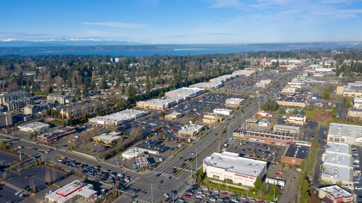
This is where Federal Way's elevated crime statistics are actually concentrated. The City Center area — anchored by The Commons mall and running along Pacific Highway S. between roughly S. 320th and S. 348th — carries the highest crime density in the city. Property crime around retail clusters is a predictable pattern in any commercial corridor, but Federal Way's Pacific Highway S. stretch has historically had more than its share of vehicle break-ins, theft, and occasional violent incidents.
The ongoing revitalization push around the City Center — including transit-oriented development near the new light rail station — may shift this over time. But anyone choosing a specific address in or adjacent to this corridor should verify the immediate block's incident history, not just the neighborhood label.
Best for: Walkable Transit

The 2024–2025 Enforcement Shift: What Changed and Why
Federal Way's crime drop did not happen by accident. Two forces converged in 2024: a deliberate strategic shift by the Federal Way Police Department, and updated Washington State legislation that gave officers clearer authority to make drug-related arrests following the policy confusion of the Blake decision years.
What FWPD Changed
The department's data from January through August 2025 shows a 38% increase in drug-related arrests compared to the same period in 2024. That figure reflects exactly the kind of enforcement concentration that tends to drive property crime down — drug-market activity around commercial corridors is one of the most reliable predictors of car break-ins and retail theft in Pacific Northwest cities. Disrupting it moves the numbers.
The shots-fired figure is the most striking: a 46% reduction. That is not a data artifact — it represents real changes in where and how frequently firearms-related incidents occurred across the city.
The Homicide Counter-Trend
The honest version of this story has to name the exception. Homicides rose from four to eight between the January–August 2024 and January–August 2025 windows. FWPD Commander Kyle Buchanan publicly noted that four of the eight were domestic-violence related — a category of crime that is largely disconnected from the patrol and enforcement strategies that move property crime numbers.
Domestic-violence homicides are a tragically common feature of many American cities, and they are not well predicted by neighborhood-level crime grades or address-level incident maps. They show up across income levels and geographic areas. Federal Way's increase warrants attention, but it should not be conflated with the commercial-corridor and property-crime picture that most relocating residents are actually evaluating.
A Sustained Trend, Not a One-Year Blip
The 2024 full-year data showed an 11% overall crime reduction. The 2025 comparative data through August showed a 25% reduction on top of that. Two consecutive years of meaningful decline in the same direction is the kind of pattern that suggests a structural shift rather than seasonal noise. It does not mean Federal Way's crime picture is resolved — but it does mean the city a relocating resident moves into today is measurably different from the one the older reputation describes.
Looking to buy in Federal Way? Estimate your payment.
Enter your numbers to see an estimated monthly mortgage payment.
Estimate only. Excludes HOA fees and mortgage insurance. The interest rate above is a starting point, not a quoted rate — replace it with your own to see real numbers. Insurance is a flat placeholder, not a Federal Way quote.
Using the City's Own Tools to Research Any Address
Citywide and neighborhood-level statistics are useful starting points. What they cannot do is tell you what has happened on a specific block in the last 90 days. The Federal Way Police Department offers a publicly accessible crime map tool that can.
The Department's Crime Map
The police department's online crime map is fed directly from the department's records management system — meaning it reflects actual reported incidents, not aggregated data with a months-long lag. You can search by address or neighborhood, filter by crime type, and set a radius. More practically, you can sign up for free email alerts by crime type and geography, which means you can monitor a neighborhood you are seriously considering before you commit to it.
That is a genuinely useful capability. Set up alerts for a 0.5-mile radius around any address you are evaluating. Run it for a few weeks. The volume and type of incidents you see in those alerts will tell you more than any aggregate grade.
What the Map Shows — and What It Misses
The department's crime map captures reported incidents. It does not capture crimes that go unreported — which, in every city, skews toward certain categories (domestic incidents, theft from vehicles where nothing of high value was taken, drug transactions). Property crime figures tend to be more complete because insurance claims create reporting incentives. Violent crime figures can undercount incidents where victims do not engage with police.
A practical approach: cross-reference the department's address-level crime map with CrimeGrade.org's address-level reports, and look at neighborhood forums for the specific area — not for individual anecdotes, but for the pattern of what residents are flagging over a 6-to-12-month window.
A Pattern Newcomers Learn the Hard Way
Six months in, many Federal Way residents who picked their neighborhood based on a general safety grade discover that the half-mile between their block and a commercial corridor makes a real difference. A house that backs up to a retail strip on Pacific Highway S. carries a different property crime exposure than one tucked into a cul-de-sac in the Twin Lakes interior — even if both technically fall in the same neighborhood boundary on a map. Checking the crime map by specific address, not just neighborhood name, is the step that separates an informed choice from a surprised one.
What the Safety Picture Means for Day-to-Day Life in Federal Way
Statistics tell you about aggregate outcomes. They do not tell you what it feels like to walk to the park on a Tuesday evening, or whether you will leave packages on your porch, or how quickly the police department responds when something happens nearby. Here is what the data and resident experience together suggest about daily life.
Property Crime Is the Real Friction
Federal Way's elevated property crime rate — 41.7 per 1,000 — is where most residents encounter the city's safety challenges directly. Vehicle break-ins, catalytic converter theft (a pattern that hit South King County cities hard in 2022 and 2023), and occasional porch theft are the friction points that come up most in resident conversations. The good news is that the 2025 data shows motor vehicle theft down 55% and larceny down 22% — the specific categories most likely to affect daily life.
Practical adaptations most Federal Way residents make: locking cars every time, not leaving anything visible in vehicles, using a garage if one is available, and in higher-density areas, using a doorbell camera. These are the same precautions people take in Auburn or Kent — they are not unique to Federal Way, but they are genuinely necessary here.
Where Families Actually Gather
The neighborhoods that feel safest in practice — Twin Lakes, Steel Lake, Dash Point — are also where you will find the day-to-day community infrastructure that signals a settled, engaged population. Steel Lake Park draws families consistently on weekends, and the lake's active management district means the space is maintained at a level that encourages regular use. West Hylebos Wetlands Park and the trails around Dash Point State Park see regular family foot traffic that functions as informal neighborhood watch in its own right.
The Seasonal Wildcard
Federal Way's summers bring a tourism and event bump that most newcomers underestimate. Wild Waves Theme Park — now announced for closure, which will itself change the character of that part of the city — has historically drawn significant weekend traffic along the SR-99 corridor. The Federal Way Performing Arts and Event Center draws evening crowds downtown. More people moving through any area means more opportunity for property crime around parking areas and commercial zones. Residents in the City Center area learn to time errands around event schedules, particularly on summer weekends.
The Honest Summary
Federal Way is not the city its 10-year-old reputation describes, and it is not yet the city its best crime-trend data implies it is becoming. It is a city where the neighborhood you choose matters enormously — where Twin Lakes and the Dash Point waterfront represent a genuinely safe suburban experience, and where City Center blocks adjacent to Pacific Highway S. require a more eyes-open approach. The trajectory is real and encouraging. The starting point is above average, and that context is worth carrying into any neighborhood decision.

Local Expert Takeaway: Federal Way's crime numbers are above average — that is a fact worth acknowledging, not minimizing. But the number that actually matters for anyone moving here is the trajectory: overall crime down 11% in 2024 and another 25% in the first eight months of 2025, with motor vehicle theft and robbery leading the decline. Before settling on a neighborhood, spend 20 minutes with the Federal Way Police Department's online crime map, enter the specific address you are considering, and run a radius search. Twin Lakes and Steel Lake consistently show the most favorable incident patterns; the blocks immediately adjacent to Pacific Highway S. between S. 320th and S. 348th show the highest. The difference between those two environments — in daily experience, not just in statistics — is not subtle.
Quick Takeaways & FAQs
✅ Federal Way's overall crime dropped 25% year-over-year through August 2025, with motor vehicle theft and commercial burglary leading the decline — a meaningful, sustained trend rather than seasonal noise.
⚠️ The citywide property crime rate of 41.7 per 1,000 residents remains above state and national averages, and the Pacific Highway S. commercial corridor still concentrates the bulk of that activity.
📍 The Federal Way Police Department's publicly accessible online crime map lets you search incidents by specific address and set up email alerts by crime type and geography — use it for any block you are seriously considering before you decide.
Is Federal Way, WA a safe place to live?
What types of crime are most common in Federal Way?
Which Federal Way neighborhoods are the safest?
How does Federal Way's crime rate compare to nearby cities like Tacoma and Kent?
How can I research crime at a specific Federal Way address before moving there?
Moving to Washington?
Tell us what you need help with and we'll connect you with local resources.
