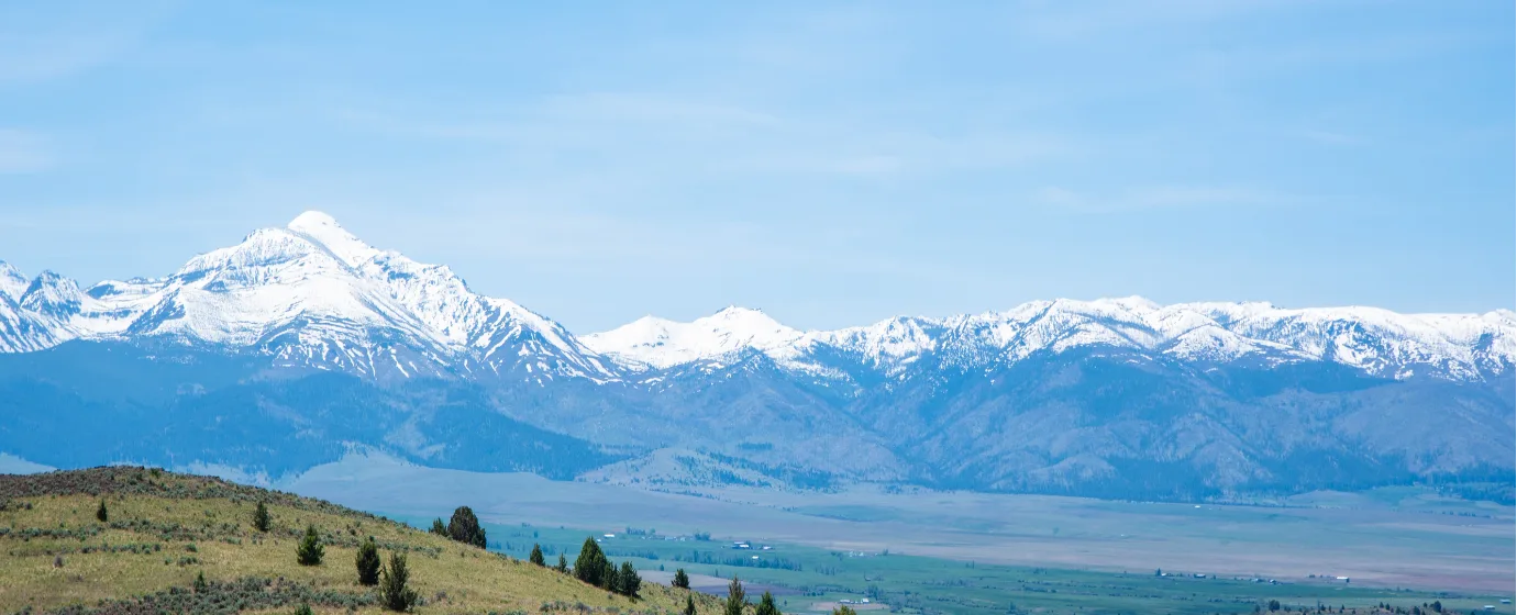
Most people moving to a city this size — 10,135 residents in a high-desert valley — expect limited outdoor infrastructure. Baker City flips that assumption. Within 35 miles you have Oregon's highest-base ski area, a 22-mile alpine ridge trail frequented by mountain goats, and North America's deepest river gorge. Inside city limits, a paved riverside trail connects the public library to the city's main park, and a network of neighborhood parks puts green space within walking distance of most addresses.
What drives people here isn't usually the job market — it's the ratio of landscape to population. The Elkhorn Mountains frame the western skyline, the Powder River runs through the city center, and the US Forest Service is one of the largest employers in town. That last detail matters: it means trail maintenance, land stewardship, and outdoor recreation are embedded in the local economy, not just the local culture. With a typical home price of $268,574 as of July 2026, outdoor access here doesn't cost what it does in Bend or Hood River.
Baker City averages 196 sunny days a year — more than Portland by a wide margin — which makes the outdoor calendar genuinely usable in ways that Western Oregon cities aren't. Winters are cold and real, but the snow falls on Anthony Lakes rather than paralyzing the valley. Spring and fall are long, dry, and ideal for trail running, road cycling, or just walking the Leo Adler Memorial Parkway at dusk while the Powder River runs beside you.
Whether you're considering a move or researching the area, the sections below break down Baker City's city parks, the LAMP trail system, the mountain and canyon recreation that sits just outside town, and what the seasonal outdoor calendar actually looks like for people who live here.
City Parks: Geiser-Pollman and the Neighborhood System
Geiser-Pollman Park is the gravitational center of Baker City's park system — a spread of grass and mature trees along the Powder River that serves as playground, event ground, and community gathering point all at once. Over 100 tree species shade the grounds, which include a gazebo, covered picnic area, horseshoe pits, and restrooms.
The Inclusive Playground
The playground here is worth calling out specifically. It was designed so children using mobility devices can play alongside everyone else — the covered wagon play structure, zipline, climbing tunnels, metal slides, inclusive spinners, accessible swings, multi-user seesaws, and communication boards all sit on accessible synthetic safety surfacing throughout. Parents who have moved here from larger cities are often surprised to find this level of inclusive design in a city of 10,000.
Community Events at the Park
Geiser-Pollman is where Baker City shows up. Miner's Jubilee, the Memory Cruise Car Show, and the Powder River Music Revue all happen here. These aren't small-town footnotes — they're the events that fill the park and pull the community off its front porches. A footbridge near the Baker County Public Library connects the park directly to the Leo Adler Memorial Parkway, so the two anchor amenities function as one continuous corridor.
Neighborhood Parks
Beyond Geiser-Pollman, the city maintains River Park, Sam-O Park, South Baker Park, H Street Park, and Kirkway Park, along with pocket parks and traffic islands distributed across residential areas. The system is broad enough that most neighborhoods have something nearby — not every park is destination-level, but the residential reach is real. Families with kids at the Baker School District 5J schools will find green space within a reasonable walk of most addresses on the west and central sides of town.
| Park | Highlights | Best For |
|---|---|---|
| Geiser-Pollman Park | Powder River frontage, inclusive playground, gazebo, event grounds | Families Walkable |
| Leo Adler Memorial Parkway | 2.35-mile paved riverside trail, connects library to sports complex | Nature Walkable |
| River Park | Powder River access, open green space | Nature Quiet |
| South Baker Park | Neighborhood park serving south residential areas | Families |
| Sam-O Park | Local neighborhood park with residential reach | Families |
| H Street Park | Pocket park in residential corridor | Quiet |
| Kirkway Park | Neighborhood green space, broad system coverage | Families |
The Leo Adler Memorial Parkway: Baker City's Riverside Trail
The Leo Adler Memorial Parkway — locals call it the LAMP — is the kind of infrastructure that takes a city from having parks to having a park system. Built in four phases between 2002 and 2015, it runs approximately 2.35 miles of paved, wheelchair-accessible trail along the Powder River, connecting residential neighborhoods to downtown and back again.
What the Route Actually Covers
The trail runs from Hughes Lane to south Bridge Street. Along the way it passes Geiser-Pollman Park, the Baker County Public Library, and the Baker Heritage Museum — which means a single walk can move through the city's civic and cultural anchors without touching a road. A spur extends to the Baker Sports Complex, making it a practical route for families heading to youth activities.
Using the Trail Day-to-Day
The LAMP is open to walking, biking, and inline skating, and benches are positioned along the route for watching the river and the birds that use it. This is not a showpiece trail that only tourists use — on a weekday afternoon in any season, you'll see parents with strollers, older residents walking for exercise, and kids on bikes. The Powder River beside it is modest in summer, but in spring runoff the sound and movement of the water make the trail feel like it belongs to a much larger city.
One honest note: at 2.35 miles, the LAMP is a comfortable out-and-back for a 45-minute walk, not a destination for serious distance running or road cycling. People who want more mileage use it as a warm-up before heading to the Elkhorns. But as urban trail infrastructure in a city this size, it's genuinely well-built and well-used.
Mountain Recreation: Anthony Lakes and the Elkhorn Crest
The Elkhorn Mountains are the defining outdoor feature for Baker City residents who want more than a park walk. About 35 miles northwest via I-84, Anthony Lakes Mountain Resort holds a distinction that surprises most newcomers: it has the highest base elevation of any ski area in Oregon, sitting at 7,100 feet.
Anthony Lakes Mountain Resort
The resort offers 1,100 acres of terrain across 21 runs, with over 900 vertical feet and a triple chairlift. The terrain suits the full range — beginners on their first lesson through experienced skiers looking for tree runs in a quieter setting than Mt. Hood. Groomed cross-country and snowshoe trails extend the options for non-downhill visitors, and snowcat skiing is available for backcountry access. The day lodge has a restaurant and lounge, and ski and snowboard rentals are on site. The 2025–26 season opened in late December 2025.
What makes Anthony Lakes genuinely different from destination resorts is the crowd profile. On a weekend in January, the mountain draws Baker City families, not Portlanders who drove four hours. That means shorter lift lines and a more local atmosphere than any ski area this size in the western part of the state.
Elkhorn Crest National Recreation Trail
When the snow melts, the same mountains offer the Elkhorn Crest National Recreation Trail — more than 22 miles along the spine of the range at an average elevation of approximately 7,200 feet. The trail passes granite peaks, alpine lakes, and terrain where mountain goats are a regular sighting. It's accessible from the Anthony Lakes trailhead and is used for day hiking, backpacking, and trail running.
Each year in late July, a long-distance trail race is held on the Elkhorn Crest, drawing runners from across the region to the high-elevation terrain above Baker City. The event has become a summer anchor for the outdoor community here. If you move to Baker City and you run, this race will be on your radar within your first season.
Summer at Anthony Lakes
The Nordic trail network converts to a U.S. Forest Service campground once the snow clears, and the alpine lake area draws mountain bikers, campers, anglers, and hikers through the summer months. The high elevation keeps temperatures cool even in August — it's where residents go when the valley hits its warmest weeks.
Looking to buy in Baker City? Estimate your payment.
Enter your numbers to see an estimated monthly mortgage payment.
Estimate only. Excludes HOA fees and mortgage insurance. The interest rate above is a starting point, not a quoted rate — replace it with your own to see real numbers. Insurance is a flat placeholder, not a Baker City quote.
Hells Canyon and Seasonal Recreation Beyond the City
Hells Canyon National Recreation Area is the kind of place that redefines what it means to live near public land. Reachable via OR-86, it encompasses 652,488 acres along the Oregon-Idaho border and is North America's deepest river gorge. The canyon drops deeper than the Grand Canyon. For Baker City residents, it's a day trip — not a destination that requires a flight or a week of planning.
What Hells Canyon Offers
The recreation inventory inside the area is substantial: nearly 900 miles of hiking trails, whitewater rafting on the Snake River, fishing, camping, and wildlife watching across an ecosystem that supports bear, elk, mule deer, bighorn sheep, and eagles. The scale of the place takes time to absorb. Most visitors spend their first trip on the rim overlooks; most returning visitors are there for multi-day float trips or backpacking.
For families who moved here weighing outdoor access as part of the decision, Hells Canyon is the kind of resource that keeps paying back over years. It's not a single hike you check off — it's a different trip every time.
What the Seasonal Calendar Looks Like
| Season | Primary Activities | Where |
|---|---|---|
| Winter | Downhill skiing, cross-country, snowshoeing, snowcat skiing | Anthony Lakes Mountain Resort |
| Spring | River trail walking, birding along the Powder River, early-season hiking | LAMP trail, Geiser-Pollman Park |
| Summer | Alpine hiking, trail running, mountain biking, rafting, fishing, camping | Elkhorn Crest, Anthony Lakes, Hells Canyon |
| Late July | Annual trail race on the Elkhorn Crest | Elkhorn Mountains |
| Fall | Backpacking, wildlife watching, elk season, high-country day hikes | Hells Canyon, Elkhorn Mountains |
| Year-round | Riverside walking and biking, community events, farmers market | LAMP trail, Geiser-Pollman Park |
What New Residents Don't Expect
Six months in, most people who moved here for the outdoor access say the same thing: the seasons feel more distinct than they expected. The valley winters are cold and dry — snow stays in the mountains rather than blanketing the city — which means the LAMP trail is walkable most of the year. The Baker City Farmers Market runs through the warm months, giving the downtown a weekly social anchor when the recreation options multiply.
The honest tradeoff is distance. Hells Canyon takes real planning. Anthony Lakes is closer, but 35 miles is still 35 miles on a winter morning with a car to load and ski boots to find. Residents who came from cities with ski resorts 15 minutes away adjust their expectations — what Baker City offers is access without the infrastructure of a resort town, which means lower prices and a quieter experience, but also a longer drive on the days you want it most.
Local Expert Takeaway: Baker City's outdoor life is built on three layers: the LAMP trail and Geiser-Pollman Park give you everyday access along the Powder River; Anthony Lakes Mountain Resort in the Elkhorns gives you a serious ski mountain 35 miles from your front door with Oregon's highest base elevation; and Hells Canyon via OR-86 gives you one of the continent's most dramatic wild landscapes as a day trip. For a city of 10,135 people, that's a recreational footprint that most cities ten times the size can't match — and the 196 sunny days a year means you'll actually use it.
Quick Takeaways & FAQs
✅ Baker City has Oregon's highest-base ski area 35 miles away at Anthony Lakes, plus a 22-mile alpine trail on the Elkhorn Crest — serious mountain access for a small-city price.
⚠️ The Leo Adler Memorial Parkway is a genuinely well-built 2.35-mile paved riverside trail, but at that length it's a daily walk, not a long-distance training route — serious distance runners will be driving to the Elkhorns for real mileage.
📍 Geiser-Pollman Park connects directly to the LAMP trail via a footbridge near the library, making the park and the river trail one continuous corridor through the center of the city.
How far is Anthony Lakes ski area from Baker City?
Is the Leo Adler Memorial Parkway good for biking?
Can you hike to Hells Canyon from Baker City?
Does Baker City have an inclusive playground?
What outdoor recreation is available in Baker City in summer?
Moving to Oregon?
Tell us what you need help with and we'll connect you with local resources.
