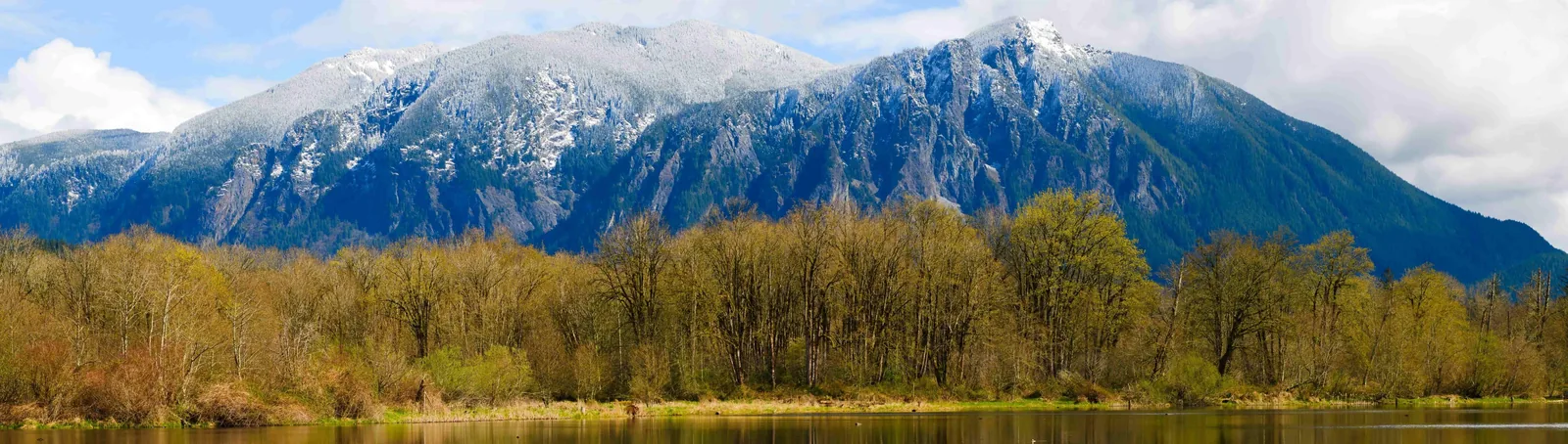
Most cities this size — around 14,000 people — have a few decent parks and a walking path or two. Snoqualmie has more than 40 parks, over 540 acres of managed open space, approximately 35 miles of public trails inside city limits, and a 268-foot waterfall that pulls more than 1.5 million visitors a year to its edge. That's not a parks department punching above its weight — it's a city that has been physically shaped by the landscape around it, wedged between the Snoqualmie River, the Cascade foothills, and a rail corridor that's now the longest trail in King County.
Living here means those resources aren't something you drive to on weekends — they're woven into the daily fabric of the place. Parents with kids run the Parkway Trail after school dropoff. Residents of Snoqualmie Ridge cut down to the Deep Creek Trail before work. On any Saturday morning, Three Forks Natural Area fills with dogs, paddlers prepping for the river, and families who just parked and started walking. The outdoor life here is participatory in a way that planned suburb amenities rarely are.
The honest caveat: Snoqualmie Falls draws crowds that can make the parking lot at the top genuinely frustrating on summer weekends. The $7-per-hour paid lot and the free overflow area both fill by mid-morning from June through September. Locals learn quickly that the falls are better at dawn on a Tuesday in October than at noon on a Saturday in July — and that the 0.7-mile interpretive trail down to the river level is almost always less crowded than the upper observation deck. That seasonal rhythm is something most newcomers don't figure out until their first summer here.
Whether you're considering a move or already have keys in hand, the sections below cover Snoqualmie's signature parks and landmarks, its trail network, the Snoqualmie River as a recreation corridor, and what's actively being built — so you know what the outdoor life here looks and feels like right now, and where it's headed.
Snoqualmie Falls and the Parks That Define the City
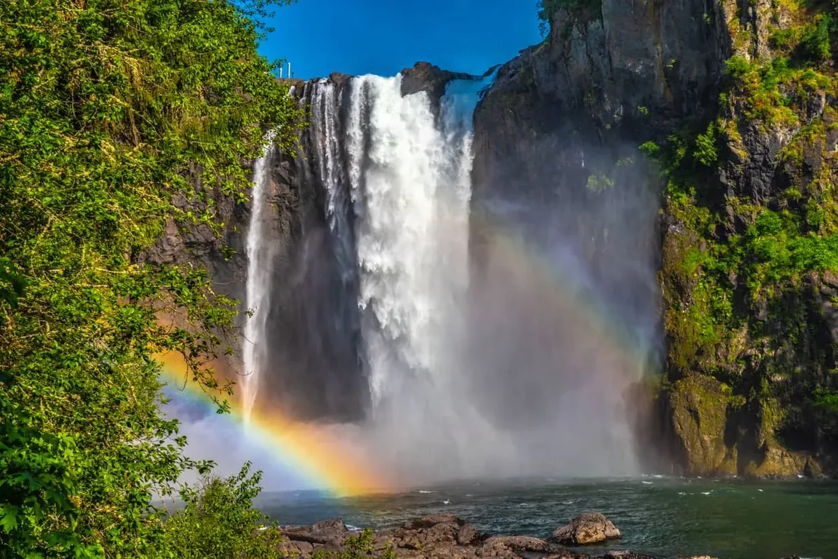
Snoqualmie Falls is the reason most people outside King County have heard of this city — and it's also the piece of local geography that residents have the most complicated relationship with. The falls drop 268 feet on the Snoqualmie River, more than 100 feet taller than Niagara Falls, and they're free to visit every day from sunrise to sunset. That combination of scale, accessibility, and zero admission cost is what produces 1.5 million annual visitors.
For residents, the falls are genuinely spectacular — especially in winter and early spring when snowmelt pushes the volume to full roar. The two-acre park at the top includes two observation decks, and the lower one sits close enough that the mist reaches you on high-flow days. The 0.7-mile interpretive trail from the upper deck descends roughly 250 feet to a river-level viewpoint, with plaques identifying native wildlife in Snoqualmie tribal names — a detail that makes it more than just a hike to the base.
What Locals Know About Visiting the Falls
The real locals' move is the trail itself, not the upper deck. Most day-trippers stop at the railing, take a photo, and leave. Walking down to river level on a weekday morning in shoulder season gives you the falls almost entirely to yourself, with the sound and scale you don't get from above.
Beyond the falls, the city's parks infrastructure is substantial for its size. The Parks Division manages more than 40 individual parks, and Three Forks Natural Area — where the multiple forks of the Snoqualmie River converge — functions as a de facto gathering place: an off-leash dog area, a Snoqualmie Valley Trail trailhead, and a future anchor point for the Rivertrail project currently under construction. Sandy Cove Park sits along the river corridor and serves as another quiet access point for the water.
| Park / Area | Type | Key Feature | Best For |
|---|---|---|---|
| Snoqualmie Falls Park | Scenic / Day use | 268-ft waterfall, 2 observation decks, 0.7-mi trail | Nature Families |
| Three Forks Natural Area | Natural area / Dog park | River confluence, off-leash area, SVT trailhead | Nature Families |
| Sandy Cove Park | River access | Snoqualmie River frontage, Rivertrail Phase I endpoint | Nature |
| Snoqualmie Ridge Parks | Neighborhood parks | Multiple small parks serving Ridge neighborhoods | Families Quiet |
| Historic Downtown Green Space | Urban / civic | Centennial Trail access, railroad corridor | Walkable Commuter |
| City Open Space (1,200+ acres) | Forested preserve | Undeveloped forested land buffering trail corridors | Privacy Nature |
The city also owns more than 1,200 acres of forested open space — land held specifically to buffer development from the trail corridors and natural areas.
The Trail Network: 35 Miles Inside City Limits Alone
Thirty-five miles of public trails within city limits is an unusual number for a city of 14,000 people. Most of Snoqualmie's named trail network divides naturally into two systems: the paved urban trails that connect neighborhoods to each other and to downtown, and the soft-surface paths that push into the forested edges of the city.
The Urban Connector Trails
The approximately 4-mile paved Snoqualmie Parkway (Ridge) Trail is the workhorse of daily life on the Ridge — the route residents use for running, cycling, and connecting to other parts of the trail system without touching a road. It links into the roughly 2-mile Deep Creek Trail, which drops into a forested ravine and feels distinctly wilder than its proximity to suburban streets would suggest.
The ½-mile paved Centennial Trail runs parallel to the railroad tracks through the Historic Downtown, connecting pedestrians to the Northwest Railway Museum corridor and giving the older part of the city a walkable spine. The 1¼-mile Business Loop Trail and the ¾-mile Fisher Creek Trail fill in gaps between the larger routes, making it genuinely possible to chain together a multi-mile loop without retracing ground.
The Snoqualmie Valley Trail — King County's Longest
The Snoqualmie Valley Trail is the regional anchor. At approximately 31.5 miles, it's the longest trail in King County's system, running from Rattlesnake Lake near North Bend all the way north to McCormick Park in Duvall — passing directly through Snoqualmie along the way.
The trail runs on a former Milwaukee Road railroad spur built in 1911, and the history shows in the best way: the crushed-rock surface crosses the Tokul Creek Trestle, passes working farmland and preserved open space, and connects North Bend, Snoqualmie, Fall City, Carnation, and Duvall in a single continuous route. For cyclists especially, it's a rare multi-community connector that doesn't require riding on a highway.
The SVT is also a designated segment of the developing Great American Rail-Trail — a 3,700-mile coast-to-coast route. A 7.6-mile gap in Snoqualmie currently separates the SVT from the Preston-Snoqualmie Trail, and closing it is an active city and county planning priority. When that gap closes, Snoqualmie will sit at the center of a significantly longer continuous corridor.
| Trail | Length | Surface | Character |
|---|---|---|---|
| Snoqualmie Valley Trail (SVT) | ~31.5 mi (regional) | Crushed rock | Rail-trail; farmland, trestles, inter-city connector |
| Snoqualmie Parkway (Ridge) Trail | ~4 mi | Paved | Primary Ridge neighborhood connector; running/cycling |
| Deep Creek Trail | ~2 mi | Soft surface | Forested ravine; wilder feel close to the Ridge |
| Business Loop Trail | ~1.25 mi | Mixed | Urban connector between commercial and residential areas |
| Fisher Creek Trail | ~0.75 mi | Soft surface | Creek-side; connects neighborhood trail gaps |
| Centennial Trail | ~0.5 mi | Paved | Historic Downtown railroad corridor; pedestrian spine |
| Snoqualmie Falls Interpretive Trail | 0.7 mi | Paved/gravel | 250-ft descent to river level; tribal interpretive plaques |
For families considering which part of Snoqualmie to live in, proximity to specific trail segments is often a deciding factor — see the neighborhood breakdown for how the Ridge, Downtown, and Riverbend areas each connect to different parts of this network.
The Snoqualmie River: Paddling, Access, and the Rivertrail Project
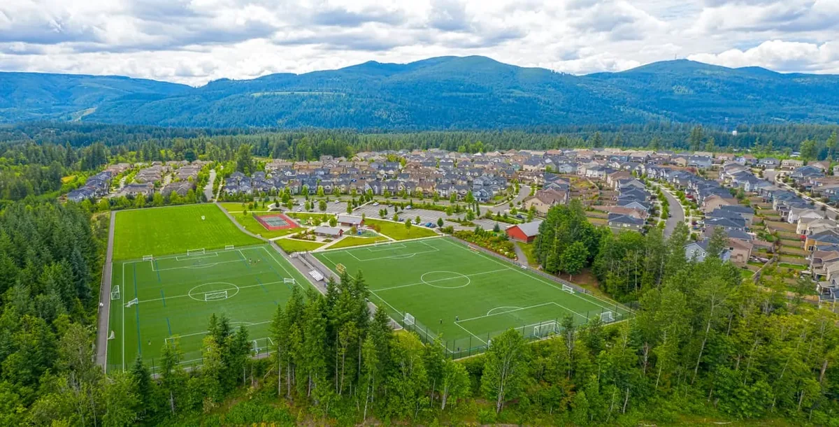
The Snoqualmie River isn't just scenery — it's an active recreation corridor that residents use throughout the year. The Middle Fork offers Class II–III whitewater, and it's marketed legitimately as the closest whitewater run to downtown Seattle, at roughly 30 miles out. For intermediate paddlers, that proximity matters: you don't need to drive three hours to find moving water with real character.
Kayaking and paddling on the Snoqualmie is accessible nearly year-round, with higher water in winter and spring from Cascade snowmelt pushing flows up. Three Forks Natural Area is the most popular launch and takeout point within city limits, functioning as both a trail access point and a paddling hub on weekend mornings. The river's flat sections between Three Forks and Sandy Cove suit beginners and families with inflatable kayaks; the whitewater stretches upstream are for paddlers who know what they're reading.
The Snoqualmie Rivertrail: What's Being Built Right Now
The most significant parks project underway in the city is the Snoqualmie Rivertrail — an ambitious plan to connect Snoqualmie Falls to Three Forks Natural Area with continuous trail along both banks of the river. Phase I construction began in 2025, with one mile of soft-surface trail being built between Kimball Creek and Sandy Cove Park.
When complete, the Rivertrail loop will give residents a river-level connection that currently requires cobbling together road walks and disconnected path segments. Three Forks Natural Area is already identified as the southern anchor for the loop — which means the off-leash dog area, the SVT trailhead, and the new Rivertrail will all converge at one access point.
This is the kind of infrastructure that changes how people use a city day to day. When the Rivertrail fills in the gap between the falls and Three Forks, a resident in Riverbend or the Historic Downtown will be able to walk or run a river-level loop without retracing steps — something that doesn't exist yet but is actively being built.
The city also adopted a new Parks, Recreation, Open Space, and Trails (PROST) Master Plan in October 2024, following a nearly year-long community engagement process. That plan sets the framework for parks priorities over the next decade-plus, with the Rivertrail as a centerpiece project.
Looking to buy in Snoqualmie? Estimate your payment.
Enter your numbers to see an estimated monthly mortgage payment.
Estimate only. Excludes HOA fees and mortgage insurance. The interest rate above is a starting point, not a quoted rate — replace it with your own to see real numbers. Insurance is a flat placeholder, not a Snoqualmie quote.
Seasonal Recreation: What Each Season Actually Looks Like
The outdoor calendar in Snoqualmie doesn't follow the same logic as cities an hour west in Seattle. The Cascade foothills compress the seasons differently: spring arrives with high river flows and mud on every soft-surface trail, summer turns crisp and clear in a way that draws people out every day, fall brings the most dramatic waterfall conditions once the rains return, and winter means the falls are at full volume while the Valley Trail stays rideable for cyclists willing to layer up.
Spring and Summer
Spring is the paddlers' season on the Middle Fork — snowmelt keeps flows in the Class II–III range through May, and the river-level views from Three Forks Natural Area are at their most dramatic. The flip side: soft-surface trails including the Deep Creek Trail and Fisher Creek Trail can be muddy enough in March and April to warrant waiting a few days after rain before heading out.
Summer is when the falls crowds peak. Locals who've lived here more than one season develop a reliable workaround: the falls are genuinely empty before 8 a.m. on weekdays, and the interpretive trail down to the lower viewpoint stays less crowded than the upper deck at almost any hour. The Snoqualmie Parkway Trail on the Ridge fills with cyclists and runners from May through September — on summer evenings, it functions as a de facto community gathering strip.
Fall and Winter
September and October are widely considered the local sweet spot. Crowds at the falls drop sharply after Labor Day, the colors along the Valley Trail are at their most photogenic around the Tokul Creek Trestle, and the river hasn't yet risen to the levels that push casual paddlers off the water.
Winter brings something counterintuitive: the falls are arguably better. Heavy rainfall and snowmelt from the mountains in December through February push the falls to maximum volume, and the mist plume can be visible from the upper deck parking area. The Snoqualmie Valley Trail remains passable for dedicated cyclists year-round — the crushed-rock surface drains well and doesn't turn to the same mud as soft-surface routes. For a fuller picture of kids' seasonal activities and recreation programs, the schools page covers those alongside the academic calendar.
What surprises most people after their first full year here is how the outdoor life shifts from optional to structural. The trails aren't something you get around to — they're the route between things, the after-school default, the reason you don't feel penned in by the suburbs. That shift happens faster than most newcomers expect.
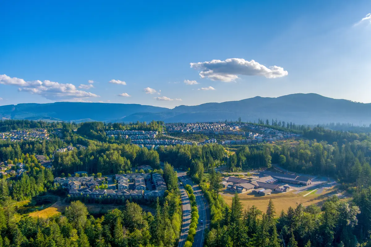
Local Expert Takeaway: Snoqualmie's outdoor infrastructure is genuinely rare at this city size — 35 miles of trails inside city limits, the longest trail in King County passing through the middle of town, and a 268-foot waterfall you can walk to from the river level on a weekday morning with almost no one around. The Snoqualmie Rivertrail, currently in Phase I construction between Kimball Creek and Sandy Cove Park, will be the piece that ties it all together — connecting the falls to Three Forks Natural Area along the river in a way that doesn't exist yet. If you're moving here for the outdoor life, the parks system already delivers. By the time the Rivertrail loop closes, it will deliver even more.
Quick Takeaways & FAQs
✅ Snoqualmie manages more than 40 parks and approximately 35 miles of public trails within city limits — an unusually deep parks infrastructure for a city of 14,000.
⚠️ The falls parking lot fills by mid-morning on summer weekends; locals visit before 8 a.m. on weekdays or in fall shoulder season for a dramatically better experience.
📍 Phase I of the Snoqualmie Rivertrail broke ground in 2025 — one mile of soft-surface trail between Kimball Creek and Sandy Cove Park, the first segment of a planned river-level loop connecting the falls to Three Forks Natural Area.
Is Snoqualmie Falls free to visit?
How long is the Snoqualmie Valley Trail and can you bike it?
What trails are inside Snoqualmie city limits?
Can you kayak the Snoqualmie River near Snoqualmie?
What is the Snoqualmie Rivertrail and when will it be finished?
Moving to Washington?
Tell us what you need help with and we'll connect you with local resources.
