
If you've searched "is Waco safe" before deciding whether to move here, you've probably landed on a heat map that looked alarming — and walked away without the full picture. Waco carries a reputation built on headlines and outdated data, and it doesn't match what residents who actually live here will tell you. A city of 147,788, anchored along I-35 between Dallas and Austin, Waco is more varied in its safety profile than any single statistic suggests. The northwest corner and the southwest are not the same city by any useful measure of risk.
The headline number worth leading with: 2024 was the safest year Waco had recorded in roughly three decades of comparable data. Then 2025 topped it. Since 2021, overall crime in Waco has decreased 30% and property crime has fallen 40% — a sustained, multi-year trend driven by deliberate policing strategy, not a statistical blip. That context is missing from most of the crime-rate aggregator sites that rank cities by raw numbers without telling you whether those numbers are improving or deteriorating.
Like most Texas cities of its size, Waco's challenge is primarily property crime rather than violent crime. Larceny-theft — package theft, car break-ins, shoplifting — accounts for the largest share of all reported offenses. Violent crime is real and not evenly distributed, but it is concentrated in specific corridors, and the gap between the city's safest and most active neighborhoods is wide enough that where you choose to live matters enormously. This guide breaks that down neighborhood by neighborhood, explains how to read the data honestly, and describes what the Waco Police Department is actively doing about it.
The sections below cover Waco's crime rates in context, the neighborhood-level safety picture, what locals actually experience day to day, the programs making the city measurably safer, and practical guidance on researching specific areas before you decide on a neighborhood.
Waco's Crime Rates in Context
Waco carries a violent crime rate of 4 per 1,000 residents and a property crime rate of 22 per 1,000 residents. The engine's comparison table below shows exactly how those figures stack up against Texas and national benchmarks — read it before drawing conclusions, because the gap is narrower than most aggregator sites imply.
The state violent crime rate sits at 4 per 1,000 and the national figure is 3.7 per 1,000 — meaning Waco's violent crime rate is essentially at the Texas average and only modestly above the national figure. On property crime, Waco carries a property crime rate of 22 per 1,000 residents — above both the state and national figures, but a narrower gap than it first appears when you factor in that Waco is a regional commercial hub with significant daily visitor traffic from surrounding McLennan County.
What the static rate doesn't show you is direction. The Waco Police Department reported that 2024's total crime count of 16,964 incidents was the lowest annual total since the city began keeping comparable records in the early 1990s. Then 2025 came in even lower — overall crime fell another 7% and property crimes dropped an additional 12% below that already-historic 2024 baseline.
Larceny-theft drives the property crime number more than any other offense. Burglary and vehicle-related thefts follow, consistent with national patterns for cities of Waco's size and commercial density. Violent crime is real but is heavily concentrated geographically — which is why the neighborhood picture matters far more than the city-wide rate for anyone choosing where to live.
The Neighborhood-by-Neighborhood Safety Picture
The most important thing to understand about crime in Waco is that the city's overall rate is an average of places that look very different from each other. Northwest neighborhoods carry notably lower per-capita rates; the southwest sees the highest total incident counts. That gap is wide enough to meaningfully change your day-to-day experience depending on where you land.
Safer by Reputation and by Data
Sanger Heights is consistently cited by residents as one of the city's most livable areas. Its historic bungalows, tree-lined streets, and active neighborhood association create the kind of block-level social fabric that correlates with lower property crime. Neighbors in established areas like this one tend to keep an eye on each other in the old-fashioned sense — the kind of informal network that crime reduction research consistently identifies as a deterrent.
Parkdale / Viking Hills also draws favorable safety assessments. It tends to attract families with school-age children and residents who have been in Waco long enough to know which neighborhoods they're choosing deliberately. The housing stock is more suburban in character, and the area's position away from the city's highest-traffic commercial corridors keeps ambient crime pressure lower.
West Waco, particularly the areas extending toward Woodway, benefits from proximity to one of Waco's quieter neighboring cities. The farther northwest you go, the more the per-capita numbers reflect that.
Downtown and Tourist Corridors: Read the Heat Map Carefully
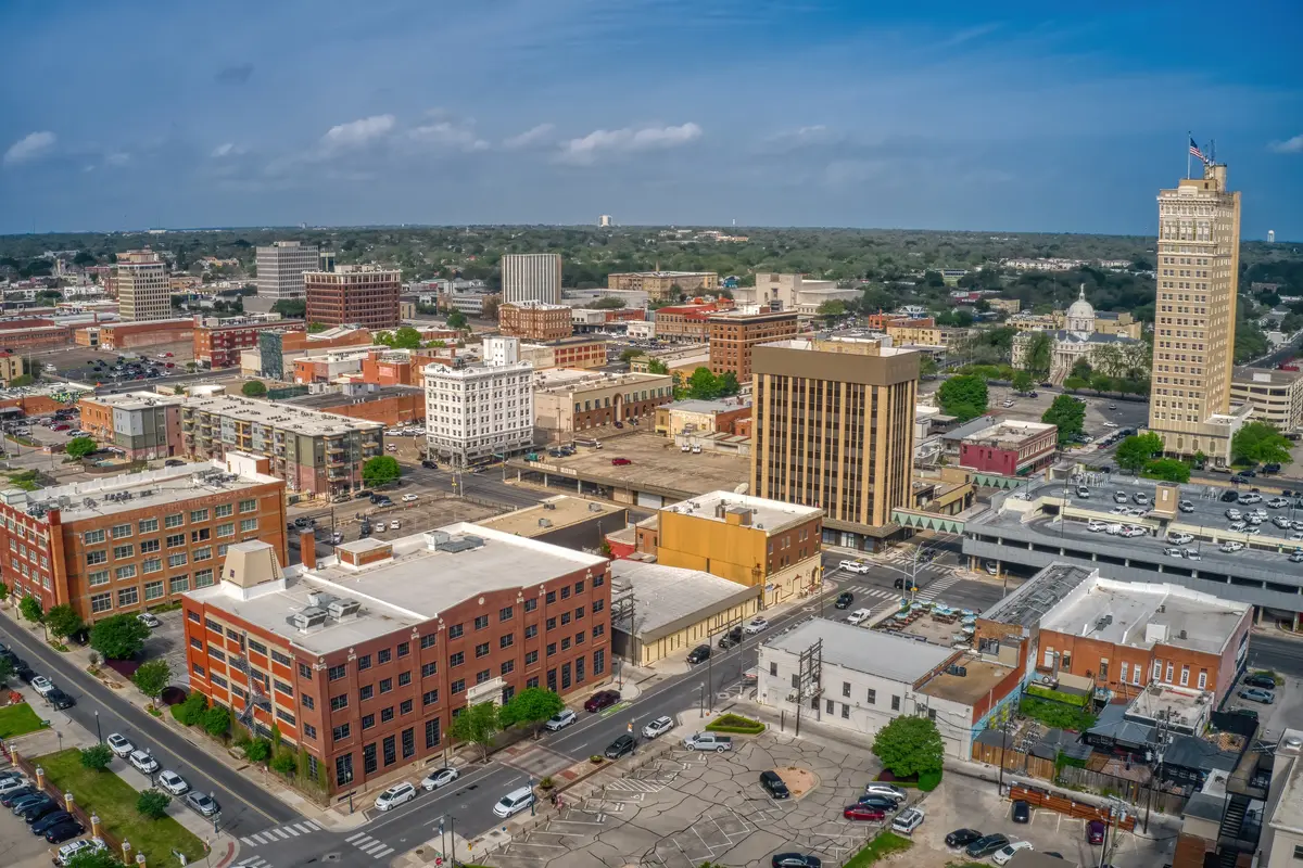
Downtown Waco generates a lot of online alarm that deserves a caveat. Waco has 30 parks, a busy tourist corridor anchored by Magnolia Market at the Silos, and McLane Stadium — all of which concentrate foot traffic and, with it, incidents that get counted where they occur rather than where victims live. A theft in a parking lot near the Suspension Bridge raises Downtown Waco's crime count, not the residential neighborhood whose residents have nothing to do with it.
That doesn't mean downtown is without risk — it means a raw heat map overstates residential risk for people who live there and commute to quieter parts of the city. If you're considering a downtown condo or loft near the Baylor corridor, the relevant question is what's happening on your block at 10 p.m., not what's happening at a parking lot two miles away during a concert.
North Waco and Brookview
North Waco and Brookview run below the city median home price, and their safety profile is more mixed. Incident counts in the north are substantially lower than in the southwest — the commercial and retail corridors in the southwest generate the highest concentrations of incidents citywide, while the north is predominantly residential with a quieter pattern. Neither neighborhood is uniform, and block-by-block conditions matter more than area-level averages. Both are worth spending time in before deciding, not just checking on a map.
Best approach: Use the Waco Police Department's public crime mapping tool alongside the broader neighborhoods guide to compare specific streets rather than relying on area-level averages alone.

What Locals Actually Experience Day to Day
Residents who move to Waco from larger Texas metros — Dallas, Austin, Houston — often say the same thing after six months: the city feels more manageable than its crime rankings suggested. That's partly because rankings don't distinguish between living in Sanger Heights and working near Cameron Park versus living in the southwest corridor without that context.
The Heat Map Trap
One of the most common mistakes newcomers make is pulling up a crime heat map, seeing red clusters near Cameron Park or the Silos, and assuming those areas are dangerous to live in. Cameron Park is one of the largest urban parks in Texas — a sprawling greenway along the Brazos River that draws thousands of visitors and runners. More foot traffic means more incidents counted in that geographic zone. The park itself and the adjacent Riverwalk are active, well-used civic spaces that residents value, not corridors to avoid.
The practical implication: if you're evaluating a neighborhood that sits near a major landmark, a stadium, or a busy commercial strip, ask the Waco PD's Neighborhood Engagement Team for a breakdown that separates residential incidents from commercial and visitor-related ones. It's a free resource and it changes the picture significantly.
The Property Crime Reality
The honest friction point for Waco residents is property crime, not violent crime. Car break-ins and package theft happen across the city — they're not confined to any single neighborhood. Residents in Sanger Heights and West Waco report them just as residents in higher-incident areas do, though at lower frequency. Leaving valuables visible in a parked car is consistently cited by the Waco PD as the most avoidable risk factor. It sounds basic because it is — but it matters here more than in quieter suburban markets.
Violent crime, by contrast, tends to cluster in specific corridors and is not a diffuse city-wide experience. The Waco PD's homicide clearance rate for 2024 reached approximately 87% — well above commonly cited national averages — which is both a measure of investigative capacity and a meaningful signal about institutional seriousness.
A Summer Visitor Influx You Didn't Expect
Waco draws a significant and growing number of visitors, particularly around Magnolia Market at the Silos and McLane Stadium on game days. If you're living close to the tourist corridor or the stadium, weekends during the fall semester feel different from weekdays — more traffic, more strangers, and occasionally more petty crime in parking areas. Residents who live near these landmarks build that into their expectations; it surprises people who moved close to downtown without thinking through the seasonal rhythm of a mid-size university and tourist city.
Looking to buy in Waco? Estimate your payment.
Enter your numbers to see an estimated monthly mortgage payment.
Estimate only. Excludes HOA fees and mortgage insurance. The interest rate above is a starting point, not a quoted rate — replace it with your own to see real numbers. Insurance is a flat placeholder, not a Waco quote.
What the Waco Police Department Is Doing About It
Sustained crime reduction doesn't happen by accident, and Waco's trend line over the past four years reflects a deliberate strategy worth understanding. Chief Sheryl Victorian has publicly committed to what the department calls "relational policing" — an approach built on consistent officer presence within specific communities rather than reactive response alone.
The Neighborhood Engagement Team
The Waco Police Department's Neighborhood Engagement Team (NET) assigns officers directly to specific neighborhood associations. Those officers attend local meetings, build ongoing relationships with residents, and address problems that neighbors identify — before those problems escalate into reportable incidents. It's the kind of program that doesn't show up in crime statistics directly but shows up in the trend line over time.
Citizens on Patrol
The city's Citizens on Patrol (COP) program enlists trained volunteer residents to monitor their designated neighborhoods, report suspicious activity, and conduct home-security checks for residents who are away. The program has an active Baylor University component, with volunteers conducting checks during academic breaks when student housing is more vulnerable. For residents in neighborhoods with active COP chapters, the presence of trained, organized neighbors is a meaningful deterrent — and it's a free resource that any resident can join.
The Heart of Texas Crisis Call Diversion Program
One of the more innovative things happening in Waco law enforcement is the Heart of Texas Crisis Call Diversion program, which embeds behavioral health clinicians directly in the police dispatch center. Since launching in February 2024, the program has diverted more than 1,303 mental-health 911 calls — reducing the average time officers spend on behavioral health responses from 11.5 hours to 3.5 hours per incident.
That math matters: officers freed from multi-hour mental health calls are available for patrol and faster response elsewhere. The CSG Justice Center highlighted Waco's model as a nationally noteworthy example of police-behavioral health partnership — meaning this isn't just a local experiment, it's an approach that peer institutions have validated.
None of this means Waco has solved its crime challenges. It means the city is moving in a measurable direction and has the institutional infrastructure to continue doing so — which is the kind of context that a static crime rate number simply cannot give you.
How to Research Safety Before Choosing a Neighborhood
A city-wide crime rate tells you roughly where Waco sits relative to Texas and the nation. It tells you almost nothing about the specific block you're considering. Here's how to go deeper before you decide on a neighborhood.
Use the Right Tools in the Right Order
Start with the Waco Police Department's public crime mapping tool, which lets you filter by incident type and geography. Look at a rolling 90-day window rather than a single month — one incident skews a small area; a pattern across multiple months is meaningful. Filter separately for property crimes and violent crimes, because the neighborhoods with the most car break-ins and the neighborhoods with the most violent incidents are not always the same places.
Third-party crime aggregator sites are useful for directional comparisons between neighborhoods but carry one important caveat: they count incidents where they occur, not where perpetrators or victims live. A high count near Cameron Park, the Brazos riverfront dining area, or McLane Stadium reflects visitor and commercial traffic as much as residential risk. Weight those areas accordingly.
Talk to the Neighborhood Engagement Team
The NET officers assigned to the neighborhood you're considering are a direct resource. They can tell you what the actual pattern of incidents looks like in a specific area, what the active concerns are, and whether a neighborhood association is functioning and engaged. A functioning neighborhood association — Sanger Heights has one of the stronger ones in the city — correlates with lower property crime more reliably than almost any other single factor.
Visit at Different Times
The gap between Waco neighborhoods is wide enough that a Saturday afternoon visit and a Tuesday evening walk give you very different information. Areas near the university and the tourist corridor are busiest on weekends; residential areas like Brookview and North Waco look and feel different on a weekday evening when the game-day traffic is gone. Neither visit alone is sufficient.
For a full picture of how Waco's neighborhoods compare on character, housing stock, and who tends to land where, the Waco neighborhoods guide covers all eight canonical areas in depth. On cost of living and what homes are actually selling for across the city, the cost of living page has the complete breakdown.
The Bottom Line on Waco Safety Research
Waco is not uniformly safe, and it is not uniformly dangerous — it is a mid-size Texas city with real geographic variation in risk. The trend is clearly positive, the institutional investment in community policing is real, and the neighborhoods at the lower end of the risk spectrum are genuinely livable. What you give up by skipping the research is the ability to distinguish between them.

Local Expert Takeaway: Waco's crime picture has improved more dramatically over the past four years than most relocation guides acknowledge — a 30% overall reduction since 2021 is not a rounding error, it's a sustained institutional effort. The city's real challenge is property crime, not violent crime, and the northwest neighborhoods like Sanger Heights and Parkdale / Viking Hills sit at a meaningfully different risk level than the city-wide average suggests. Before settling on an area, run the Waco PD's crime map for 90 days of data, separate property and violent filters, and discount the heat-map clusters near Cameron Park and McLane Stadium — those reflect foot traffic, not residential risk. The Neighborhood Engagement Team is a free, direct resource that most relocating buyers never think to use; it should be your first call after narrowing to two or three neighborhoods.
Quick Takeaways & FAQs
✅ Since 2021, overall crime in Waco has decreased 30% and property crime has fallen 40% — a sustained trend that most crime-ranking sites fail to capture.
⚠️ Waco carries a property crime rate of 22 per 1,000 residents, above state and national averages, and car break-ins and package theft are the realistic day-to-day risk across most neighborhoods.
📍 Crime heat maps near Cameron Park and the downtown tourist corridor overstate residential risk — incidents are counted where they occur, and Waco's 30 parks generate significant visitor-traffic noise in the data.
Is Waco, TX a safe place to live?
What are the safest neighborhoods in Waco?
How does Waco's crime rate compare to the rest of Texas?
Is downtown Waco safe to live in?
What is the Waco Police Department doing to reduce crime?
Moving to Texas?
Tell us what you need help with and we'll connect you with local resources.
