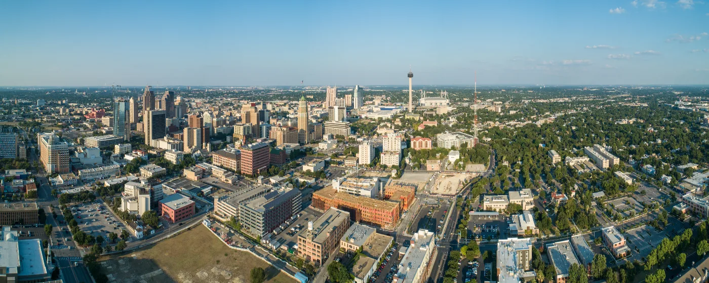
Most people who haven't lived here think of San Antonio as a city of history and tourism — the Alamo, the River Walk, the missions. What they miss is that the same geography that created those landmarks also gave the city one of the most usable outdoor recreation systems in Texas. The Edwards Plateau drops into South Texas Plains right inside city limits, the San Antonio River runs 15 miles through the urban core, and Hill Country terrain begins before you've left the northwest side. For a city of 1,548,422 people, the variety on offer is genuinely unusual.
The outdoor system here works at two scales. Close to home, the city maintains a network of neighborhood and regional parks — with a proposed budget of over $117 million for fiscal year 2025 — that keeps expanding as the population grows. At the larger scale, Government Canyon State Natural Area preserves 13,067 acres of canyon and Hill Country terrain within a reasonable drive of most neighborhoods, and the San Antonio River itself functions as a linear park threading the city from the Pearl District south to the historic missions. Both scales matter, and both are worth understanding before you decide where to plant roots.
220 sunny days a year means outdoor recreation isn't a weekend hobby here — it's the default. Summer heat is real and should not be minimized; July and August mornings are the practical window for anything strenuous. But from October through April, conditions rival anywhere in the country, and residents who learn to front-load their outdoor time in the morning get far more out of this city than those who don't. The parks tend to be busiest on weekend mornings during the cool months, especially after a cold front passes through.
Whether you're considering a move or just researching the area, the sections below break down San Antonio's signature parks, the River Walk in full, the trail and water options across the city, and what recreational life actually looks like season to season.
The San Antonio River Walk: More Than a Tourist Attraction
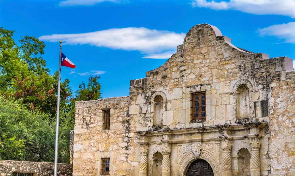
Most newcomers underestimate the River Walk. They assume it's a tourist corridor — restaurant patios, riverboats, holiday lights — and miss the fact that it's also 15 miles of connected urban trail divided into three functionally different sections.
The Downtown River Walk is the commercial core: stone paths, dining, the boat tours, the Arneson River Theatre. It is genuinely crowded on weekends and during Fiesta, and it is not where residents go for a quiet run. But even here, the path itself is continuous, shaded by cypress trees, and walkable from the King William Historic District all the way to the convention center corridor.
The Museum Reach extends roughly 4 miles north and is a different experience entirely. Three miles of pedestrian pathways weave past more than 70,000 plantings, public murals, and a lock-and-dam system that drops river barges approximately nine feet to connect the downtown core to the Pearl District. This stretch is where locals actually walk and jog — it's quieter, greener, and connects to some of the most interesting urban development in the city. From April through October, roughly 60,000 Mexican free-tailed bats roost under the I-35 bridge along this stretch, and their evening departures draw a loose crowd of spectators most nights. Nobody announces it; you just show up near dusk.
The Mission Reach is the 8-mile southern stretch, and it is the least visited and most ecologically significant of the three. The San Antonio River Authority restored this section as a wetland-woodland ecosystem, and it now connects by trail and paddle to four UNESCO World Heritage missions — Mission Concepción, Mission San José, Mission San Juan, and Mission Espada — the same network that, with the Alamo, forms Texas's only UNESCO World Heritage Site. Kayak rentals are available along this stretch, and the trail is wide, paved, and genuinely peaceful on a weekday morning.
What the River Walk does best is give the city a continuous north-south spine. You can walk or paddle from the Pearl District to Mission Espada without touching a road. That kind of linear connectivity is rare in a Texas city, and it's one of the things longtime residents point to when asked why they stay.
The Pearl District Connection
Museum Reach terminates near the Pearl, which has become the social anchor of the north end of the River Walk. The Pearl Farmers Market operates here on weekends through the warm months and is one of the city's most consistent gathering points. The market draws a mix of Southtown regulars, Stone Oak families making a morning out of it, and people who've just finished a run along the Museum Reach path.
Brackenridge Park, McAllister Park, and the City's Green Anchors
San Antonio's two most significant urban parks sit at opposite ends of the city's character spectrum. Brackenridge Park is historic, layered, and dense with things to do. McAllister Park is raw, ecologically varied, and built primarily for trail use. Both are worth knowing before you choose a neighborhood.
Brackenridge Park
Brackenridge sits on the National Register of Historic Places and carries a Texas State Antiquities Landmark designation — one of the few city parks in the state to hold both. The San Antonio River runs through it. The Japanese Tea Garden occupies a former rock quarry and limestone kiln on the park's western side, creating one of the more unexpected green spaces in any American city. The Sunken Garden Theater has hosted outdoor concerts for decades, and Lambert Beach provides a riverside spot that draws families on warm afternoons.
The San Antonio Zoo anchors the park's northern edge. The park also has a golf course, ball fields, jogging trails, and enough internal variety that a family could spend most of a Saturday morning without leaving. For residents in the Monte Vista and Midtown neighborhoods, it functions as a true neighborhood park despite its size — walkable from several of the older residential streets nearby. For people moving in from other cities, this is often the park that resets their expectations of what a Texas city's green infrastructure can look like.
McAllister Park
McAllister is a different kind of park entirely. Its 976 acres along Salado Creek span three ecological zones — the Edwards Plateau, Blackland Prairie, and South Texas Plains — which means the terrain and vegetation shift noticeably as you move through it. That ecological seam makes it a legitimate birding destination, not just a running trail.
The trail system here covers more than 15 miles and accommodates hikers, trail runners, and mountain bikers on terrain that ranges from flat creek corridors to rolling upland sections. The park also has soccer fields, baseball diamonds, a cricket field, a 1.5-acre dog park, a pump track for cyclists, shaded playgrounds, and multiple picnic pavilions. It is, practically speaking, a full recreation complex inside a natural park — and it is heavily used by the north side neighborhoods closest to it. On a weekend morning during fall or spring, the trail head areas fill early.
Eisenhower Park
Eisenhower Park, on the northwest side, adds another piece to the city's trail network. It sits at the edge where San Antonio's urban fabric gives way to Hill Country terrain, and the trails reflect that — rougher, more exposed, and better suited to people looking for something that feels less managed than Brackenridge. It doesn't get the same press as McAllister, but residents who know it tend to be loyal to it.
| Park | Size | Trail Miles | Best For |
|---|---|---|---|
| Brackenridge Park | 343 acres | Multiple loop paths | Families Walkable |
| McAllister Park | 976 acres | 15+ miles | Nature Families |
| Eisenhower Park | NW edge of city | Hill Country terrain | Nature Privacy |
| Government Canyon SNA | 13,067 acres | 40+ miles | Nature Quiet |
| Mission Reach Trail | 8-mile linear | 8 miles | Walkable Nature |
| Museum Reach Trail | 4-mile linear | 3 miles pedestrian | Walkable Connected |
Government Canyon and Hill Country Access
Government Canyon State Natural Area is the outdoor asset that surprises most people who move to San Antonio from cities without equivalent access. 13,067 acres of rugged Hill Country terrain sit on the northwest edge of the city — close enough that a weekday morning hike before work is realistic for residents of the northwest side or Medical Center area.
The park draws steady use from across the city and the wider metro, yet spread across a site this size on any given weekday, the backcountry sections feel genuinely uncrowded. The trail network covers more than 40 miles, ranging from the 1.23-mile accessible Discovery Trail — which families with younger kids use almost exclusively — to remote canyon routes that feel genuinely isolated. The elevation change, exposed limestone, and scrub oak canopy all read as Hill Country rather than suburban trail; it does not feel like a city park.
What Makes It Unusual
Government Canyon sits directly atop the Edwards Aquifer — the largest single rechargeable aquifer in the United States — and the land is managed partly as a recharge zone for the water supply that more than 1.5 million people depend on. That dual purpose as recreational space and watershed protection shapes how the area is managed: backcountry trails require a separate permit, camping is limited to 23 walk-in sites, and some sections are seasonally restricted to protect recharge capacity. The restrictions are real and worth knowing before you plan a trip.
The accessible amenities are substantial. Ranger-led programs run regularly, geocaching routes are established throughout the trail system, and the playscape near the Discovery Trail makes it a workable option for families with kids who aren't ready for a full hike. The more remote sections of the trail network require some navigation competence; the terrain is not technical, but it is easy to extend a hike longer than planned.
The Seasonal Reality
This is where newcomers from the Pacific Northwest or Midwest most often get caught off guard. Summer heat at Government Canyon is not the gentle warmth of the marketing materials — it is exposed Hill Country in July, with temperatures that make midday hiking genuinely unsafe. The experienced locals who use this park frequently shift to fall and early spring as their primary seasons, use early morning starts in late spring, and essentially treat June through August as a planning period. That pattern is worth adopting quickly. The park is at its best — and most rewarding — from late October through March, when the crowds thin and the canyon sections are fully accessible.
Looking to buy in San Antonio? Estimate your payment.
Enter your numbers to see an estimated monthly mortgage payment.
Estimate only. Excludes HOA fees and mortgage insurance. The interest rate above is a starting point, not a quoted rate — replace it with your own to see real numbers. Insurance is a flat placeholder, not a San Antonio quote.
Seasonal Recreation and What Locals Actually Do
The rhythm of outdoor life in San Antonio is shaped almost entirely by heat management. 220 sunny days a year is an asset, not a liability — but only if you learn to use it on the city's terms rather than assuming the outdoor calendar mirrors what it would be in Denver or Portland.
Fall and Spring: The Real Outdoor Season
October through April is when San Antonio's parks fill with people doing things at a relaxed pace. The Mission Reach trail draws cyclists and walkers all week. McAllister's mountain bike trails see consistent weekend traffic. Brackenridge becomes a default Saturday morning destination for families with kids, especially when the weather drops after a front moves through. The River Walk is genuinely pleasant for a morning walk during this window — cool enough to be comfortable, light enough to see the cypress reflections on the water before the crowds arrive.
The Pearl Farmers Market pulls a steady crowd on weekend mornings, and it functions as one of the more reliable spots to get a feel for the north end of the city's social fabric. Parents with strollers, dog walkers, and people who've come off a Museum Reach run all overlap here in a way that's specific to this city.
Summer: Front-Load Everything
Summer outdoor recreation in San Antonio is a morning sport. Most trail users at McAllister and Government Canyon are out and done by 9 or 10 a.m. from June through August. The River Walk's covered sections and tree canopy make it more tolerable than open trails midday, but even there, the serious walkers are out before the tour boats start running.
SeaWorld San Antonio, the 416-acre marine park on the city's west side — the largest in the SeaWorld chain — becomes a practical summer option for families with kids precisely because it's designed for the heat. The water attractions are the primary draw during peak summer, and the park's accreditation through the Association of Zoos and Aquariums means the conservation and animal care programs have substance beyond the standard theme-park experience.
Six Flags Fiesta Texas adds a second major theme park option on the northwest side, and the two parks together mean San Antonio's summer calendar for families with school-age children is genuinely full. The parks are crowded; that's the honest trade-off. But on a Tuesday in July when the alternative is an exposed trail at noon, the trade-off makes sense.
What People Who Move Here Get Wrong
The most common mistake: underestimating how much the summer heat compresses the outdoor window. People move here in spring, spend two months hiking Government Canyon on perfect mornings, and then hit July convinced they've figured out the city. The first triple-digit week reorganizes that assumption quickly. The second mistake is treating the River Walk as a tourist amenity rather than a commuter and recreation spine — residents who live within a few blocks of Museum Reach and don't use it for morning walks are leaving one of the city's best quality-of-life assets on the table. For those exploring which neighborhood to settle in, proximity to the River Walk or a major park changes daily life more than most buyers anticipate.
The parks and recreation system here is extensive enough that the right question isn't whether there's enough outdoor access — there clearly is — but whether you'll adapt quickly to using it on San Antonio's schedule. The city rewards early risers significantly more than it rewards people who prefer afternoon hikes.
Local Expert Takeaway: San Antonio's outdoor infrastructure is built around water and geology in a way most Texas cities can't match. The River Walk's three distinct sections — tourist corridor, urban greenway, and ecological restoration — give different residents different things. McAllister Park's 976 acres cover three ecological zones inside city limits. Government Canyon puts 40-plus miles of Hill Country trail within reach of most northwest side neighborhoods. The catch is summer: outdoor San Antonio is a morning city from June through August, and the people who get the most out of it are the ones who accept that schedule rather than fight it.
Quick Takeaways & FAQs
✅ The 15-mile San Antonio River Walk isn't just tourist infrastructure — Museum Reach and Mission Reach function as a connected urban trail and paddling corridor that most residents never fully explore.
⚠️ Summer heat compresses the practical outdoor window to early morning; newcomers consistently underestimate how thoroughly July and August reorganize the trail calendar.
📍 Government Canyon State Natural Area spans 13,067 acres of Hill Country terrain at the city's edge — the backcountry sections on weekdays feel genuinely remote despite sitting within reach of most northwest side neighborhoods.
How long is the San Antonio River Walk trail system?
Is Government Canyon State Natural Area worth the drive from central San Antonio?
What is McAllister Park, and is it good for mountain biking?
What's the best time of year to use San Antonio's outdoor parks?
Can you kayak or paddle on the San Antonio River Walk?
Moving to Texas?
Tell us what you need help with and we'll connect you with local resources.
