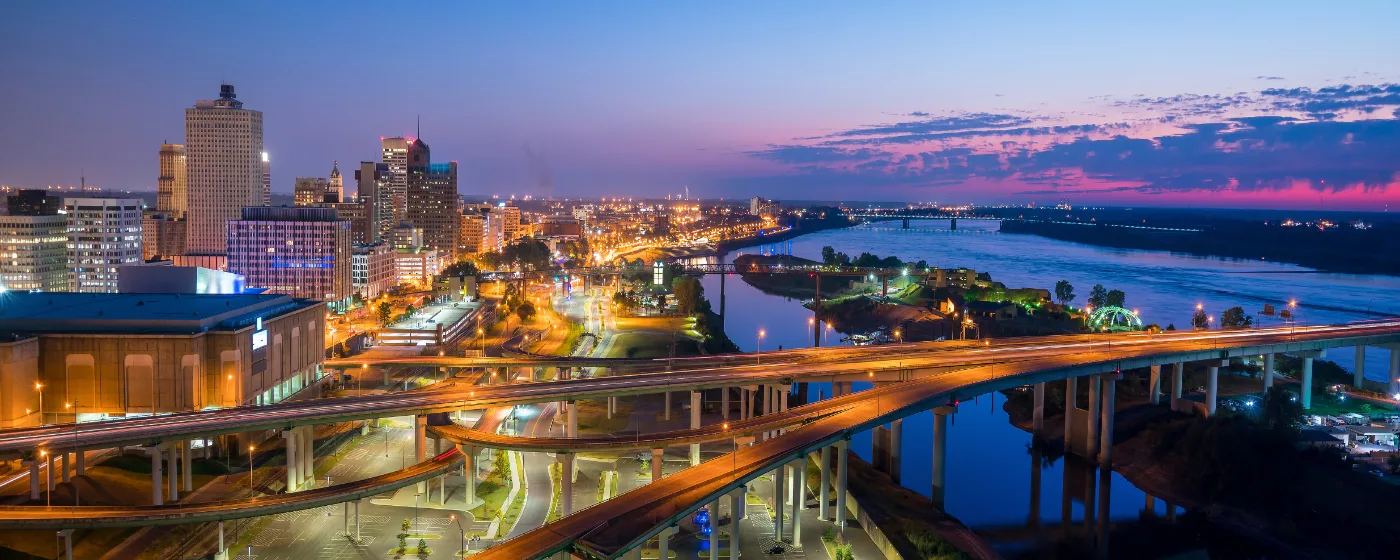
Memphis has a geography problem — in the best possible way. The city sits on a bluff above the Mississippi River, spreads east across 300 square miles of flat Tennessee terrain, and manages to pack more green space into its urban footprint than most American cities twice its size. People relocating from cities with polished, compact park systems sometimes underestimate what Memphis offers outdoors. The parks here are not pocket squares of grass. They are forests, lakes, levees, and bottomland swamps — and they are woven into the fabric of neighborhoods from Midtown to Cordova.
The anchor is Shelby Farms Park, a 4,500-acre expanse that routinely shocks newcomers who expected a city park and found something closer to a wilderness preserve. But the outdoor story in Memphis extends well beyond one landmark destination. The Shelby Farms Greenline threads Midtown to Cordova along a converted rail corridor. Overton Park holds an old-growth forest that has stood since before the city existed. Big River Crossing puts the Mississippi itself underfoot. And Meeman-Shelby Forest State Park — less than 20 miles north along US-51 — adds another 12,539 acres of cypress swamps and hardwood bottomland. Memphis has more than 60 miles of bike trails citywide, a figure that surprises almost everyone who moves here.
What does not surprise people after a few months is how central outdoor life becomes to the city's social rhythm. Shelby Farms draws cyclists, dog owners, kayakers, and parents on a warm weekend the way a town square draws foot traffic elsewhere. Overton Park anchors Midtown's identity as firmly as any coffee shop or music venue. The Mississippi River is not just scenery — it is a recreational corridor managed by the Memphis River Parks Partnership across 12 city-owned parks along six miles of riverfront. For a city with a typical home price of $145,335 (August 2026), the outdoor amenity set punches well above its weight class.
Whether you are deciding where to live or figuring out how weekends will feel once you arrive, the sections below break down Memphis's signature parks, trail networks, waterfront access, and what the outdoor calendar actually looks like across the seasons.
Shelby Farms Park: The Anchor That Redefines Urban Green Space
The first time you drive out to Shelby Farms Park, the scale registers before you even park. At 4,500 acres east of Downtown Memphis, it is one of the largest urban parks in the United States — roughly five times the size of New York City's Central Park — and it sits entirely within the city's metro footprint. No admission gate. No long drive into the countryside. Just a former prison farm that Shelby County transformed into the defining recreational amenity of the mid-South.
The trail system alone runs more than 40 miles of paved and unpaved paths suited to walking, cycling, running, and horseback riding. Shelby Farms Stables offers trail rides year-round and is the only operation of its kind in the region. More than 20 bodies of water dot the park, and fishing access is available across them.
On the water, Hyde Lake is where kayak, canoe, and stand-up paddleboard rentals operate seasonally. Pine Lake carries pedal boats. The park's 100-acre off-leash dog area is among the largest in Tennessee and functions as an informal social hub — bring a dog on a Saturday morning and you will meet half your neighborhood. For families with younger kids, the Woodland Discovery Playground and a Go Ape Zipline and Adventure Park add options that extend a visit well past the trail loop.
Disc golf, BMX areas, and a full calendar of organized events round out what is, by any reasonable measure, an extraordinary piece of civic infrastructure. The honest friction point: Shelby Farms is most accessible by car. If you are renting or buying in Midtown or Cordova, the Shelby Farms Greenline connects you directly and changes the calculus considerably. But if you are in Frayser or South Memphis without a car, this park is effectively off the table for casual use.
Best for: Families Nature Dog Owners
Trails and Greenways: The 60-Mile Network Connecting the City
Memphis does not get enough credit for its trail infrastructure, and that is partly a marketing failure and partly a matter of scale — the network is spread across a large city rather than concentrated in one photogenic corridor. The practical upshot for residents is that the system rewards people who take the time to learn it.
The centerpiece is the Shelby Farms Greenline, a 10.65-mile paved trail built on the former Nashville, Chattanooga and St. Louis Railway corridor. It runs from Midtown Memphis through Shelby Farms Park to Cordova, drawing more than 200,000 users per year. It is fully separated from vehicle traffic, wide enough for side-by-side riding, and links directly into the park's internal trail network — meaning a Midtown resident can pedal from their neighborhood into 4,500 acres of green space without touching a road.
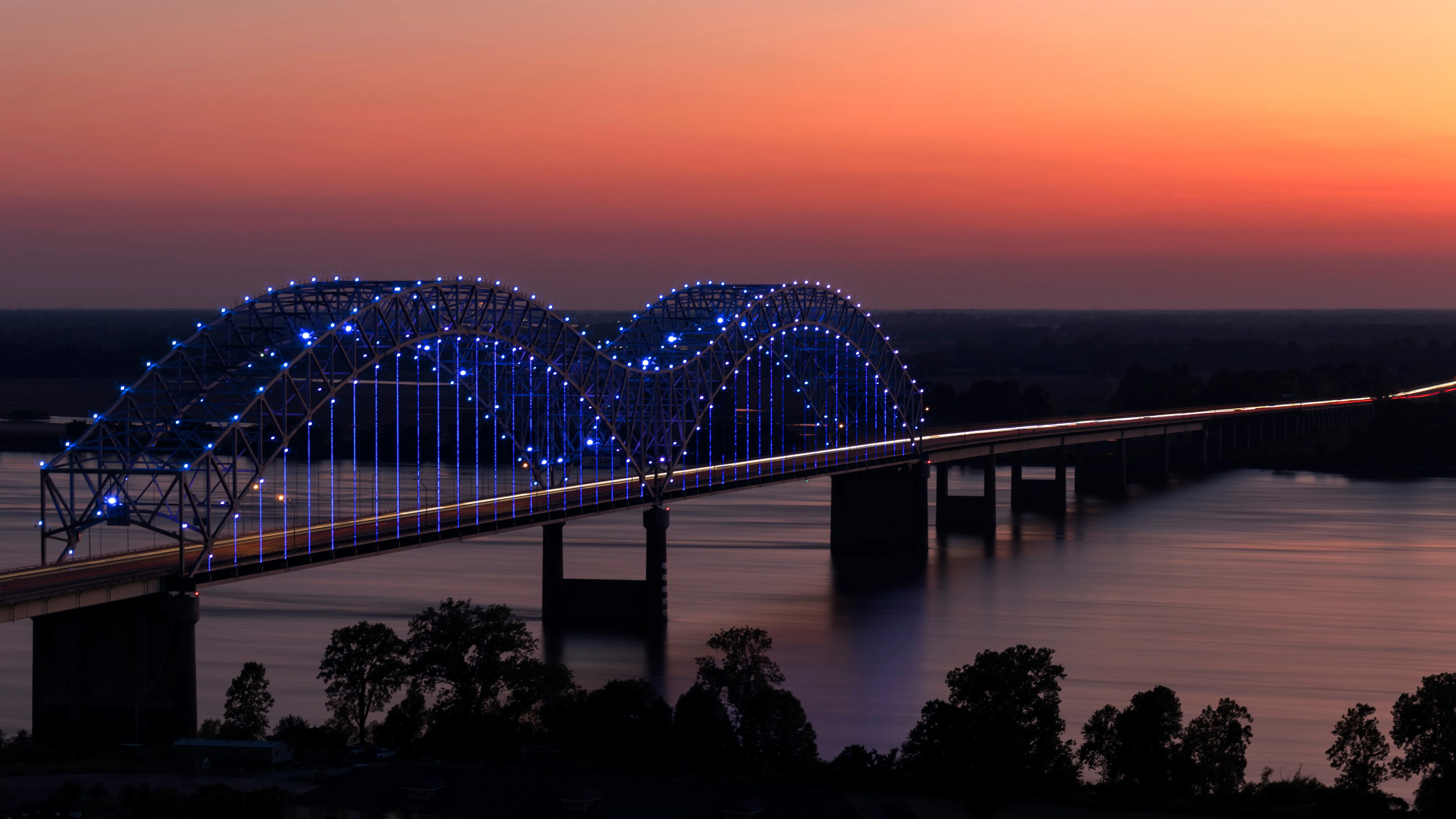
On the river, Big River Crossing changes what the Mississippi means for daily outdoor life. The pedestrian and cycling bridge — built on the historic Harahan Bridge — is the longest of its kind across the Mississippi River. It connects Downtown Memphis to West Memphis, Arkansas and anchors a 10-mile multi-modal corridor called Main Street to Main Street. On the Arkansas side, the Big River Trail runs along the levee for more than 70 miles toward Marianna. Most Memphians use Big River Crossing as a destination in itself rather than a throughway, and on any evening when the Mighty Lights LED show illuminates the Hernando de Soto Bridge, the crossing draws a crowd that has nothing to do with exercise.
| Trail / Greenway | Length | Surface | Best Use |
|---|---|---|---|
| Shelby Farms Greenline | 10.65 miles | Paved | Cycling, running, commuting |
| Shelby Farms Park Trails | 40+ miles | Paved and unpaved | Hiking, biking, horseback riding |
| Overton Park Old Forest Trails | 8+ miles | Natural surface | Trail running, walking |
| Overton Park Limestone Loop | 1.4 miles | Limestone | Running |
| Big River Crossing | Bridge + 10-mi corridor | Paved | Cycling, walking, photography |
| Meeman-Shelby Forest Trails | 20+ miles | Natural surface | Hiking, biking, birding |
| Mississippi River Greenbelt | Multi-mile riverfront | Paved and natural | Walking, cycling |
The citywide total exceeds 60 miles of bike trails, which puts Memphis ahead of most Southern cities its size. The honest caveat is connectivity: the system is excellent within corridors but uneven between them, and the gap between Midtown's trail access and that of neighborhoods like Whitehaven or Frayser is real.
Overton Park, Mud Island, and the Midtown-to-River Experience
Overton Park is the park Memphis residents tend to feel most personally about. At 342 acres in the heart of Midtown, it is close enough to walk from many of the neighborhood's streets — and inside it sits the 126-acre Old Forest State Natural Area, one of the only old-growth urban forests in the Southeast. The trees predate the city. Some of them predate European settlement of Tennessee. Running the forest trails on a weekday morning, you can move for an hour without the sense that you are inside a metro area of 600,000-plus people.
In November 2025, the Overton Park Conservancy opened a new half-mile loop trail in a section of the Old Forest that had been closed to the public since the 1980s, unlocking roughly 17 acres of previously inaccessible forest. For a park that is already heavily used, that addition mattered. The limestone running loop, a nine-hole public golf course, and an off-leash dog park round out what Overton offers. The Memphis Zoo, the Levitt Shell outdoor concert pavilion, and the Memphis Brooks Museum of Art all share the park's footprint — which means a single afternoon can move from forest trail to live music without a parking change.
Mud Island River Park brings a different energy. The 52-acre island is accessible via a pedestrian Skybridge from Downtown, and its centerpiece is the Riverwalk — a scale replica of the Lower Mississippi River running roughly five city blocks. The park is currently being revitalized by the Memphis River Parks Partnership, which manages 12 city-owned parks along six miles of the Mississippi. Some features are temporarily out of service during that work, and the Riverwalk's scale model is walkable but not currently filled with water. The island's natural beach at its southern tip and the marina remain accessible. Newcomers should think of Mud Island as the thing it is becoming rather than a finished product — the bones are remarkable and the revitalization work is real.
The Mississippi River Greenbelt Park extends the riverfront experience further, and the nightly Mighty Lights LED show on the Hernando de Soto Bridge — visible from Big River Crossing and from Mud Island — gives the waterfront a draw after dark that few cities can match for free.
Best for: Walkable Families Views
Looking to buy in Memphis? Estimate your payment.
Enter your numbers to see an estimated monthly mortgage payment.
Estimate only. Excludes HOA fees and mortgage insurance. The interest rate above is a starting point, not a quoted rate — replace it with your own to see real numbers. Insurance is a flat placeholder, not a Memphis quote.
Beyond the Monthly Mortgage Payment — What to Factor In
- The property tax rate above — The 0.59% used in the estimate is the median effective rate — tax actually paid as a share of market value — published by Ownwell, 2026. Half of local homes pay more and half pay less: your own bill depends on that property's assessed value and any exemptions it qualifies for, which can differ a lot from its market price. Confirm with the Shelby County assessor before you budget.
- Total cost of ownership — Your monthly mortgage payment is just the baseline. Depending on the specific city, county, and service district, homeownership costs also include local utility fees, municipal surcharges, and special assessments (such as water, sewer, storm drainage, or local energy taxes) that vary by location.
- Independent due diligence — Because these recurring local costs and municipal fees change depending on the exact property address, buyers must research them independently during their transaction process.
Tax laws, local municipal fees, and utility costs change frequently and individual situations vary. This page is general information, not tax or legal advice — always consult a qualified tax professional, CPA, or local municipal offices for personalized guidance.
Meeman-Shelby Forest and Seasonal Recreation: What the Calendar Actually Looks Like
Meeman-Shelby Forest State Park is less than 20 miles north of Downtown Memphis via US-51, but it feels like a different world. At 12,539 acres of bottomland hardwood forest along the Mississippi River, it is the most visited state park in Tennessee — a fact that surprises people who assume something that big and wild would be further from a city. The park sits in the river's floodplain, which means its terrain looks nothing like the rest of the Memphis landscape: cypress swamps, flooded bottomland, hardwood ridges, and Poplar Tree Lake threading through the middle.
The trail network runs more than 20 miles through that terrain, and the disc golf setup is one of the more serious in the region — 36 holes across two 18-hole courses. Paddling and fishing on Poplar Tree Lake, birdwatching for over 200 documented species including the American Bald Eagle, and overnight stays via 49 campsites or six lakeside cabins make this a full-weekend destination rather than a day trip. Families with kids who have exhausted Shelby Farms tend to discover Meeman-Shelby in their second year of living in Memphis and wonder why they waited.
The Seasonal Reality
Memphis gets 218 sunny days a year, which supports an outdoor calendar that runs most of the year — but the summer heat and humidity are not incidental. July and August afternoons are genuinely punishing, and trail runs or cycling that feel manageable in April become serious commitments by mid-summer. Most veteran Memphis outdoor enthusiasts front-load their activity before 9 or 10 a.m. in those months.
Spring is the city's outdoor peak. March through May brings mild temperatures, the Old Forest trails at their best, Shelby Farms at full capacity, and enough migratory bird traffic through Meeman-Shelby to draw birders from across the mid-South. Fall is nearly as good. Winter stays mild enough for trail use on most days, though flooding along the Mississippi corridor can periodically close sections of Meeman-Shelby's lower trails — something first-year residents often do not account for when planning a winter camping trip.
Weekends and Local Favorites
Shelby Farms Park and Overton Park anchor most residents' weekend outdoor routines. The Agricenter Farmer's Market and Winchester Farmers Market give the outdoor week a social and culinary dimension, particularly in the warmer months. After a morning at the park, the local dining scene picks up — spots like Gus's World Famous Fried Chicken, Charlie Vergos' Rendezvous, and The Arcade Restaurant draw the post-trail crowd, while Ramblin' Joe's Coffee, Otherlands Coffee Bar, Memphis Chess Club, Aldar Cafe, and The Hub handle the coffee side of the recovery. Blues City Cafe and B.B. King's Blues Club extend the evening on Beale Street when the energy calls for it.
What people do not expect when they move to Memphis is how quickly the outdoors becomes load-bearing in daily life. The parks are free, enormous, and close. That is a combination that most cities at this price point simply do not offer.
Best for: Nature Families Birders & Campers
Local Expert Takeaway: Memphis's outdoor infrastructure is the city's best-kept relocation secret. Shelby Farms Park alone — 4,500 acres with kayak rentals, a 100-acre dog park, 40-plus miles of trails, and the only trail-riding stable in the mid-South — would be the defining amenity of most American cities. Add Overton Park's old-growth forest, Big River Crossing's Mississippi views, and Meeman-Shelby Forest's 12,539-acre bottomland wilderness accessible via US-51, and you have an outdoor lifestyle that rivals cities with a much higher cost of entry. If you are weighing Memphis against a pricier market, the parks argument is more serious than it looks on a spreadsheet.
Quick Takeaways & FAQs
✅ Shelby Farms Park's 4,500 acres make it one of the largest urban parks in the United States — kayaking, trail riding, disc golf, and a 100-acre dog park are all within city limits.
⚠️ Summer heat and humidity are real: July and August afternoons on the trails are demanding, and most experienced Memphis outdoor enthusiasts start their activities before mid-morning.
📍 The Shelby Farms Greenline — a 10.65-mile paved trail on a converted rail corridor — connects Midtown Memphis directly to Shelby Farms Park and Cordova, making car-free access to the park genuinely practical for many residents.
How big is Shelby Farms Park compared to other city parks?
Is Big River Crossing free to use?
What is the status of Mud Island River Park right now?
How far is Meeman-Shelby Forest State Park from Memphis?
What is the best time of year to use Memphis parks and trails?
Moving to Tennessee?
Tell us what you need help with and we'll connect you with local resources.
