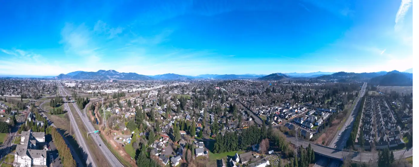
Springfield does not get the outdoor credit it deserves. Most people who have heard of the Eugene–Springfield area think of Eugene when they think of trails and parks, which means they miss the fact that Springfield runs its own dedicated park district — one that has been operating since 1944 — with 46 parks and natural areas, 10 waterfront sites, and 28 miles of hiking and biking trails covering nearly 1,500 acres across a city of 61,182 people. That is a serious parks system for a mid-size Oregon city, and it shapes daily life here in ways that a quick drive-through would not reveal.
The engine behind all of it is the Willamalane Park and Recreation District, a voter-created special district governed by an elected five-member board, separate from the city government. Willamalane earned national park and recreation accreditation in 2022 — a third-party audit of operational quality — and it runs everything from the riverside natural areas to the indoor waterpark in the Thurston neighborhood. For families deciding whether Springfield fits, the district is one of the city's strongest practical arguments.
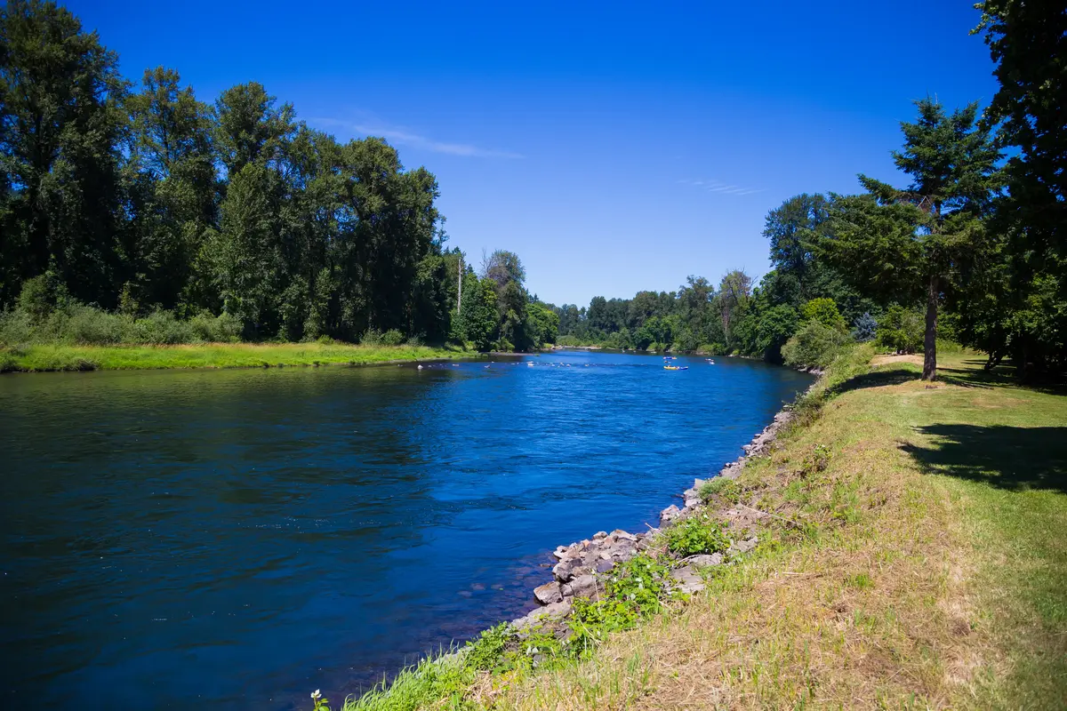
What makes Springfield's outdoor offering genuinely distinctive is how much of it connects to water. The Middle Fork of the Willamette River threads through the city's south end, and the trail system is built around it. You can walk from a National Register of Historic Places hazelnut farm through Douglas-fir forest, along the river, and out to a 65-acre swimming and boating park — all on a paved or gravel path — without touching a road. That kind of continuous green corridor is rare in a city this size. Springfield gets 158 sunny days a year, which is honest Willamette Valley weather, so residents who get outside tend to do it year-round rather than waiting for a long summer window.
Whether you are weighing a move or just getting oriented, the sections below cover Springfield's signature parks, its trail network, its water recreation options, and the seasonal programming that makes the district's calendar worth knowing before you arrive.
Willamalane District: The Scale of What Springfield Has Built
The numbers are worth sitting with for a moment. Forty-six parks and natural areas. Nearly 1,500 acres. Ten waterfront sites. Twenty-eight miles of trails. For a city that often plays second fiddle to its neighbor, Springfield's park infrastructure is not a small-town afterthought — it is a full-scale system that would be competitive in cities twice the size.
Willamalane was established by a voter-approved measure in 1944, which makes it one of the older park districts in the state. The fact that it operates independently of the city means it has its own funding stream, its own elected board, and its own accreditation track. The national accreditation it earned in 2022 is not a marketing label — it is a third-party audit of whether an agency's operations, management, and community service actually meet national industry standards. Most park districts never pursue it.
What that means practically: the parks are maintained. The trails are signed and paved or groomed where they need to be. The facilities run year-round. Newcomers from cities with under-resourced parks systems sometimes assume Oregon's rain means the outdoor infrastructure goes neglected — Springfield's does not.
| Park / Trail | Acreage or Length | Primary Use | Best For |
|---|---|---|---|
| Dorris Ranch Living History Farm | 268 acres | Walking, birding, living history | Nature Families |
| Clearwater Park | 65 acres | Boating, paddlesports, swimming, fishing | Nature |
| Island Park | 14 acres | Events, picnicking, riverside walks | Families Walkable |
| Willamalane Park (flagship) | — | Running trail, memorials, fitness | Families |
| Middle Fork Path | 4 miles | Walking, running, cycling | Nature |
| Mill Race Path | 2.7 miles | Walking, cycling, commuting by bike | Walkable Commuter |
| Splash! at Lively Park | — | Indoor waterpark, lap swimming | Families |
The district also organizes the city's major seasonal events — more on those in the final section — which means Willamalane is not just managing green space but anchoring the community calendar.
Dorris Ranch, Clearwater, and Island Park: The Three Anchors
Dorris Ranch Living History Farm
Dorris Ranch is one of those places that sounds like a regional curiosity until you actually walk it. The 268-acre municipal park south of downtown Springfield is listed on the National Register of Historic Places as the site of the first commercial filbert — hazelnut — orchard established in the United States, dating to 1892. That history is still visible: the old orchards are part of the trail system, and the farm still functions as a working orchard and living history site.
The trail network here covers 4.5 miles of gravel paths through hazelnut orchards, Douglas-fir forest, and riparian corridor along the Middle Fork of the Willamette River. The habitat variety makes it one of the better birding spots in Lane County — oak woodland, native understory shrubs, and a river edge in one loop. The living history programming includes a replica Native American plank house and a pioneer log cabin, which gives families with kids a reason to slow down rather than just walk through.
Dorris Ranch is free to visit, open from dawn to dusk. It also serves as the western trailhead for the Middle Fork Path, so it functions both as a destination and as the starting point for a longer river run. The annual Haunted Hayride each October has become a genuine community tradition — the kind of event that fills a calendar before the summer is over.
Best for: birding, family walks, history-minded visitors, trail access to the river corridor.
Clearwater Park
Clearwater is the water-access park — 65 acres on the Middle Fork of the Willamette River with two boat ramps, paved parking for boat trailers, and direct river access for paddlesports, fishing, and swimming. It is the eastern terminus of the Middle Fork Path, which means you can park here, run or bike the path west to Dorris Ranch, and return without doubling back on roads.
Life jackets are available at the park through the warm months, which matters for families who want river access without needing to bring full gear. The swimming area makes this one of the most-used parks on hot summer days — and on the 158 sunny days a year Springfield actually gets, the river stretch here draws steady use.
Best for: boating, paddling, fishing, swimming, anchoring a longer trail-and-water day.
Island Park
Island Park sits between the Willamette River and downtown Springfield on 14 acres, connected to the broader riverfront trail network. It is where the city gathers for summer events — the stage at Island Park anchors concerts and community programming, including the annual Children's Celebration each July that Willamalane runs. Picnic shelters and grills can be reserved, which makes it the practical choice for family gatherings close to downtown.
The park's position — downtown-adjacent, riverfront, trail-connected — is what gives it outsized social weight relative to its acreage. It is not the place you go for a long hike; it is the place you go when the city is doing something together.
Best for: community events, picnics, riverside walks, families with young children.

The Trail Network: Getting Around Springfield on Foot and by Bike
Springfield's trail system is more connected than most people expect. The two key routes — the Middle Fork Path and the Mill Race Path — link together to form roughly an 8-mile loop that pulls in Dorris Ranch, the river corridor, and downtown Springfield. That is a genuinely useful circuit, not a linear out-and-back that dead-ends at a parking lot.
Middle Fork Path
The Middle Fork Path runs 4 miles point-to-point, paved to a 10-foot width, along the Middle Fork Willamette River. Trailheads sit at Dorris Ranch to the west and Clearwater Park to the east. The paving and width make it accessible to cyclists, parents with strollers, and runners — the surface does not demand trail shoes or a mountain bike. Wildlife sightings along the river edge are common, and Mount Pisgah is visible to the south on clear days, which is the kind of detail that makes a routine run feel less routine.
Mill Race Path
The Mill Race Path adds 2.7 miles of paved trail running alongside the historic Mill Race canal, connecting downtown Springfield westward to the Middle Fork Path. The canal history gives the corridor a different character than the river trail — it is quieter, more enclosed, and genuinely urban-to-rural in feel as it moves from the downtown edge toward the river system. Combined with the Middle Fork Path, the two trails form that ~8-mile loop that includes downtown.
For residents who commute by bike or want to run from their front door without loading gear into a car, the connectivity matters. Several neighborhoods near downtown can reach the trail system without crossing a major arterial.
Willamalane Park's Shana's Trail
The flagship Willamalane Park added Shana's Trail in 2021 — a half-mile rubberized running loop honoring former Springfield High School track athlete Shana Thomas Barr. The rubberized surface is easier on joints than pavement and the loop is accessible, with a fitness station adjacent to the track. It is not a destination trail by length, but for daily use — a quick lunch run, a walk with kids after school — it fills that role in the neighborhood around the flagship park.
The park also houses the Springfield Vietnam Veterans Memorial, constructed in 1968 in a collaboration between Willamalane and the City of Springfield, which gives the space a civic weight beyond its recreation footprint.
One thing newcomers underestimate: the 28 miles of trails Willamalane manages do not all connect. The Middle Fork and Mill Race corridors form the spine, but several of the 46 parks are standalone neighborhood sites. If trail connectivity is your primary reason for choosing a neighborhood, the areas nearest Dorris Ranch or the Middle Fork Path give you the most direct on-foot access. For a closer look at how neighborhoods map to the trail system, see the neighborhoods guide.
Looking to buy in Springfield? Estimate your payment.
Enter your numbers to see an estimated monthly mortgage payment.
Estimate only. Excludes HOA fees and mortgage insurance. The interest rate above is a starting point, not a quoted rate — replace it with your own to see real numbers. Insurance is a flat placeholder, not a Springfield quote.
Seasonal Recreation and Indoor Options: Year-Round Use of Springfield's Parks
The honest reality of Willamette Valley outdoor life is that you build habits around the shoulder seasons, not just summer. With 158 sunny days a year, Springfield residents who wait for a clear-sky window will spend a significant part of the year inside. The parks system is used in the rain — Dorris Ranch's gravel paths drain reasonably well, the paved trail routes stay accessible year-round, and the district's indoor facilities pick up the slack when the weather closes in.
Splash! at Lively Park
Splash! at Lively Park, in the Thurston area, is the only indoor waterpark in the Springfield–Eugene area. It opened as the first indoor wave pool in the Pacific Northwest, and the facility has expanded since: a wave pool, a large waterslide, a six-lane lap pool, a kiddie pool, a spa, and an outdoor sun deck for the days when the sun actually cooperates. For families with young kids, this is the park that gets used most heavily in the November-through-March stretch when outdoor options narrow.
It is also the lap-swimming venue for residents who want year-round water fitness that the river obviously cannot provide in January. The Thurston neighborhood location means it is most convenient to that part of the city — something worth considering if indoor water access is a priority for your household.
The Community Event Calendar
Willamalane anchors the city's seasonal community calendar in a way that goes beyond passive park maintenance. The MEGGA Hunt each spring at Lively Park is one of the district's signature spring events. The Children's Celebration each July brings families to Island Park's stage. The Haunted Hayride at Dorris Ranch each October is the kind of event that fills up fast and gives the farm a reason to draw crowds outside the typical walking-and-birding season.
These are not incidental add-ons. For a city where community gathering can feel spread thin between Springfield and its larger neighbor to the west, Willamalane's calendar functions as one of the primary reasons residents feel a sense of local identity rather than just a Eugene suburb. Parents with school-age children tend to discover the district's programming early and stay tied to it — for more on youth activities and school connections, see the schools page.
What to Know Before You Move Here
Six months in, most newcomers are pleasantly surprised by how much the trail system gets used — and occasionally frustrated that the indoor facilities are the only real option during a gray February stretch. The outdoor parks are genuinely good. The rainy-season gap between them and a full indoor recreation offering is real, and Splash! at Lively Park is doing most of that work.
The other thing people do not expect: Dorris Ranch, which looks on a map like a distant municipal oddity, ends up being a regular part of weekly life for families who live nearby. The combination of free access, varied habitat, and quiet trails makes it the kind of place that turns a 45-minute afternoon into a habit. That is not guaranteed by the acreage alone — it takes a park that is actually maintained well. Willamalane's national accreditation reflects what you see on the ground.
Local Expert Takeaway: Springfield's Willamalane Park and Recreation District is the city's most underrated asset — 46 parks, nearly 1,500 acres, and a trail corridor that links Dorris Ranch's historic hazelnut orchards to Clearwater Park's river access in a single 4-mile paved route. The Middle Fork Path and Mill Race Path together form an ~8-mile loop that residents actually use to commute, run, and spend an afternoon without getting in a car. If outdoor access matters to your decision, put the neighborhoods near the Middle Fork corridor at the top of your list — and factor Splash! at Lively Park into your calculus if you have kids and plan to live here through a Willamette Valley winter.
Quick Takeaways & FAQs
✅ Willamalane Park and Recreation District manages 46 parks and nearly 1,500 acres, with national accreditation earned in 2022 — serious infrastructure for a city of Springfield's size.
⚠️ Springfield gets only 158 sunny days a year, and the indoor options (primarily Splash! at Lively Park) are limited to one facility — outdoor enthusiasts need to build habits around the shoulder seasons.
📍 Dorris Ranch Living History Farm is listed on the National Register of Historic Places as the first commercial hazelnut orchard in the U.S., and it doubles as the western trailhead for the Middle Fork Path — free to visit, open dawn to dusk.
How many parks does Springfield, Oregon have?
Is Dorris Ranch in Springfield free to visit?
What is the Middle Fork Path and where does it go?
Does Springfield have an indoor swimming or recreation facility?
What outdoor recreation is available at Clearwater Park?
Moving to Oregon?
Tell us what you need help with and we'll connect you with local resources.
