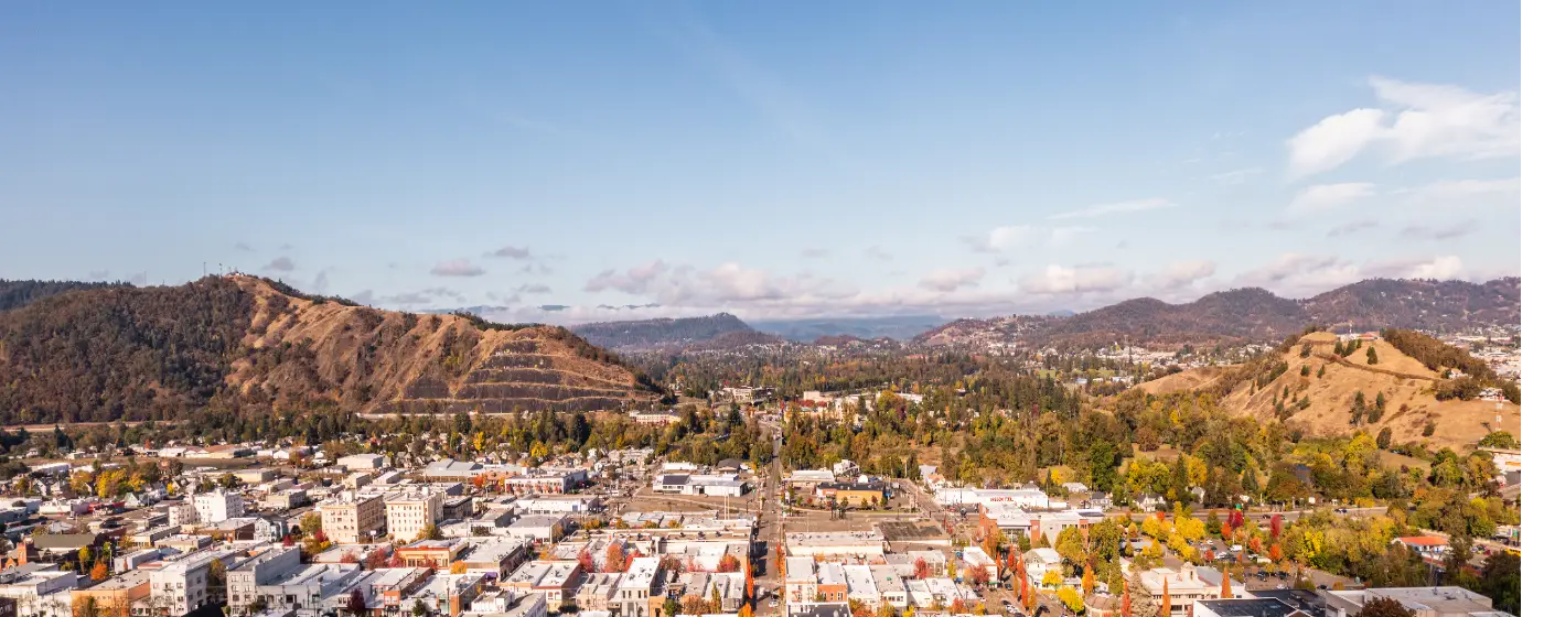
The headline number that stops people when they research Roseburg is the property crime rate. It looks alarming on first glance, and if you read it without context, you might cross the city off your list before understanding what's actually driving it. Here's the honest version: Roseburg carries a city of 23,795 people on the daily service burden of something closer to 50,000 to 60,000 — residents, workers, travelers, and freight moving through one of I-5's main corridor stops in Southern Oregon. That structural reality shapes the crime picture more than anything about the residential character of the city itself.
Violent crime is the number that matters most to most families weighing a move, and on that measure, Roseburg compares favorably. The city posts a violent crime rate of 2.4 per 1,000 residents — below the Oregon state rate of 3.3 per 1,000 and meaningfully below the national rate of 3.7 per 1,000. A property crime rate of 38.5 per 1,000 residents is the figure that requires more explanation, because it runs above state and national benchmarks. But the distribution of that property crime is heavily skewed toward commercial zones, not the residential neighborhoods where most buyers are actually looking. Understanding that split is the most useful thing you can do before choosing an area.
There is also a directional story worth knowing. FBI Uniform Crime Report data released in late 2025 showed violent crime in Roseburg dropped roughly 34 percent in 2024 compared to 2023, with overall crime down approximately 15 percent — part of a multi-year downward trend rather than a single-year blip. The city's typical home price of $368,343 (July 2026) puts homeownership within reach for many buyers, and the neighborhoods that attract families tend to read very differently from the aggregate statistics that dominate the search results.
The sections below break down how Roseburg's crime numbers compare to state and national benchmarks, what's driving the property crime figure, which neighborhoods trend safer, what the Roseburg Police Department looks like structurally, and what to actually look for when you're researching specific streets or blocks.

How Roseburg's Crime Numbers Compare to Oregon and the Nation
| Measure | Roseburg | Oregon | National | vs. national |
|---|---|---|---|---|
| Violent crime (per 1,000) | 2.4 | 3.3 | 3.7 | 35% lower |
| Property crime (per 1,000) | 38.5 | 24.5 | 18.4 | 109% higher |
State and national figures — Bureau of Justice Statistics, Crime Known to Law Enforcement, 2024 (tables 2 and 3). City figures — NeighborhoodScout. City rates come from a different reporting series than the state and national benchmarks, so read the comparison as a direction, not a precise multiple.
The comparison table the engine renders below this section tells the core story in numbers. The prose here adds the context those numbers alone can't give you.
Roseburg posts a violent crime rate of 2.4 per 1,000 residents — below both the Oregon state rate of 3.3 per 1,000 and the national rate of 3.7 per 1,000 (Bureau of Justice Statistics, Crime Known to Law Enforcement, 2024, tables 2 and 3). That gap is meaningful, not marginal. A city of Roseburg's size pulling a violent crime rate a third below the national average is a real data point, not cherry-picking.
A property crime rate of 38.5 per 1,000 residents is where the story gets more complicated. Oregon's state rate is 24.5 per 1,000; the national rate is 18.4 per 1,000. Roseburg runs notably above both. What that figure does not tell you is where the crime happens or who it happens to.
The I-5 Effect
I-5 runs directly through Roseburg, routing high-volume freight and a transient population through the city's commercial corridors every day of the year. Analysts consistently identify this as the primary structural driver of elevated property crime numbers — not a reflection of the residential neighborhoods most buyers are evaluating.
Crime rates calculated per resident can read high in commercial zones even when the resident count there is low. A stretch of commercial blocks that serves thousands of daily visitors produces the same kind of statistical distortion you see in any city whose retail core has a much larger daytime population than a nighttime one. The Garden Valley commercial corridor, which is Roseburg's most active retail strip, accounts for a disproportionate share of vehicle break-ins, shoplifting, and motor vehicle theft.
Drug Crime in Context
CrimeGrade.org's analysis places Roseburg's drug offense rate slightly below the average U.S. city, and puts the city in approximately the 39th percentile for burglary — meaning the majority of cities nationally have a more serious burglary problem. Those figures are directionally consistent with what the FBI UCR data shows: Roseburg's property crime issue is real and concentrated, rather than spread evenly across the city.
What most people searching "is Roseburg safe" don't find is that the chance of becoming a crime victim varies sharply by geography — from roughly 1 in 19 in the eastern commercial zones to roughly 1 in 55 in the northwestern parts of the city. That range illustrates why the city-level average is the least useful number for a buyer trying to choose a specific neighborhood.
Neighborhood-by-Neighborhood Safety Picture
The single most useful frame for understanding safety in Roseburg is the divide between commercial corridors and residential hillside neighborhoods. The city's topography does a lot of the work here — literally. Neighborhoods elevated above the valley floor tend to be insulated from the commercial traffic patterns that drive property crime numbers in the flatlands.
Hucrest
Hucrest sits on the western hillside above the city, and that elevation creates a natural separation from the Garden Valley retail strip and its associated property crime clusters. Residents describe the neighborhood as quiet and family-oriented, with established homes and proximity to Stewart Park. It consistently trends among the safer parts of the city, both in available data and in the day-to-day experience residents report.
Best for: Families Quiet
Garden Valley
Garden Valley is Roseburg's commercial engine — the retail corridor where most of the city's daily commerce happens. Vehicle break-ins and retail theft are most concentrated here, a pattern that is consistent with any high-traffic commercial zone anchored to an interstate. The residential streets that run adjacent to the commercial strip are not the same as the strip itself, and buyers who understand that distinction evaluate Garden Valley more accurately than those who treat the commercial stats as a neighborhood verdict.
Best for: Commuters Renters
Edenbower
Edenbower is one of the more established residential areas in Roseburg, with a character that skews quieter than the Garden Valley corridor. It draws families with school-age children partly for its proximity to schools and partly because it reads as a conventional suburban neighborhood rather than a transitional one. The area's safety profile tends to track closer to Hucrest than to the commercial zones.
Best for: Families Schools
West Harvard
West Harvard sits in the city's western reaches and benefits from some of the same insulation from commercial traffic that characterizes Hucrest. It is a lower-profile neighborhood in terms of available data, but it sits on the quieter end of the city's spectrum rather than the commercial end.
Best for: Quiet Value
Downtown Roseburg — Mill-Pine Historic District
Downtown Roseburg is an honest mixed picture. The Mill-Pine Historic District has been on the National Register of Historic Places since 1985, and Thrive Umpqua's 2024 entry into the Oregon Main Street program — followed by a 2025 Oregon Main Street Revitalization Grant for structural and roof repair projects — signals real institutional investment in the area's trajectory. That investment is happening in part because downtown had ground to recover: proximity to the interstate and to transient traffic has historically pushed property crime numbers higher here than in the residential neighborhoods. The direction is positive; the starting point requires honesty.
Best for: Walkable Renters
Melrose
Melrose, southwest of the city core, trends toward the safer end of Roseburg's neighborhood spectrum. Available aggregated data places it among the more favorable parts of the city for property crime, and its residential character is consistent with that picture — it is away from the commercial corridors and does not carry the same transient-traffic patterns that elevate numbers elsewhere.
Best for: Families Privacy
Winchester and Highlands
Winchester and Highlands did not return strong independent safety data in available sources. What can be said: both sit outside the primary commercial corridors that drive Roseburg's property crime statistics, and neither carries the kind of concentrated commercial traffic that anchors the Garden Valley numbers. Treat them as consistent with the broader residential picture — less exposed to commercial crime patterns than the city's aggregate statistics suggest.
Best for: Nature Quiet

What's Driving the Property Crime Numbers
Roseburg's property crime rate deserves a structural explanation rather than a verdict, because the structural explanation is what's actually useful to a buyer.
Commercial-Zone Concentration
Vehicle break-ins, shoplifting, and motor vehicle theft — the three categories that move a property crime rate the most — are overwhelmingly concentrated in Roseburg's commercial zones. The Garden Valley retail corridor is the clearest example. It serves a regional customer base drawn from the surrounding Douglas County area, which means the number of people moving through those blocks on any given day is a multiple of the resident population. Crime that happens in that corridor gets counted against Roseburg's 23,795 residents, not against the larger daily population actually using it.
This is not unique to Roseburg — it is the standard distortion for any small city sitting on a major interstate with a regional commercial center. But it means the aggregate property crime rate is a less accurate guide to residential neighborhood safety than most city-level comparisons imply.
The Freeway as a Variable
I-5's path through Roseburg brings genuine benefits — access to Eugene and Medford, economic activity, jobs. It also routes a transient population through the city's commercial strips in a volume that would overwhelm any city of similar residential size. The property crime clusters that CrimeGrade.org identifies in the eastern commercial zones align directly with the I-5 interchange areas and the retail density that has built up around them.
Buyers who understand this can make better decisions about where in Roseburg they want to live. The hillside neighborhoods to the west — Hucrest, Melrose, West Harvard — are not in the path of that traffic in the same way, and their day-to-day character reflects that.
What Doesn't Show Up in the Headline Number
The city-level rate also cannot capture the direction of travel. FBI UCR data for 2024 showed violent crime dropping roughly 34 percent from the prior year and overall crime falling approximately 15 percent — a meaningful shift in a single reporting period, and consistent with a multi-year trend rather than a one-year anomaly. A rate that is already below the national violent crime benchmark and moving further in that direction tells a more useful story than a static snapshot.
Looking to buy in Roseburg? Estimate your payment.
Enter your numbers to see an estimated monthly mortgage payment.
Estimate only. Excludes HOA fees and mortgage insurance. The interest rate above is a starting point, not a quoted rate — replace it with your own to see real numbers. Insurance is a flat placeholder, not a Roseburg quote.
Roseburg Police Department and Public Safety Infrastructure
Understanding the department's structure adds useful context to the raw crime numbers.
Department Size and Call Volume
The Roseburg Police Department is the largest municipal law enforcement agency in Douglas County. The department handles a substantial call volume every year — a significant load for a city of 23,795 residents, but less surprising when you account for the daily service population that approaches 50,000 to 60,000 people counting workers and through-traffic. The retail corridor sees the most incidents; the residential hillside neighborhoods see far fewer. The per-resident staffing picture looks different when you denominate it against the actual number of people generating those calls.
In July 2024, the department implemented a 32-hour workweek program — a retention and recruitment strategy that has drawn attention statewide as one approach to the officer staffing challenges that have affected departments across Oregon. The goal was to retain experienced officers without relaxing hiring standards, rather than simply increasing the force through accelerated hiring.
Co-Responder Model
One of the more consequential changes to how Roseburg handles public safety calls is the Adapt Mobile Crisis Team, which works alongside the police department to respond to mental health crises. The team uses mobile vans to connect individuals with voluntary services — a co-responder model funded in part through the state IMPACTS grant program. Mental health calls represent a meaningful share of what generates police service volume in any city of Roseburg's size, and diverting appropriate calls to a specialized response team is both a better outcome for individuals in crisis and a more efficient use of sworn officers.
This kind of infrastructure investment does not show up in crime statistics directly, but it reflects the kind of systemic approach that tends to produce gradual, durable reductions in both crime rates and the kinds of incidents that alarm residents.
What Six Months Here Teaches You
People who move to Roseburg from larger metros often arrive expecting the property crime statistics to be visible everywhere. What most of them find after a few months is that their specific neighborhood — particularly if they landed west of the commercial corridors — feels substantially quieter than the numbers implied. The experience of living in Hucrest or Edenbower is not the experience of the Garden Valley commercial strip, and many new arrivals say no one told them that distinction mattered as much as it does.
How to Research Safety Before Choosing a Neighborhood
City-level crime statistics are a starting point, not a conclusion. Here's how to actually use the available data when you're evaluating specific parts of Roseburg.
Use Geography as Your First Filter
The west-side hillside neighborhoods — Hucrest, West Harvard, Melrose — sit physically removed from the commercial corridor traffic that drives Roseburg's property crime numbers. If your priority is minimizing exposure to property crime, that geography is the single most useful filter to apply before looking at anything else. The topography does real work here: the elevation and the residential-only character of those streets limit the transient traffic that creates commercial-zone crime patterns.
Edenbower and the established neighborhoods in the city's southern reaches carry a similar residential character without the same hillside elevation. They are not immune to the city's aggregate statistics, but they are not the commercial corridors either.
Check Block-Level Data, Not Just Neighborhood Labels
Tools like CrimeGrade.org let you look at smaller geographic slices than neighborhood-level labels. The difference between a block adjacent to a commercial strip and a block two streets removed can be substantial in a city where crime concentrates as sharply as it does in Roseburg. When you're evaluating a specific address, use those tools to check the immediate surroundings rather than relying on the neighborhood name alone.
The range CrimeGrade.org identified — from roughly 1 in 19 in the eastern commercial zones to roughly 1 in 55 in the northwest — illustrates how much precision matters here. A neighborhood-level label averages across that range rather than resolving it.
Talk to the People Who Already Live There
Nextdoor is active in Roseburg's residential neighborhoods, and the conversations there tend to give you a faster read on what residents are actually experiencing than any aggregated statistic. Hucrest residents, for example, describe the neighborhood as quiet and well-kept — consistent with the data, but also more specific about what daily life actually feels like. Residents who have lived near the Garden Valley commercial strip will tell you plainly which blocks they avoid and which ones are genuinely fine.
Roseburg is not a city where you need to be anxious about your safety in a general way. It is a city where the specific street matters more than the city-level statistic suggests. That distinction is easy to research if you know what to look for — and the neighborhood guide at the best neighborhoods page gives you the character read for each area to start from.
The Honest Tradeoff
Some buyers move to Roseburg expecting the property crime statistics to improve quickly and uniformly. The structural drivers — I-5, the regional commercial footprint, the daily service population — are not going anywhere. What is genuinely improving is the directional trend in both violent and property crime, and the investment in alternatives to traditional police response for certain call types. The realistic expectation is gradual, steady improvement in the residential neighborhoods, not a fast resolution to the commercial-corridor numbers that will continue to pull the aggregate rate upward as long as the commercial activity is there.
That is an honest picture, and it is a better starting point for a neighborhood decision than either the alarming headline or an overly optimistic counter-narrative.
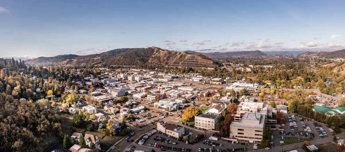
Local Expert Takeaway: Roseburg posts a violent crime rate of 2.4 per 1,000 residents — a fact that tends to surprise people who found the property crime rate first. The property crime figure is real, but it is overwhelmingly concentrated in the Garden Valley commercial corridor and the I-5 interchange zones, not the residential hillside neighborhoods where most families end up living. Hucrest, Melrose, and Edenbower read very differently from the aggregate statistics. If you're weighing a move to Roseburg, the most useful thing you can do is research your specific block rather than relying on the city-level number — the variance across the city is sharp enough that the headline figure is almost the least informative number available to you.
Quick Takeaways & FAQs
✅ Roseburg posts a violent crime rate of 2.4 per 1,000 residents — below both the Oregon state average and the national average, a genuine safety strength that gets buried under the property crime headlines.
⚠️ A property crime rate of 38.5 per 1,000 residents is real and runs above state and national benchmarks, driven primarily by vehicle break-ins and retail theft concentrated in the Garden Valley commercial corridor and I-5 exchange areas — not the residential neighborhoods most buyers are evaluating.
📍 The difference in crime exposure between Roseburg's western hillside neighborhoods and its commercial corridors is sharper than in most cities its size — block-level research matters more here than it does in a city with more uniform crime distribution.
Is Roseburg, Oregon a safe place to live?
Which Roseburg neighborhoods are the safest?
Why is Roseburg's property crime rate so high?
Is crime in Roseburg getting better or worse?
How does Roseburg compare to other Southern Oregon cities for safety?
Moving to Oregon?
Tell us what you need help with and we'll connect you with local resources.
