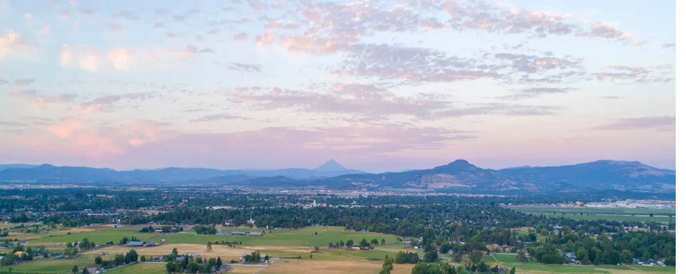
Most cities of Central Point's size don't sit at the trailhead of a 20-mile regional greenway and within a short drive of two volcanic mesa hikes that draw visitors from across the Rogue Valley and well beyond. Central Point does. The city's geography puts it at the northern end of the Bear Creek Greenway, within reach of the Rogue River at TouVelle State Recreation Site, and practically in the shadow of Upper and Lower Table Rock — a pair of lava-capped mesas that are as close to a landmark as the Rogue Valley gets. If outdoor access is a factor in where you choose to live, this city has a case that its larger neighbor Medford cannot fully match.
Day-to-day recreation is grounded, not aspirational. Don Jones Memorial Park anchors the city's park system with a full suite of amenities, and Twin Creeks Park in the neighborhood of the same name functions as a true community gathering space with a bandshell, picnic shelters, and sports fields at adjacent Civic Field. What you won't find here is a resort-town price tag attached to that access — the typical home price sits at $423,657 as of July 2026, and much of the best outdoor recreation is free. For the full cost-of-living picture, see the cost of living in Central Point page.
Southern Oregon's climate is a genuine asset for outdoor recreation. Central Point gets 192 sunny days a year, which means the Greenway, the Table Rock trails, and TouVelle's riverbanks are usable through most of the calendar. Spring brings wildflower season on the mesas and the best birding along Bear Creek. Summer means the spray park at Don Jones and fishing the Rogue. Fall is the second peak for trail use — cooler temperatures and less foot traffic than spring. There are real seasonal rhythms here, and once you know them, the city's recreation calendar starts to feel remarkably full for a place this size.
This guide covers Central Point's signature parks, its trail connections, the Rogue River access at TouVelle, and what each season actually looks like for residents who plan to spend time outdoors.
Bear Creek Greenway: Central Point's 20-Mile Backyard Trail
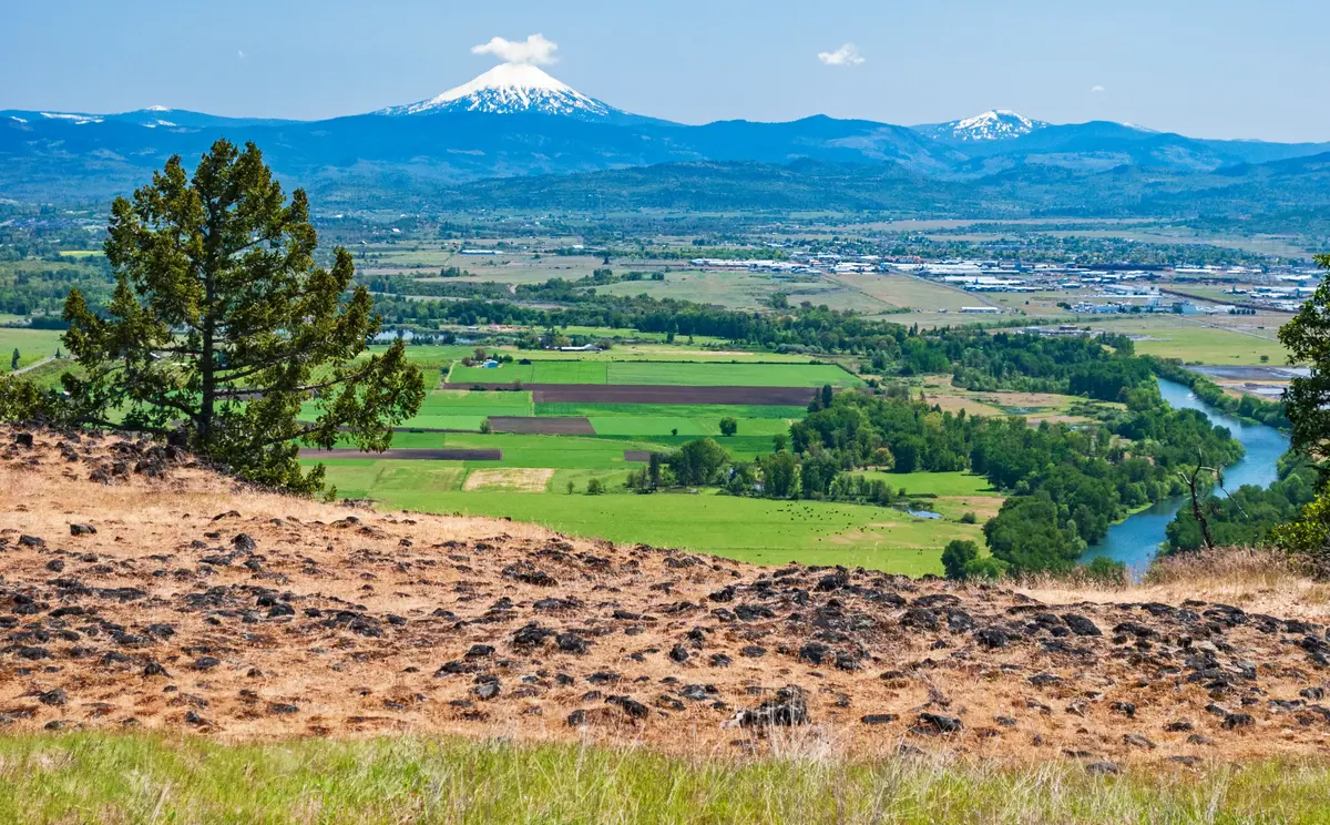
Central Point sits at the northern end of the Bear Creek Greenway — a 20-mile paved, multi-use trail that runs south through Medford, Phoenix, Talent, and all the way to Ashland. That positioning matters. Residents here don't have to drive to reach a trailhead; the Greenway is the kind of infrastructure that shapes how a city actually functions, not just how it markets itself.
The trail is separated from vehicle traffic for nearly its entire length, with only two at-grade road crossings over 20 miles. It parallels Bear Creek itself, so the route carries real riparian character — willows, red-winged blackbirds, great blue herons working the shallows — rather than just asphalt between two points. Cyclists, runners, and walkers share it comfortably, and leashed dogs are welcome throughout.
The spring wildflower window, roughly March through May, and the fall stretch from September into October are the two peaks for trail use. Midwinter weekdays you can run it with more herons than other people. Parks along the route supply parking, restrooms, drinking water, and picnicking areas at regular intervals, which makes longer out-and-back trips practical without hauling supplies.
What Locals Know About the Greenway
The Greenway's birding is genuinely good — good enough that serious birders target it, not just casual walkers who notice a heron. The stretch nearest Bear Creek through Central Point offers some of the best wildlife viewing on the whole corridor. If that kind of thing matters to your household, it's worth factoring into your neighborhood search; the Central Point neighborhoods page breaks down which areas sit closest to Greenway access points.
One honest note: the trail's popularity grows with the region. On a spring weekend morning, the sections nearest Medford see real foot and bike traffic. The Central Point end tends to be quieter, which is either a feature or a limitation depending on what you're after.
City Parks: Don Jones, Twin Creeks, and the Neighborhoods They Serve
Don Jones Memorial Park is Central Point's largest park at approximately 8 acres, and it earns that designation. The facility includes a water spray park, a large playground, basketball and tennis courts, walking paths, a gazebo, BBQ areas, and restrooms. For families with younger children, the spray park is the summer draw — it runs from Memorial Day through Labor Day and is free.
The park also holds the Oregon Fallen War Heroes Memorial, a tribute to Oregon citizens lost in conflicts from the Civil War through the Iraq War. It's a sober, well-maintained installation that gives the park a civic weight beyond its recreational footprint. It's worth knowing about before you arrive with kids, because it tends to prompt real conversations.
Twin Creeks Park: The Neighborhood Hub
Twin Creeks Park, in the Twin Creeks neighborhood on the city's newer northwest side, functions differently than Don Jones. It's a community gathering space by design — covered picnic shelters with log construction, gazebos, a bandshell, basketball courts, and sand volleyball, with sports fields at adjacent Civic Field directly across from the park. Seasonal events draw residents here throughout the year, and on a warm weekend afternoon it reads as a genuine neighborhood commons rather than an underused amenity.
The park reflects the demographic reality of Twin Creeks itself: a planned neighborhood built for families with kids, where the park was part of the original vision rather than retrofitted later. If that neighborhood is on your list, the neighborhoods page covers the distinction between Twin Creeks and the city's older residential areas.
What Surprises People After Six Months
New residents often underestimate how much of social life in Central Point organizes itself around these parks — not just for scheduled events, but for the informal rhythms of weekday mornings and weekend afternoons. Don Jones in particular becomes a reference point you use more than you expect. People who move here thinking the parks are a secondary feature tend to revise that assessment by summer.
Upper and Lower Table Rock: The Hikes That Define This Part of Oregon
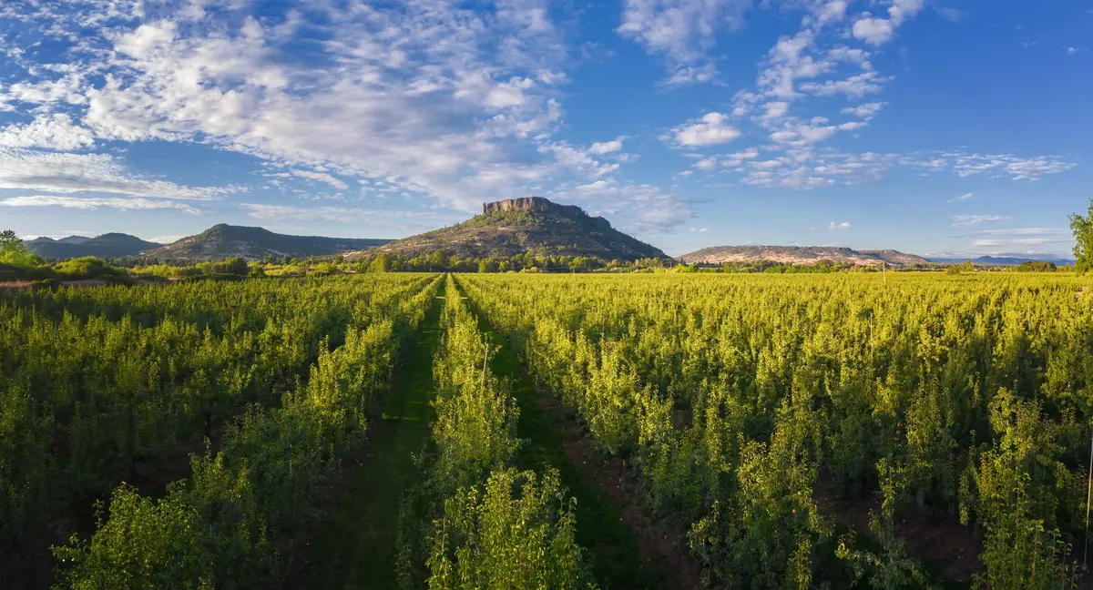
Upper and Lower Table Rock are two lava-capped volcanic mesas jointly managed by the Bureau of Land Management and The Nature Conservancy, accessible from the Central Point area via Table Rock Road. They draw visitors from across the region and well beyond — the parking areas on a spring weekend morning fill well before midday — and they're the reason the city ends up in so many conversations about where to live in the Rogue Valley.
The Upper Table Rock trail runs 2.5 miles round trip with 720 feet of gain. Lower Table Rock is 3.5 miles round trip with 780 feet of gain. Both routes top out on broad, flat plateaus with panoramic views of the Rogue Valley and the surrounding Cascade and Siskiyou ranges. On a clear spring day at the top, you can see the shape of the whole valley — Medford below, the Cascades to the east, the Siskiyous to the south. It's the kind of view that explains why people move here from Sacramento and never quite leave.
Spring Wildflower Season: The Detail Worth Planning Around
Up to 75 species of wildflowers bloom on the Table Rocks in spring, concentrated in the vernal pools that form on the flat basalt plateaus. The BLM and The Nature Conservancy offer guided educational hikes in spring for both school groups and the general public — worth timing a trip around if you have kids or a genuine interest in the ecology. The blooms are the primary reason spring sees the heaviest trail traffic of the year.
For visitors who want access without the elevation gain, a 0.5-mile wheelchair-accessible Oak Savannah Loop Trail on Lower Table Rock covers genuinely interesting terrain at a fraction of the effort. Both trails are free and available year-round.
The Honest Trade-off
The Table Rocks pull crowds from across Southern Oregon and northern California, which means spring weekend parking is a real consideration. Arriving early on a Saturday in April is the local adjustment, not a complaint — but if you're moving here partly for the outdoor access, knowing that the trails have genuine regional draw is more useful than discovering it on your first spring hike.
Looking to buy in Central Point? Estimate your payment.
Enter your numbers to see an estimated monthly mortgage payment.
Estimate only. Excludes HOA fees and mortgage insurance. The interest rate above is a starting point, not a quoted rate — replace it with your own to see real numbers. Insurance is a flat placeholder, not a Central Point quote.
TouVelle State Recreation Site and Rogue River Access
TouVelle State Recreation Site is a 51-acre Oregon state park on the banks of the Rogue River, north of Central Point via Table Rock Road. It is the closest Rogue River access point for most Central Point residents, and it offers more activities in one location than most comparable parks in the region: fishing, swimming, a 2-mile hiking trail, picnicking at six separate picnic areas, boating from an on-site boat ramp, horseshoe pits, and volleyball courts.
The adjacent Denman Wildlife Refuge amplifies the park's ecological character significantly. Salmon and steelhead pass through seasonally, rainbow trout are stocked by the Oregon Department of Fish and Wildlife, and the refuge draws both resident and migratory bird species that make this stretch of the Rogue one of the more productive birding corridors in Southern Oregon. If you're moving here from somewhere landlocked, the combination of river access and wildlife-watching in one location tends to be the detail that sticks.
Fishing, Swimming, and the Rogue River Calendar
Fishing pressure picks up when steelhead and salmon runs are active — the river sees serious angling interest during those windows, and the boat ramp at TouVelle gets corresponding use. Swimming is a warmer-months activity; the Rogue runs cold even in summer by most standards, which keeps it refreshing rather than comfortable for long swims. The hiking trail through the park adds a quieter alternative to Table Rock on days when the mesa trails are crowded.
A day-use fee applies at TouVelle — an Oregon State Parks annual pass covers it if your household will visit more than a handful of times a year, which most families here do. The park is a short drive from Central Point, and its combination of river, wildlife habitat, and multi-use facilities makes it a regular weekend destination rather than an occasional one.
Putting It All Together
Central Point's recreation picture is more coherent than the city's size might suggest. The Bear Creek Greenway handles your daily and weekly trail needs. Don Jones and Twin Creeks Park absorb the family and neighborhood life. The Table Rocks give you genuine wilderness hiking in under 20 minutes. TouVelle puts the Rogue River within reach for fishing, swimming, and wildlife watching. For a city of fewer than 20,000 people, that's a range of outdoor options that most buyers from larger metros don't expect — and that most residents, once settled, use more than they anticipated.
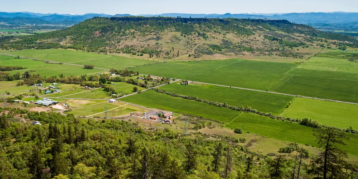
Local Expert Takeaway: Central Point's outdoor access is the city's most underrated asset. The Bear Creek Greenway starts here, the Table Rocks are a short drive away, and TouVelle State Recreation Site puts the Rogue River within reach of your regular weekend routine. Don Jones Memorial Park handles daily family use with a free spray park and solid amenities. What surprises most newcomers isn't that any one of these exists — it's that all four are genuinely accessible from one small city, at a price point well below what comparable outdoor access costs in other parts of the West.
Quick Takeaways & FAQs
✅ Central Point sits at the northern terminus of the 20-mile Bear Creek Greenway, giving residents immediate, car-free trail access that most cities its size can't match.
⚠️ The Table Rocks draw visitors from across Southern Oregon and beyond — spring weekend parking fills early, so plan your first hike for a weekday morning to get the experience without the crowds.
📍 TouVelle State Recreation Site on the Rogue River offers salmon and steelhead fishing, swimming, a boat ramp, and wildlife watching from the adjacent Denman Wildlife Refuge — all within a short drive of downtown Central Point.
Where does the Bear Creek Greenway start in Central Point?
Are the Table Rock hikes appropriate for kids or beginners?
Is Don Jones Memorial Park suitable for young children?
What outdoor activities are available at TouVelle State Recreation Site?
What is the best time of year for outdoor recreation in Central Point?
Moving to Oregon?
Tell us what you need help with and we'll connect you with local resources.
