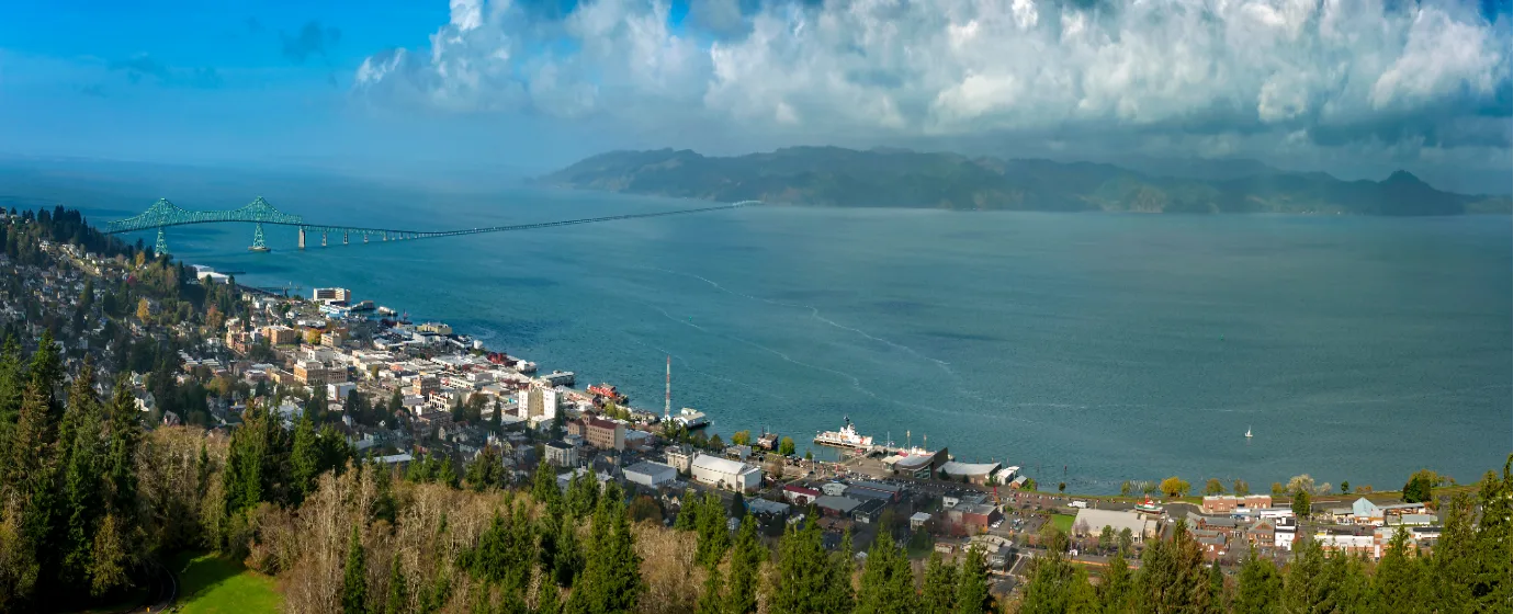
Most people moving to a coastal Oregon town expect some green space and maybe a decent beach. What they don't expect is a city of 10,109 people that sits at the junction of the Columbia River and the Pacific Ocean, with a 6.4-mile waterfront trail, a national historical park five miles down the road, and a 4,300-acre state park close enough to reach on a lunch break. Astoria's outdoor infrastructure is genuinely outsized for its population — a product of geography more than planning, though the city finished a new 2026–2036 Parks Master Plan Update that suggests the investment will continue.
The outdoor calendar here runs on rain as much as sunshine. With 127 sunny days a year, you learn to layer up and go anyway, or you spend a lot of time indoors. The residents who thrive here are the ones who treat a gray drizzle on the Riverwalk as normal rather than a reason to cancel. That said, when the weather breaks — typically late June through September — Astoria delivers the kind of clear-sky coastal days that remind you why you moved here: the Columbia wide and glittering to the north, Saddle Mountain visible to the south, and the whole Clatsop Plains spreading out below Coxcomb Hill.
The outdoor options here sort roughly into three categories: the urban waterfront (the Riverwalk and Tapiola Park), the forested hillside trails (Cathedral Tree, Coxcomb Hill), and the larger wild spaces just outside city limits (Fort Stevens, Fort Clatsop, Youngs River Falls). Each one serves a different kind of day. Whether you're considering a move or just researching the area, the sections below cover Astoria's signature parks, trail network, water access, and what seasonal recreation here actually looks like.
The Astoria Riverwalk: Six Miles of Flat, Year-Round Access
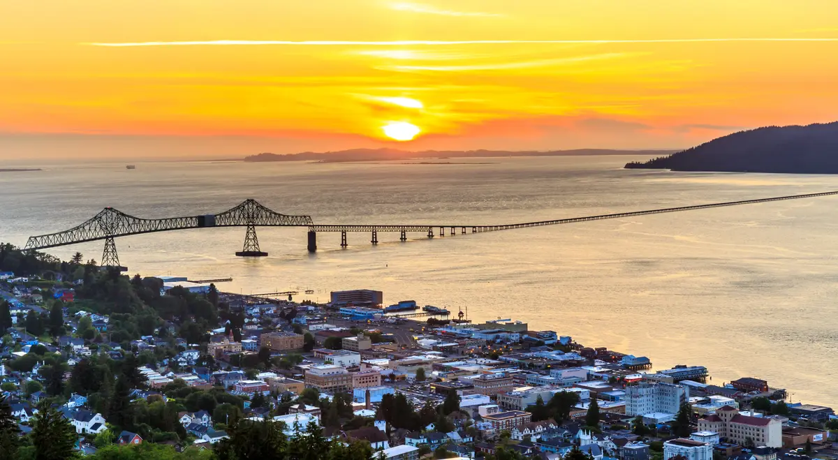
The Riverwalk is the connective tissue of outdoor life in Astoria. Running 6.4 miles along the Columbia River on the city's north edge — from the Smith's Point and Port area on the west all the way to Lagoon Road in the Alderbrook neighborhood on the east — it is flat, mostly paved, and passable in almost any weather. Walkers, runners, cyclists, and inline skaters all share the corridor, and the path's width and surface make it genuinely accessible for strollers and light wheelchairs through most of its length.
The trail follows the former Burlington Northern railroad right-of-way, converted in the mid-1990s, and some sections still run on the original wooden railroad trestles over the water. Walking those trestle sections with the Columbia below you and the Astoria-Megler Bridge overhead is a distinctly Astoria experience — the kind of thing that doesn't exist anywhere else on the coast.
What makes the Riverwalk genuinely unusual, even by Oregon standards, is the Astoria Trolley. A restored historic streetcar shares a portion of the route on summer weekends, one of the only trails in the state where you have to step aside for a vintage trolley. It's a small detail, but it tells you something about how seriously this city takes its waterfront.
The path connects directly to the Columbia River Maritime Museum, the Flavel House Museum, and several waterfront spots for coffee or a meal. It functions as the city's main artery for both recreation and casual movement — and because it's flat, it's the trail that actually gets used on a daily basis rather than just on good-weather weekends.
What Locals Know
The western end, closer to Smith's Point, tends to be quieter and windier. The stretch through the central waterfront draws the most foot traffic and the best views of marine traffic on the Columbia. If you want solitude, head east toward Alderbrook early in the morning.
Hillside Trails: Cathedral Tree, Coxcomb Hill, and the Forest Above the City
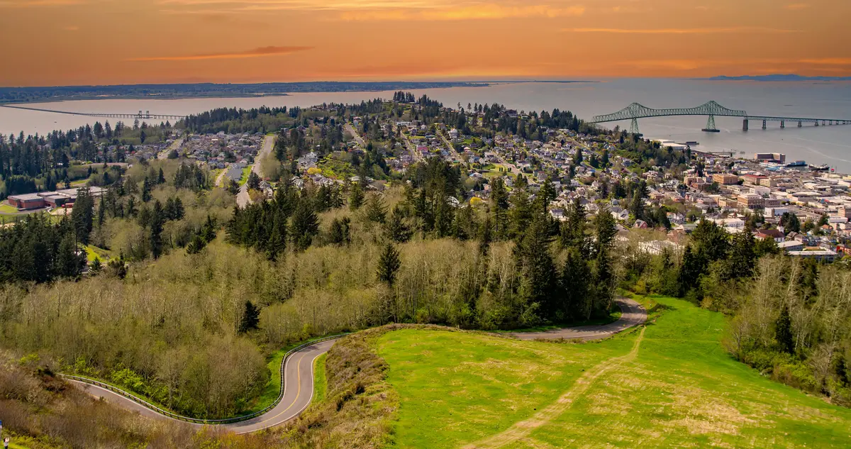
Astoria's hills are steeper than they look from the waterfront, and the trail network on them rewards the effort. The Cathedral Tree Trail is the signature route — a path that winds through old-growth coastal forest from the hillside neighborhoods above downtown up to the Astoria Column on Coxcomb Hill. Along the way, it passes the tree that gives the trail its name: a Sitka spruce estimated at more than 300 years old, roughly 200 feet tall, with a trunk diameter of about 8.5 feet. Standing at its base recalibrates your sense of scale in a way that no photograph quite captures.
The Column itself — completed in 1926, rising 125 feet — is reached by a spiral staircase inside. The observation deck delivers panoramic views south toward Saddle Mountain and west toward the mouth of the Columbia River. On a clear day, you can see Washington State across the water. The combination of the old-growth forest trail and the 1920s monument at its end is an unusual pairing that makes this the most distinctive hike within city limits.
The Cathedral Tree Trail connects the forested hillside to multiple neighborhoods, which matters for daily life. Residents in the hillside neighborhoods above downtown can access the trailhead on foot, making the old-growth forest a genuine part of their weekly routine rather than a destination drive. That kind of walkable trail access — to actual old-growth — is rare for a city this size.
The Trade-Off
The hillside trails are not flat, and some sections are genuinely steep by urban-trail standards. They are also heavily shaded, which means they stay wet and slippery well into the morning after overnight rain. Runners use them regularly, but if you're expecting a well-groomed surface, the Riverwalk is the better fit. These trails reward people comfortable with mud and root systems underfoot.
Fort Stevens and Fort Clatsop: The Big Wild Spaces
Astoria's most significant outdoor amenity isn't technically within city limits — it's a short drive away, and it changes the whole calculus for people evaluating the outdoor lifestyle here. Fort Stevens State Park covers approximately 4,300 acres where the Columbia River meets the Pacific Ocean. It is one of the largest campgrounds in the country and one of the most diverse state parks in Oregon, combining ocean beach, freshwater lake, spruce and hemlock forest, wetlands, dunes, and the ruins of a military installation that served from the Civil War through World War II.
The trail network inside Fort Stevens runs to nine miles of bicycle trails and six miles of hiking trails. Coffenbury Lake, within the park, has two swimming areas and a 2-mile loop trail, along with a boat ramp and ranger-guided kayak tours. The disc golf course winds through the forest. And on the ocean side, the rusting hull of the Peter Iredale — a four-masted steel barque that ran aground on Clatsop Spit in October 1906 — is accessible via a short walk and is one of the most visited historic shipwrecks on the entire Oregon Coast.
Fort Clatsop, part of Lewis and Clark National Historical Park, sits approximately five miles south of Astoria and draws visitors from across the region and well beyond. The replica fort and costumed rangers are the headline, but the outdoor infrastructure is substantial: the Netul River Trail runs 1.25 miles along the Lewis and Clark River, and the Fort to Sea Trail extends approximately 6 miles one-way from the visitor center through coastal woods and dunes to views of the Pacific. That trail also marks the northernmost starting point of the Oregon Coast Trail, which means serious long-distance hikers treat Fort Clatsop as a literal beginning.
Seasonal Reality
Fort Stevens campgrounds book out months in advance for summer weekends — this is not a secret, and the park's size doesn't entirely solve the crowd problem in July and August. If you move to Astoria and want to use Fort Stevens regularly, the shoulder seasons are your answer. The park in October or early November, with storm light on the Columbia and almost no other visitors at the Peter Iredale, is one of the genuinely underrated experiences on the coast. Many residents prefer it to the summer version.
| Area | Distance from Astoria | Key Features | Best For |
|---|---|---|---|
| Astoria Riverwalk | Within city | 6.4 miles, flat, paved, trestle sections | Walkable Daily Use |
| Cathedral Tree Trail | Within city | Old-growth Sitka spruce, connects to Coxcomb Hill | Nature Views |
| Tapiola Park | Within city | Ball fields, skate park, basketball, playground | Families |
| Fort Stevens State Park | Short drive | 4,300 acres, beach, lake, forest, shipwreck | Nature Families |
| Lewis and Clark NHP (Fort Clatsop) | ~5 miles south | Netul River Trail, Fort to Sea Trail, ranger programs | Nature Families |
| Youngs River Falls | Short drive via OR-202 | 45-foot waterfall, trails | Nature Quiet |
Looking to buy in Astoria? Estimate your payment.
Enter your numbers to see an estimated monthly mortgage payment.
Estimate only. Excludes HOA fees and mortgage insurance. The interest rate above is a starting point, not a quoted rate — replace it with your own to see real numbers. Insurance is a flat placeholder, not a Astoria quote.
City Parks, Water Access, and What Daily Outdoor Life Actually Looks Like
Beyond the marquee trails, Astoria's city park system fills in the day-to-day. Tapiola Park is the largest and most active — four baseball and softball fields, a basketball court, a skate park, a large playground, and picnic areas overlooking Youngs Bay. It's the park that draws a consistent cross-section of the community across ages and seasons, the kind of place you end up at on a Saturday afternoon whether you planned to or not.
Youngs River Falls, reached via OR-202 (Nehalem Highway), gives you a 45-foot waterfall and connecting trails without much of a crowd. It's a fair-weather destination more than an all-season one, but on a dry spring or early summer day it's the kind of short outing that makes living here feel like a reasonable trade for the rain and the commute. Residents in the know keep it on rotation during May and June when the water volume is still high.
Water access in Astoria proper is less developed for active recreation than you might expect given the city's position at the river's mouth. Youngs Bay and the Columbia front the city, but on-the-water activity for residents typically means driving to Fort Stevens for Coffenbury Lake, or using the Riverwalk as a launching point for kayaking the lower Columbia. The Astoria Sunday Market, running through the warm months, anchors the social outdoor calendar downtown and is where the community actually gathers at the end of the week in a way the parks alone can't replicate.
What Surprises People After Six Months
New residents consistently underestimate how much the rain shapes the outdoor rhythm here. The trails don't close — the Cathedral Tree Trail and Riverwalk are accessible year-round — but riding out a November that delivers 11 inches of rain is a real adjustment if you moved from somewhere drier. The flip side is that Astoria residents develop an outdoor tolerance and a gear collection that most coastal towns can't match, and the trails on a quiet January morning, with mist in the spruce canopy and the Columbia running hard below, are genuinely beautiful in a way the summer postcards don't capture. For school-age children, the Astoria School District connects youth to some of these same spaces through outdoor programming — worth reviewing if that's a priority for your household.
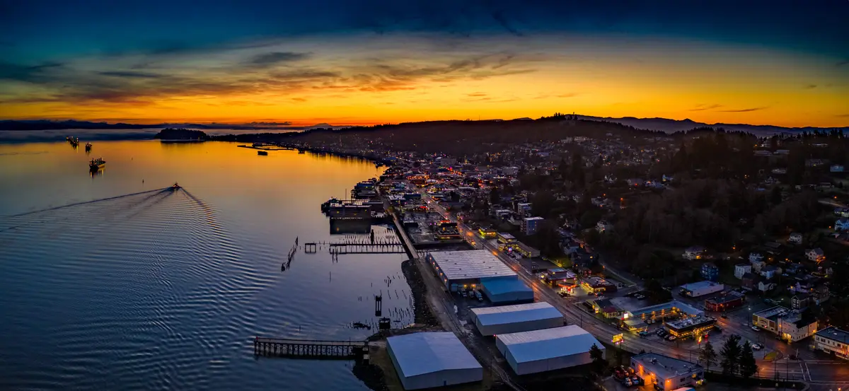
Local Expert Takeaway: Astoria punches well above its weight for outdoor access. The Riverwalk gives you a flat, year-round waterfront trail; the Cathedral Tree Trail puts old-growth Sitka spruce within walking distance of multiple neighborhoods; and Fort Stevens State Park — a short drive away — adds beach, forest, lake swimming, and a century-old shipwreck to the mix. The catch is the weather: 127 sunny days a year means you'll spend most of your outdoor time under gray skies. The residents who love it here lean into that, and they'll tell you the trails in November beat the ones in July for solitude and atmosphere.
Quick Takeaways & FAQs
✅ The Astoria Riverwalk runs 6.4 miles along the Columbia River and is flat, paved, and open year-round — one of the most accessible waterfront trail corridors on the Oregon Coast.
⚠️ With only 127 sunny days a year, outdoor recreation in Astoria requires a genuine comfort with rain and overcast conditions — this is not a sunshine-and-sandals outdoor culture.
📍 The Cathedral Tree Trail passes a 300-year-old, 200-foot Sitka spruce on its way up to the Astoria Column — a hike that starts in hillside neighborhoods and ends with panoramic views of the Columbia.
How long is the Astoria Riverwalk and what can you do on it?
Is Fort Stevens State Park worth visiting if I live in Astoria?
What is the Cathedral Tree Trail and how hard is it?
Where do families with kids recreate in Astoria?
Can you kayak or swim near Astoria?
Moving to Oregon?
Tell us what you need help with and we'll connect you with local resources.
