
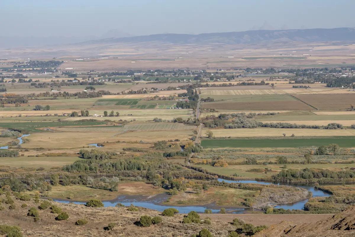
Most people researching St. Anthony, Idaho ask the safety question with one hand already on the back button, expecting a small town on the edge of rural eastern Idaho to have the kind of crime profile that doesn't make it into the brochure. The reality runs the other direction. St. Anthony sits along the Henry's Fork of the Snake River in Fremont County, about 17 minutes north of Rexburg and roughly an hour from Idaho Falls via US-20. Its roughly 4,081 residents live in a county seat where the biggest public-safety conversation most weeks is about ATV traffic heading out toward the Sand Dunes, not violent crime.
The numbers that drive that impression are genuine. St. Anthony's violent crime rate of 1.31 per 1,000 residents sits well below Idaho's statewide rate of 2.54 per 1,000 — and Idaho itself ranks among the two safest states in the country by 2024 FBI Uniform Crime Reporting data. That means you're benchmarking against an already low bar, and still coming in well under it. Property crime tells a similar story: St. Anthony's rate of 3.15 per 1,000 compares favorably against the Idaho statewide figure of 9.67 per 1,000, which is itself the lowest statewide property crime rate in the nation.
What tends to surprise newcomers after six months here isn't danger — it's the absence of it as a daily variable. People from the Wasatch Front or the Treasure Valley often arrive prepared for city-style vigilance and gradually stop practicing it. That's not naivety; it's calibration to a town where the main commercial strip is the kind of place you leave your car running in winter without giving it a second thought. The compromise is that very low crime comes bundled with very limited anonymity: in a community this size, unusual behavior gets noticed quickly, which is both a safety asset and a lifestyle consideration depending on how you're wired.
Whether you're comparing St. Anthony to nearby Rexburg, deciding between neighborhoods, or just trying to understand what you're actually moving into, the sections below break down the crime data, what it means at the neighborhood level, how the numbers have trended over time, and what practical safety research looks like before you settle on a specific area.
St. Anthony Crime by the Numbers: Violent and Property Crime
The clearest way to read St. Anthony's safety profile is to put its raw figures next to the benchmarks that matter — Idaho and the nation — and let the gap speak for itself.
| Crime Type | St. Anthony (per 1,000) | Idaho Average (per 1,000) | U.S. Average (per 1,000) |
|---|---|---|---|
| Violent Crime | 1.31 | 2.54 | 3.59 |
| Property Crime | 3.15 | 9.67 | 17.60 |
| Total Combined | 4.46 | 12.21 | 21.19 |
Source: St. Anthony figures from city fact sheet (authoritative); Idaho benchmarks from SafeWise 2026 citing FBI Uniform Crime Reporting data; U.S. benchmarks from USAFacts citing FBI UCR 2024.
What the Raw Counts Actually Mean
Areavibes' analysis of the same 2024 FBI UCR data translates those rates into raw incident counts: roughly 7 violent crimes and 19 property crimes reported across the entire city in a given year. For a town of about 4,081 people, 19 property crime incidents annually is a figure most mid-size American cities would measure in a single precinct over a few days.
City-Data.com's composite crime index for St. Anthony sits at 42 — approximately 5.4 times below the U.S. average of 228.4. That index also fell roughly 27% from 2024 to 2025, continuing a multi-year downward trend. These are not numbers that require hedging or heavy qualification.
What Violent Crime Looks Like Here
With 7 reported violent incidents over a year, the category is real but thin. Assault — typically domestic or alcohol-adjacent — accounts for the majority of violent incidents in small Idaho towns at this population scale. Stranger-initiated violent crime is rare enough that law enforcement in Fremont County tends to know the circumstances of individual incidents. That's not a boast; it's just the texture of public safety in a county seat with fewer than 15,000 people in the entire county.
How St. Anthony Compares: Idaho and National Context
St. Anthony's figures don't exist in a vacuum. They're part of a broader Idaho trend that makes the city's low numbers structurally credible rather than a statistical anomaly from a slow year.
Idaho's Safety Trajectory
Idaho's statewide crime rate dropped 35.2% over the five-year period from 2019 to 2024, falling from 1,925 incidents per 100,000 residents to 1,248. The Idaho Statistical Analysis Center reported a 6.3% drop in the total offense rate from 2023 to 2024 alone — the lowest statewide figure in roughly two decades. FBI Uniform Crime Reporting data ranks Idaho #2 among all 50 states for overall public safety in 2024.
Idaho's property crime rate is the lowest of any state in the country. When St. Anthony posts a property crime rate of 3.15 per 1,000 against that already-low statewide average of 9.67, it's performing well even within a state that is already an outlier.
The National Picture
Nationally, violent crime has been declining. The 2024 national violent crime rate of approximately 3.59 per 1,000 residents was described by the FBI as among the lowest in decades. St. Anthony's violent crime rate of 1.31 per 1,000 is well below that national floor. For property crime, the national rate of 17.60 per 1,000 is more than five times St. Anthony's figure of 3.15 per 1,000.
| Geography | Violent Crime (per 1,000) | Property Crime (per 1,000) | Relative Safety |
|---|---|---|---|
| St. Anthony, ID | 1.31 | 3.15 | Well below all benchmarks |
| Idaho (statewide) | 2.54 | 9.67 | #2 safest state, 2024 |
| United States | 3.59 | 17.60 | National baseline |
Source: St. Anthony from city fact sheet; Idaho from SafeWise 2026 / FBI UCR; U.S. from USAFacts / FBI UCR 2024.
One caution worth stating: small-population cities see bigger percentage swings from year to year than large metros do, because single incidents move the rate meaningfully. A year with three additional assaults in a city of 4,081 looks dramatic in percentage terms even when the absolute count is still low. Trend lines over five-plus years are a more reliable read than any single year's figure.

Neighborhood Safety Picture in St. Anthony
St. Anthony doesn't have the kind of sharp geographic safety divide you'd find in a city ten times its size. At roughly 4,000 residents, the whole town fits inside what would be a single neighborhood in Boise. That said, the eight distinct areas have meaningfully different characters, and some carry more practical safety considerations than others. For a fuller breakdown of each area's character and location, see the neighborhoods guide.
Historic Downtown and the Bridge Street Corridor
Historic Downtown, centered on Bridge Street near the Fremont County Courthouse and the Yellowstone Tabernacle, is St. Anthony's most publicly active zone. A community drugstore and soda fountain along N Bridge St has been a neighborhood anchor for generations — the kind of spot where people know each other by name. Foot traffic here is higher than anywhere else in the city, which both deters opportunistic property crime and means any unusual activity gets noticed quickly.
The downtown core is among the more walkable parts of St. Anthony and generally considered safe at most hours. The main friction point is that it's also where the handful of bars and late-night establishments operate — which is where the city's small violent crime count is most likely to concentrate, as is typical in small Idaho towns.
Riverside and East Bridge
Riverside, hugging the Henry's Fork, draws people who want to live close to the water and the fishing access that comes with it. Property crime in riparian corridors in small towns often tracks with seasonal patterns — higher when off-highway vehicle visitors and seasonal users are moving through, calmer in shoulder months. It's worth paying attention to how well-lit access points are and whether neighbors are present year-round rather than seasonally.
East Bridge, near the S Bridge St corridor, sits in a more residential transition zone. It's quiet by any reasonable standard but sees some light commercial foot traffic from the highway-adjacent area.
North Bench, West Main, and the Quieter Residential Areas
North Bench and West Main represent the more conventional residential grid — single-family homes, established yards, neighbors who have lived adjacent to each other for decades. Parker Junction and Sand Dunes Access are farther out, with Sand Dunes Access in particular being semi-rural in character given its proximity to the BLM-managed dune system. South Side fills out the southern residential pattern with a similar profile: calm, low-density, minimal crime exposure in any practical sense.
The honest safety note for Sand Dunes Access specifically: the BLM's 10,600-acre dune system draws off-highway vehicle visitors from across the region, and the access corridor sees more transient vehicle traffic than the rest of St. Anthony put together. Homes in that zone should be evaluated with that seasonal dynamic in mind — not because the area is dangerous, but because it's a different kind of exposure than a typical residential street.
Looking to buy in St. Anthony? Estimate your payment.
Enter your numbers to see an estimated monthly mortgage payment.
Estimate only. Excludes HOA fees and mortgage insurance. The interest rate above is a starting point, not a quoted rate — replace it with your own to see real numbers. Insurance is a flat placeholder, not a St. Anthony quote.
What the Trend Line Says: Is St. Anthony Getting Safer?
The five-year trajectory answers this question more clearly than any single data point. Idaho's overall crime rate fell 35.2% from 2019 to 2024. St. Anthony's City-Data composite crime index dropped roughly 27% from 2024 to 2025 alone. Both the state-level and city-level trends point in the same direction, and have for several consecutive years.
Why the Trend Is Likely to Hold
St. Anthony's crime profile is structurally low for reasons that don't disappear with economic cycles. The city is the county seat, which means law enforcement presence — including the Fremont County Sheriff's Office — is locally concentrated. The St. Anthony Work Camp, a correctional facility that is also one of the city's significant employers, maintains a consistent official presence. Small-town social cohesion is a real deterrent: the kind of anonymity that enables opportunistic property crime in denser areas doesn't exist here.
The city's median household income of $53,152 sits in a range that, in a community with low housing costs and strong social ties, tends to correlate with stable public safety outcomes rather than economic-stress-driven crime spikes. That's not a guarantee, but it's a reasonable structural read.
What Could Move the Numbers
Population growth is the variable most likely to shift St. Anthony's crime profile over time. The Rexburg metro has been one of the faster-growing corners of eastern Idaho, and spillover into Fremont County is plausible. As of mid-2026, that growth hasn't materially changed St. Anthony's character or its crime figures, but it's the factor worth watching for anyone planning a decade-long horizon here rather than a two-year one.
Seasonal off-highway vehicle traffic near the Sand Dunes is the other variable. It doesn't appear in violent crime statistics in meaningful ways, but it does generate vehicle-related incidents and occasional property issues in the access corridor during peak spring and summer weekends. For residents of Sand Dunes Access and Parker Junction, that's a real seasonal texture, not a hypothetical risk.
Practical Safety Research Before Choosing a Neighborhood
Low city-wide crime rates are a good starting point, but they tell you about averages — not about the specific block where you're considering putting down roots. Here's how to go deeper before committing to an area in St. Anthony.
Use the Right Tools for Street-Level Research
City-Data.com's St. Anthony crime profile is updated annually from FBI UCR data and gives you trend lines across multiple years, not just a snapshot. Areavibes provides a comparable breakdown with a livability scoring layer. Neither of these will give you block-by-block resolution in a city this small — that level of granularity doesn't exist for a town of 4,081 — but they will confirm whether the city-wide trend is moving in the direction the overall figures suggest.
The Fremont County Sheriff's Office and the St. Anthony Police Department are small enough agencies that a phone call can yield a genuinely useful conversation. Asking about call patterns in a specific neighborhood — not for raw data, but for a general sense of what types of incidents they respond to in a given zone — often produces more useful intelligence than any database.
What Locals Actually Notice
Six months in, most newcomers to St. Anthony report the same thing: they stop locking their car in the driveway without thinking about it. That behavior is either reassuring or disconcerting depending on how you read it. The local version of property crime awareness runs toward leaving garage doors open in summer or off-highway vehicle gear unsecured near the dunes — not toward catalytic converter theft or package porch piracy at the rates you'd encounter in a larger Idaho city.
Veterans Memorial Park and Keefer Park are where families actually gather on weekday afternoons and weekend mornings — soccer on the grass, kids on the equipment, dogs on the perimeter. If you want an unscripted read on how residents feel about safety and community in St. Anthony, an hour at either park on a Saturday morning will tell you more than any index score.
The One Area to Evaluate More Carefully
If you're drawn to the Sand Dunes Access zone for the proximity to the BLM dunes and the more rural feel, spend a weekend out there before deciding. The seasonal off-highway vehicle crowd that comes through on spring and summer weekends is largely responsible and law-abiding, but it is a fundamentally different neighborhood texture than Riverside or North Bench. The question isn't whether it's safe — it generally is — but whether the seasonal activity pattern fits your lifestyle. That's a livability question as much as a safety one.
The rest of St. Anthony's neighborhoods don't require that level of deliberation. The data is clear, the trend is favorable, and the day-to-day reality matches the numbers.
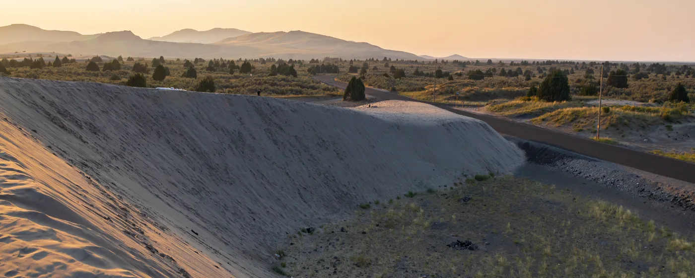
Local Expert Takeaway: St. Anthony posts a violent crime rate of 1.31 per 1,000 and a property crime rate of 3.15 per 1,000 — both well below Idaho's already-low statewide averages, which themselves rank among the best in the country. The city's composite crime index has been falling for five consecutive years. For most neighborhoods — from the Historic Downtown corridor near the Fremont County Courthouse, to the residential grid of North Bench and West Main — the practical safety calculus is straightforward. The one area worth extra due diligence is the Sand Dunes Access zone, where seasonal off-highway vehicle traffic creates a different character than the rest of the city. Everywhere else, the numbers and the lived experience tell the same story.
Quick Takeaways & FAQs
✅ St. Anthony's violent crime rate of 1.31 per 1,000 is well below Idaho's statewide average — itself one of the lowest in the nation — making the city one of the safer small towns in eastern Idaho by any standard measure.
⚠️ Small-population cities like St. Anthony see bigger statistical swings from single incidents year to year, so one headline number can look alarming even when raw incident counts remain low — always read the multi-year trend, not just the latest figure.
📍 The Sand Dunes Access corridor sees significant seasonal off-highway vehicle traffic from the BLM's 10,600-acre dune system each spring and summer, creating a different neighborhood texture than the rest of St. Anthony that's worth evaluating in person before choosing that specific area.
What is St. Anthony, Idaho's crime rate compared to the rest of Idaho?
How many crimes actually happen in St. Anthony each year?
Is St. Anthony safe for families with kids?
Are there any parts of St. Anthony that have more crime than others?
Has crime in St. Anthony been getting better or worse over time?
Moving to Idaho?
Tell us what you need help with and we'll connect you with local resources.
