The raw numbers on SeaTac give most people pause — and then, once you understand the geography, most of them exhale a little. SeaTac is a city of roughly 34,000 residents built around Seattle-Tacoma International Airport, one of the busiest airports in the country. Millions of travelers, tens of thousands of airport workers, and a constant churn of rideshare drivers and delivery vehicles move through this 10-square-mile city every single day. When crimes committed at or near the airport — theft from a rental car lot, a disturbance at a transit station, a shoplifting incident in an airport terminal — get counted against SeaTac's small residential population, the resulting per-resident rate looks alarming. The reality on the ground, for people who actually live here, is more nuanced.
Based on 2024 federal crime reporting data released in fall 2025, SeaTac's violent crime rate is 4 per 1,000 residents and its property crime rate is 37 per 1,000. The violent number sits modestly above both the national average of 3.59 per 1,000 and Washington State's average of 3.26 per 1,000 — not dramatically so, but above. Property crime is the real story: at roughly double the national property crime rate, auto break-ins and theft are genuine daily-life concerns. The encouraging counterpoint is that both figures have been falling sharply — property crime dropped 24% year-over-year in the most recent reporting cycle, and preliminary 2025 data shows the city's overall crime index down approximately 41% compared to 2024.
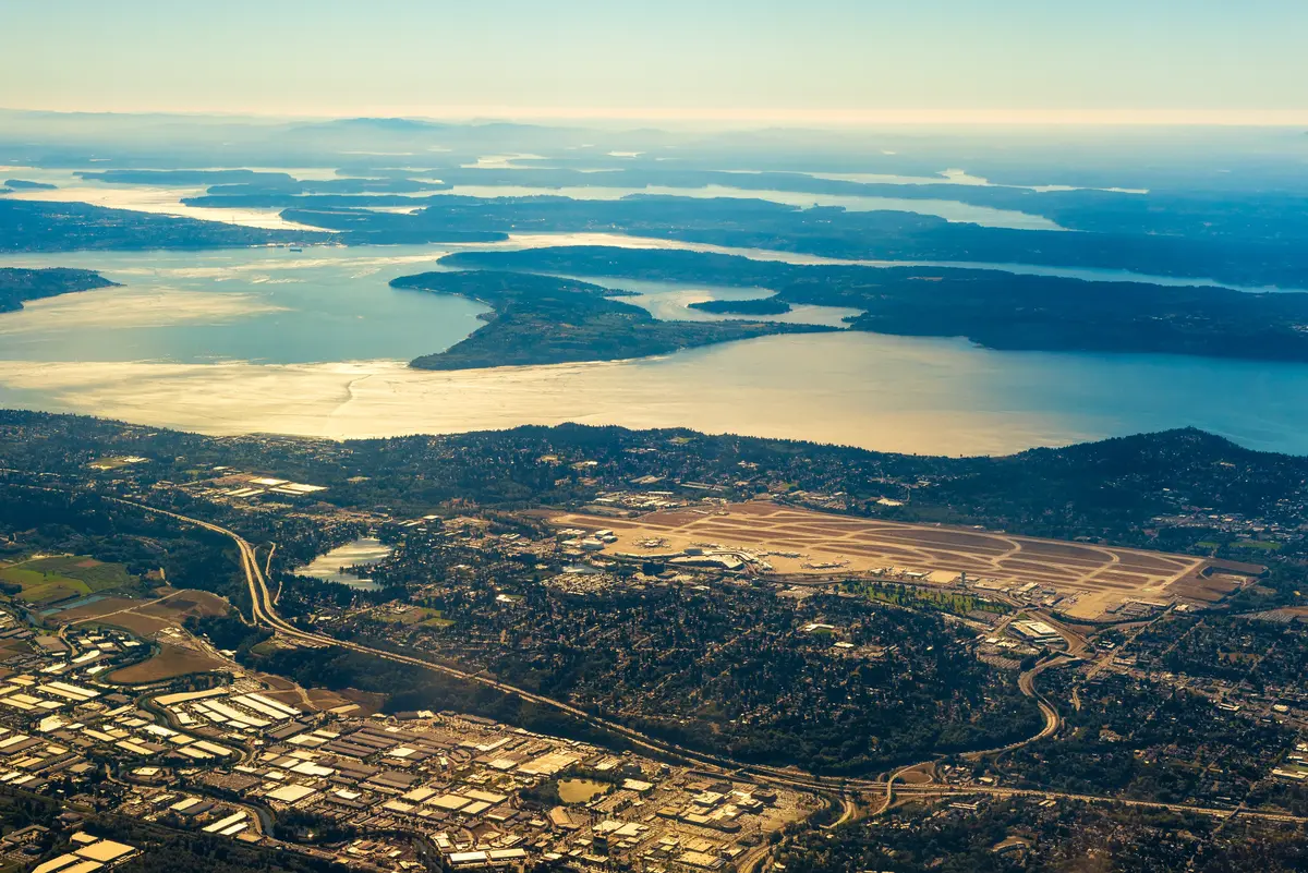
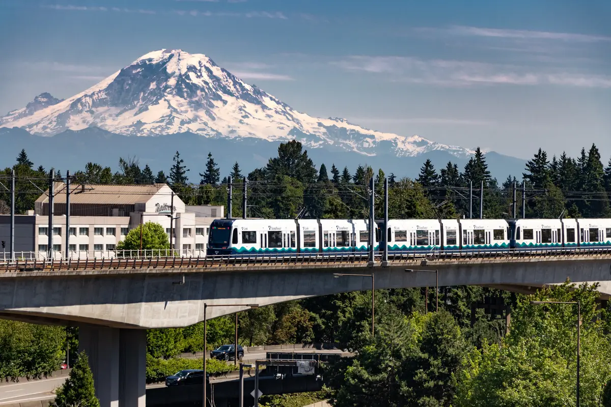
SeaTac sits along International Boulevard (SR-99), the spine of the city, with Link light rail connecting it to Seattle in roughly 20 minutes. The airport anchors the eastern employment corridor; residential neighborhoods climb the hills to the west, away from the noise and the foot traffic. Understanding which parts of SeaTac you're actually considering — whether it's the quieter streets of North Hill or McMicken Heights versus the commercial strip near the airport — matters more than any city-wide average. The airport's gravitational pull on crime statistics is the most important thing to understand before you evaluate SeaTac on safety alone.
This guide breaks down SeaTac's crime figures against state and national benchmarks, explains the airport inflation effect in plain terms, maps the safety picture across SeaTac's distinct neighborhoods, assesses police staffing and the city's trajectory, and gives you the practical framework for evaluating specific streets and areas before you decide where to put down roots.
SeaTac Crime Numbers in Context: What the Data Actually Shows
The Headline Figures
SeaTac's 2024 crime rates — violent crime at 4 per 1,000 residents and property crime at 37 per 1,000 — come from federal crime reporting data released in September–October 2025. These are the authoritative numbers, and they deserve an honest read rather than either dismissal or alarm.
On violent crime, SeaTac is modestly above average. The national rate in 2024 was 3.59 per 1,000; Washington State's was 3.26 per 1,000. SeaTac's 4 per 1,000 lands above both benchmarks — but the gap is not as wide as crime-map heat colors often suggest. This is not a city with a violent crime problem on the scale of genuinely high-crime metros.
Property crime is a different conversation. At 37 per 1,000, SeaTac runs roughly double the national property crime rate of 17.6 per 1,000. Auto theft, vehicle break-ins, and theft from commercial areas near the airport are real. That said, the 24% year-over-year drop in property crime in the 2024 data is among the steepest declines of any comparable city in the region.
The Trend Line Matters as Much as the Snapshot
Statewide, Washington's overall crime rate fell 14.1% between 2023 and 2024 — the second consecutive year of decline. Nationally, 2024 violent crime fell 4.5% and property crime fell 8.1%, with federal crime data showing the lowest national violent crime rate since at least 1969. SeaTac is moving in the same direction as these broader trends, and faster in some categories.
| Metric | SeaTac | Washington State | U.S. National |
|---|---|---|---|
| Violent Crime (per 1,000) | 4.0 | 3.26 | 3.59 |
| Property Crime (per 1,000) | 37.0 | ~24.0 (est.) | 17.6 |
| Year-over-Year Violent Crime Change | −2% | −14.1% (total crime) | −4.5% |
| Year-over-Year Property Crime Change | −24% | declining | −8.1% |
| 5-Year Crime Index Trend | Sustained decline | Declining | Declining |
| Preliminary 2025 Crime Index vs. 2024 | −41% (City-Data) | N/A | N/A |
The trend line is genuinely meaningful. A city that was elevated two years ago and is falling this sharply is not the same safety story as one that has been stuck at high rates for a decade.
The Airport Effect: Why SeaTac's Numbers Look Worse Than They Are for Residents
How the Math Gets Distorted
This is the single most important thing to understand about SeaTac's crime statistics. Per-resident crime rates are calculated by dividing incident counts by the residential population — in SeaTac's case, roughly 34,000 people. But SeaTac-Tacoma International Airport handles tens of millions of passengers per year, plus hundreds of thousands of cargo movements, workers from dozens of airlines and ground-services companies, and constant transit traffic from Link light rail and surface routes along International Boulevard.
A theft from a rental car facility near the airport, a disturbance at a parking structure, a pickpocketing at a transit station — all of these get counted as SeaTac crimes and divided by 34,000 residents. The resulting rate overstates the per-resident risk that someone actually living in a SeaTac neighborhood faces. CrimeGrade and AreaVibes both flag this methodology issue explicitly in their SeaTac notes.
What This Means for Residents vs. Travelers
If you're a traveler, the airport-adjacent zones deserve standard big-airport precautions: keep valuables out of sight in rental cars, watch your bags in transit areas, and treat the International Boulevard strip the way you'd treat any high-traffic urban corridor. If you're a resident evaluating whether to live here, the relevant comparison is residential neighborhood crime — not the aggregate count that includes every airport incident.
The honest read: SeaTac's residential neighborhoods, particularly on the hillside west of SR-99, see meaningfully lower activity than the city-wide rate implies. The airport corridor and transit hubs closest to the terminal are where the numbers concentrate. Choosing a neighborhood on the quieter western streets is a materially different safety situation than living directly off International Boulevard.
Within Washington State, NeighborhoodScout reports that more than 94% of communities have a lower crime rate than SeaTac — a sobering figure. But that ranking reflects the airport-inflated aggregate, not the experience of someone living on a residential block in McMicken Heights or North Hill. The state ranking is a useful starting point, not the final word for prospective residents.
Neighborhood-by-Neighborhood Safety Picture
SeaTac's geography does most of the safety sorting for you. The closer to the airport and International Boulevard, the higher the ambient activity. The further west and uphill into residential blocks, the quieter the streets. The full neighborhood breakdown covers character and livability in depth; here the focus is on what the safety picture looks like across SeaTac's seven neighborhoods.
North Hill
North Hill sits on the western ridge, well removed from the airport corridor. Streets here are predominantly single-family residential, with lower foot traffic and fewer of the commercial-area incidents that drive city-wide totals. Families who've lived in SeaTac for decades tend to cluster here.
Best for: Families Quiet Streets
McMicken Heights
McMicken Heights occupies the southwestern portion of the city, with a similar residential character to North Hill. It's one of the areas locals point to when they push back on SeaTac's aggregate crime reputation. The commercial stretch along Military Road S adds some activity, but it's not the same intensity as the International Boulevard corridor.
Best for: Families Value
Angle Lake
Angle Lake's draw is the park itself — a genuine neighborhood amenity that brings consistent foot traffic and community activity. That visibility cuts both ways: active community spaces tend to self-regulate, and Angle Lake has that quality. The streets immediately around the lake have a stronger neighborhood identity than many parts of SeaTac.
Best for: Nature Walkable
Bow Lake
Bow Lake sits between the airport's southern edge and residential streets, making it one of the more airport-influenced neighborhoods. Commercial warehousing and logistics operations mix with residential pockets. Proximity to SR-99 and airport support infrastructure means higher ambient activity than the western neighborhoods.
Best for: Commuter Renter
Riverton Heights
Riverton Heights borders Tukwila to the north — and that border matters. Tukwila has the highest crime rate of any city in Washington state, and proximity to that boundary is something to factor into your block-level research. Riverton Heights itself has a mixed character, with some well-established residential streets and some higher-activity commercial zones.
Best for: Commuter First-Time Buyers
SeaTac City Center
City Center, straddling International Boulevard near the light rail stations and municipal buildings, is the most transit-dense part of SeaTac. It's also where city-wide crime figures concentrate most heavily. The SeaTac Community Center and civic infrastructure give the area purpose and foot traffic, but this is the neighborhood where the airport-effect inflation is most pronounced in raw incident counts.
Best for: Transit Renter
Manhattan
Manhattan — SeaTac's southernmost neighborhood — is quieter than its New York namesake would suggest. It borders Des Moines to the south, a city with a noticeably lower crime rate than SeaTac. The southern edge of SeaTac benefits from that neighborly calm, and Manhattan's residential blocks feel disconnected from the airport churn to the north.
Best for: Quiet Families
Looking to buy in SeaTac? Estimate your payment.
Enter your numbers to see an estimated monthly mortgage payment.
Estimate only. Excludes HOA fees and mortgage insurance. The interest rate above is a starting point, not a quoted rate — replace it with your own to see real numbers. Insurance is a flat placeholder, not a SeaTac quote.
Police Staffing, Response, and What the City Is Doing About It
The Staffing Gap
SeaTac operates with 57 sworn police officers — approximately 2.1 officers per 1,000 residents. That figure is 5.1% below the Washington State average and 36.7% below the national average. It sounds alarming, but there's important statewide context: Washington ranks last in the nation for officers per capita, so SeaTac's gap reflects a structural pattern across the entire state, not a local policy failure unique to this city.
What it means in practice: response times in SeaTac can be longer than in more heavily staffed suburban departments. Residents occasionally notice this. It's an honest limitation to know about before you decide on a neighborhood.
The Regional Comparison That Matters Most
SeaTac's position within its immediate neighborhood is actually more favorable than its statewide ranking suggests. Tukwila, directly to the north, has the highest crime rate of any city in Washington. To the south, Des Moines and Normandy Park both have significantly lower crime rates. Burien and Kent, the other immediate neighbors, also come in below SeaTac. That places SeaTac roughly in the middle of its micro-region — not the safest city within reach of Sea-Tac Airport, but not the riskiest either.
What a Friction Moment Looks Like Here
People who move to SeaTac from quieter suburbs — Des Moines, Normandy Park — often report the same surprise at month six: vehicle break-ins near the light rail park-and-ride lots. It's the most consistent complaint from residents on community boards, and it's concentrated in the areas immediately adjacent to Angle Lake Station and the International Boulevard transit corridor. If you park at a light rail station regularly, leave nothing visible in the car. It's standard big-city advice that catches people off guard in a city this size.
The trajectory is what gives long-term residents reason for measured optimism. Total crime fell 22% year-over-year in the 2024 reporting cycle, and preliminary 2025 figures suggest the decline has continued. Two consecutive years of statewide decline, a national trend toward lower violent crime, and SeaTac's own sharp property crime drop are all pointing in the same direction.
How to Research Safety Before Choosing a Street in SeaTac
Go Below the City-Wide Average
City-wide figures are the least useful tool for evaluating a specific address in SeaTac. The airport's gravitational pull on incident counts means the aggregate number obscures wide variation between, say, a quiet cul-de-sac in North Hill and a block off International Boulevard near a transit hub. Before you settle on a neighborhood, pull block-level data from CrimeGrade or NeighborhoodScout — both allow you to search by specific address and see incident density on a map.
Time Your Visit Deliberately
One thing people don't do enough before committing to a SeaTac address: visit at multiple times of day. A block that feels calm at 10 a.m. on a Tuesday can feel different at 9 p.m. on a Friday when airport-adjacent commercial traffic peaks. Drive the specific streets you're considering in the evening, on a weekend, and during a weekday morning. The western residential neighborhoods — North Hill, McMicken Heights, Manhattan — will feel consistently quieter than the International Boulevard corridor at any hour.
Check the Tukwila Border
If you're looking at anything in Riverton Heights or the northern edge of SeaTac, map the exact distance to the Tukwila city line. Tukwila's crime rate is the highest of any city in Washington state, and the border is not a hard break — activity patterns don't stop at city limit signs. Blocks that sit within a few hundred feet of that line warrant extra block-level scrutiny.
Talk to Residents, Not Just Stats Sites
SeaTac has active community Facebook groups and a city-run neighborhood engagement program. People who've lived on a specific street for five years know things that no crime map captures: whether a particular intersection has had ongoing issues, whether a commercial parking lot nearby has improved or gotten worse. That local knowledge is irreplaceable. A neighborhood breakfast spot along Military Road S or a coffee counter near the Community Center is the kind of place where longtime residents gather and you can get an honest read on what's actually going on in a given pocket of the city.
Factor in Trajectory, Not Just Today's Number
A city with a 41% preliminary drop in its overall crime index between 2024 and 2025 is a different bet than one sitting still. SeaTac's numbers were elevated partly because of the airport-geography effect and partly because of genuine property crime concentration that is now declining sharply. Evaluating SeaTac as if this year's numbers will be next year's numbers ignores the clearest trend the data shows: things are improving, and improving quickly.

Local Expert Takeaway: SeaTac's crime statistics read worse than the residential experience for one structural reason: crimes at one of the busiest airports in the country get counted against a residential population of 34,000. The real choice in SeaTac is geographic — the western hillside neighborhoods of North Hill, McMicken Heights, and Manhattan sit in a meaningfully quieter environment than anything along International Boulevard. Property crime near light rail park-and-rides is a genuine daily-life nuisance that locals navigate with basic precautions. But a 24% property crime drop in one year, a 41% preliminary drop in the overall crime index for 2025, and a sustained five-year declining trend put SeaTac in a genuinely different position than its aggregate ranking within Washington State implies. Look at the block, not just the city.
Quick Takeaways & FAQs
✅ SeaTac's violent crime rate of 4 per 1,000 is only modestly above the national average of 3.59 per 1,000 — nowhere near as alarming as heat-map visuals suggest.
⚠️ Property crime runs roughly double the national rate, and vehicle break-ins near light rail park-and-rides are the most consistent complaint from residents — leave nothing visible in parked cars near transit stations.
📍 SeaTac's overall crime index dropped approximately 41% in preliminary 2025 data, making the city's five-year downward trajectory one of the most important context points for any safety evaluation.
Is SeaTac, WA a safe place to live?
Why is SeaTac's crime rate so high compared to other Washington cities?
Which SeaTac neighborhoods are safest?
How does SeaTac's crime rate compare to Tukwila and Burien?
Is SeaTac's crime rate getting better or worse?
Moving to Washington?
Tell us what you need help with and we'll connect you with local resources.
