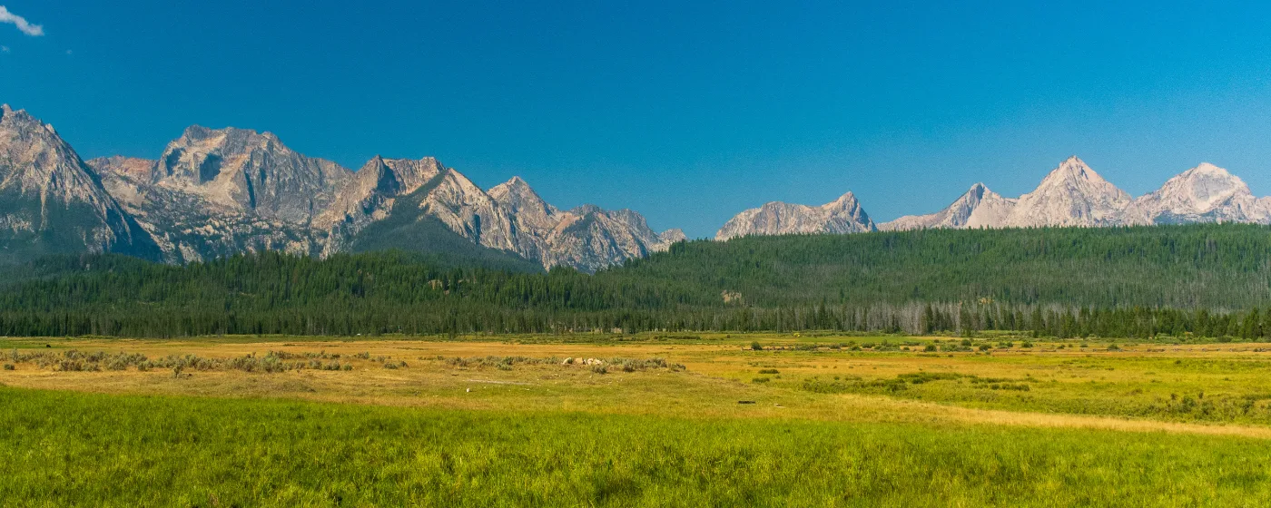
Most towns of 122 people don't have a recreation profile worth writing about. Stanley is the exception — and the exception is dramatic. The town sits at the hub where three National Scenic Byways converge inside the Sawtooth National Recreation Area, which means your backyard isn't a neighborhood park with a swing set. It's 756,000 acres of federal land containing three designated wilderness areas, more than 700 miles of trails, 40 peaks rising above 10,000 feet, and over 300 high-elevation alpine lakes. That geography shapes everything about daily life here in ways that don't fully register until you've lived through your first summer.
The Salmon River originates in the mountains above town and runs right through the valley. Redfish Lake — 4.5 miles long, 387 feet deep, sitting at 6,547 feet elevation — is a five-mile drive south on Highway 75. Stanley Lake is four and a half miles west on Highway 21. Valley Creek Hot Springs is accessible from a short dirt road near the Stanley Museum, a ten-minute walk from town. These aren't weekend destinations you drive to — they're the infrastructure of ordinary life here. People who relocate to Stanley typically say the same thing six months in: they underestimated how much of their time the landscape would simply claim.
What you give up is almost everything else. There's no fitness center, no municipal pool, no organized youth league complex. Recreation is overwhelmingly self-directed, seasonal, and wilderness-scaled. The shoulder seasons — particularly mid-October through late November, and again in April — can feel genuinely remote when summer crowds thin and before winter recreation fully kicks in. For people who want outdoor access built into daily life rather than scheduled around it, that trade-off lands as a feature rather than a bug.
The sections below cover the Sawtooth NRA's trail and wilderness system, Stanley's two signature lakes, the Salmon River corridor, and how recreation shifts across the four seasons — including what winter here actually looks like beyond the ski resorts an hour away in Ketchum.
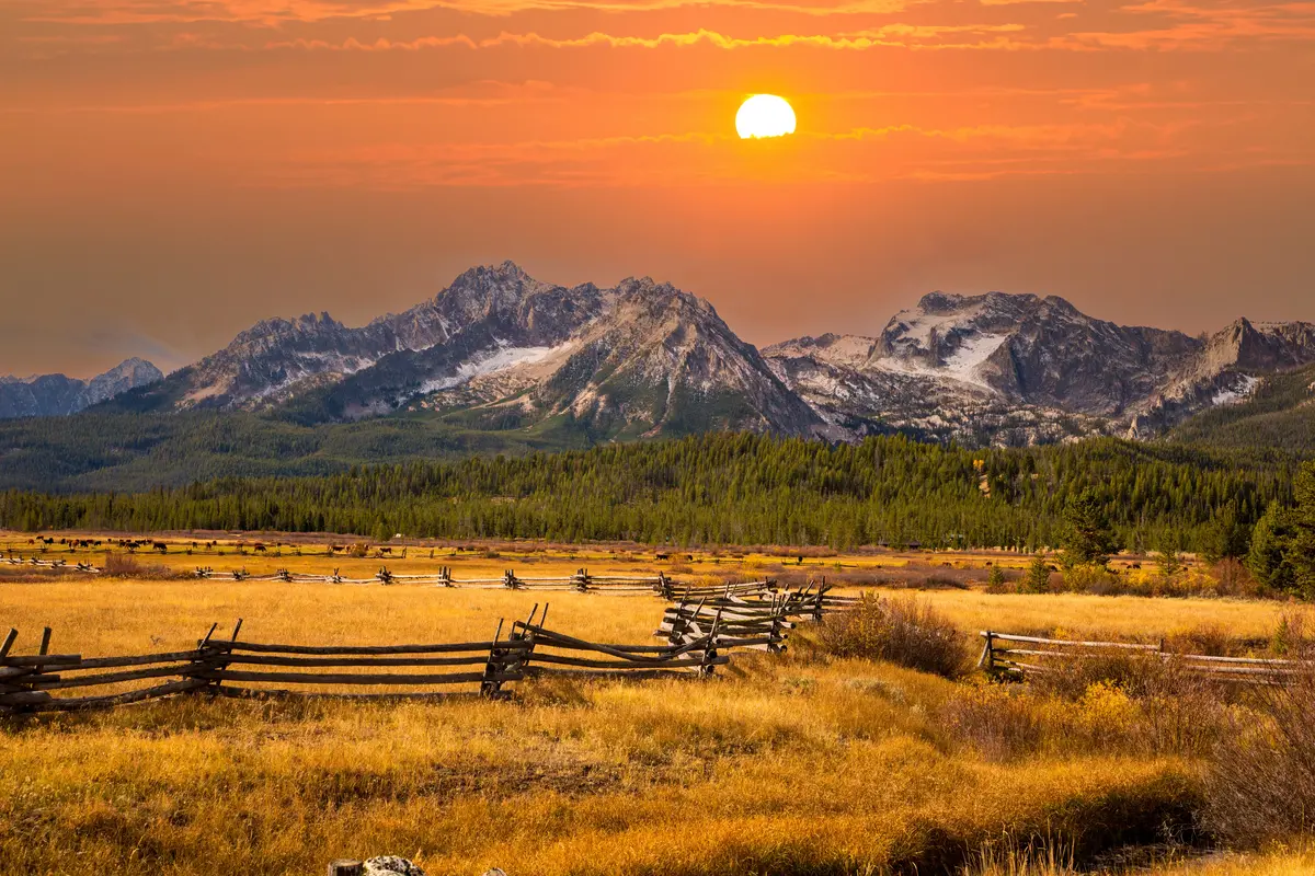
The Sawtooth National Recreation Area: Your 756,000-Acre Backyard
The Sawtooth National Recreation Area is not a park you visit — it's the place Stanley exists inside. Understanding the scale matters before you start planning hikes. The Sawtooth NRA encompasses 756,000 acres and three federally designated wilderness areas: the Sawtooth Wilderness to the south and west, the Cecil D. Andrus–White Clouds Wilderness to the east, and the Hemingway-Boulders Wilderness to the southeast. Each has its own character, access points, and regulatory requirements.
Trail System at a Glance
| Feature | Detail |
|---|---|
| Total trail miles | Over 700 miles across the SNRA |
| Peaks above 10,000 ft | 40+ |
| High-alpine lakes | 300+ |
| Wilderness areas | 3 (Sawtooth, White Clouds, Hemingway-Boulders) |
| Multi-use paved connector | Stanley to Redfish Lake Trail, 4.6 miles (hiking, biking, horseback) |
| Day-use fee trailhead | Pettit Lake (formerly Tin Cup), new fees as of May 2025 |
| Scenic byways converging in Stanley | 3 (Sawtooth, Salmon River, Ponderosa Pine) |
The most accessible gateway into the wilderness system for people living in town is the Stanley to Redfish Lake Trail — a 4.6-mile crushed-stone multi-use path that departs from near Pioneer Park on the southern edge of Stanley and runs past the Sawtooth NRA Ranger Station to Redfish Lake Road. It's open to hiking, biking, and horseback riding, though e-bikes are not permitted. For residents without a car readily available during the day, this trail is effectively a walk-to wilderness connection.
What Locals Know About Access
The Alice-Toxaway Loop in the Sawtooth Wilderness is one of the most-traveled overnight circuits in central Idaho — typically a two-to-three day backpacking trip accessed from the Pettit Lake Trailhead, roughly 20 miles south of Stanley on Highway 75. In May 2025, the Forest Service implemented new day-use fees there, citing overuse impacts. That fee structure is worth checking at fs.usda.gov before planning any trailhead-dependent outing, since the SNRA has been incrementally expanding its fee program at high-traffic access points.
Fire history also matters. Trail closures following summer fire seasons have affected parts of the NRA in recent years, and the Forest Service's current-conditions page is the only reliable source for what's actually open on any given week. Don't rely on printed guidebooks or app-based trail databases for closure status — confirm directly.
The Redfish Lake Amphitheater hosts evening campfire programs and interpretive activities Wednesday through Saturday during summer, run by Forest Service staff. If you have kids or you're showing visiting family what the NRA is actually about beyond the scenery, these programs are among the better free offerings in the area.
Redfish Lake and Stanley Lake: Two Very Different Experiences
Stanley has two major lakes within easy reach, and they are not interchangeable. Redfish Lake and Stanley Lake sit in opposite directions from town, serve different recreational purposes, and attract different users. Knowing the distinction before you move here — or before guests arrive — saves confusion.
Redfish Lake: The Flagship
Redfish Lake is five miles south of town on Highway 75, sitting at 6,547 feet elevation, 4.5 miles long, and 387 feet deep at its maximum. The name comes from the sockeye salmon whose bright spawning coloration once turned the water red during fall runs. The National Marine Fisheries Service has operated a local hatchery and stocked the lake with sockeye since 1999 as part of an endangered-species recovery effort — which means the lake has an ecological story running alongside the recreational one.
| Facility / Feature | Details |
|---|---|
| Elevation | 6,547 feet |
| Size | 4.5 miles long, up to 387 feet deep |
| Campgrounds | Glacier View (64 sites), Sockeye (23 sites) |
| Day-use facilities | Visitor center, boat launch, day-use areas, showers |
| Rentals & services | Boat rentals, equestrian stables, gas station with propane, dump station |
| Interpretive programs | Amphitheater programs Wed–Sat, summer season |
| Access road | Paved, off State Highway 75 |
The Redfish Lake Recreation Complex, operated partly by Redfish Lake Lodge and partly by the Forest Service directly, is as developed as recreation infrastructure gets in this part of Idaho. You can rent a boat, buy propane, shower, and attend a naturalist program all in the same afternoon. That's a meaningful amenity when you live 60 miles from the nearest full-service town.
What Redfish is not: quiet in July and August. The campgrounds fill well in advance, the launch area gets busy on summer weekends, and parking pressure on peak days is real. Residents who want the lake's backcountry hiking — trails push into the Sawtooth Wilderness from the far end of the lake — typically go mid-week or in September, when crowds thin and the light on the Sawtooth range turns extraordinary.
Stanley Lake: The Local Alternative
Stanley Lake sits roughly 4.5 miles west on Highway 21 in the northwest corner of the Sawtooth NRA. It's smaller and quieter than Redfish, with no commercial lodging complex attached. Fishing, kayaking, and water skiing (permitted 10 a.m. to 6 p.m. only) are the draws, along with hiking to Stanley Lake Overlook — a viewpoint where McGown Peak appears to rise directly from the water. If Redfish Lake is where you take out-of-town guests in August, Stanley Lake is where locals go on a Tuesday morning when they want the mountains without the crowd.
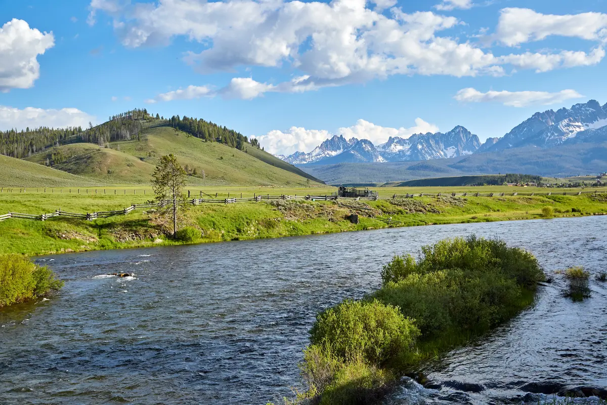
The Salmon River: Headwaters, Hot Springs, and the Middle Fork
The Salmon River begins in the mountains above Stanley. By the time it reaches town it's already running with enough volume to float — and that puts Stanley in a genuinely unusual position: it's one of the few small towns in the American West where world-class river recreation starts essentially at the edge of the residential area.
The Upper Salmon: Everyday River Access
The Upper Salmon supports Chinook salmon, sockeye salmon, and steelhead — anadromous species that travel from the coast all the way to headwaters above 6,000 feet. That biological reality brings bald eagles, osprey, deer, elk, and bighorn sheep to the river corridor in numbers that surprise people who haven't lived alongside a wild salmon river before. Wildlife watching on a morning float near town is not unusual; it's routine.
Rafting, fishing, hot springs soaking, and riverside camping are all available on the Upper Salmon without driving to a trailhead or paying a launch fee. For residents, the river is essentially a linear park running through the valley.
Valley Creek Hot Springs: Walk-to Warm Water
Valley Creek Hot Springs sits along Valley Creek off a short dirt road near the Stanley Museum on Highway 75 — close enough to town that some residents walk or bike to it. A footbridge crosses Valley Creek to reach the warm pools. It's a primitive setup with no facilities, no fee, and no guarantee of consistency; access conditions and pool temperatures vary seasonally, and the Forest Service periodically issues advisories affecting use. Confirm current access status before bringing guests who've traveled specifically to soak.
The Middle Fork: Stanley as Base Camp
Stanley functions as the primary staging point for guided trips down the Middle Fork of the Salmon River, a 100-mile wilderness canyon run through the Frank Church–River of No Return Wilderness. The Middle Fork is among the most celebrated whitewater rivers in North America, featuring Class III–IV rapids — Velvet Falls, Pistol Creek, and Tappan Falls among the named ones. Most trips are five to six days, guided, and launched from the Boundary Creek put-in accessible from the Stanley area.
If you move here and have any interest in whitewater, budget for a Middle Fork trip in your first summer. It's expensive relative to local income levels, but it's the kind of experience that exists nowhere else on the planet, and it starts in your town.
| Water Recreation | Where | What's Available |
|---|---|---|
| Upper Salmon River | Through Stanley valley | Rafting, fishing, wildlife watching, camping |
| Valley Creek Hot Springs | Off Hwy 75, near Stanley Museum | Primitive soaking pools, footbridge access |
| Middle Fork of the Salmon | Frank Church Wilderness, launched from Stanley area | Guided whitewater, Class III–IV, 100-mile canyon |
| Redfish Lake | 5 miles south on Hwy 75 | Boating, fishing, swimming, kayaking |
| Stanley Lake | 4.5 miles west on Hwy 21 | Fishing, kayaking, water skiing (10 a.m.–6 p.m.) |
Looking to buy in Stanley? Estimate your payment.
Enter your numbers to see an estimated monthly mortgage payment.
Estimate only. Excludes HOA fees and mortgage insurance.
Seasonal Recreation: What Stanley Actually Looks Like in Every Month
Stanley's elevation — roughly 6,260 feet — and its position inside the NRA mean the recreational calendar here doesn't follow a conventional Idaho pattern. Summer is compressed and intense. Winter arrives early and lingers. The shoulder seasons require honest assessment before you commit to living here year-round.
Summer (Mid-June through Mid-September)
This is the operating season for most of what makes Stanley famous. Redfish Lake's campgrounds and boat rentals run at full capacity. The trail system above town is snow-free enough for day hikes and multi-day backpacking. The Salmon River is runnably warm. Guided Middle Fork trips fill months in advance. Summer is also the sprint season for anyone working in hospitality or seasonal retail in the valley.
The catch: Stanley's population of 122 swells dramatically with seasonal workers and visitors on summer weekends. The Ace of Diamonds Avenue corridor, normally quiet enough to feel like an old mining town, gets noticeably compressed. Locals who need groceries or propane on a Saturday afternoon in August learn quickly to go early or late.
Fall (Mid-September through October)
September is the season that residents talk about most. Aspen groves along the Valley Creek corridor turn gold, the crowds thin almost overnight after Labor Day, and the Sawtooth range often gets its first dusting of snow on the upper peaks while the trails below are still completely clear. Elk are moving. The light is different. September is when people who live here full-time feel most rewarded for doing so.
October brings serious cold — overnight lows can drop below freezing consistently by mid-month — and by early November most seasonal businesses have closed. The transition from full summer operation to winter-mode quiet happens fast enough to feel abrupt if you're new to it.
Winter (November through April)
Winter recreation in the SNRA is real and varied. Cross-country skiing and snowshoeing operate on trails that summer hikers know well. Snowmobiling is permitted in designated areas. The SNRA Headquarters maintains a pond for ice skating. Steelhead fishing on the Salmon River continues through winter for those willing to stand in cold water. Sledding is informal and accessible near town.
What winter is not here: convenient. Stanley gets significant snowfall, and road conditions require proper tires and judgment. Sun Valley's lift-served skiing in Ketchum is roughly 60 miles south. If alpine skiing is central to your winter, most people make the drive south rather than find it at their doorstep. The cross-country and snowshoe terrain directly accessible from town is the more practical daily option.
Spring (May through Mid-June)
Spring is the hardest season to sell. Snowmelt runs Valley Creek and the Salmon hard, which makes riverside access muddy and limited. Higher trails hold snow into June most years. The seasonal businesses are not yet open. Temperature swings are wide — warm afternoons, freezing nights. People who move here for the outdoor access and arrive in May sometimes find themselves waiting three or four weeks for the landscape to actually become usable in the ways they imagined.
Plan an overlap: if you're relocating in spring, budget time and patience. The payoff is real, but it doesn't start the week you arrive.
| Season | Primary Activities | What to Know |
|---|---|---|
| Summer (mid-June–mid-Sept) | Hiking, backpacking, boating, rafting, fishing, mountain biking | Crowds peak July–Aug; campgrounds book fast |
| Fall (mid-Sept–Oct) | Hiking, fishing, wildlife watching, elk season | Locals' favorite; businesses begin closing late Oct |
| Winter (Nov–Apr) | Cross-country skiing, snowshoeing, snowmobiling, ice skating, steelhead fishing | Alpine skiing requires a drive south to Ketchum |
| Spring (May–mid-June) | River fishing (high water), snowshoeing at elevation | Muddy, cold, limited access; patience required |
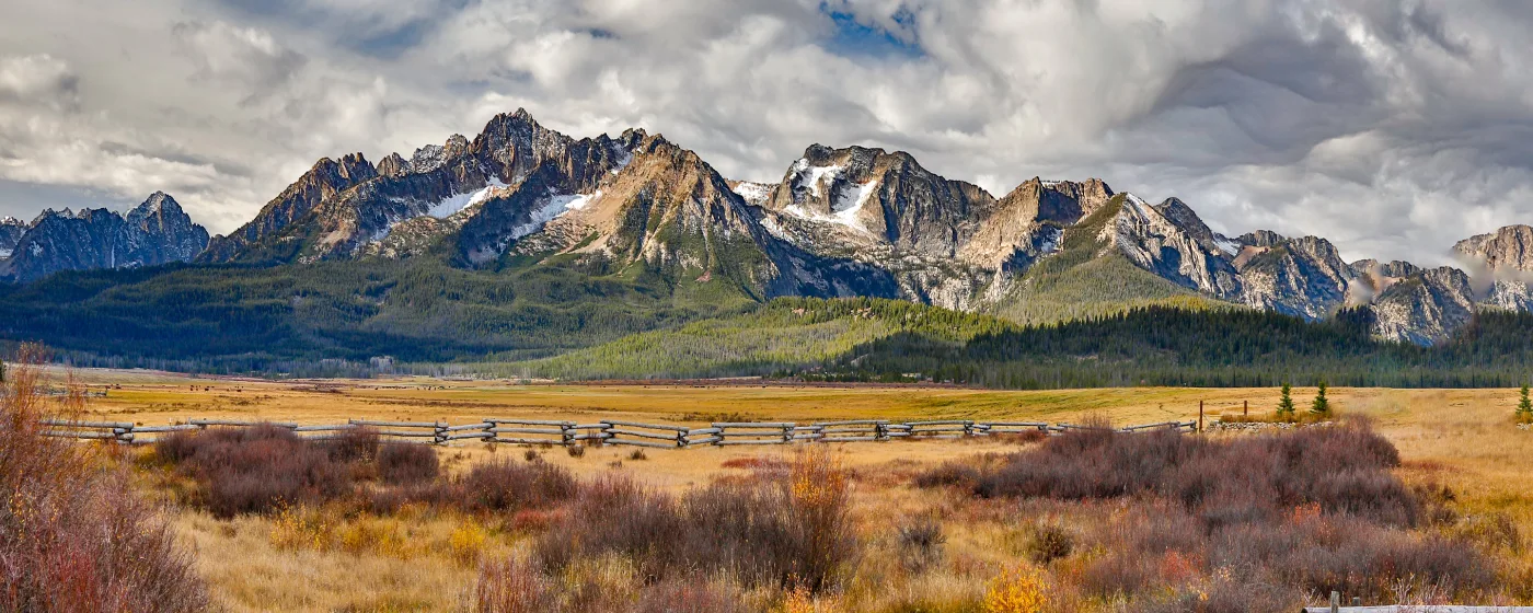
Local Expert Takeaway: The Stanley to Redfish Lake Trail is the detail most people miss when they're researching the move. It's a 4.6-mile crushed-stone path from near Pioneer Park at the edge of town to Redfish Lake Road — walkable, bikeable, no car required. For residents who want the wilderness without driving to it every time, that trail is more valuable than any amenity a town this size could plausibly offer. Confirm any planned backcountry route at fs.usda.gov before you leave the pavement — trail conditions and fee requirements change seasonally and don't always make it into the apps.
Quick Takeaways & FAQs
✅ The Sawtooth NRA's 756,000 acres and 700+ miles of trails are literally the backyard here — not a day trip.
⚠️ Winter in Stanley is real and requires preparation: the nearest lift-served ski resort is roughly 60 miles south in Ketchum, and spring arrives late, often keeping upper trails snowed in through mid-June.
📍 Valley Creek Hot Springs is a short walk from the Stanley Museum off Highway 75 — a footbridge crosses the creek to the pools, but access conditions change seasonally, so verify before you go.
Are the trails around Stanley suitable for beginners, or is most of the hiking technical?
Do I need a permit or pass to use the trails and recreation areas in the Sawtooth NRA?
What is the Middle Fork of the Salmon River, and do I need a guide to do it?
Can I swim in Redfish Lake and Stanley Lake?
What outdoor recreation is available in Stanley during winter?
Moving to Idaho?
Tell us what you need help with and we'll connect you with local resources.
