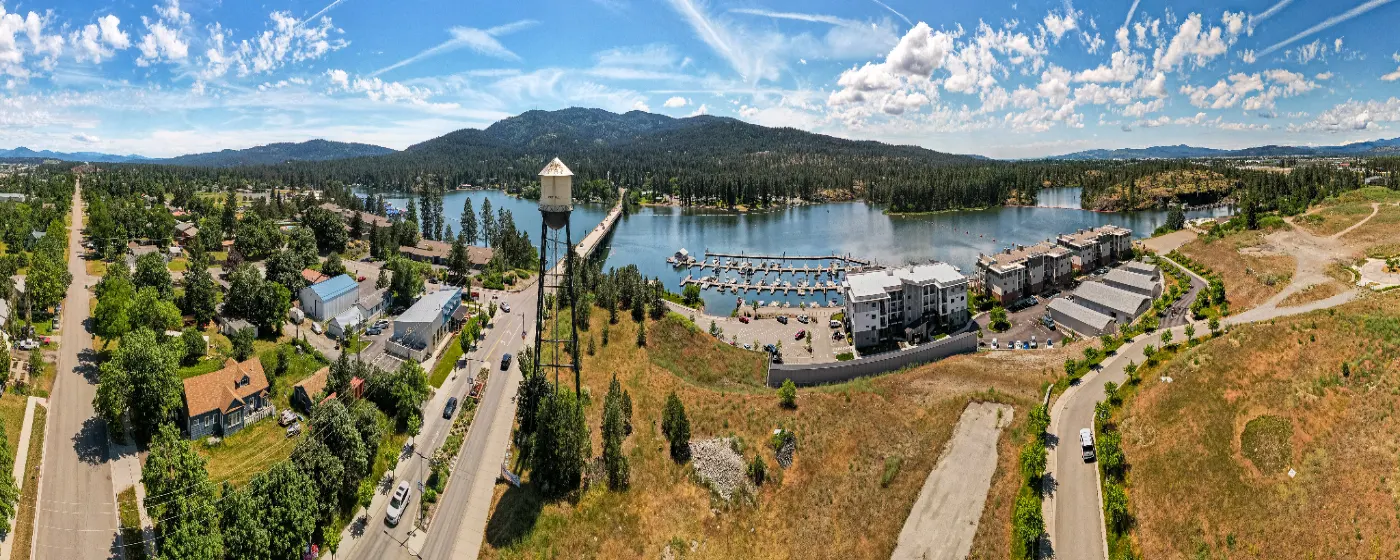
People moving to Post Falls from the Spokane metro or from out of state often ask the same early question: is this actually a safe place to live? The honest answer is yes — with context. Post Falls sits in Kootenai County along Interstate 90, about 20 minutes east of Spokane, and it carries the particular dynamic of a rapidly growing city: more people, more retail corridors, and the friction that comes with fast development. That growth doesn't automatically mean more danger, but it does mean the safety picture deserves a clear-eyed look rather than a reassuring wave.
By the numbers, Post Falls's violent crime rate stands at 2.3 per 1,000 residents — noticeably below the national figure of 3.59 per 1,000 (FBI 2024 data via USAFacts) and essentially in line with Idaho's own statewide rate of approximately 2.34 per 1,000. The property crime rate of 13.9 per 1,000 tells a more textured story: it's manageable, but property crime — particularly vehicle break-ins and opportunistic theft near the I-90 commercial corridor — is the category that residents mention most when the topic of safety comes up. Understanding that distinction shapes where in the city you'll want to focus your research.
Post Falls is not a city with dramatic neighborhood-to-neighborhood crime swings the way a large urban center would have, but location still matters. Proximity to the Spokane Street commercial strip, the highway-adjacent retail zones, and the older downtown core correlates with higher property crime exposure compared to the newer residential areas further north and east. Most people who move here settle into daily life without incident — but knowing which pockets carry more risk, and why, is worth the 15 minutes it takes to understand before you settle on a neighborhood.
Whether you're narrowing down areas or just doing your due diligence before committing to North Idaho, the sections below walk through the specific crime figures, how they stack up regionally and nationally, the neighborhood-level safety landscape, what property crime actually looks like on the ground, and the practical steps locals use to evaluate safety before deciding where to put down roots.

Post Falls Crime Rates at a Glance
The headline figures: Post Falls reports a violent crime rate of 2.3 per 1,000 residents and a property crime rate of 13.9 per 1,000. Those numbers come from the city's own reporting aligned with FBI Uniform Crime Report methodology — not an estimate or index score.
| Metric | Post Falls | Idaho State | U.S. National |
|---|---|---|---|
| Violent crime (per 1,000) | 2.3 | ~2.34 | 3.59 |
| Property crime (per 1,000) | 13.9 | — | — |
| Chance of violent crime victimization | 1 in 660 | — | — |
| Chance of property crime victimization | 1 in 156 | — | — |
| City-Data crime index (lower = safer) | 71 | — | 235.3 (avg) |
| Year-over-year change (2024 vs. 2023) | −21% | — | −5.4% |
* Violent crime national figure from USAFacts/FBI 2024 data. Idaho state violent crime figure from FBI UCR 2023 data. City-Data index and year-over-year change from City-Data.com, September 2025. Victimization odds from FBI 2024 UCR data, September 2025.
The 21% drop in Post Falls's overall crime rate between 2023 and 2024 is the most significant recent data point. Nationally, violent crime fell an estimated 5.4% in 2024 — Post Falls outpaced that decline sharply, suggesting the city's trend is moving in a genuinely positive direction rather than just mirroring a national pattern.
The City-Data composite index of 71, against a U.S. average of 235.3, puts Post Falls well below the national midpoint. That figure reflects the combined weight of both violent and property crime categories in a single index — it's one of the broader indicators that shows Post Falls performing solidly, not just on one metric.
How Post Falls Compares to Idaho and the Nation
Idaho itself is a relatively safe state. CrimeGrade rates Idaho's violent crime at a B and places the state in the 67th percentile for safety nationally — meaning Idaho is safer than roughly two-thirds of U.S. states before you even zoom into individual cities.
Post Falls lands almost exactly at the Idaho average for violent crime. That's a meaningful benchmark: living here puts you at roughly the risk level of the typical Idaho resident, not the risk level of someone in a high-crime urban corridor. Compared to the national average, Post Falls's violent crime rate is measurably lower.
The NeighborhoodScout Percentile — What It Actually Means
One figure that sometimes confuses people researching Post Falls: NeighborhoodScout reports that Post Falls's crime rate is lower than approximately 26% of Idaho communities, based on FBI 2024 data released October 2025. That sounds concerning until you read it carefully. It means roughly three-quarters of Idaho's towns — many of them tiny rural communities with near-zero reported crime — statistically have lower rates. Post Falls is a mid-size city of nearly 50,000 people; comparing it to rural Idaho towns of 400 residents on a raw percentile is a methodological mismatch worth understanding.
The more useful comparison is against cities of similar size and similar regional context. Against those benchmarks — and against the national average — Post Falls holds up well. The NeighborhoodScout percentile tells you Post Falls isn't the safest place in Idaho; the FBI figures tell you it's safer than most of the country.
The Regional Picture
Kootenai County, which contains Post Falls, saw a 4.0% increase in total offenses in 2023 compared to 2022, reaching over 11,000 countywide and ranking fifth among Idaho counties. That regional uptick is worth tracking — county growth in population and commercial activity tends to bring some crime alongside it. Post Falls's 2024 drop, however, suggests the city-level picture diverged positively from that county-wide 2023 trend.
Multiple public data sources put Post Falls's total daily crime rate noticeably below the Idaho state average and well below the national average — a composite that reinforces what the raw rates show individually.

Neighborhood Safety in Post Falls: Where It Varies
Post Falls doesn't have the kind of stark neighborhood-by-neighborhood crime divide you'd find in a large city, but geography still creates real differences in daily risk — particularly for property crime. For a deeper look at each area's character, the neighborhoods guide covers Post Falls's distinct areas in detail.
Lower-Risk Residential Areas
Prairie Falls and The Highlands sit north of I-90 in the newer residential growth zones. Distance from the commercial corridor matters here — there's less transient foot traffic, newer construction with better lighting and visibility, and an overall profile that draws families prioritizing a quieter daily environment. Residents in these areas typically report fewer encounters with the opportunistic property crime that affects the commercial strips closer to the highway.
Foxtail and North Prairie share a similar profile: established suburban streets, cul-de-sac layouts in places, and the kind of neighborhood familiarity where people notice unfamiliar vehicles. These aren't gated or policed differently — the lower risk comes from land use and layout, not enforcement.
Areas with More Exposure
West Seltice, which runs along the Seltice Way commercial corridor toward I-90's interchange zone, carries the higher property crime exposure you'd expect near heavy retail and transient traffic. Vehicle break-ins in parking areas and theft from unsecured garages are the specific patterns that tend to surface in this zone — not violent crime.
Central Post Falls and the area around Spokane Street have the highest density of reported incidents simply because they have the highest density of activity. The downtown core around Q'emiln Park and Falls Park sees more foot traffic year-round, which correlates with more opportunity for property crime. Evening hours near the bar and restaurant areas along E 4th Ave and Spokane Street are the times when most minor incidents occur, as is true of any active downtown in any city this size.
Riverside Harbor
Riverside Harbor sits along the Spokane River with a more contained, residential feel that moderates its crime exposure despite being relatively close to downtown. The natural boundary of the river and the neighborhood's layout keep it quieter than its proximity to Central Post Falls might suggest.
Milltown is a transitional area — older housing stock, more mixed land use, and the kind of patchwork that tends to produce uneven safety outcomes block by block. It's worth walking the specific streets you're considering rather than treating it as a uniform zone.
| Neighborhood | Relative Safety Profile | Primary Risk Type | Best For |
|---|---|---|---|
| Prairie Falls | Lower risk | Minimal | Families Quiet |
| The Highlands | Lower risk | Minimal | Families School |
| Foxtail | Lower risk | Minimal | Families Value |
| North Prairie | Lower risk | Minimal | Quiet Families |
| Riverside Harbor | Moderate | Occasional property crime | Views Walkable |
| Central Post Falls | Moderate | Property crime, minor incidents | Walkable Transit |
| Milltown | Mixed | Block-by-block variation | First-time Renter |
| West Seltice | Higher property crime exposure | Vehicle break-ins, retail theft | Commuter |
Looking to buy in Post Falls? Estimate your payment.
Enter your numbers to see an estimated monthly mortgage payment.
Estimate only. Excludes HOA fees and mortgage insurance. The interest rate above is a starting point, not a quoted rate — replace it with your own to see real numbers. Insurance is a flat placeholder, not a Post Falls quote.
Property Crime Is the Real Story in Post Falls
Violent crime in Post Falls is genuinely low — a 1-in-660 chance of victimization per year puts the risk in perspective quickly. Property crime is where residents actually feel the city's friction, and the 13.9 per 1,000 rate warrants a more specific conversation than the violent crime figures do.
What Property Crime Actually Looks Like Here
The dominant property crime categories in Post Falls are vehicle break-ins, theft from vehicles, and shoplifting near the I-90 commercial zone. Catalytic converter theft, which became a regional problem across Kootenai County in recent years, affects both residential driveways and commercial parking lots. Garages left unlocked overnight — particularly in older neighborhoods like Milltown and parts of Central Post Falls — are the most frequently cited vulnerability.
Home burglaries, the category most people imagine when they hear "property crime," are a smaller slice of the total figure than vehicle-related theft. Most residents go years without a home break-in; vehicle and garage security is the more practical daily concern.
What Locals Have Learned
Six months in, new residents typically make the same observation: the city feels safe in a personal, walking-around sense, but you learn not to leave anything visible in your car overnight near the Seltice Way commercial area. That's not unique to Post Falls — it's standard operating procedure across the entire Spokane-Coeur d'Alene regional corridor — but it catches people off guard if they moved from a very low-density rural area where unlocked cars were the norm.
Ring camera adoption in Post Falls's newer subdivisions has been high, partly driven by early residents passing along the same lesson. In Prairie Falls, The Highlands, and Foxtail, front-door camera coverage is now common enough that it functions as a low-level deterrent in those neighborhoods.
The I-90 Corridor Effect
The interstate doesn't just shape commutes — it shapes crime patterns. The interchange zones at Spokane Street and Seltice Way bring the highest concentrations of daily transient traffic through Post Falls, and those are the zones where property crime clusters. If you're evaluating a property within a few blocks of either interchange, the proximity to that transient activity is a real factor to weigh. It doesn't make the area dangerous in a violent-crime sense, but it does elevate the likelihood of the opportunistic stuff: car windows, package theft, unlocked storage units.
Practical Ways to Evaluate Safety Before You Decide on a Neighborhood
The aggregate city statistics give you a framework. What they don't give you is a block-level read on the specific street you're considering — and in a city growing as fast as Post Falls, those block-level differences matter.
Use the City's Crime Map as a Starting Point
The Kootenai County Sheriff's Office and Post Falls Police Department both publish incident data that feeds into publicly accessible crime mapping tools. Pulling up a 90-day window for the specific addresses you're comparing will show you whether the incidents in the area are property crime near a commercial lot two blocks away or something that occurred on residential streets at night. The distinction changes the practical risk calculus significantly.
Visit at Different Times of Day
A neighborhood at 10 a.m. on a weekday tells you something different than the same block at 9 p.m. on a Friday. If you're seriously considering Central Post Falls or Milltown, an evening visit — walking past the bar and restaurant row on E 4th Ave or along Spokane Street — gives you a more complete picture than a daytime drive-through. Most of what you'll observe is just normal city activity; the point is to observe it directly rather than extrapolate from daytime impressions.
Talk to Neighbors — This Actually Works
Post Falls has the community density of a mid-size Idaho city where people still talk to each other across driveways. Knocking on a door two houses down from a property you're serious about and asking what the block is like will get you an honest answer more often than not. Residents in Prairie Falls and The Highlands are frequently asked exactly this, and the consistent feedback is that the primary crime concern is porch package theft during peak delivery season — manageable and common everywhere in the country.
Check Kootenai County Trend Data, Not Just the City Snapshot
The county-level 4.0% crime increase in 2023 is a reminder that regional context matters alongside the city figure. Post Falls's 2024 drop is encouraging, but watching whether that trend continues — or whether county growth pressure reverses it — is worth doing annually if you're making a long-term decision tied to a specific neighborhood's character.
The North Idaho Centennial Trail, which runs through Post Falls along the Spokane River, is consistently cited as one of the safer recreational corridors in the area — well-used during daylight hours, well-maintained, and with enough regular foot traffic to feel comfortable. Treaty Rock Park and Q'emiln Park are active enough during daylight that they don't present the isolated-park risks that smaller, less-trafficked green spaces sometimes do. Evening use in the off-season is a different calculation, as it is anywhere.
One Thing Not to Do
Don't evaluate West Seltice or Central Post Falls based on a daytime drive past the big-box retail zone on Seltice Way and conclude the whole corridor is unsafe. The retail parking areas have elevated property crime; the residential streets even a few blocks north of that strip are a genuinely different environment. Conflating the two is one of the more common mistakes people make when they're researching Post Falls remotely rather than on the ground.

Local Expert Takeaway: Post Falls is not a crime-free city, and growing fast enough that anyone telling you 'it's totally safe everywhere' isn't paying attention. What's true: violent crime runs well below the national average and essentially mirrors Idaho's own statewide rate. Property crime — specifically vehicle break-ins and theft near the I-90 commercial corridors on Seltice Way and Spokane Street — is the realistic daily concern, not violent crime. The 2024 crime rate dropped 21% year-over-year, which is a meaningful positive trend. For most families considering Prairie Falls, The Highlands, or Foxtail, the safety picture is genuinely strong. For anyone looking at West Seltice or Central Post Falls, the trade-off is a more active, urban-feeling environment with correspondingly higher property crime exposure — know that going in, plan accordingly with basic vehicle security, and the risk stays manageable.
Quick Takeaways & FAQs
✅ Post Falls's violent crime rate of 2.3 per 1,000 residents is measurably below the U.S. national average of 3.59 per 1,000 and nearly identical to Idaho's own statewide figure.
⚠️ Property crime — not violent crime — is the genuine friction point in Post Falls, with vehicle break-ins and theft concentrated near the I-90 interchange zones on Seltice Way and Spokane Street.
📍 Post Falls's overall crime rate fell 21% in 2024 compared to 2023, a drop that significantly outpaced the national year-over-year decline of 5.4%.
What is the crime rate in Post Falls, Idaho?
Is Post Falls safer than Coeur d'Alene or Spokane?
Which parts of Post Falls have the lowest crime?
What kind of crime is most common in Post Falls?
Has crime in Post Falls been getting better or worse?
Moving to Idaho?
Tell us what you need help with and we'll connect you with local resources.
