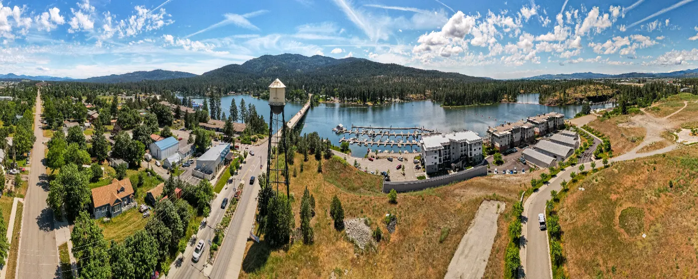
People who move to Post Falls from landlocked metros tend to have the same reaction within the first warm weekend: they didn't expect a city this size to have a guarded river beach, a paved trail corridor stretching more than 60 miles, a 500-acre community forest, and a gorge overlook all within a few minutes of downtown. The Spokane River isn't a backdrop here — it's the organizing principle of outdoor life, running east to west through the city and anchoring every major green space residents actually use.
What surprises people six months in isn't that the parks exist — they show up in any relocation search. It's how genuinely local they feel. Q'emiln Park (say it 'ka-mee-lin') draws families from Prairie Falls and Riverside Harbor all summer, not just tourists. The Centennial Trail fills up on weekday mornings with commuters on bikes and retirees walking the river section before the heat sets in. These aren't amenities maintained for a brochure — they're places people use constantly, which means they also fill up fast on summer weekends.
The honest downside: Post Falls parks and trails are heavily concentrated along the river corridor, and most of the city's residential growth is happening north of I-90, farther from that corridor. If you're considering a neighborhood in North Prairie or Foxtail and you're counting on walking to Q'emiln Park, check the map carefully — it's a drive, not a stroll. The parks are excellent; the distribution isn't perfectly even.
Whether you're considering a move or just researching the area, the sections below break down Post Falls's signature parks, the Centennial Trail system, water recreation on the Spokane River, and how outdoor life changes across seasons.
Falls Park and Q'emiln Park: The Two Anchors
These are the parks that define Post Falls for most residents, and they serve completely different moods.
Falls Park — Gorge Views and a Fishing Pond
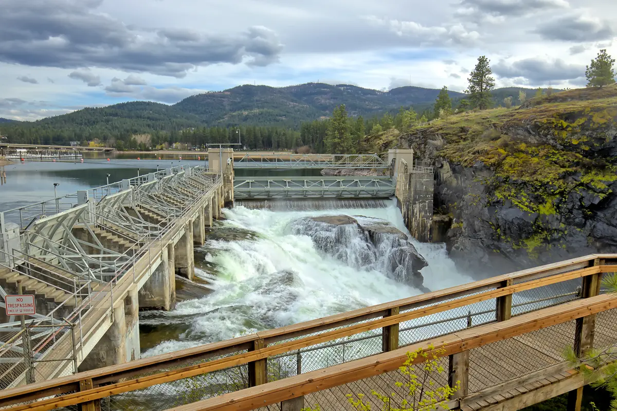
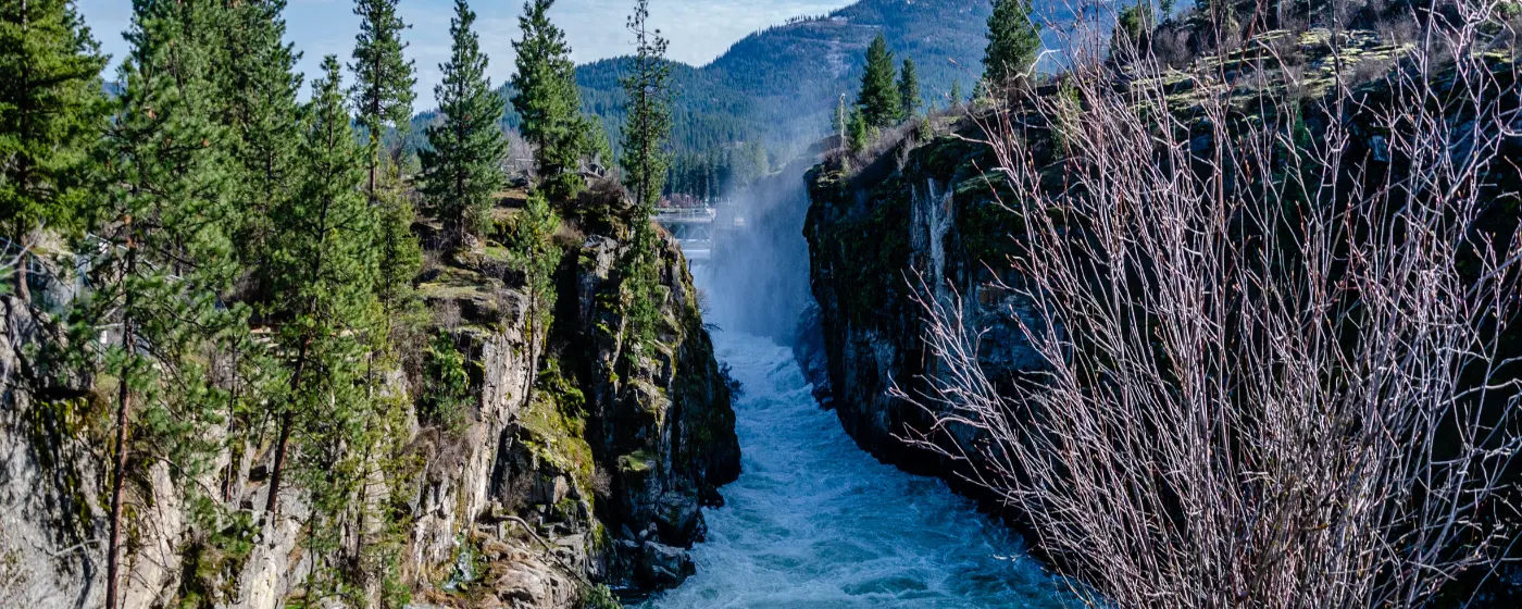
Falls Park sits at 305 W. 4th Avenue, right at the edge of the Post Falls gorge. The views down to the Post Falls Dam and the river canyon below are genuinely dramatic — spring runoff from March through May is when the waterfall display peaks, and it's worth planning a first visit around that window.
The park's stocked fishing pond covers 0.6 acres and can be fished from a dedicated bridge, the shoreline, or accessible platforms designed for anglers with mobility limitations. It's a reliable spot for kids getting their first cast in without needing a boat or a license for Idaho youth anglers. Picnic tables and a playground round out the setup — Falls Park is short on square footage but high on character.
Q'emiln Park — 78.5 Acres on the River
Q'emiln Park is the one most Post Falls residents mean when they say they're "going to the park." At 78.5 acres along the Spokane River, it runs a full summer season with lifeguarded swimming, a seasonal boat launch, BBQ pits, covered picnic shelters, volleyball courts, horseshoe pits, a concession stand, and rock climbing walls. That's an unusual concentration of amenities for a city of roughly 48,000.
The boat launch operates on a schedule set annually by Avista, the dam operator, based on river levels and weather — it typically closes by mid-November and doesn't reopen until late spring or early summer. Plan accordingly if boating is your primary draw. The swimming beach, though, is what brings most families back week after week.
Q'emiln also serves as the access point for the Post Falls Community Forest, which adds another dimension entirely — covered in detail below.
| Park | Size | Key Features | Best For |
|---|---|---|---|
| Falls Park | ~4 acres | Gorge overlook, stocked fishing pond, playground, picnic tables | Families Nature |
| Q'emiln Park | 78.5 acres | Guarded beach, boat launch, volleyball, climbing walls, concessions, BBQ pits | Families Walkable |
| Treaty Rock Park | 4 acres | 0.3-mile paved loop, 1871 pictograph, National Register of Historic Places | Nature Quiet |
| Post Falls Community Forest | ~500 acres (planned) | Hiking, mountain biking, granite cliffs, 2 miles of river frontage, wildlife habitat | Nature Privacy |
| Post Falls Dam Area | N/A | Scenic overlook, historic hydroelectric infrastructure, gorge access | Views Quiet |
| Centennial Trail (PF segment) | ~10 miles | Paved multi-use path, river views, connects to 60+ mile corridor | Commuter Families |
After a morning at Q'emiln, Post Falls Brewing Company at 112 N Spokane St — a 15-barrel taproom situated above the river — is where a lot of locals end up on a Saturday afternoon.
Treaty Rock Park and the Post Falls Community Forest
Treaty Rock Park is four acres, but it carries more history per square foot than anywhere else in the city.
The Rock Itself
The 0.3-mile loop trail — mostly paved — leads to a granite rock face carved with a pictograph in 1871 by Frederick Post and Chief Andrew Seltice of the Coeur d'Alene Tribe. The inscription documents the agreement in which Post received more than 200 acres of Spokane River land to build a sawmill, in exchange for providing lumber to the tribe. That sawmill site eventually became the Post Falls Dam hydroelectric site — which you can see from Falls Park today. The pictograph is protected under plexiglass, and the site was added to the National Register of Historic Places in 1992.
It's a short walk, not a hike. Most people do it in under 20 minutes. But the context it gives to the rest of the city — the river, the dam, the name "Post Falls" itself — makes it worth an early visit when you're orienting to the area.
Post Falls Community Forest — The Underused Gem
Accessed via the Q'emiln Park trailhead, the Post Falls Community Forest is an in-progress 500-acre natural area that most new residents don't find until a neighbor mentions it. It holds approximately 2 miles of Spokane River frontage, hiking and mountain biking trails through native trees and shrubs, granite cliff faces, and wildlife habitat that feels genuinely removed from a suburban city.
The entire area is currently open for non-motorized public recreation. Mountain bikers treat this as one of the better natural-surface trail systems in Kootenai County, and hikers who want something with more elevation change and less pavement than the Centennial Trail tend to gravitate here. Bring water — there are no facilities inside the forest boundary itself.
What locals know: the forest trails get muddy from late October through April, and the granite sections stay slick long after the rain stops. The late May through September window is when the trail conditions are best and the river views along the cliff edges are worth the extra effort.
The North Idaho Centennial Trail: Post Falls's Everyday Trail
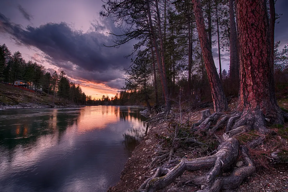
The North Idaho Centennial Trail is 23 miles of paved, multi-use path running from the Idaho/Washington state line west of Post Falls to Higgins Point, six miles east of Coeur d'Alene. About 10 of those miles run east-west directly through Post Falls — making it the trail most residents actually use for daily life, not just weekend outings.
What It Connects
At the state line, the Centennial Trail connects with the Spokane River Centennial Trail on the Washington side, which extends roughly 39 more miles through Riverside State Park and Riverfront Park all the way to Nine Mile Falls. The combined corridor runs more than 60 miles of continuous paved trail — one of the longer connected urban trail systems in the Pacific Northwest.
Within Post Falls, the main parking access points are at 4th Avenue west of Spokane Street and at the Huetter Rest Area off I-90. The 4th Avenue entry drops you almost immediately into the river corridor section, which is the most scenic stretch. The Huetter Rest Area is more convenient for people coming from the western neighborhoods like West Seltice.
How Locals Actually Use It
The Centennial Trail functions differently depending on the season. Summer weekends bring cyclists doing long out-and-back rides toward Coeur d'Alene or pushing all the way into Washington. Weekday mornings — especially the 6 to 8 a.m. window — are dominated by commuters on bikes and walkers moving fast. The trail is Class I and II paved surface, open year-round, and wide enough that faster cyclists and pedestrians rarely create conflict if you stay predictable.
The trail also serves as a practical commute route. Riders who live near the Riverside Harbor or Central Post Falls neighborhoods can cover the Post Falls segment and reach Coeur d'Alene without touching a road. That's not hypothetical — on a clear summer morning, the eastbound section is genuinely busy with people carrying backpacks.
| Segment | Direction | Distance from Post Falls | Character |
|---|---|---|---|
| Post Falls (4th Ave) → State Line | West | ~5 miles | River corridor, some road crossings, connects to WA trail |
| Post Falls (4th Ave) → Coeur d'Alene | East | ~10 miles | Paved lakeside approach, more residential |
| State Line → Spokane (via WA trail) | West | ~39 additional miles | Riverside State Park, Riverfront Park, urban Spokane |
| Coeur d'Alene → Higgins Point | East | ~6 miles past CDA | Lake Coeur d'Alene frontage, trail terminus |
| Full combined corridor | End-to-end | 60+ miles total | Continuous paved surface, no significant gaps |
One commute tip worth knowing: if you're heading west toward Spokane Valley by bike, the Huetter Rest Area start shaves several minutes off the route versus fighting traffic to reach 4th Avenue from the east side of Post Falls.
Looking to buy in Post Falls? Estimate your payment.
Enter your numbers to see an estimated monthly mortgage payment.
Estimate only. Excludes HOA fees and mortgage insurance. The interest rate above is a starting point, not a quoted rate — replace it with your own to see real numbers. Insurance is a flat placeholder, not a Post Falls quote.
Seasonal Recreation: What the Spokane River Makes Possible
Post Falls's outdoor life changes dramatically by season — not just in what activities are available, but in where people go and how crowded it gets.
Spring: The Gorge at Its Peak
Spring runoff through March, April, and May produces the most dramatic water levels of the year, and Falls Park is the place to watch it. The gorge views from the park trail are legitimately striking when the Spokane River is running high. This is also when the Centennial Trail starts drawing consistent traffic again after the slower winter months — the pavement dries faster than dirt trails, so it comes back into regular use earlier in the year.
The Community Forest trails, by contrast, stay soft and muddy into May. Impatient mountain bikers who head out too early leave ruts that take the rest of the season to recover. Mid-May is a reasonable target for the first ride in there.
Summer: The River Is the Social Scene
From late June through August, Q'emiln Park becomes the gathering point for a significant share of Post Falls's social life. Weekend afternoons pack the swimming beach. The boat launch (when open per Avista's annual schedule) brings watercraft from across Kootenai County. Families from neighborhoods across the city — Foxtail, Prairie Falls, Milltown — drive in and treat Q'emiln the way other cities treat a community pool.
Fishing on the Spokane River and at Falls Park's stocked pond stays productive through the summer. The pond's accessible platforms make it a regular destination for anglers who need a stable surface — a detail that isn't obvious until you look at the Idaho Department of Fish & Game's listing for the site.
After a day on the water, Post Falls Brewing Company's taproom on N Spokane St sits above the river and has become a reliable end-of-day spot for the outdoor-adjacent crowd — kayakers, cyclists coming off the Centennial Trail, families heading back from Q'emiln.
Fall and Winter: Quieter, But Not Closed
The boat launch at Q'emiln typically closes by mid-November. The swimming beach season ends earlier. But the Centennial Trail stays open and usable year-round — it's paved, relatively flat, and the river section stays clear of ice accumulation longer than you'd expect at this latitude.
Fall is when the Community Forest comes into its own for hikers. The granite cliffs and native tree canopy produce genuine color through October, and the trail crowds that peak in July thin out considerably. If you want the 2 miles of Spokane River frontage inside the forest mostly to yourself, a Tuesday morning in October is when that happens.
| Season | Top Activity | Best Location | What to Know |
|---|---|---|---|
| March – May | Gorge viewing, trail cycling | Falls Park, Centennial Trail | Peak runoff; Community Forest trails stay muddy until mid-May |
| June – August | Swimming, boating, fishing | Q'emiln Park, Spokane River | Boat launch open (Avista-dependent); beach gets crowded by noon on weekends |
| September – October | Hiking, mountain biking, fall foliage | Post Falls Community Forest | Best trail conditions of the year; crowds thin significantly |
| November – February | Trail walking, off-season fishing | Centennial Trail, Falls Park pond | Boat launch closed; Community Forest trails slick; paved trail remains open |
The consistent through-line across all four seasons is the Centennial Trail — it's the one amenity Post Falls residents rely on whether the river is at flood stage or frozen at the edges.
Local Expert Takeaway: The Spokane River corridor between Falls Park and Q'emiln Park is where Post Falls actually lives on weekends — not at a rec center or a mall. If you're evaluating neighborhoods, proximity to the 4th Avenue Centennial Trail access or the Q'emiln trailhead matters more than people expect before they move here. The Post Falls Community Forest is the underused asset: 500 acres of mountain biking and hiking with river frontage, accessed right off Q'emiln, that most new residents discover only after a neighbor tips them off. Post Falls Brewing Company on N Spokane St has become the natural endpoint for a Centennial Trail ride or a day at Q'emiln — it's the kind of local anchor that makes the river corridor feel like a complete place, not just a park.
Quick Takeaways & FAQs
✅ The North Idaho Centennial Trail puts 60+ miles of continuous paved corridor at Post Falls residents' doorsteps — connecting directly to Coeur d'Alene to the east and Spokane's Riverfront Park to the west.
⚠️ Q'emiln Park and the Centennial Trail are both concentrated in the river corridor — residents in northern neighborhoods like North Prairie or Foxtail will need to drive to access most of Post Falls's best outdoor amenities.
📍 The Post Falls Community Forest — a planned 500-acre natural area with mountain biking, hiking, granite cliffs, and 2 miles of Spokane River frontage — is accessed via the Q'emiln Park trailhead and remains largely unknown to newer residents.
Is Q'emiln Park's swimming beach open to the public, and does it have a lifeguard?
Can I bring my kayak or canoe to Q'emiln Park?
How long is the North Idaho Centennial Trail, and where does it start and end?
What is Treaty Rock, and is it worth visiting?
Where can I go mountain biking in Post Falls?
Moving to Idaho?
Tell us what you need help with and we'll connect you with local resources.
