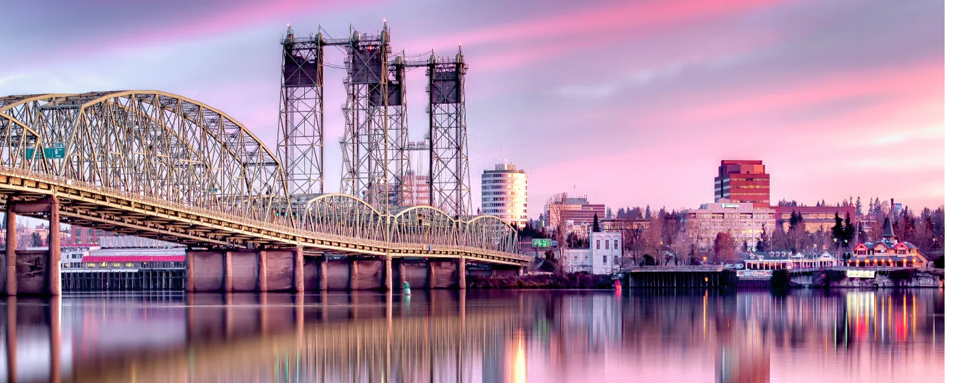
Most people moving to Vancouver expect a city in Portland's shadow — a bedroom community where you drive across the bridge for the good stuff. Six months in, they're surprised to find themselves spending entire weekends without leaving Washington. The Columbia River waterfront alone, rebuilt on the site of the old Boise Cascade paper mill that closed in 2006, gives you river views, a fishing pier, a sandy beach, and nearly seven miles of paved trail — all within the city limits. This isn't a park system that punches above its weight; it's one that most newcomers genuinely didn't see coming.
The outdoor infrastructure here is anchored by three distinct draws: the waterfront corridor running east from downtown toward Wintler Park, the Fort Vancouver National Historic Site campus that doubles as one of the most walkable green spaces in the city, and Esther Short Park — established in 1853 — which functions as Vancouver's true town square. Between those anchors, the Columbia River Renaissance Trail, the Discovery Historic Loop, and the Vancouver Land Bridge stitch the whole system together on foot or by bike. You can ride from downtown to a sandy beach without touching a car.
Vancouver's parks also reward people who don't like competing for trail space. The Renaissance Trail on a Tuesday morning feels nothing like Portland's Waterfront Park on a Saturday. That said, summer weekends at Wintler Community Park — where a $5 parking fee applies between Memorial Day and Labor Day — get genuinely crowded, and the farmers market adjacent to Esther Short Park draws serious foot traffic from April through October. Knowing when to show up matters.
Whether you're considering a move or just researching the area, the sections below cover Vancouver's signature parks and waterfront, the trail network that connects them, the Fort Vancouver campus and historic outdoor spaces, and what seasonal recreation actually looks like here across the year.
The Waterfront: Vancouver's Most Dramatic Outdoor Transformation
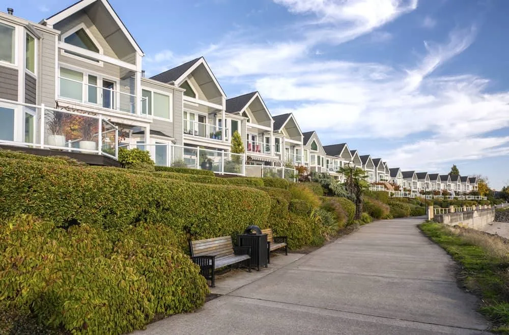
The 7.3-acre Vancouver Waterfront Park sits where a paper mill stood for decades. Since opening in fall 2018, it's become the clearest argument for what Vancouver's outdoor scene actually is — not borrowed from Portland, not aspirational, just genuinely good.
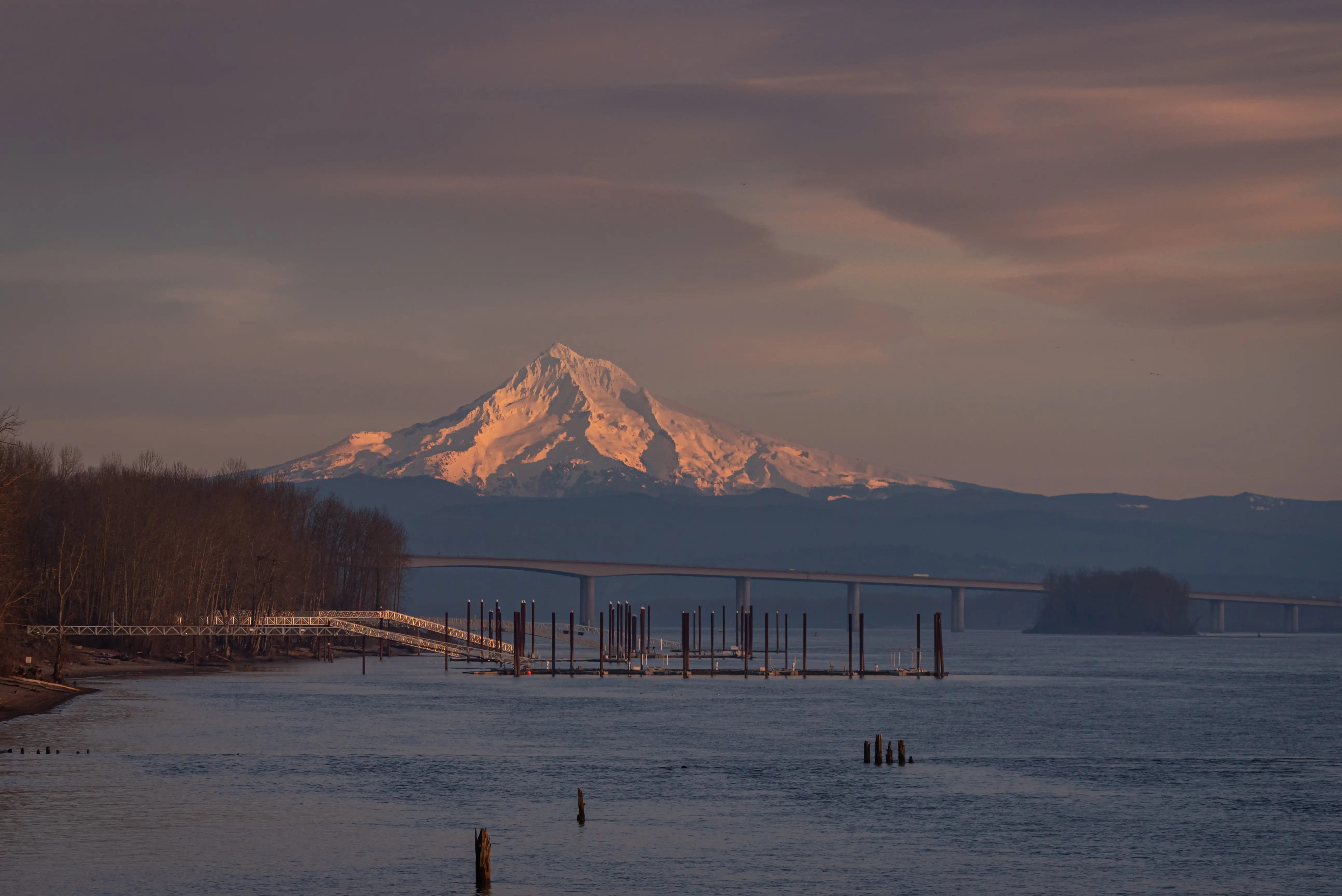
Grant Street Pier extends roughly 90 feet into the Columbia River from the park's edge. It's a working fishing spot and a sunset-watching platform in equal measure, and on clear evenings the view east toward Mount Hood is the kind of thing that makes people reconsider whether they want to stay in the Pacific Northwest at all.
The waterfront connects seamlessly westward to Marine Park, which has a boat launch, and eastward through the broader trail network. The Kaiser Shipyard Viewing Tower along the route is one of those stops that genuinely earns a pause — the interpretive panels about Vancouver's wartime shipbuilding history are specific enough to be interesting rather than perfunctory.
The Sandy Beach at Wintler
The Renaissance Trail's eastern anchor, Wintler Community Park, is a 12.5-acre park with a sandy beach, picnic tables, and restrooms open April through October. Families with kids tend to claim it as a summer destination in its own right — the beach is genuinely swimmable and doesn't require a ferry or a long drive.
The $5 parking fee between Memorial Day and Labor Day is worth knowing in advance. Arrive before 10 a.m. on summer weekends if you want space, because by noon the lot fills and the beach blankets are edge to edge.
What the Land Bridge Actually Is
The Vancouver Land Bridge, spanning State Highway 14, is the pedestrian connection between Fort Vancouver's historic grounds and the Columbia River waterfront. It was designed by Maya Lin — the landscape architect behind the Vietnam Veterans Memorial in Washington, D.C. — and it shows. The bridge isn't just infrastructure; it's a deliberate piece of civic design with viewpoints, interpretive signage, and a quiet that feels intentional given the highway noise below it.
Most newcomers don't learn about it until someone local mentions it. Walk it at least once before deciding what you think of Vancouver's outdoor spaces.
The Columbia River Renaissance Trail: Seven Miles Along the Water
The paved, five-mile Columbia River Renaissance Trail runs from Esther Short Park east to Wintler Community Park and is genuinely flat the entire way — no significant elevation, wide enough for bikes and pedestrians to coexist, and open year-round. With the Terminal 1 extension connecting the I-5 Bridge area into the system, the full waterfront-accessible pathway stretches nearly seven miles.
The surface is well-maintained and suitable for rollerblading, strollers, and road bikes. It's not a technical trail and it's not meant to be — the point is river access, open sky, and the kind of run or ride where you're looking at the Columbia rather than watching your footing.
Key Stops Worth Building a Route Around
| Stop | What's There | Notes |
|---|---|---|
| Esther Short Park (west trailhead) | Farmers market, public art, open lawn | Start here for downtown access; market Sat–Sun, April–October |
| Marine Park | Boat launch, picnic area | Mid-trail; good turnaround point for a shorter out-and-back |
| Kaiser Shipyard Viewing Tower | Historic interpretive stop | Wartime shipbuilding history; worth the five-minute pause |
| Grant Street Pier | Fishing, river views | ~90 feet into the Columbia; strong Mount Hood sight lines |
| Vancouver Land Bridge connection | Pedestrian bridge to Fort Vancouver | Designed by Maya Lin; connects trail to historic campus |
| Wintler Community Park (east trailhead) | Sandy beach, restrooms, picnic tables | $5 parking Memorial Day–Labor Day; beach open April–October |
The trail also connects to Portland-area paths via the Oregon-Washington Bridge toward Hayden Island, giving cyclists a cross-river option when conditions allow.
One Thing Locals Know
The Renaissance Trail is at its best in early morning on weekdays, when you'll share it with serious runners and commuter cyclists rather than weekend crowds. The stretch near the waterfront park around midday on summer Saturdays can feel congested — not unpleasant, but not the peaceful river run you might have imagined.
Fort Vancouver and the Historic Loop: Where Green Space Meets Genuine History
Fort Vancouver National Historic Site is the outdoor anchor that sets Vancouver apart from every other city on the I-5 corridor. The reconstructed Hudson's Bay Company fort charges a $10 entrance fee for adults 16 and older, but the visitor center at 1501 E Evergreen Blvd, the Pearson Air Museum, and the park grounds themselves are free. The grounds are open dawn to dusk, seven days a week.
Officers Row, directly across Evergreen Boulevard from the visitor center, lines the northern edge of the site — a row of historic homes that once housed Army officers and now serve as one of the more unusual free walks in the region. The combination of active green space, interpretive history, and that Land Bridge connection to the waterfront makes the Fort Vancouver campus feel much larger than its footprint suggests.
The Discovery Historic Loop
The Discovery Historic Loop is a marked 2.3-mile walking route that connects Fort Vancouver, the Pearson Air Museum, Providence Academy, Esther Short Park, and the Old Apple Tree — reportedly one of the oldest apple trees in the Pacific Northwest, planted in the 1820s. It takes roughly 45 minutes at a comfortable pace and covers more Vancouver history per mile than anything else in the city.
The loop is entirely flat, well-signed, and walkable in street shoes. It's the route to show someone visiting who asks what makes Vancouver distinctly Vancouver rather than just a Portland suburb with cheaper rents.
Esther Short Park as a Daily Gathering Space
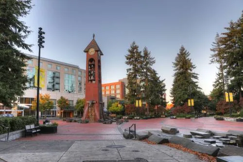
Established in 1853, Esther Short Park is where downtown Vancouver's daily life actually happens. The Vancouver Farmers Market has operated here since 1990, running Saturdays from 9 a.m. to 3 p.m. and Sundays 10 a.m. to 3 p.m. from April through October (and continuing Saturday-only through winter). The 2026 summer season runs April 4 through October 31.
Beyond the market, the park hosts outdoor concerts, beer festivals, and rotating public art installations. On a Friday evening in July, the lawn fills with blankets and portable speakers — it's the closest thing Vancouver has to a neighborhood living room at city scale.
One honest note: Esther Short sits in a transitional part of downtown where street-level activity varies by block and by time of day. It's busy and lively during market hours and events; quieter stretches of downtown adjacent to it feel less polished. That contrast is worth understanding before you plan an evening walk.
Looking to buy in Vancouver? Estimate your payment.
Enter your numbers to see an estimated monthly mortgage payment.
Estimate only. Excludes HOA fees and mortgage insurance. The interest rate above is a starting point, not a quoted rate — replace it with your own to see real numbers. Insurance is a flat placeholder, not a Vancouver quote.
Seasonal Recreation: What Changes, What Doesn't, and What to Expect
Vancouver's outdoor calendar is shaped by one reality: the Pacific Northwest's rainy season is longer than most transplants expect, and it starts earlier. September can be beautiful; November through February is consistently gray and wet. The good news is that almost all of Vancouver's core outdoor infrastructure — the Renaissance Trail, the Fort Vancouver grounds, the Discovery Loop, Esther Short Park — is usable year-round, rain or not.
By Season, What You're Actually Doing
| Season | Primary Activity | What Locals Know |
|---|---|---|
| Spring (March–May) | Trail running, cycling, farmers market opening | Market reopens April 4; Wintler beach restrooms open in April |
| Early Summer (June–July) | Waterfront events, beach days at Wintler, evening rides | Crowds arrive fast; weekday mornings are the local secret |
| Peak Summer (August) | Columbia River kayaking, outdoor concerts at Esther Short | A post-ride stop at one of the breweries near the waterfront is a common local habit |
| Fall (September–October) | Trail running, final farmers market weekends, Fort Vancouver tours | October 31 closes the summer market; fall light on the river is exceptional |
| Winter (November–February) | Waterfront walks, indoor farmers market (Saturdays), Fort Vancouver history | Winter market runs 10 a.m.–2 p.m. Saturdays; trail stays open in rain |
The winter farmers market at Esther Short is a detail most newcomers miss entirely — it runs every Saturday through March and is smaller but genuinely active.
Water Recreation on the Columbia
The Columbia River is the organizing fact of Vancouver's outdoor life, and the waterfront infrastructure makes it more accessible than people expect before they move here. Kayaking and paddleboarding launch from Marine Park's boat ramp and from Wintler's beach. The river is wide and moves with real current — it is not a casual paddle for beginners on busy boating days — but on calm mornings it's one of the more rewarding spots in the metro area.
Fishing from Grant Street Pier doesn't require a boat or special access. It's a walk-up, year-round option that regulars treat as casually as a park bench.
Youth Sports and Organized Recreation
Vancouver's parks system supports an active youth sports scene through its recreation programs; for a full breakdown of school-tied athletics and organized activities for kids, see the Vancouver schools page.
What Surprises People After Six Months
The thing newcomers don't expect is how much outdoor life happens between the landmarks. The Renaissance Trail isn't just a weekend destination — people use it for grocery runs, commutes, and lunch breaks. The Fort Vancouver grounds see dog walkers every morning. Esther Short Park fills up on Tuesday evenings when nothing specific is scheduled. The parks here aren't reserved for recreation; they're woven into daily life in a way that takes a few months to fully notice.
Local Expert Takeaway: Vancouver's outdoor system is most underestimated by people who assume Portland has already claimed everything worth using on the Columbia. The Renaissance Trail from Esther Short Park to Wintler's sandy beach, the Land Bridge designed by Maya Lin connecting the historic Fort Vancouver grounds to the waterfront, and the Discovery Historic Loop's 2.3-mile circuit through the city's oldest landmarks — none of that requires crossing a bridge or paying for parking most of the year. The farmers market runs year-round. The trail runs in the rain. On weekday mornings, the whole waterfront corridor is yours.
Quick Takeaways & FAQs
✅ The Columbia River Renaissance Trail connects downtown Vancouver to a sandy beach at Wintler Community Park in five paved, flat miles — usable year-round on foot or by bike.
⚠️ Summer weekends at Wintler Community Park fill fast, and the $5 parking fee applies Memorial Day through Labor Day; arriving before 10 a.m. is the practical solution.
📍 The Vancouver Land Bridge — designed by Maya Lin, the architect behind the Vietnam Veterans Memorial — is one of the most specific and least-known details of the city's outdoor system, and it connects the Fort Vancouver campus directly to the waterfront trail.
How long is the Columbia River Renaissance Trail in Vancouver, WA?
Is Vancouver Waterfront Park free to visit?
When is the Vancouver Farmers Market open?
What is the Discovery Historic Loop in Vancouver, WA?
Can you kayak or paddleboard on the Columbia River in Vancouver?
Moving to Washington?
Tell us what you need help with and we'll connect you with local resources.
