Most cities of 6,327 people don't sit inside a 4,300-acre state park. Warrenton does. Fort Stevens State Park isn't a short drive away — it is woven into the city's western edge, which means residents walk or bike into old-growth spruce forest, freshwater lake swimming, and Civil War-era gun batteries the way residents of other small Oregon towns walk to a neighborhood playground. That geographic reality shapes daily life here more than almost anything else.
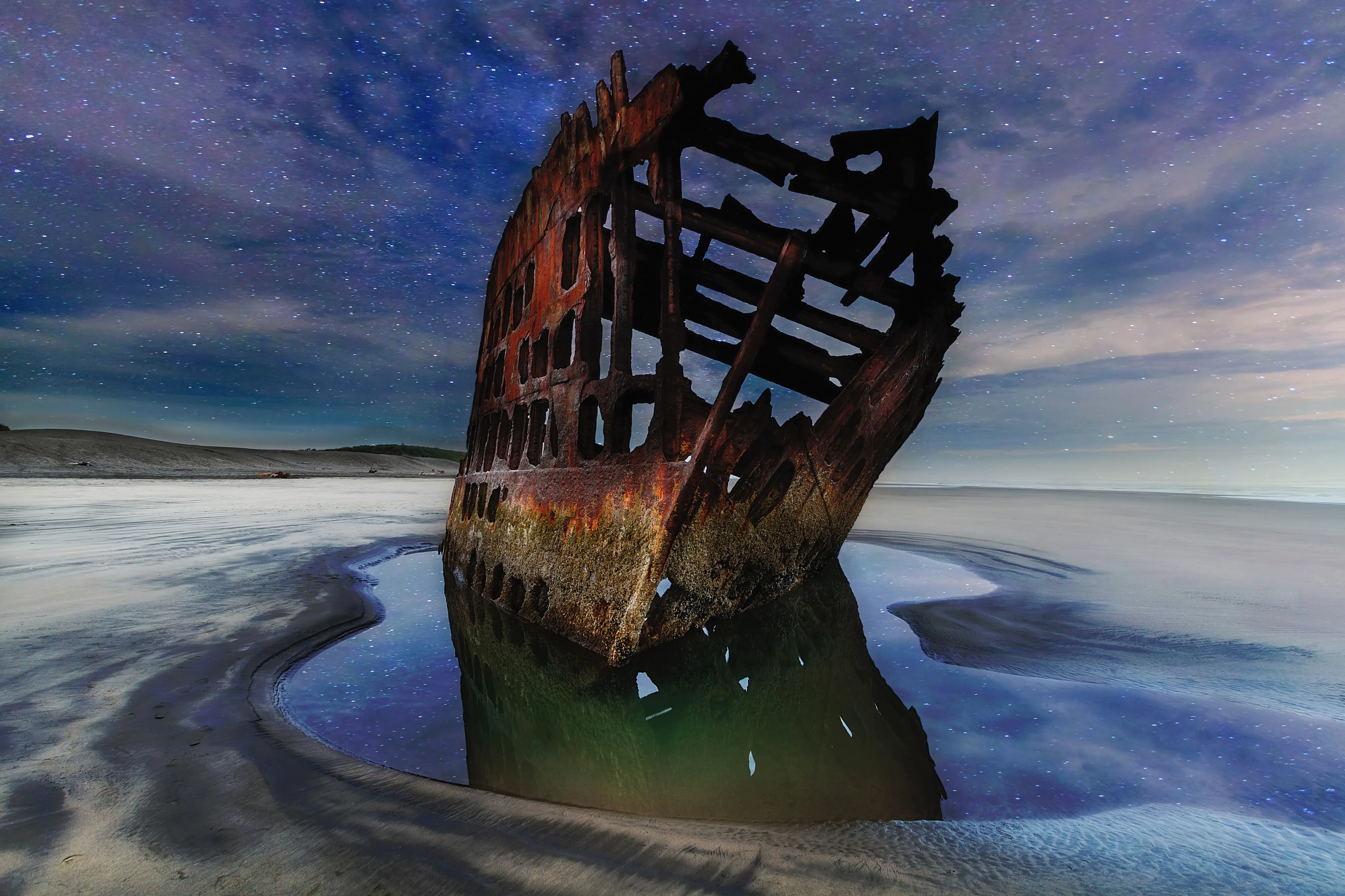
The outdoor infrastructure goes well beyond the park. The Warrenton Waterfront Trail traces 4.7 miles of the Skipanon Peninsula on a former rail corridor, connecting the Columbia River waterfront to downtown with a paved, wheelchair-accessible path. The Skipanon River Marina gives paddlers a launch point into Young's Bay and the Columbia River estuary. Charter boats run out of the Hammond area targeting chinook, coho, Dungeness crab, and rockfish. And the Peter Iredale — a rusted four-masted steel ship beached since 1906 — sits right on the sand, free and accessible at any low tide, as casually as a park bench.
The catch, and it is worth saying plainly: Warrenton gets 126 sunny days a year. The Oregon Coast's famous overcast is real, and anyone moving from a sunnier climate needs to make peace with drizzly trail runs and grey beach mornings. What locals know is that fog and mist make the forests and the estuary feel otherworldly in a way that 300 sunny days never would. The trade-off is real; so is what you get for it.
Whether you're considering a move or just mapping out what daily life here looks like, the sections below break down Warrenton's parks, trails, water recreation, and seasonal outdoor calendar in detail.
Fort Stevens State Park: What It Means to Live Next to It
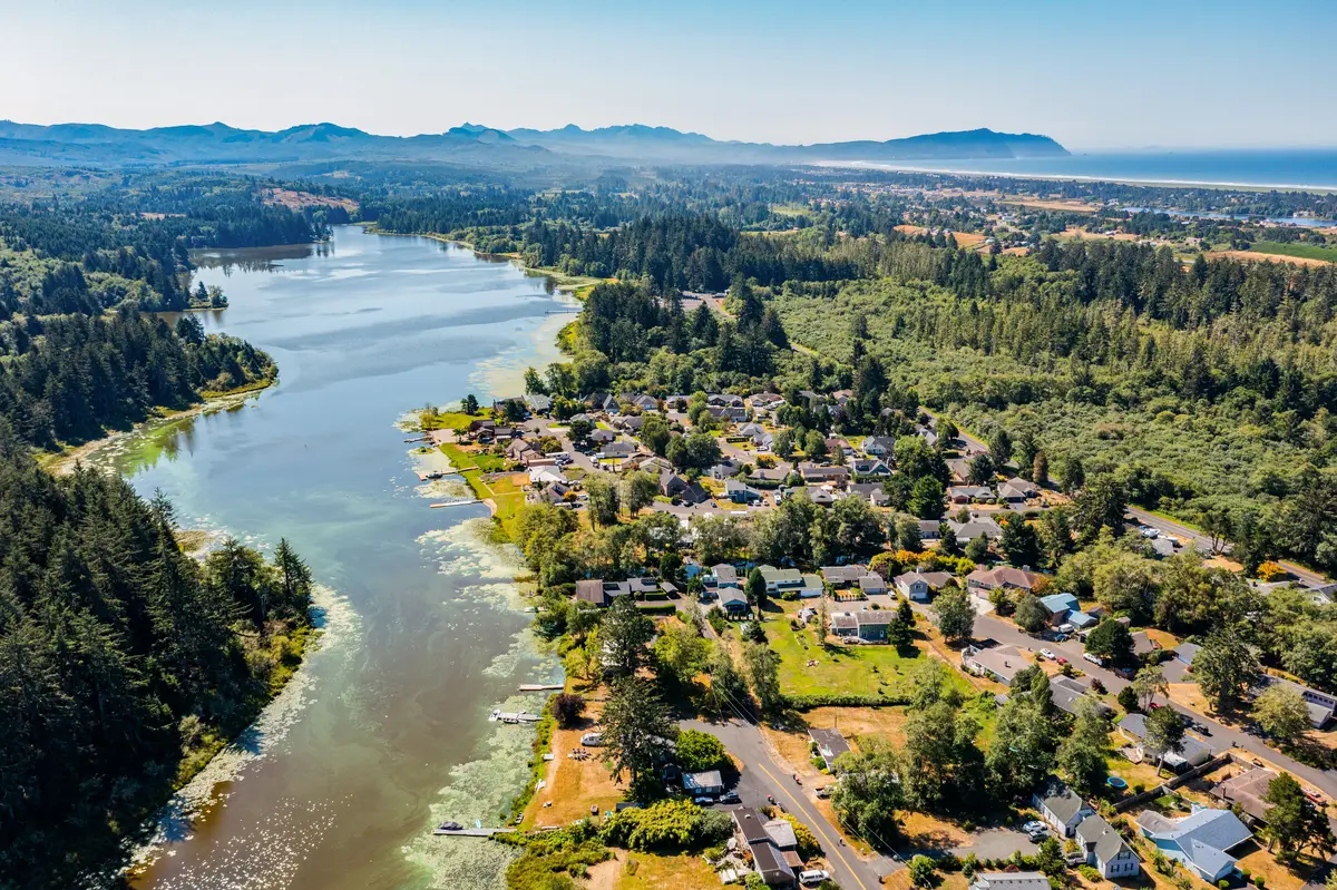
Living in Warrenton means having Oregon's most diverse state park as your effective backyard. Fort Stevens covers 4,300 acres and packs in ocean beach, freshwater lake, old-growth forest, wetlands, dunes, shore pine flats, a Civil War fort, and a shipwreck — all within a single park boundary that touches the city's edge.
The Trail System
Nine miles of paved bicycle trails thread through the park, connecting the campground loops, the military history area, and the lake. Six miles of hiking trails run through spruce and hemlock forest, wetlands, and the dune transition zone. Fort Stevens also marks the northern terminus of the Oregon Coast Trail, which means long-distance hikers arrive here from the south and day-walkers can pick up the trail for a genuine coastal stretch without driving anywhere.
The mix of paved and unpaved trail is a practical detail that matters: families with young kids on bikes, trail runners, and birders on foot can all use the same system without competing for the same surface. That's rarer than it sounds on the Oregon Coast.
The Military History Layer
Fort Stevens is the only Civil War earthen fort on the West Coast, and its preserved earthworks are open for exploration. The concrete artillery gun batteries built at the turn of the century are a different kind of attraction — massive, atmospheric, and free to walk through. A military museum operates year-round for anyone who wants the full historical context. The Columbia Shore Disc Golf Course also runs through the park, one of the more unusual rounds of disc golf available on the Oregon Coast.
The Practical Upgrade
Oregon State Parks funded a $6–8 million infrastructure upgrade at Fort Stevens through a 2021 general obligation bond, covering wastewater systems, electrical, paving, water infrastructure, and a new restroom building. New day-use restrooms at the Peter Iredale beach area were completed as part of that project. For residents who use the park several times a week, this matters: the facilities are in better shape now than they were five years ago.
One logistical note that catches newcomers off guard: since October 2025, all day-use areas require a parking permit, available at self-serve kiosks, the visitor center, and the ranger station. Oregon State Parks annual passes and active campsite reservations are accepted in lieu of a daily permit. If you plan to use the park regularly — and most Warrenton residents do — an annual pass is the move.
The campground itself has more than 500 sites, including full-hookup, electric-and-water, tent sites, yurts, and cabins, making it one of the largest campgrounds in Oregon. Residents mostly ignore the campground in their daily routines, but having it next door means the park fills with visitors on summer weekends. By Labor Day the crowds thin out and the trails feel like yours again.
Coffenbury Lake: Swimming, Fishing, and the Quiet Freshwater Alternative
Coffenbury Lake sits inside Fort Stevens State Park and functions as Warrenton's de facto community swimming hole for anyone who finds the Pacific too cold or too rough. At roughly 50 acres, it's small enough to feel intimate but large enough to absorb a summer crowd without feeling cramped.
Swimming and the Summer Window
Two sandy beach swimming areas bookend the lake, and water temperatures climb to around 70°F in July — genuinely warm for the Oregon Coast, where the ocean rarely breaks 55°F. That contrast is significant. Families with young kids who want lake swimming in July have a reliable option minutes from home rather than driving inland to the Willamette Valley.
The lake also has a boat ramp with a 10 mph speed limit and a no-gas-motors rule, which keeps the water calm and the noise level low. Kayaks, canoes, and paddleboards are the standard. Ranger-guided kayak tours run during warmer months for anyone new to paddling or wanting a more structured introduction to the estuary environment around the lake.
Fishing Year-Round
Coffenbury Lake is regularly stocked with rainbow trout, including trophy-sized fish, and receives adult hatchery steelhead during winter. Warmwater species — largemouth bass, bluegill, black crappie, brown bullhead, and yellow perch — round out the fishery. The fishing docks make it accessible without a boat, which matters in a city where not every angler owns one.
The 2-mile perimeter trail around the lake is one of those routes that works in all weather. Residents run it, walk it with dogs, and use it as a quick morning loop before work. It's not dramatic terrain — flat, forested, with lake views — but it's the kind of trail you actually use every week rather than saving for a special occasion.
If you're drawn to Warrenton partly by the outdoor lifestyle, Coffenbury Lake is the specific place where that lifestyle plays out most consistently. The ocean beach is dramatic but unpredictable; the lake is the reliable, low-key alternative that residents lean on.
The Waterfront Trail and the Skipanon River System
The Warrenton Waterfront Trail is a 4.7-mile paved, wheelchair-accessible path built on a former rail corridor that traces the shape of the Skipanon Peninsula. It connects the Columbia River waterfront to the Skipanon River through downtown, giving residents a linked, car-free route that functions as both a commuter path and a recreational corridor.
What the Trail Actually Feels Like
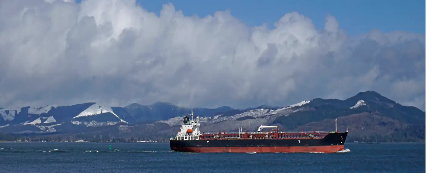
The most visually striking stretch runs along the Columbia River waterfront, where boardwalk overlooks frame views of the Astoria-Megler Bridge and the ocean-going ships moving in and out of the river. Freighters, container ships, and fishing vessels pass close enough that you can read their names from the trail. It's the kind of infrastructure that other cities would market aggressively; in Warrenton it's just the daily running route.
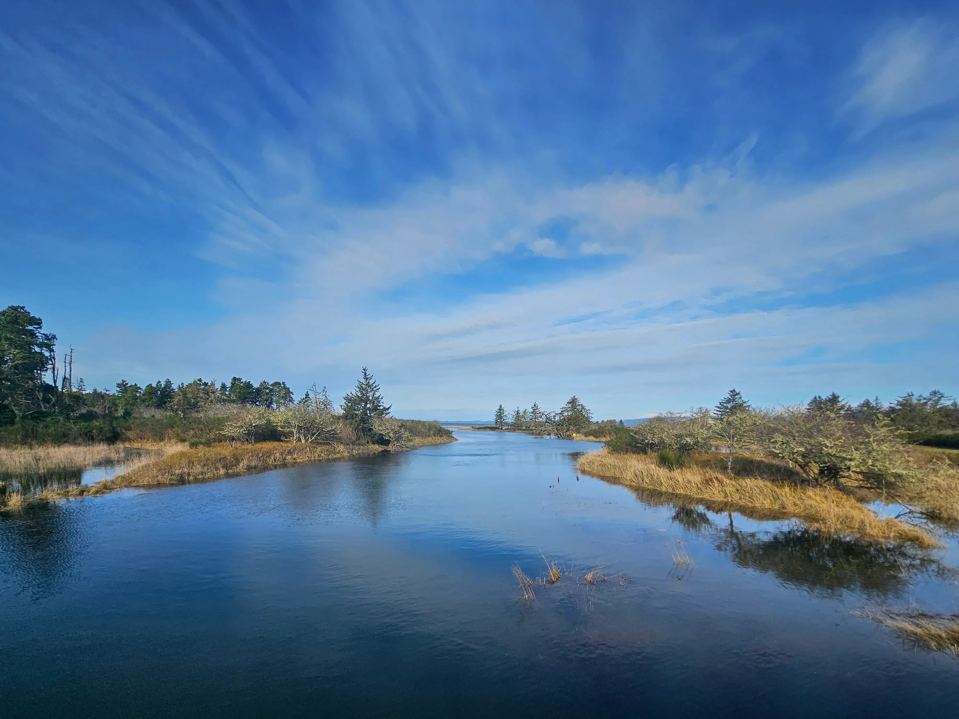
The Skipanon River segment through downtown is quieter — tidal sloughs, marsh grasses, and heron sightings are the texture here rather than bridge views. The two stretches feel like different trails on the same route, which keeps a 4.7-mile loop from feeling repetitive.
The Broader Trail Network
The city maintains a wider Skipanon Peninsula Trail Network beyond the Waterfront Trail itself, including the Skipanon River Loop Trail, the Airport Dike Trail, and several connector spurs. Together these give residents a linked system that covers more terrain than any single trail number suggests. The Airport Dike Trail in particular offers open views across the estuarine flats that are worth knowing about if you're a birder — shorebird migration here can be genuinely impressive in spring and fall.
The Marina as a Launch Point
The Skipanon River Marina sits at the mouth of the Skipanon River and serves both commercial fishing operations and recreational paddlers. Paddlers can follow the Skipanon Waterway from the marina out to Young's Bay and into the Columbia River — a route that runs through one of the most productive estuaries on the West Coast. The marina has restrooms, showers, and a fish-cleaning station, which tells you something about the culture: this is a working waterfront, not a decorative one.
For anyone interested in saltwater fishing, charter boats operating out of the Warrenton and Hammond area target chinook salmon, coho salmon, Dungeness crab, lingcod, and rockfish. The Buoy 10 fishery at the Columbia River's mouth is a regionally well-known salmon run that draws serious anglers every fall. Living here means having access to that fishery without a long drive, which is not a small thing for people who fish.
Looking to buy in Warrenton? Estimate your payment.
Enter your numbers to see an estimated monthly mortgage payment.
Estimate only. Excludes HOA fees and mortgage insurance. The interest rate above is a starting point, not a quoted rate — replace it with your own to see real numbers. Insurance is a flat placeholder, not a Warrenton quote.
Seasonal Recreation and the Peter Iredale Experience
Every season in Warrenton has a different outdoor rhythm, and knowing the calendar before you move here saves a lot of confused expectations.
The Wreck of the Peter Iredale
The Peter Iredale ran aground on October 25, 1906, and has sat on the same stretch of Fort Stevens beach ever since. The rusted steel skeleton of a four-masted ship rising out of the sand at low tide is one of those landmarks that genuinely delivers in person. It's considered one of the most accessible shipwrecks on the West Coast — there's no dive required, no boat, no guided tour. You walk down to the beach and the wreck is there. New day-use restrooms were added as part of the recent state parks infrastructure project, which has made the site more functional for families.
What newcomers often don't expect: the beach around the wreck is fully exposed to ocean wind, and even on a July day that looks warm from inland, the wind chill at the waterline can be significant. Layers are not optional here. Residents know this; visitors who drove up from the Willamette Valley in shorts learn it quickly.
Summer: The Peak Window
July and August are when Coffenbury Lake hits its warmest temperatures, the disc golf course sees its heaviest play, and the campground fills nightly. Residents who time their park visits to early morning during summer get the trails essentially to themselves. The Waterfront Trail is genuinely pleasant on a calm summer morning — fog burning off the Columbia, herons in the sloughs, container ships moving slowly upriver.
Fall: When the Fishing Gets Serious
Fall is when anglers move to the front of the local recreational hierarchy. The Buoy 10 salmon run draws boats from across the region, and the Dungeness crab season that follows keeps charter traffic active well into the winter. Coffenbury Lake receives its hatchery steelhead in winter, which extends the fishing calendar past what most freshwater lakes on the coast offer.
Winter and Spring: The Honest Assessment
Winter in Warrenton is wet, grey, and sometimes dramatic in the way that only an exposed coastal city can be. The upside is that the trails and the beach are essentially yours. The Peter Iredale at a winter low tide with no other visitors around is a different experience entirely from the summer version — quieter, more elemental, and the kind of thing that makes long-term residents feel like they have something most people don't know about.
Spring is the best season for shorebird migration along the Airport Dike Trail and the estuarine margins of the Skipanon Peninsula. The Lewis and Clark National Historical Park, nearby, adds another layer of historical and ecological context to the broader landscape that rewards slow, repeated visits rather than a single tourist stop.
For a fuller picture of how the neighborhoods relate to park access, or what the cost of living looks like alongside these amenities, the linked pages go deeper on both.
Local Expert Takeaway: Warrenton's outdoor recreation case is straightforward and specific: a 4,300-acre state park with nine miles of paved bike trails, a warm freshwater lake, a 4.7-mile waterfront trail with Columbia River views, and charter fishing access to the Buoy 10 salmon run — all within a city of 6,327 people. The Peter Iredale is the landmark that surprises people most when they move here, not because they didn't know about it but because having it ten minutes from home never gets old. What you give up is sunshine — 126 sunny days a year is the honest figure — and what you get is uncrowded trails, dramatic coastal scenery, and recreational infrastructure that most small Oregon cities can't come close to matching.
Quick Takeaways & FAQs
✅ Fort Stevens State Park's 4,300 acres sit directly within Warrenton's city limits, giving residents trail, lake, and beach access that most small Oregon cities simply don't have.
⚠️ Warrenton averages only 126 sunny days a year — the Oregon Coast's grey, wet winters are real, and the outdoor lifestyle here requires genuine comfort with drizzle and overcast.
📍 Day-use parking at Fort Stevens has required a permit since October 2025 — residents who use the park regularly should budget for an Oregon State Parks annual pass.
Is Fort Stevens State Park free for Warrenton residents?
Can you swim in the ocean near Warrenton, or is it too cold?
How good is the fishing in and around Warrenton?
What is the Warrenton Waterfront Trail like for daily use?
Can you visit the Peter Iredale shipwreck without a guided tour?
Moving to Oregon?
Tell us what you need help with and we'll connect you with local resources.
