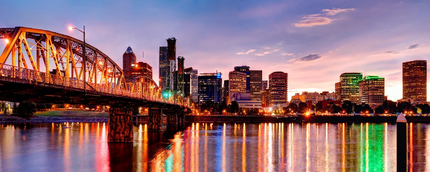
Portland does not have to manufacture its outdoor identity — it sits inside it. A city of 640,623 people, it contains one of the largest urban forests in the United States, a 176-acre extinct volcano, miles of riverfront paths, and an island the size of Manhattan within its daily orbit. The Willamette River splits the city east from west, I-5 and I-84 frame the commuter corridors, and the parks system threads through virtually every neighborhood in between. You do not have to leave town to find old-growth Douglas fir, panoramic views of Mt. Hood, or a stretch of riverbank where the only sounds are birds.
That outdoor abundance shapes who moves here and how they live. Families drawn by proximity to Legacy Health, OHSU, and Portland Public Schools find that weekends almost naturally organize themselves around the parks system — Washington Park on a Saturday morning, Mt. Tabor for an after-dinner walk, Sauvie Island for the long days of July. The parks are not an amenity bolted onto the city; for most residents, they are a primary reason the city works as a place to live.
The honest caveat: Portland logs only 144 sunny days a year, which means the parks earn their use in layers of mist and mud as much as sunshine. Locals who thrive here learn the trails in the rain and consider a gray November hike in Forest Park as legitimate as any summer outing. New arrivals who expect the outdoor life to look like a travel brochure sometimes find the adjustment harder than expected — but most come around by their second winter. For a broader look at what living here costs day-to-day, the cost of living page has the full picture.
Whether you are considering a move or just getting oriented, the sections below cover Portland's signature parks, the trail networks that connect them, the waterfront and island recreation that defines summer, and the seasonal rhythms that make outdoor life here genuinely distinctive.
Forest Park: 5,200 Acres in the Middle of the City
Most cities have a park. Portland has a forest. Forest Park covers 5,200 acres along the eastern slope of the Tualatin Mountains, stretches more than seven miles across the northwest corner of the city, and contains more than 80 miles of trails, fire lanes, and forest roads. It overlooks the convergence of the Columbia and Willamette Rivers — a view that never stops feeling improbable given that you reached it by city bus.
The spine of the whole system is the 30.2-mile Wildwood Trail, a National Recreation Trail that runs the full length of the park and connects south to Washington Park, Pittock Mansion, and the Bird Alliance of Oregon nature sanctuary. It is also part of the regional 40-Mile Loop, a network linking Forest Park to trails along the Columbia River, through Gresham, down into Southeast Portland, and back via the Willamette Greenway. You can, in theory, string together a very long day using only that loop.
More than 40 access points are scattered across Portland's neighborhoods, which matters practically: you do not need to drive to a single trailhead and fight for parking. Residents in the Northwest District step onto the Wildwood within a few blocks of their front doors. Forest Park supports more than 112 bird species and 62 mammal species — black-tailed deer, coyote, and great horned owls are all regular sightings — which surprises people who expect an urban park to feel manicured. It does not. It feels like a forest, because it is one.
What Locals Know
The Wildwood gets crowded on dry weekend mornings, especially near the southern trailheads closest to Washington Park. Regulars who want solitude push north, deeper into the park, where the fire lanes thin out the foot traffic. The trails are almost universally muddy from November through April — trail shoes with real grip matter more than any piece of gear you might buy. And the park's 40-plus access points mean the best entry is often the one closest to your neighborhood, not the one the hiking blogs feature.
Washington Park and Mt. Tabor: Two Parks, Two Personalities
Washington Park and Mt. Tabor sit on opposite sides of the city and draw completely different crowds — but both punch well above their acreage in what they offer.
Washington Park
At 410 acres about two miles west of downtown, Washington Park draws crowds from across the region and ranks among the most-visited urban parks in the Pacific Northwest. The draw is the concentration: the Oregon Zoo, the Portland Japanese Garden, Hoyt Arboretum, the International Rose Test Garden, the World Forestry Center, an archery range, tennis courts, soccer fields, picnic areas, and more than 15 miles of hiking trails that connect directly to Forest Park. You can spend a full day here without covering all of it.
Hoyt Arboretum functions as Portland's living tree museum — more than 2,300 species of trees and shrubs from around the world, threaded by 12 miles of trails. It is one of the few places where you can walk among coast redwoods, dawn redwoods, and a grove of Oregon white oaks within the same afternoon. The International Rose Test Garden has been growing roses since 1917, with approximately 10,000 roses in bloom from May through October, looking out over the downtown skyline and Mt. Hood on a clear day.
Getting here without a car is genuinely easy. The MAX Light Rail Red and Blue lines serve the Washington Park station with frequent service, and a free seasonal shuttle loops through the park itself. For a city where park access by transit is more the exception than the rule, this one is set up well.
Mt. Tabor Park
Mt. Tabor is the eastside counterweight — smaller at 176 acres, more neighborhood-scaled, and stranger in the best way. Portland is one of only a handful of American cities with an extinct volcano within its limits, and Mt. Tabor's 636-foot cinder cone is that volcano. The forested trails and open-air historic reservoirs give it a texture no flat park can replicate. On a clear evening, the views from the summit take in the downtown skyline and Mt. Hood simultaneously.
The park has an outdoor stage, a dog off-leash area, basketball and tennis courts, and picnic areas that fill with neighbors on summer evenings. The signature seasonal event is the PDX Adult Soapbox Derby, held each year in August, when homemade cars race down the volcanic slopes to the considerable entertainment of everyone watching. It is one of those specifically Portland events that makes no sense to explain and complete sense once you have seen it.
Best for: Families Nature Walkable
The Willamette River Greenway and Sauvie Island
Portland's relationship with the Willamette River is central to daily life here in a way that the bridges alone don't capture. The Willamette River Greenway provides miles of paved, accessible paths for walking, jogging, and cycling along the riverfront, with continuous views of the water, the city's iconic bridges, and the skyline. It is part of a statewide greenway corridor running from south of Eugene northward to Portland — but the Portland stretch is where residents actually use it, on weekday lunch runs and weekend cycling loops that string together multiple bridges and neighborhoods.
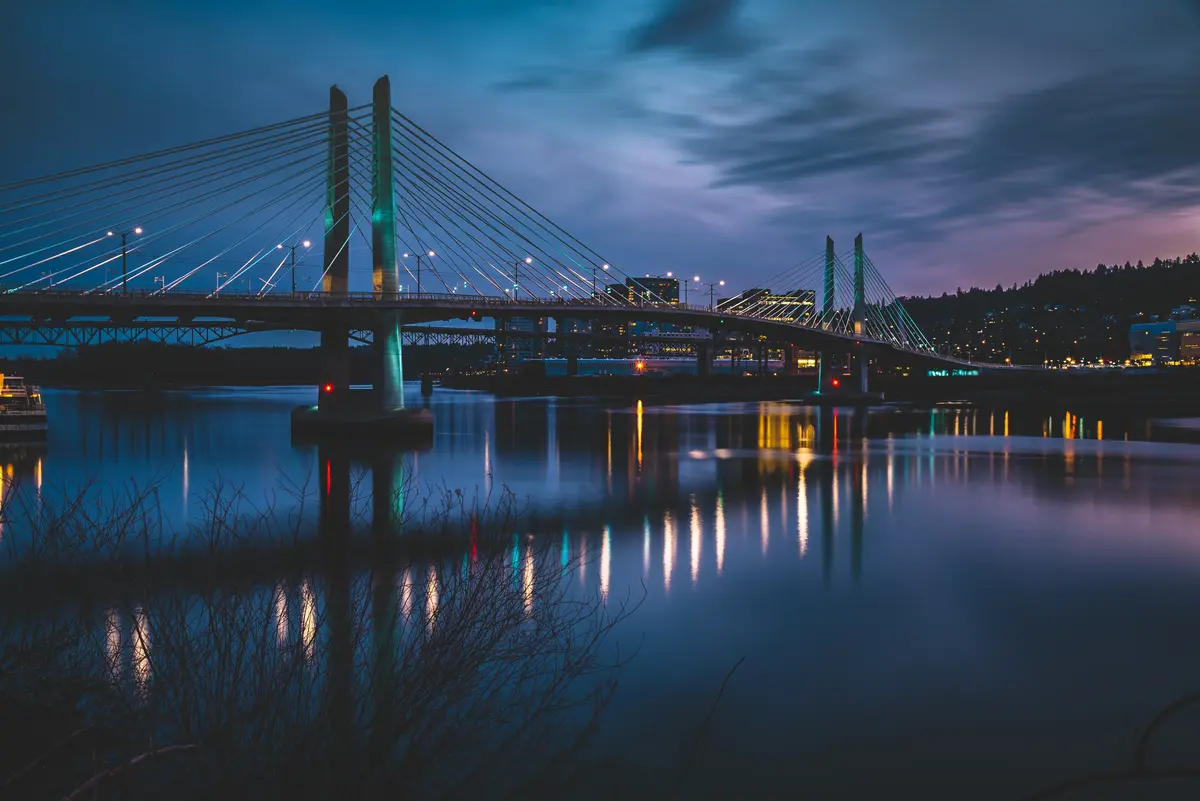
Tilikum Crossing — the pedestrian and transit bridge connecting the South Park Blocks area to the eastside — is the newest of Portland's signature spans and part of what makes the Greenway feel connected rather than fragmented. The path is flat, paved, and accessible, which makes it genuinely usable for a wider range of people than the forest trails.
Sauvie Island
Sauvie Island sits just north of Portland on the Columbia River, roughly the size of Manhattan, and it operates as a kind of pressure valve for the city. On a warm summer weekend, families spread across the sandy beaches at Walton Beach and Collins Beach, and the island's farms draw visitors looking for U-pick produce and a sense of something slower than the city pace.
The hiking is varied enough to stay interesting. The Wapato Access Greenway State Park Trail covers an easy 2-mile loop through big-leaf maples and Douglas firs around a seasonal lake, where bald eagles and blue herons are common sightings. The Warrior Rock Lighthouse Trail at the island's northeastern end runs approximately 7 miles round-trip and rewards the distance with Columbia River views that most visitors never reach.
The practical detail to know before moving here: a seasonal parking permit is required at the main beaches during summer weekends and holidays. This catches first-timers who drive out expecting to park freely. Plan ahead or arrive early — the island's geography means there is no workaround once the lots fill. Birding is excellent year-round, and the island is significantly less crowded outside the summer beach season, which is when longtime residents tend to prefer it.
Looking to buy in Portland? Estimate your payment.
Enter your numbers to see an estimated monthly mortgage payment.
Estimate only. Excludes HOA fees and mortgage insurance. The interest rate above is a starting point, not a quoted rate — replace it with your own to see real numbers. Insurance is a flat placeholder, not a Portland quote.
Seasonal Recreation and What to Expect Through the Year
Portland's outdoor calendar is not evenly distributed. The city averages 144 sunny days a year, which concentrates outdoor life into a June-through-September window that residents treat with near-religious intensity. The flip side is that the parks themselves are extraordinary in the off-season — Forest Park's canopy turns in October in a way that the summer crowds never see, and Mt. Tabor's historic reservoirs have a particular quality on a gray November morning that is genuinely worth the damp.
What the Seasons Actually Look Like
| Season | Where People Go | What to Know |
|---|---|---|
| Spring (Mar–May) | International Rose Test Garden, Hoyt Arboretum, Wildwood Trail | Trails are muddy through April; roses begin blooming by May |
| Summer (Jun–Sep) | Sauvie Island beaches, Willamette River Greenway, Mt. Tabor | Sauvie Island parking permit required at main beaches during summer weekends and holidays |
| Fall (Oct–Nov) | Forest Park, Mt. Tabor, Washington Park | Foliage peaks in October; crowds thin noticeably after Labor Day |
| Winter (Dec–Feb) | Wildwood Trail, Willamette Greenway | Wet and mild; trail conditions vary; wildlife sightings increase in Forest Park |
The PDX Adult Soapbox Derby at Mt. Tabor each August is one of those events that newcomers stumble onto accidentally and return to deliberately. The Rose Test Garden's peak — roughly May through October — draws visitors from well outside the metro, so weekday mornings are the local's choice.
The Human Friction Moment
People who move here from sunnier climates frequently underestimate how the park system changes in October. The Wildwood Trail that felt inviting in July becomes a rooted, slick, and genuinely demanding path by November. That transition — from summer park life to wet-season trail culture — is where some newcomers fall away from the outdoor habits they arrived with. The locals who maintain those habits year-round are the ones who invest in waterproof layers early and stop treating rain as a reason not to go. Six months in, most people who moved here for the parks have either made that adjustment or quietly started looking at the gym membership instead.
For families weighing which neighborhoods give the best day-to-day access to these parks, the neighborhoods guide breaks down proximity and character across Portland's distinct areas.
Local Expert Takeaway: Portland's parks system is the rare case where the reputation is actually undersold. Forest Park's 5,200 acres and 80-plus miles of trails are within city limits — not a regional preserve you drive an hour to reach. Washington Park packages the Rose Test Garden, Hoyt Arboretum, and the Portland Japanese Garden into a single 410-acre complex that connects directly to Forest Park via the Wildwood Trail. Mt. Tabor gives the eastside its own volcano-summit park with skyline views. And Sauvie Island, a short drive north, operates as Portland's beach day without leaving the metro. The catch is the 144 annual sunny days — learning to use these parks in the rain is not optional, it is the skill that separates people who love living here from people who moved here for the summers and leave by year three.
Quick Takeaways & FAQs
✅ Forest Park's 5,200 acres and 80-plus miles of trails make it one of the largest urban forests in the United States — accessible by neighborhood on foot, not just by car.
⚠️ Portland averages only 144 sunny days a year, which means the outdoor lifestyle here is genuinely a wet-season commitment, not just a summer one.
📍 Sauvie Island's main beaches require a seasonal parking permit during summer weekends and holidays — first-timers regularly show up unprepared and can't park.
How big is Forest Park and how do I access it from different neighborhoods?
Is Washington Park accessible without a car?
Do I need a permit to visit Sauvie Island beaches?
What makes Mt. Tabor Park unique compared to other Portland parks?
What's the best way to experience Portland's parks year-round given the rainy climate?
Moving to Oregon?
Tell us what you need help with and we'll connect you with local resources.
