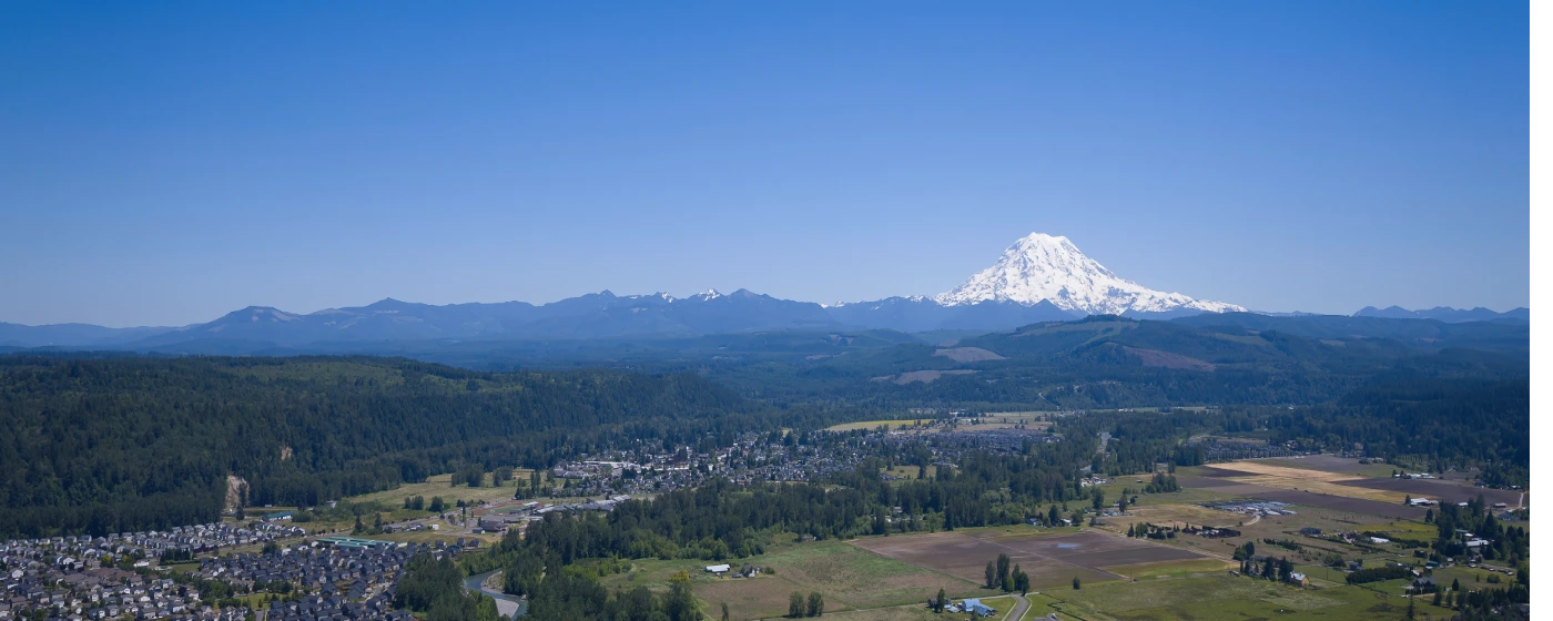
You can stand at the Washington Avenue viewpoint in downtown Orting on a clear morning and see Mount Rainier filling the entire eastern sky — not as a distant postcard backdrop, but close enough that you notice the detail in the glaciers. That proximity defines outdoor life here in a way that's genuinely different from any other Pierce County town. Orting sits at the convergence of the Carbon and Puyallup Rivers, tucked into a valley at the mountain's foothills, and the recreation that flows from that geography — paved rail-trails following old railroad grades, river paths with milky glacial water, salmon streams, bald eagle sightings — is woven into everyday life for residents, not reserved for weekend day-trippers.
The town center itself is anchored by three parks shaded by giant maples and Douglas firs, and the Foothills Trail trailhead sits right inside Orting City Park, steps from Washington Avenue. That proximity matters: you don't drive to get to the trail. Families walk to it from the neighborhoods closest to downtown, and on weekday mornings it's as busy with commuter cyclists heading toward Puyallup as it is with recreational users. The Carbon River Trail — a nearly 6-mile paved out-and-back running north–south alongside the river — feeds directly into the Foothills system, creating more connected mileage than most cities ten times Orting's size can claim.
Recreation here does come with a layer of context you won't find anywhere else: lahar warning signs posted along the Foothills Trail east of town, evacuation bridges under active construction, and a city that takes volcanic-hazard planning seriously enough to build a $9-million pedestrian bridge specifically for emergency egress. Geologists estimate a roughly one-in-seven chance of a catastrophic lahar event during a resident's lifetime — that's not a reason most people rule Orting out, but it shapes how the community thinks about the outdoors in a way that's honest to acknowledge.
Whether you're deciding whether to move here or trying to understand what daily life actually looks like on the ground, the sections below cover Orting's signature trails and parks, the Carbon River corridor, the seasonal events that define the community calendar, and the broader outdoor access — including camping — that the surrounding valley provides.
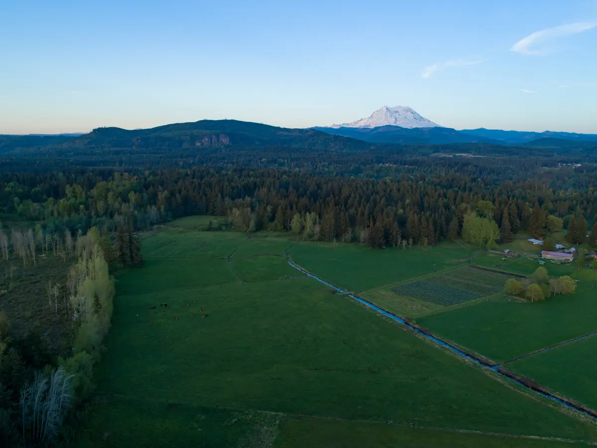
The Foothills Trail: Orting's Everyday Outdoor Backbone
The Foothills Trail is the single piece of infrastructure that defines outdoor life in Orting more than anything else. It's a 12-foot-wide paved, non-motorized rail-trail running roughly 20 miles between eastern Puyallup and Buckley, following the old railroad grade through the valley — and Orting sits near its center.
The trailhead is inside Orting City Park, just off Washington Avenue downtown. That placement is deliberate and significant: it means trail access doesn't require a car, a parking lot, or a plan. Residents in the neighborhoods closest to downtown walk or bike to the trailhead in under ten minutes.
What the Orting–South Prairie Section Is
The stretch east of Orting toward South Prairie is nearly 11 miles — the longest single segment on the entire Foothills route. It crosses eight bridges, four of them converted from historic railroad trestles that give the path a distinctly different feel from a standard paved greenway. You're rolling over century-old infrastructure repurposed for recreation, with the Carbon River visible below.
This section follows the Carbon River east, and the water itself is something to see: glacial melt from Rainier gives it a milky, blue-green tint that looks almost artificial on a summer afternoon. The trail passes a cattle farm and a buffalo ranch — genuinely unexpected sightings along a paved path — and crosses Voight Creek and Roush Creek, both salmon-bearing streams. Eagles work the river islands regularly; the sightings aren't rare enough to be remarkable anymore to long-term residents.
The Lahar Signs
This section of the Foothills Trail is likely the only rail-trail in the United States posted with lahar warning signs. They're not alarming in the visual sense — they blend into standard trail signage — but they direct users to head for higher ground in the event of a volcanic mudflow from Rainier. First-time visitors notice them; residents largely don't anymore.
The signs represent something broader about recreation in Orting: the outdoors here is genuinely spectacular and genuinely real. This isn't a managed park experience with sanitized risk. The mountain is close, the rivers are live, and the community takes emergency preparedness seriously alongside enjoying what it has.
Trail Closures to Know
Construction of the Bridge for Kids — a $9-million emergency evacuation pedestrian bridge crossing SR-162 along Rocky Road NE — temporarily closed a section of the Foothills Trail between Lane Blvd NW and Old Pioneer Way NW in January 2025, with a detour along Old Pioneer Way. WSDOT culvert work on Rauch Creek under SR-162 has also caused intermittent closures in 2024–2026. Check Pierce County's Foothills Trail page for current status before planning longer rides, especially the eastern segments.
The soft shoulder alongside the paved trail surface is open to equestrians — an unusual amenity for a suburban rail-trail, and one that reflects Pierce County's rural roots even this close to the Puget Sound metro.
| Segment | Length | Surface | Key Features |
|---|---|---|---|
| Puyallup to Orting | ~9 miles | Paved asphalt | Suburban transition, valley entry |
| Orting to South Prairie | ~11 miles | Paved asphalt | 8 bridges (4 trestles), Carbon River views, lahar signs, eagles |
| South Prairie to Buckley | ~2 miles | Paved asphalt | Rural, connects to Buckley trailhead |
| Equestrian shoulder | Full length | Packed gravel/dirt | Open to horses alongside paved surface |
The trail's full Puyallup-to-Buckley length is roughly 20 miles of paved surface per Pierce County and the Washington Trails Association — the authoritative sources for that figure, which varies slightly across other platforms.
The Carbon River Corridor: Water, Wildlife, and the Valley Floor
Orting's position between two rivers isn't just a geographic description — it's the reason the outdoor experience here feels like something you'd expect from a mountain town twice as remote. The Carbon River runs along the city's eastern edge, and the Puyallup curves around the north and west.
Carbon River Trail
The Carbon River Trail is a paved, nearly 6-mile out-and-back multi-use path running north–south alongside the river. It connects directly to the Foothills Trail and is open year-round for walking, running, and road biking. Unlike the Foothills route, which follows an old rail grade and stays relatively flat, the Carbon River Trail keeps you closer to the water — close enough that you can watch the milky glacial current move through the valley and spot the wildlife that gathers along the banks.
Eagles are the signature sighting, particularly around the river islands east of town where Voight Creek and Roush Creek meet the Carbon. Salmon move through these streams seasonally, and the combination draws raptors reliably enough that residents mention it matter-of-factly. If you move here from a city where a hawk sighting is worth noting, the adjustment takes a few months.
The Bridge for Kids: Infrastructure as Recreation
The city broke ground in January 2025 on a $9-million emergency evacuation pedestrian bridge — the Bridge for Kids — crossing SR-162 over the Carbon River along Rocky Road NE, with a connection to the Foothills Trail. As of the city's July 2026 update, handrail installation was underway and the bridge was slated to open in late September 2026, with a ribbon-cutting planned.
This bridge is primarily an emergency evacuation structure — one of two planned crossings intended to help up to 10,000 residents move out of the valley in under an hour in a lahar event. But its connection to the Foothills Trail also means it will add a new recreational crossing once open, changing how trail users can loop between the north and south sides of the Carbon River corridor.
A second bridge, planned to cross the Carbon River itself toward Tehaleh, would further expand the connected trail network. Neither bridge is a traditional recreational amenity — both exist because this valley has a real volcanic hazard — but the effect on trail connectivity will be significant when they're complete.
What the Rivers Aren't
Worth being direct: the Carbon and Puyallup Rivers near Orting are not swimming or casual wading rivers. Glacial outflow keeps the Carbon cold year-round, and both rivers run through an active floodplain — they've closed trail segments and damaged bridges as recently as December 2025, when flood events took out pedestrian crossings on the Foothills Trail before they were cleared after inspection. The rivers here are things you watch and walk alongside, not things you recreate in the way you might on a warmer, lower-gradient stream.
Downtown Parks, Seasonal Events, and the Daffodil Parade
Orting's town center is anchored by three parks shaded by giant maples and mature evergreens. They're not destination parks with elaborate facilities — they're the kind of in-town green space that makes a small city feel like it has actual breathing room between its buildings and its street grid. Central Park, which sits along the Daffodil Parade route, is the most visible of the three.
Central Park and the Parade Route
Each spring, Washington Avenue becomes the finishing straight of the Daffodil Grand Floral Parade — a Pierce County tradition that dates to 1934 and covers multiple cities before it ends here. Orting is the parade's final stop, where the floats arrive at 5:00 p.m. and the crowd that's been lining Washington Avenue since mid-afternoon gets the conclusion. The 93rd annual parade ran on April 4, 2026.
If you move here without knowing about it, you'll find out the first April when your street parking disappears and several thousand people appear in town for the afternoon. Longtime residents treat it as a neighborhood event — chairs on the sidewalk, kids on shoulders — rather than a tourism interruption. It's one of the things that makes Orting feel like a real community rather than a bedroom suburb, and the daffodil fields that bloom around the valley in late March give the whole event a visual logic that actually makes sense here.
The Washington Avenue Viewpoint
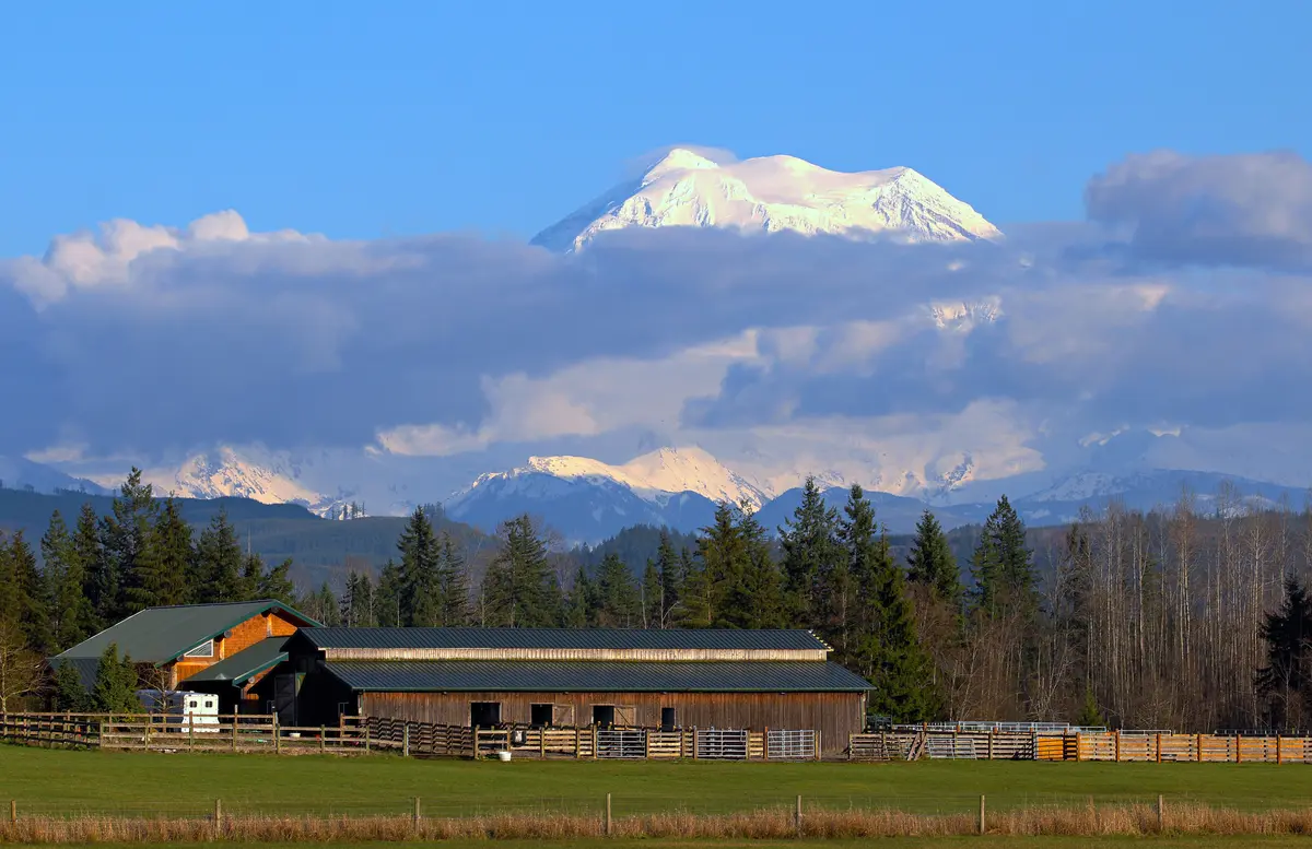
The Mount Rainier viewpoint along Washington Avenue isn't a formal park or a managed overlook — it's simply where the street grid opens up enough that the mountain is unobstructed. On clear days from late fall through early spring, Rainier dominates the eastern horizon in a way that genuinely stops newcomers mid-sentence. Longtime residents use it as an informal weather gauge: if you can see the summit clearly, the window is good for higher-elevation recreation in the park.
Seasonal Rhythms and What Newcomers Miss
The recreational calendar here runs on the outdoor season rather than a traditional spring–fall arc. Fall and winter bring the valley's signature fog — the same inversion layer that creates those dramatic Rainier shots from the viewpoint — and the trail network stays in use year-round because Orting's elevation keeps it largely snow-free even when the mountains are buried.
What catches newcomers off guard isn't the cold; it's the gray. The valley can sit under a low ceiling for weeks between November and February while the rest of the region gets breaks. Investing in good rain gear before your first winter here is advice that sounds obvious until you're three weeks in and still haven't seen the sun.
Looking to buy in Orting? Estimate your payment.
Enter your numbers to see an estimated monthly mortgage payment.
Estimate only. Excludes HOA fees and mortgage insurance. The interest rate above is a starting point, not a quoted rate — replace it with your own to see real numbers. Insurance is a flat placeholder, not a Orting quote.
Beyond City Limits: Camping, Day Trips, and Broader Outdoor Access
Living in Orting doesn't mean your outdoor radius starts and ends with the Foothills Trail. The valley's position at the base of the Cascades puts a significant amount of backcountry, state park, and mountain access within reasonable driving distance — and most residents use it.
Camping Near Orting
The most accessible overnight option from Orting is Kanaskat-Palmer State Park, roughly 20 miles east in the Cascade foothills. It offers year-round camping with tent sites, RV hookups, and cabin rentals in a forested setting along the Green River. It tends to have availability on weekends when Olympia- and Tacoma-area parks fill up — a practical advantage for residents who want to camp without booking three months out.
Riverside camping along both the Carbon and Puyallup corridors exists in various forms — dispersed sites and small private campgrounds — though conditions vary by season and both rivers are subject to high-water events in winter and spring. For casual car camping with amenities, Kanaskat-Palmer is the practical first choice.
Mount Rainier National Park
The park's Carbon River entrance — the only rainforest ecosystem in the continental Northwest — is accessible from Orting via a direct drive east on SR-165. The road to the Carbon River Rainforest trailhead is unpaved and can be rough, but the destination is genuinely unlike anything else in the region: old-growth temperate rainforest at the base of a glacier, essentially in your backyard. It's the kind of access that relocating residents from drier parts of the country take a few months to fully absorb.
The Sunrise and Paradise areas of the park require longer drives but are still day-trip territory from Orting on a clear weekend. For families moving here, the proximity to the national park is one of the practical reasons Orting competes with neighboring cities like Buckley and Bonney Lake for buyers who want more outdoors than the Puyallup valley's flatter suburbs offer.
What the Recreation Scene Is Missing
| Activity | Availability in/near Orting | Notes |
|---|---|---|
| Paved trail cycling | Strong | Foothills Trail + Carbon River Trail = 25+ connected miles |
| Trail running | Strong | Both trails open year-round; flat to moderate grade |
| Wildlife viewing | Strong | Eagles, salmon streams east of downtown |
| Camping (overnight) | Moderate | Kanaskat-Palmer ~20 miles east; no city campground |
| Swimming / water recreation | Limited | Rivers too cold/fast; nearest lakes require driving |
| Mountain biking | Limited in-city | Single-track requires driving to Carbon River or Cascade foothills |
| Alpine/ski access | Day-trip | Crystal Mountain ~60–70 min; no Orting-area ski facilities |
| Equestrian trails | Available | Foothills Trail shoulder open to horses full length |
The honest gap is water-based summer recreation — Orting doesn't have a lake, a pool, or a river stretch that invites casual floating. Residents who want that tend to drive toward Bonney Lake or east into the Cascades on weekends.
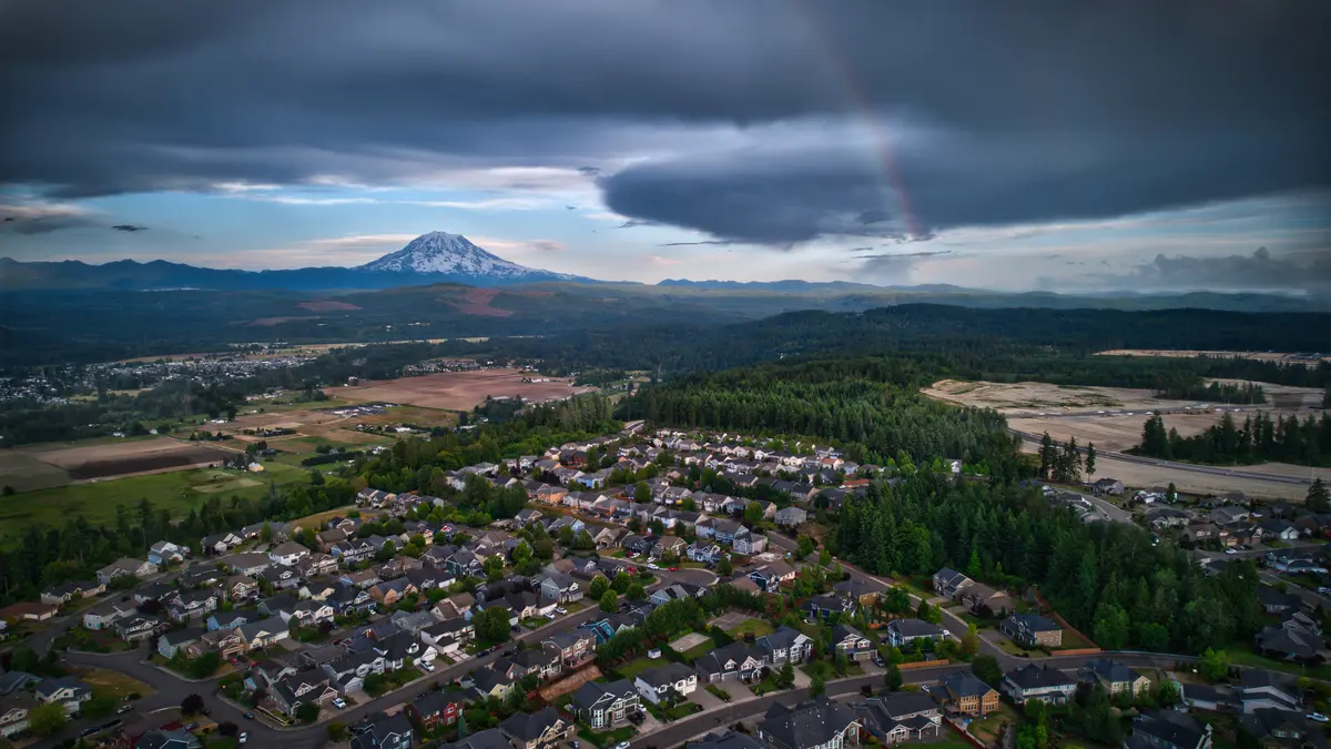
Local Expert Takeaway: The Foothills Trail trailhead inside Orting City Park is the practical center of daily outdoor life here — walk to it from downtown, ride east toward South Prairie on 11 miles of converted rail-trail past trestle bridges and glacial river views, or connect south on the Carbon River Trail for a quieter out-and-back alongside the water. The mountain access is real and close: the Carbon River entrance to Mount Rainier National Park is a direct drive east on SR-165, and on clear mornings the summit is visible from Washington Avenue without leaving town. Just check the Pierce County Foothills Trail page before longer rides east — construction-related closures near Lane Blvd NW have been active in 2025–2026, and trail conditions after high-water events in winter warrant a current-status check.
Quick Takeaways & FAQs
✅ The Foothills Trail trailhead sits inside Orting City Park downtown, giving residents walkable access to roughly 20 miles of paved rail-trail connecting Puyallup to Buckley — more connected trail mileage than most Pierce County cities offer.
⚠️ The Carbon and Puyallup Rivers border the city on two sides but aren't usable for swimming or casual water recreation — glacial temperatures and active floodplain conditions mean the rivers here are for viewing and walking alongside, not floating.
📍 The Foothills Trail east of Orting is likely the only rail-trail in the U.S. posted with lahar warning signs — a genuine quirk of living this close to Mount Rainier that shapes both local emergency planning and the character of outdoor recreation here.
How long is the Foothills Trail section near Orting?
Is the Foothills Trail open year-round in Orting?
What are the lahar warning signs on the Foothills Trail?
What is the Daffodil Parade in Orting?
Is there camping near Orting?
Moving to Washington?
Tell us what you need help with and we'll connect you with local resources.
