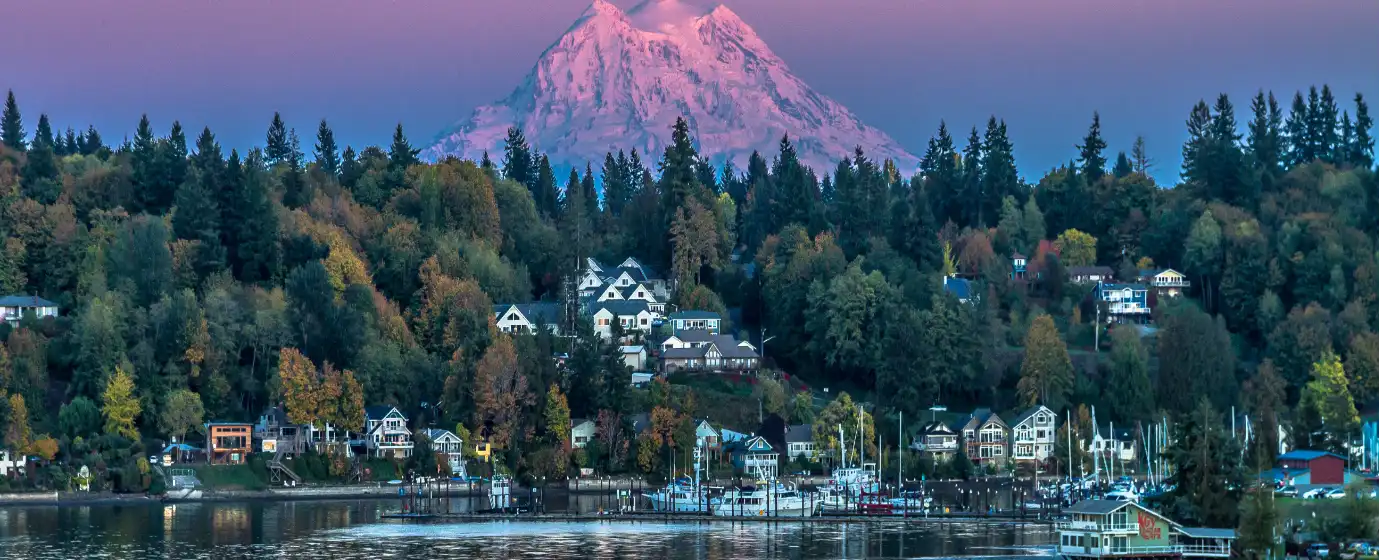
Most people moving to Olympia picture the Capitol dome and the rain. What they don't picture — until they're actually here — is the Tuesday morning crowd on the Chehalis Western Trail, the harbor seals visible from Percival Landing's boardwalk on a clear October day, or a park system that manages more than 1,400 acres across 45 parks in a city of fewer than 56,000 people. For a state capital, Olympia punches well above its weight in green space, and that infrastructure shapes daily life in ways that don't show up in any employer brochure.
The Olympia Parks, Arts & Recreation Department — known locally as OPARD — runs that 45-park system, which ranges from tiny neighborhood pocket parks to the 195-acre Grass Lake Nature Park on the city's south side. The waterfront is the civic centerpiece: Percival Landing connects directly to Heritage Park along Budd Bay, putting a working boardwalk, public art, a splash pad, and free boat moorage within a few blocks of downtown. Families with school-age kids find the summer calendar surprisingly full without ever leaving the city — for a fuller picture of youth sports and organized activities, see the Olympia schools page.
The honest caveat for outdoor lovers is that the South Puget Sound climate demands adjustment. November through March, the trail network stays wet and the daylight window is short. Locals who thrive here invest in rain gear early and learn to read the breaks in cloud cover. The reward is that by late April, when the rest of the country is still waiting for spring, the rhododendrons along Capitol Lake's paved path are already peaking and the Farmers Market reopens on the waterfront.
Whether you're weighing a move to Olympia or already have an offer in, the sections below break down the city's signature parks, its trail system, its water and waterfront options, and the seasonal events and recreation patterns that define outdoor life here.
Signature Parks: From the Waterfront to the Forest
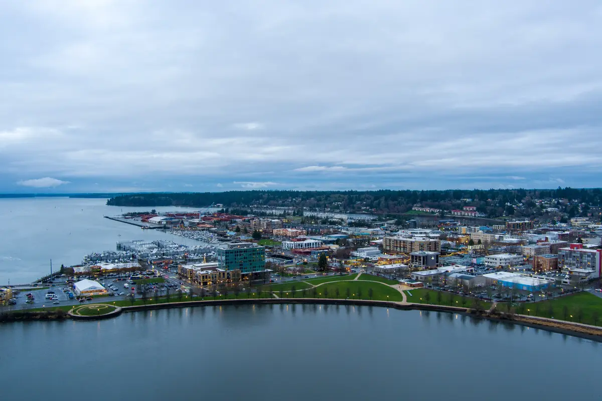
Percival Landing is the park most new residents discover first, and it earns the attention. The 3.38-acre waterfront park sits on the east shore of Budd Bay and features a 0.9-mile boardwalk running from the Fourth Avenue Bridge north to Thurston Avenue, a three-story timber observation tower, public pavilions, and a rotating collection of public art. It is not a passive green space — on any given afternoon you'll find locals jogging the boards, others watching boats navigate the inlet, and still others sitting at Budd Bay Cafe on Thurston Ave NW for Pacific Northwest seafood with the water a few feet away.
The public moorage at Percival Landing deserves its own mention. Daytime stays of four hours or less are free, and the maximum stay is seven days within any 30-day period — all on a first-come, first-served basis. For anyone arriving by water, this is a genuinely rare amenity at a downtown waterfront.
Directly across from the boardwalk, Heritage Park adds a free public sprayground on a 1.1-acre parcel. In July, this corner of downtown becomes one of the busiest spots in the city — partly because of the splash pad, and partly because Heritage Park hosts Capital Lakefair every third week of July, a five-day festival that drew more than 200,000 attendees to its most recent edition, July 16–20, 2025, with stage acts, a parade, a car show, and fireworks over the lake.
Grass Lake Nature Park
On the south side of the city, Grass Lake Nature Park covers 195.71 acres — the second-largest park in Olympia — and completed a $2.8 million infrastructure overhaul in June 2025. The project expanded its multi-use trail system, improved parking and ADA access, added public art sculptures, and enlarged the picnic area by half an acre. If Percival Landing is Olympia's civic living room, Grass Lake is its backyard: quieter, more wooded, and better suited to the kind of extended outing where you actually lose track of time.
Kaiser Woods Park
West Olympia's Kaiser Woods Park is less celebrated but worth knowing about. The city acquired the forested land in 2015 using a Washington State Recreation and Conservation Office grant, and it currently offers a 1.25-mile loop trail through second-growth forest. Trail expansion for multi-use hiking and mountain biking was slated for 2025 — a sign of where OPARD is investing as the park system matures.
| Park | Size | Key Features | Best For |
|---|---|---|---|
| Percival Landing | 3.38 acres | 0.9-mi boardwalk, observation tower, public moorage, public art | Walkable Transit |
| Heritage Park | 1.1-acre sprayground parcel | Free splash pad, Lakefair venue, Capitol Lake views | Families |
| Grass Lake Nature Park | 195.71 acres | Multi-use trails, expanded picnic area, public art (renovated 2025) | Nature Quiet |
| Kaiser Woods Park | Forested city parcel | 1.25-mi loop trail, trail expansion planned | Nature Privacy |
| Capitol Lake surrounds | 260-acre lake + paved path | Wildlife viewing, walking/jogging path, future estuary restoration | Nature Views |
| Marj Yung Park (in development) | 70 acres | ~15 bike-only directional trails, approx. 5 miles of singletrack planned | Nature |
The system rewards exploration — the 45-park network includes smaller neighborhood stops that don't make the highlight reel but become the daily routine once you settle into a part of the city.
Trails: Paved Rails, Forest Loops, and What's Coming
The Chehalis Western Trail is the anchor of Olympia's trail network. At 22 miles, it is the longest shared-use path in Thurston County — a paved rail trail open year-round to hikers, cyclists, and even horseback riders, with minimal elevation gain across its entire length. The flat profile makes it accessible to riders of almost any ability, and locals use it as a genuine transportation corridor as much as a recreation route. On a dry Saturday morning in May, it can feel like much of the city is out on it simultaneously.
The Karen Fraser Woodland Trail adds 4.7 paved miles at a grade of 3% or less, maintained jointly by Olympia and Lacey. Its cross-jurisdictional management means it tends to stay in good shape; the gentle grade makes it a favorite for new runners and families pushing strollers who find the Chehalis Western's longer stretches more than they need on a weekday evening.
Mountain Biking: Two Scales
Capitol State Forest, just west of the city, gives serious mountain bikers more than 160 miles of singletrack — one of the largest trail networks within easy reach of any Washington city of this size. The forest sits outside city limits but close enough that riders with a truck or bike rack treat it as a regular weekend option.
Inside city limits, dedicated mountain bike infrastructure has historically been absent. That changes with Marj Yung Park: a 70-acre city acquisition funded in part by a $675,000 grant and designed by the Evergreen Mountain Bike Alliance. The plan calls for approximately 15 bike-only directional trails totaling about five miles of in-city singletrack. As of July 2026, the project is in development — trail completion status should be confirmed before counting on them for your first weekend here. When finished, it will be Olympia's first purpose-built in-city mountain bike system.
What Locals Know About the Trail Network
The biggest thing newcomers underestimate is how usable these trails are in winter. The Chehalis Western and Karen Fraser trails are paved, relatively flat, and drain well enough that a midwinter drizzle rarely closes them. The local habit is to invest in fenders and a rain jacket in October and then simply keep the routine going. Riders who wait for dry skies end up riding about eight times a year.
Kaiser Woods is the gap in most newcomers' trail knowledge. It sits west of the main residential corridors, doesn't appear on the first page of any trail app, and as a result remains less crowded than its quality warrants. The 1.25-mile loop through second-growth fir and cedar is a genuine forest experience without driving anywhere.
Water and Waterfront: What You Can and Can't Do
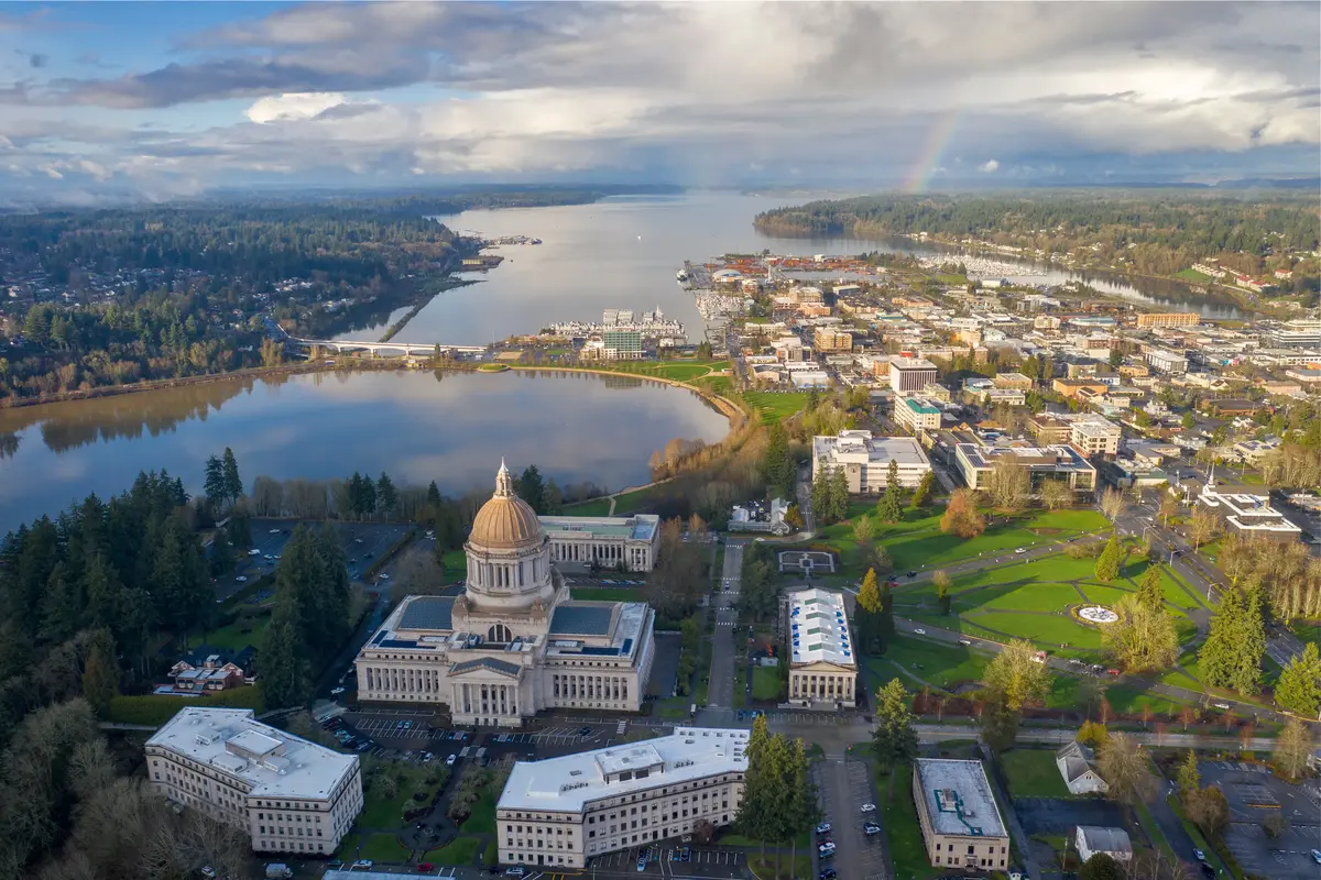
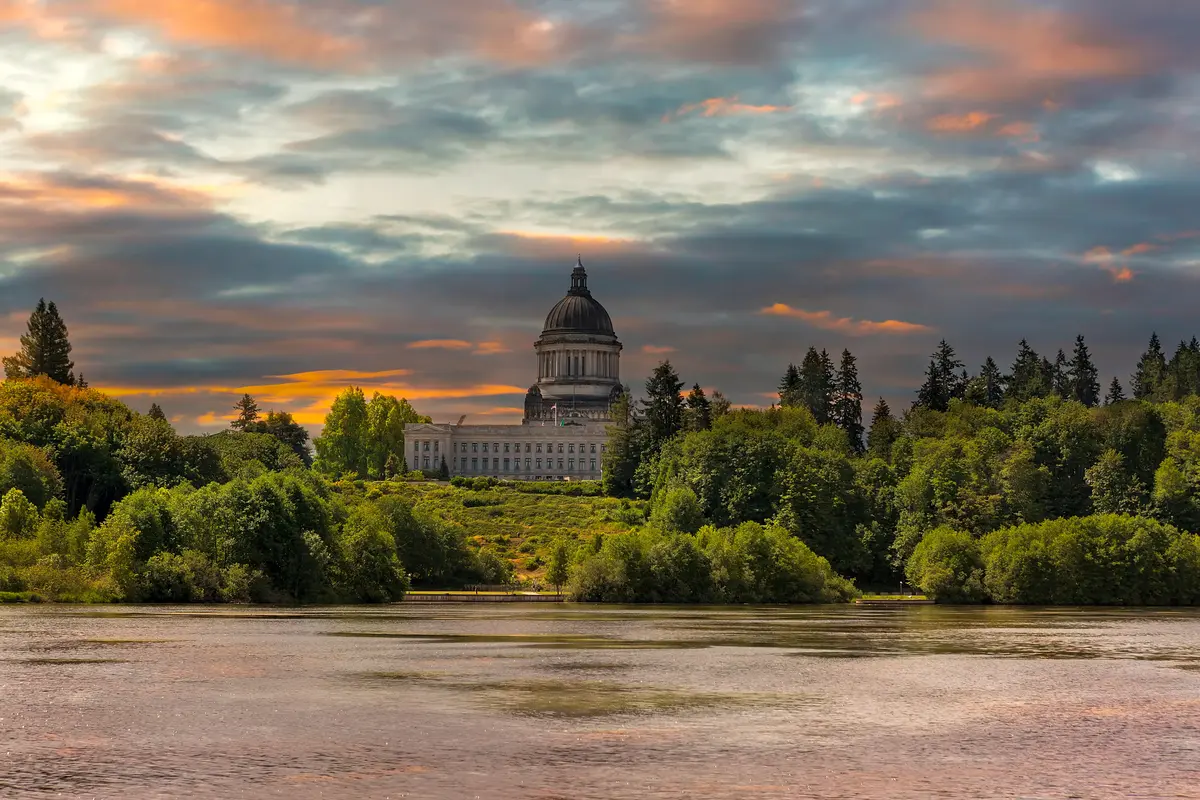
The honest answer about Capitol Lake surprises most people researching Olympia from a distance. The 260-acre lake at the mouth of the Deschutes River — the one visible from the Capitol Campus and framed in virtually every Olympia photograph — is closed to all water contact. No swimming, no kayaking, no fishing, no wading. The closure is indefinite, caused by an established population of invasive New Zealand mudsnails that state managers are unwilling to risk spreading to other waterways through gear and skin contact.
What you can do is walk or jog the surrounding paved path, which delivers some of the best views in the city: the dome reflected in still water on a calm morning, great blue herons working the shallows, and the occasional bald eagle overhead. The path is a local favorite for exactly this reason, even knowing the lake itself is off-limits.
The Restoration Project Worth Watching
The Washington State Department of Ecology is leading what is described as one of the largest urban estuary restoration projects in the country at Capitol Lake. The current plan involves removing the existing dam at the Deschutes River mouth and restoring the tidal estuary — a project that would, among other changes, add non-motorized boat launches giving kayakers direct access to the restored water. This is a future-tense project; nothing should be counted on as open today. But for anyone buying in Olympia with a long view, the eventual transformation of Capitol Lake from a closed impoundment to a working estuary would be a meaningful change to the city's central waterfront.
Budd Bay and Puget Sound Access
Budd Bay — the southernmost reach of Puget Sound — is where Olympia's actual water recreation happens. Percival Landing's public moorage is the focal point for boaters, with free daytime stays making it one of the more accessible downtown moorages in the region. Kayakers and paddleboarders launch from various points along the bay, with access to the wider inlet and the tidal flats that extend south at low water. The waterfront at Percival Landing gives you a working harbor feel — fishing vessels, pleasure craft, the occasional research vessel — that feels distinctly different from a manicured marina.
After a paddle or a long walk along the boardwalk, Cascadia Grill on W 4th Ave — a few blocks from the water — has become a reliable stop for a meal before heading home. It's a short walk from the waterfront, which is part of why the downtown-to-waterfront connection functions as a real amenity rather than just a scenic backdrop.
Looking to buy in Olympia? Estimate your payment.
Enter your numbers to see an estimated monthly mortgage payment.
Estimate only. Excludes HOA fees and mortgage insurance. The interest rate above is a starting point, not a quoted rate — replace it with your own to see real numbers. Insurance is a flat placeholder, not a Olympia quote.
Seasonal Recreation and the Olympia Outdoor Calendar
Olympia's outdoor year runs on a different rhythm than most Pacific Northwest cities, partly because of its position at the southern end of Puget Sound and partly because the Capitol Campus grounds and waterfront create seasonal anchors that don't exist in smaller towns. Knowing what happens when saves you from missing the best of it in your first year here.
| Season | What Locals Do | The Catch |
|---|---|---|
| Late March – May | Rhododendrons peak on Capitol Campus grounds; Farmers Market reopens; trail crowds return to Chehalis Western | Rain remains frequent; waterproof layers still required most days |
| June – August | Percival Landing boardwalk evenings; Heritage Park sprayground; Lakefair in late July; kayaking Budd Bay | July can fill Heritage Park to capacity during Lakefair week; parking downtown becomes scarce |
| September – October | Best weather window for long rides and trail running; harbor seal sightings increase near Percival Landing | Daylight drops faster than newcomers expect — by late October, evening trail time evaporates |
| November – February | Paved trail running (Chehalis Western, Karen Fraser); Capitol Lake path for wildlife viewing in low light | Unpaved trails at Grass Lake and Kaiser Woods stay muddy; Capitol State Forest riding requires full fenders |
Lakefair: The Event That Reclaims the Waterfront
Capital Lakefair, every third week of July, is the event most outsiders haven't heard of and most longtime residents build their summer around. The five-day festival at Heritage Park pulled more than 200,000 people in 2025 — a number that seems improbable for a city of 56,000 until you realize the draw extends across Thurston County and beyond. The fireworks over Capitol Lake on the final night are visible from neighborhoods across the city.
What surprises people after their first Lakefair: downtown Olympia becomes genuinely hard to navigate by car for most of that week. Locals who have been here more than a year plan around it — either committing fully to walking and transit, or leaving town for a long weekend. New residents who discover this mid-July without warning find it either a delight or a serious inconvenience, depending entirely on their parking situation.
The Seasonal Trade-off Worth Knowing Before You Buy
The parks and trail system here is genuinely good. The catch is that it is most usable during a roughly six-month window — late March through September — and the city has not fully solved the problem of what to do with outdoor-oriented residents during the darker half of the year. People who move here from sunnier climates and expect to maintain an outdoor running or cycling routine through January do it, but it requires deliberate commitment: rain gear, lights for the bike, and the mental shift toward accepting wet feet as a baseline condition rather than a failure of the plan.
Those who make that adjustment — and many do — find the offseason trail network quieter and, in its own way, more rewarding. A foggy November morning on the Chehalis Western Trail with the alders gone bare and no other riders in sight is not a consolation prize. It is, for a certain kind of person, the whole point of being here.
Local Expert Takeaway: Olympia's parks system is real infrastructure, not a selling-point afterthought — 45 parks, 1,400-plus acres, a 22-mile paved rail trail, and a waterfront boardwalk you can walk to from downtown. The one thing to get straight before you arrive: Capitol Lake looks like a kayaking destination and isn't, not yet. Walk the paved path around it for the views, save the paddling for Budd Bay, and build your outdoor routine around the Chehalis Western Trail and Grass Lake Nature Park. If mountain biking matters to you, Capitol State Forest is the real resource right now — with Marj Yung Park's dedicated in-city trails still in development as of mid-2026.
Quick Takeaways & FAQs
✅ Olympia's Olympia Parks, Arts & Recreation Department oversees 45 parks covering more than 1,400 acres — an unusually large system for a city of 56,000.
⚠️ Capitol Lake is closed to all water contact due to invasive New Zealand mudsnails, a fact that surprises almost every newcomer who assumed it was a kayaking destination.
📍 The Chehalis Western Trail — a 22-mile paved rail trail with minimal elevation change — stays open and usable year-round, making it the backbone of Olympia's outdoor routine for runners, cyclists, and equestrians alike.
Can you kayak or swim in Capitol Lake in Olympia?
How many parks does Olympia have, and are they well-maintained?
What is the best trail for biking in or near Olympia?
What is Lakefair and when does it happen?
Is Olympia's park system usable in winter, or does rain shut things down?
Moving to Washington?
Tell us what you need help with and we'll connect you with local resources.
