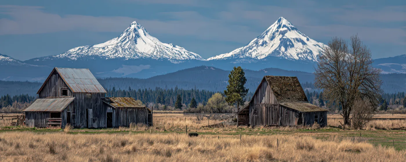
You don't choose Sisters, Oregon for the commute. You choose it because 3,022 people have figured out how to live at the edge of something genuinely wild — the Three Sisters Wilderness begins roughly where the town ends, and on a clear morning you can see three volcanic peaks from the park at the center of downtown. The recreation here isn't a weekend amenity. It's the reason most people moved here in the first place, and it shapes nearly every aspect of daily life.
Sisters sits along US-20 in Deschutes County, roughly about 25 minutes to Bend, OR to the east. That geography — high desert transitioning into Cascade foothills — means the terrain changes dramatically within a few miles of the city limits. Ponderosa pine forest gives way to rimrock canyon along Whychus Creek. The flat singletrack of Peterson Ridge shifts to alpine terrain as you move toward the wilderness boundary. And the 6,436-foot stratovolcano called Black Butte sits just off US-20 to the northwest, visible from most of the town.
What surprises people after six months here isn't the scenery — they knew about that before they arrived. It's the density of recreational infrastructure for a city this small. A trail system of more than 20 miles lies within walking distance of downtown. The city park doubles as an event venue. The annual rodeo draws national PRCA competitors and a purse that serious rodeo followers recognize immediately as outsized for a city this size. Sisters earns its outdoor reputation, but it does so with genuine local institutions rather than tourist-facing marketing.
Whether you're weighing a move or already committed, the sections below cover Sisters' signature parks, the trail systems that define daily outdoor life here, the creek corridor that runs through the city's ecological heart, and the seasonal events that give the recreation calendar its shape.
Village Green City Park: The Town's Outdoor Living Room
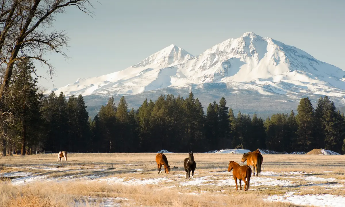
Most cities this size have a park. Sisters has one that does serious work. Village Green City Park sits at the center of downtown, beneath a canopy of towering ponderosa pines, and it functions as a civic hub in a way that most small-town parks simply don't.
The park's amenities go well beyond a picnic table and a swing set. A covered gazebo anchors the main lawn. There's a covered BBQ area with picnic tables, playground equipment, bicycle lockers, a bike repair station, and paid showers — the last item particularly useful because Peterson Ridge Trail's main trailhead sits roughly half a mile away, and a lot of people finishing a morning ride would rather not drive home soaked in trail dust. That combination of facilities makes Village Green the de facto staging area for cyclists passing through Central Oregon.
The open lawn beneath Cascade views is also Sisters' primary outdoor event space. The Sisters Folk Festival — a three-day roots music event founded in 1995 — anchors a large stage in the park. The Sisters Rhythm & Brews Festival and a rotating schedule of concerts use the same lawn through the warmer months. If you're considering a move here, understanding that your downtown park transforms into a regional music destination several weekends a year is useful: the town fills up, parking becomes genuinely difficult, and the noise is real. Most locals consider it a feature, not a bug.
What Locals Know
Village Green is the place to orient yourself when you first arrive. The park's proximity to the Peterson Ridge trailhead, the farmers market, and the main commercial strip along Cascade Avenue means that on a good Saturday, you can cover most of what makes Sisters worth living in without moving your car.
Peterson Ridge Trail System: 20-Plus Miles in Your Backyard
For anyone moving to Sisters who runs, rides, or hikes, Peterson Ridge is the headline. The Sisters Trails Alliance maintains a multi-use network of more than 20 miles of singletrack south of downtown — mountain biking, hiking, and equestrian use all share the system, though horse trails are separated from the bike and hike routes to reduce conflicts.
The layout is a ladder-style stacked loop with an east leg and a west leg connected by short trail connectors. That structure matters practically: you can dial your distance depending on the morning, starting with a flat easy loop and tacking on additional connectors as time allows. The terrain across the system ranges from easy to moderate cross-country singletrack through open ponderosa pine forest. From higher elevations, the Cascade Range comes into full view — the Three Sisters peaks to the southwest, the ridgeline stretching north toward Mount Jefferson.
Who Uses It and How
Peterson Ridge isn't a destination trail that draws visitors from across the state — it's a neighborhood trail that residents use on weekday mornings before work. The trailhead sits about half a mile from Village Green City Park, which means a significant portion of users park downtown and ride or run in. That's the kind of access that genuinely changes daily life: you're not loading bikes onto a rack and driving to the mountains. You're rolling out the front door.
The system was expanded in 2008 and has been consistently maintained since. New residents often underestimate how thoroughly they'll use it in the first year — and how much the condition of those trails becomes part of their mental weather report. Sisters Trails Alliance trail work days are one of the more genuine community gatherings in a town that has a lot of them.
The Honest Caveat
Peterson Ridge is intentionally a dry-weather system. The ponderosa pine forest stays open and beautiful in summer, but Central Oregon's rain, when it comes, can make the packed-dirt singletrack slick in ways that aren't immediately obvious. The trails are also fully exposed to wildfire smoke during August and September, which in a bad year can sideline outdoor activity for weeks at a time. That seasonal reality is worth factoring into the move.
Best for: Nature Families Active Commuters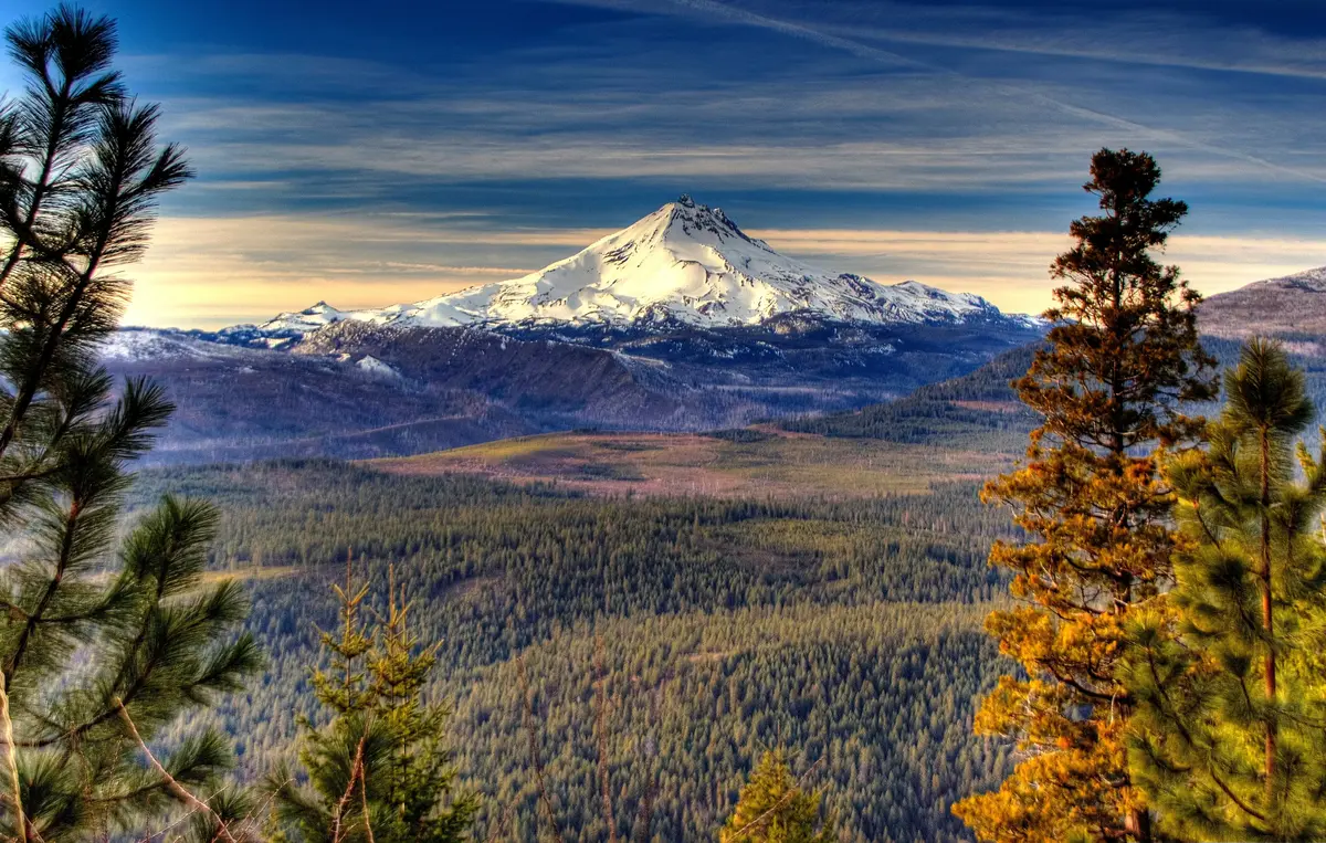
Whychus Creek and Black Butte: Water, Canyon, and Summit
Sisters' two most dramatic pieces of natural geography sit in opposite directions from downtown, and they couldn't feel more different from each other.
Whychus Creek Corridor
Whychus Creek originates on the northern slopes of Broken Top and flows directly through Sisters before converging with the Deschutes River. The Deschutes Land Trust's Whychus Canyon Preserve protects four miles of that creek corridor — rimrock canyon, juniper and pine forest, native grassland, and habitat for redband trout, salmon, mule deer, elk, and golden eagles.
The Sisters Trails Alliance maintains the Whychus Creek Scenic Overlook trail, a roughly 1-mile packed-gravel route accessible enough for most fitness levels, ending at cliff-top views of the Whychus Creek Wild and Scenic River corridor with the Three Sisters filling the horizon behind it. A more challenging north-trail loop option extends the distance and adds two additional mountain viewpoints for those who want more than the overlook.
A current-conditions note: As of mid-2026, Whychus Canyon Preserve experienced impacts from the Flat Fire and was temporarily closed; reports from early July 2026 indicated a partial reopening, though fire-affected terrain remained visible on the trails. Anyone planning to visit the Preserve specifically should check the Deschutes Land Trust website for the latest access status before making the trip. The Whychus Creek Overlook trail itself, maintained separately by Sisters Trails Alliance, is worth verifying independently as well.
Black Butte
About 10 miles northwest of Sisters via US-20 sits Black Butte, an extinct stratovolcano at 6,436 feet. The standard summit trail is approximately 4 miles round-trip with roughly 1,550 feet of elevation gain. You start in old-growth ponderosa pine and emerge at the top with a 360-degree Cascade panorama: the Three Sisters, Broken Top, Mount Jefferson, Mount Washington, and Three Fingered Jack all visible on a clear day.
The summit has served as a fire lookout site since 1910. The historic cupola-style lookout building from 1923 still stands alongside a modern 62-foot tower built in 1995. A Northwest Forest Pass or a day-use fee covers the trailhead parking.
Black Butte is the hike that Sisters residents do with every visitor who comes through. It's also the one that reveals, with more clarity than anything else, exactly what Central Oregon looks like from above — a high desert basin ringed by volcanoes, and Sisters sitting right at the edge of where the pines take over.
Best for: Nature Views QuietLooking to buy in Sisters? Estimate your payment.
Enter your numbers to see an estimated monthly mortgage payment.
Estimate only. Excludes HOA fees and mortgage insurance. The interest rate above is a starting point, not a quoted rate — replace it with your own to see real numbers. Insurance is a flat placeholder, not a Sisters quote.
Seasonal Recreation and the Sisters Rodeo
Sisters runs on a recreation calendar that's more varied than most towns its size. The outdoor season roughly tracks the snow: trails open as the forest dries out, wildfire smoke marks the transition to late summer, fall brings the clearest skies and the fewest crowds, and winter means cross-country skiing and snowshoeing in the higher terrain, with the Three Sisters Wilderness accessible for those equipped for it.
The Sisters Rodeo
The biggest single recreational event of the year in Sisters isn't a trail race or a music festival — it's the rodeo. The Sisters Rodeo, billed as "The Biggest Little Show in the World," is a PRCA-sanctioned event that has run every June since 1940. It's held at the Sisters Rodeo Grounds and is community-owned and volunteer-run, which is unusual for an event this scale.
The rodeo draws professional competitors from across the country and carries a purse that serious rodeo followers recognize as substantial for a community this size. The event includes an Xtreme Bulls competition, live music, and a free downtown parade. What newcomers consistently underestimate is how much the town changes during rodeo weekend. Traffic backs up, lodging fills months in advance, and the downtown commercial strip goes from quiet Western storefront to genuine destination. If you move here, rodeo weekend is the one time you'll be reminded that Sisters has a national profile that its size doesn't suggest.
The Three Sisters Wilderness and Beyond
The Three Sisters Wilderness begins at the edge of the city's western geography, and its trailheads are genuinely close — wilderness permits and trailhead quotas apply to some entry points in summer, so planning ahead matters more than it does at Peterson Ridge. OR-242, the McKenzie Highway, opens seasonally and is one of the more dramatic drives in the state, connecting Sisters to the Willamette Valley through ancient lava fields and high passes.
For families with school-age children, the Sisters School District runs active OSAA athletics programs, and youth outdoor programming is woven into the community in ways you'd expect from a place where most parents chose the location for the landscape. The recreation infrastructure here isn't a bonus — it's the organizing principle of the town.
Best for: Families Nature Quiet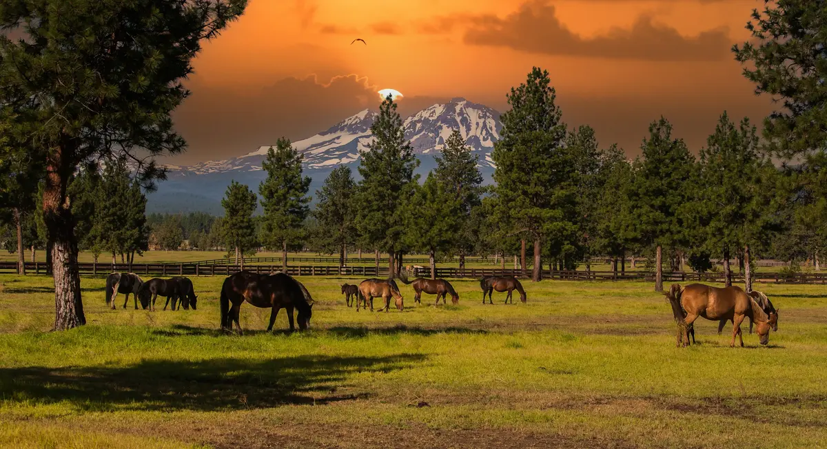
Local Expert Takeaway: Sisters punches well above its weight recreationally for a city of 3,022. Peterson Ridge gives you 20-plus miles of singletrack within walking distance of downtown. Village Green handles both your post-ride shower and your Folk Festival weekend. Black Butte delivers one of the cleaner summit hikes in Central Oregon without requiring a long drive. The honest trade-off is seasonal: wildfire smoke can sideline outdoor activity for weeks in late summer, and some years it's significant enough to change how you think about the whole relocation. Come with eyes open on that, and the recreation case for Sisters is hard to argue with.
Quick Takeaways & FAQs
✅ Peterson Ridge Trail System puts over 20 miles of hiking and mountain biking singletrack within half a mile of downtown Sisters — accessible enough to ride from the front door.
⚠️ Late-summer wildfire smoke is a genuine seasonal constraint in Sisters; August and September can bring stretches where outdoor activity on trails is uncomfortable or inadvisable.
📍 The Sisters Rodeo has run every June since 1940, draws professional PRCA competitors from across the country, and is community-owned and volunteer-run — a serious rodeo happening in a city of 3,022.
How many miles of trails does Sisters have?
Is Black Butte Trail difficult?
Can beginners use the Peterson Ridge trails?
Are the Whychus Canyon Preserve trails open?
What is the Sisters Rodeo and when does it happen?
Moving to Oregon?
Tell us what you need help with and we'll connect you with local resources.
