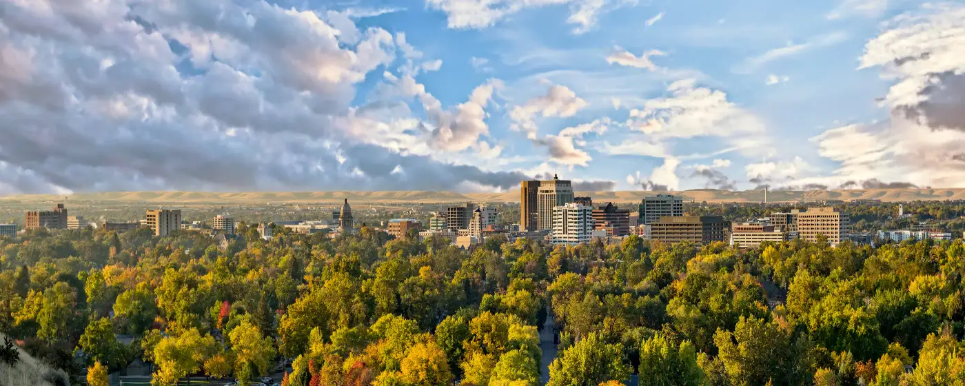
People moving to Boise from Denver or Salt Lake often expect a decent park system and maybe a ski hill within driving distance. What they don't expect is to be lacing up trail shoes on a Tuesday morning and reaching open ridgeline within 20 minutes of leaving their front door. The foothills aren't backdrop here — they're infrastructure. The Ridge to Rivers trail network covers approximately 220 miles directly above the city, accessed from dozens of trailheads that feed off residential streets. That proximity is the thing that changes how you live once you're here.
Boise Parks and Recreation maintains 101 developed parks and more than 5,000 acres of open space. The 29-mile Boise River Greenbelt threads through the heart of the city along both banks of the Boise River, connecting riverside parks from one end of town to the other. The city's recreational facilities stretch across all four seasons: Zoo Boise, two municipal golf courses, public pools, and Idaho IceWorld (an indoor ice rink) sit under the same department umbrella as the trail system and the river corridor. The recreation infrastructure here wasn't built to attract relocating buyers — it grew alongside a city that genuinely uses it.
Sixteen miles up Bogus Basin Road from downtown, the nonprofit Bogus Basin Mountain Recreation Area offers 82 ski trails across 2,600 acres in winter and flips to mountain biking, disc golf, and chairlift sightseeing by June. The 2025–2026 ski season ran from late November through April 20, 2026 — with a bonus day on May 3 after the mountain hit 100 inches of base snow by mid-March. That kind of season, within a short drive of a city of nearly 239,000 people, is genuinely unusual.
Whether you're considering a move or already have a contract pending, the sections below cover Boise's signature parks, the Greenbelt and river corridor, the foothills trail system, and what recreation looks like across the calendar year.
Signature Parks: From Julia Davis to Camel's Back
Boise's most-used parks aren't interchangeable green rectangles. Each one has a distinct character shaped by where it sits in the city and who shows up there on a Saturday morning.
Julia Davis Park — The Civic Core
Julia Davis Park anchors the east edge of downtown along the Greenbelt, and it carries more amenities per acre than any other park in the system. Zoo Boise sits inside its borders, as does the Boise Art Museum and the Morrison Center for the Performing Arts. Families with younger kids tend to gravitate here for the combination of lawn space, riverside access, and the ability to bounce between the zoo and the water in the same afternoon.
The park connects directly to the Greenbelt, so arriving by bike from the North End or East End is straightforward. On summer evenings the lawn fills up for outdoor concerts and community events — it's one of those parks that reliably answers the question of where people in Boise actually go.
Camel's Back Park — The Foothills Gateway
Camel's Back is an 11-acre city park at the corner of 13th Street and Heron Street in the North End, and its real value is what it connects to. The park itself has tennis courts, sand volleyball, a playground, and an outdoor fitness area. But the trailhead at its upper edge drops you into Hull's Gulch Reserve and the broader Boise Foothills network — together, the park and reserve cover more than 350 acres.
On weekday mornings before 8 a.m., the parking lot on Heron fills completely. The regulars who've figured this out park one block down and walk up, treating the approach to the trailhead as part of the warm-up.
Best for: Hikers and trail runners living in or near the North End who want foothills access without a drive.
Ann Morrison Park — The River Anchor
Ann Morrison Park sits on the south bank of the Boise River and serves as one of the primary access points for floating. Its open lawn is where tubers and kayakers stage before putting in, and it connects directly to the Greenbelt path. The park also hosts the city's large-format outdoor events, including festivals that draw crowds from across the Treasure Valley.
| Park | Acres / Scale | Signature Feature | Best Access |
|---|---|---|---|
| Julia Davis Park | Riverside; Zoo Boise inside | Zoo, Art Museum, Greenbelt link | Capitol Blvd or Greenbelt by bike |
| Camel's Back Park | 11 acres + 350-acre reserve | Hull's Gulch trailhead gateway | 13th St & Heron St, North End |
| Ann Morrison Park | South riverbank; large lawn | River float staging, Greenbelt link | Americana Blvd off the Connector |
| Kathryn Albertson Park | Wildlife refuge pocket park | Waterfowl habitat, walking paths | Americana Blvd, near Ann Morrison |
| Esther Simplot Park | Boise Whitewater Park on-site | Kayak waves, Greenbelt access | Shoreline Dr off Chinden |
| Municipal Golf Courses | Full 18-hole facilities | Two city-operated courses | Multiple city locations |
The range of park types matters here. You're not choosing between large lawns — you're choosing between ecosystems, from wildlife-habitat pockets like Kathryn Albertson Park to the whitewater features at Esther Simplot.
The Boise River Greenbelt: 29 Miles Through the City's Heart
The Greenbelt is the thread that ties Boise's outdoor life together. The city-maintained pathway runs 29 miles along both banks of the Boise River, open from sunrise to sunset daily, with multiple parking access points along its length. The series of riverside parks it strings together is officially nicknamed the "Ribbon of Jewels" — which sounds like tourism copy until you've actually ridden the full length and counted what you pass through.
What the Greenbelt Actually Connects
A single out-and-back on the Greenbelt takes you past Julia Davis Park, Ann Morrison Park, Esther Simplot Park and its whitewater features, wildlife habitat corridors, and open cottonwood groves where great blue herons are a routine sighting. The path is paved and wide enough that cyclists and pedestrians coexist without much conflict — though weekend mornings near the Julia Davis section get genuinely crowded by mid-morning.
Floating the Boise River is the signature summer activity for residents, and the Greenbelt defines where you put in and take out. The Boise Whitewater Park at Esther Simplot Park creates standing kayak waves that draw paddlers from across the region. Tubers typically launch near Barber Park on the east end and float west toward Ann Morrison — a run that takes anywhere from two to three hours depending on flow rates.
What's Coming: Wood Duck Island and Expo Idaho
A Greenbelt improvement project through Wood Duck Island is underway in 2026, with Phase 2 of development set to begin this summer. Separately, the Park at Expo Idaho — currently under construction in Boise — is planned to include an Olympic-level skate park, a family zipline, an adventure playground, and Greenbelt access, with a Phase 1 completion window also in 2026.
These two projects matter for buyers looking at homes near the river corridor. The Greenbelt's western sections, which have historically been less polished than the downtown stretch, are actively improving.
A Practical Note on Timing
Summer weekends on the Greenbelt between Julia Davis and Ann Morrison feel like a parade. If you're using it for a morning run and want open path, aim for before 7:30 a.m. or after 6:30 p.m. Weekday mornings are consistently clear. The path's condition varies by segment — the downtown sections are the most maintained, while sections further east toward Barber Park have more surface variation.
Ridge to Rivers Trails and the Boise Foothills
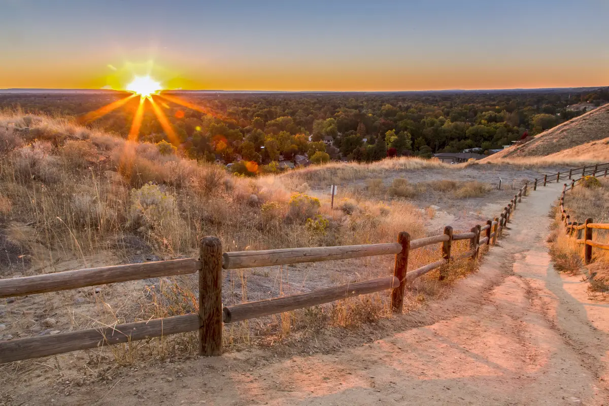
The Ridge to Rivers trail system is approximately 220 miles of trails running through the Boise Foothills directly north of the city. No shuttle required, no mountain town drive — the trailheads are woven into residential streets on the north side of town, and the trails climb from desert scrub into pine-covered ridgelines with views back over the entire Treasure Valley.
The Geographic Reality
The foothills rise steeply from the city's north edge, which means elevation gain happens fast. Most popular trails gain 500 to 1,000 feet within the first two miles. That's not a complaint from residents — it's the feature. The trails are graded for multiple uses: hikers, trail runners, mountain bikers, and equestrian users all share the system under a seasonal use rotation that restricts bikes on some trails during wet conditions.
Camel's Back Park is the most accessible entry point for North End residents, but it's far from the only one. The Shane's Trail corridor, accessed further east, tends to get less foot traffic on weekday mornings and is a better option when the Camel's Back lot is full.
What Locals Know About Trail Crowding
By 9 a.m. on a Saturday in late spring or early fall, popular foothills trailheads are legitimately packed. The regulars — and there are many, given that trail running is practically a cultural identifier here — have shifted their start times to 6 or 6:30 a.m. to beat both the crowd and the afternoon heat. Summer midday temperatures in the foothills regularly exceed 95°F, and there's limited shade above the first ridge.
The flip side: on a clear January morning after a light snow, those same trails are nearly empty, the views are exceptional, and the city feels improbably close. That particular experience — a snowy ridgeline with downtown Boise visible below — is the thing people describe after six months here when they're trying to explain why they stayed.
Trail System At a Glance
| Feature | Detail |
|---|---|
| Total trail miles | ~220 miles (Ridge to Rivers system) |
| Primary gateway parks | Camel's Back, Shane's Trail corridor, Hulls Gulch Reserve |
| Elevation gain (typical) | 500–1,000 ft in first 2 miles from trailhead |
| Permitted uses | Hiking, trail running, mountain biking, equestrian (seasonal restrictions apply) |
| Peak crowding window | Weekends, 8–11 a.m., spring and fall |
| Best low-crowd window | Weekdays before 8 a.m.; midwinter after snowfall |
| Summer heat caution | Midday temps frequently exceed 95°F; limited shade above first ridge |
The trail system is free and publicly accessible year-round. Parking at major trailheads is limited and routinely maxed out on weekend mornings — planning to walk or bike to the trailhead from nearby neighborhoods is worth considering if you're looking at homes in the North End.
Looking to buy in Boise? Estimate your payment.
Enter your numbers to see an estimated monthly mortgage payment.
Estimate only. Excludes HOA fees and mortgage insurance. The interest rate above is a starting point, not a quoted rate — replace it with your own to see real numbers. Insurance is a flat placeholder, not a Boise quote.
Four-Season Recreation: Bogus Basin, the River, and What Fills the Calendar
Boise's outdoor calendar doesn't have an off-season. It has a rotation. The same people floating the Boise River in August are skiing Bogus Basin in January — and the geographic proximity of those two activities is smaller than in almost any other mid-size American city.
Winter: Bogus Basin Is the Asset
Bogus Basin Mountain Recreation Area sits 16 miles from downtown Boise on Bogus Basin Road. The resort is a nonprofit operation with 82 trails across 2,600 acres, and its 175 acres of night skiing terrain is the largest night-skiing footprint in the northwestern United States.
The 2025–2026 season ran from November 29, 2025 through April 20, 2026, with a bonus day on May 3 following 100 inches of base snow by mid-March. That was an exceptional season, but Bogus reliably operates through March most years. Season passes are priced for the local market, not the destination-resort market — that distinction is meaningful when you're comparing life in a ski-access city against places like Park City or Bend.
One honest note: the road to Bogus Basin is a single steep mountain highway. On heavy snowfall days or when ice sets in, the drive becomes significantly more demanding. Chains or 4WD are not optional in those conditions.
Summer: River, Trails, and Bogus Basin Flips
By June, Bogus Basin transitions to summer operations: chairlift rides with views of Boise National Forest and the Sawtooth Mountains, more than 20 miles of mountain biking and hiking trails, an 18-hole disc golf course, and a gravity park. The resort's summer crowds are a fraction of winter — it's genuinely one of the better-kept weekday options for residents who want to escape valley heat.
Down in the city, floating the Boise River occupies summer weekends the way tailgating occupies fall Saturdays elsewhere. Barber Park on the east end is the traditional put-in, and the float to Ann Morrison or Americana Boulevard runs two to three hours. The water is cold even in August — the river comes out of the mountains — and flow rates vary significantly by year depending on snowpack.
Year-Round Facilities
Beyond trails and the mountain, the city operates Zoo Boise, two municipal golf courses, public pools open seasonally, and Idaho IceWorld, an indoor ice rink that keeps skating accessible through summer. For families with school-age children interested in youth sports and structured recreation, see the schools and activities page for organized league and program details.
After a long outdoor day, Payette Brewing on S Pioneer St has a large beer garden that functions as an informal post-trail gathering point for the mountain biking and trail-running crowd. Flying M Coffee on W Idaho St at 5th is a long-running independent coffeehouse that opens early enough to fuel a pre-dawn trailhead start. Neither place needs a special occasion — they're just where Boise's outdoor-oriented residents land on a Tuesday evening or a Saturday morning.
| Season | Primary Activity | Where | What to Know |
|---|---|---|---|
| Winter (Nov–Mar) | Downhill skiing, night skiing | Bogus Basin, 16 mi from downtown | 82 trails; road requires 4WD or chains in heavy snow |
| Spring (Mar–May) | Foothills hiking, trail running | Ridge to Rivers, Camel's Back | Best trail conditions; wildflowers on lower slopes |
| Summer (Jun–Aug) | River floating, Greenbelt cycling | Barber Park to Ann Morrison; Greenbelt | River is cold year-round; Bogus Basin open for biking/disc golf |
| Fall (Sep–Nov) | Mountain biking, trail running | Ridge to Rivers; Bogus Basin trails | Ideal temps; foliage on lower foothills; early Bogus opening some years |
| Year-round | Ice skating, golf, zoo | Idaho IceWorld; city golf courses; Zoo Boise | All city-operated facilities; seasonal hours vary |
The recreation calendar here is genuinely broad. The catch is that peak windows for each activity are crowded, the foothills heat up fast in July and August, and Bogus Basin's road demands real winter-driving competence. Those aren't dealbreakers — but they're the things nobody mentions until you've already moved in.
Local Expert Takeaway: Boise's outdoor infrastructure is the real estate amenity that doesn't show up on a listing sheet. The 220-mile Ridge to Rivers trail system starts at the end of residential streets in the North End — Camel's Back Park at 13th and Heron is the most-used gateway, but arrive before 8 a.m. on weekends or the lot is gone. The 29-mile Greenbelt connects Julia Davis Park, Ann Morrison, and the Boise Whitewater Park at Esther Simplot in a single continuous corridor. And Bogus Basin is 16 miles from downtown — close enough that season pass holders ski after work on powder days. The four-season overlap is what surprises people most: you can float the Boise River in June and ski in May in the same year, without leaving Ada County.
Quick Takeaways & FAQs
✅ Boise's Ridge to Rivers system covers approximately 220 miles of foothills trails that begin at residential trailheads in the North End — no mountain-town drive required.
⚠️ Bogus Basin's single access road becomes genuinely demanding in heavy snow and ice conditions; 4WD or chains are not optional, and the mountain drive can stretch well past its normal window in bad weather.
📍 The Greenbelt's popular downtown stretch between Julia Davis and Ann Morrison gets crowded by mid-morning on summer weekends — regulars run or bike it before 7:30 a.m. to have open path.
How many miles of trails does Boise have?
Is Bogus Basin worth it for Boise residents compared to other Idaho ski areas?
Where do locals float the Boise River and how long does it take?
What are the best parks in Boise for families with young children?
What new parks or recreation projects are coming to Boise?
Moving to Idaho?
Tell us what you need help with and we'll connect you with local resources.
