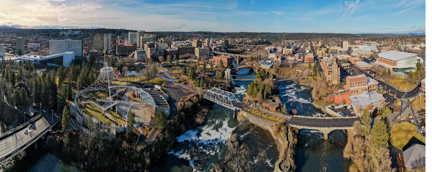
People moving to Spokane from denser metro areas often expect a mid-sized city with decent parks — a few green squares, maybe a paved loop around a pond. What they find instead is a city whose entire downtown is anchored by a 100-acre park built around the largest urban waterfall system in the United States. Spokane Falls drops approximately 146 feet through the heart of the city. You can watch it from a gondola ride above the river, from a walking bridge, or from a bench at your lunch break. That's not a weekend destination — that's Tuesday.
The parks system here runs deeper than most newcomers realize. The Olmsted Brothers — the same firm behind New York's Central Park — drew up Spokane's original parks master plan, and that early investment shows. The city now manages over 4,100 acres of protected green space across more than 87 parks, from the formal European-style gardens at Manito Park on the South Hill to the 9,194-acre wilderness of Riverside State Park nine miles northwest of downtown. Add a 40-mile paved trail corridor and a ski mountain 23 miles out, and the outdoor options are genuinely unusual for a city this size.
What surprises people after six months here is how much of this is free and accessible year-round. Manito Park's five garden areas charge nothing, ever. The Centennial Trail is open every day. The sledding hill at Manito fills up on snow days with families who simply showed up. For people coming from cities where green space costs something — a parking fee, a reservation, a membership — Spokane's parks culture takes some adjusting to. The catch is winter: January and February can be genuinely cold, and some fair-weather outdoor habits need to adapt.
Whether you're considering a move or just researching the area, the sections below break down Spokane's signature parks, its trail network, the rivers and seasonal water recreation, and what day-to-day outdoor life here actually looks like across all four seasons.
Riverfront Park and Spokane Falls: The Downtown Core
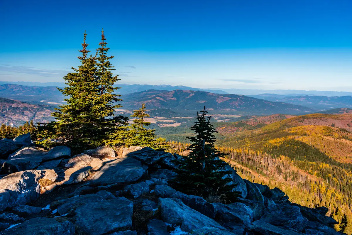
Riverfront Park sits on 100 acres along the Spokane River, directly in the city center, and it functions as something most cities only have in theory: a park that locals actually use on ordinary weekdays, not just during festivals.
The falls themselves are the anchor. Spokane Falls is recognized as the largest urban waterfall system in the United States, with the full series of cascades dropping roughly 146 feet through downtown. The Numerica SkyRide gondola crosses directly over the upper falls — a four-minute ride that locals ride multiple times a year and never quite get bored of. First-timers from out of state tend to be genuinely stunned that this exists in a city of 230,000.
What's Actually in the Park
The 1909 Looff Carrousel — hand-carved, still spinning, and one of fewer than 150 classic carousels remaining in operation in the country — sits inside the park. The Red Wagon slide, an oversized sculpture climb, draws lines of kids on summer afternoons. An outdoor covered ice rink runs in winter. The Rotary Interactive Fountain cools off the under-12 crowd from June through August.
Year-round programming at the Gesa Pavilion includes outdoor movies, free fitness classes, food trucks, and a late-night youth basketball program. The park stays open daily until midnight, which is not how most parks work — and it matters for a downtown that's trying to activate after 8 p.m.
The Honest Footnote
Riverfront Park is beautiful and well-maintained, but it sits at the edge of Spokane's most visible unhoused population concentration. The park experience varies meaningfully by time of day and by which corner you're in. Families with young kids gravitate toward the carrousel and fountain area; the riverbank paths east of the pavilion can feel less managed. That's not a reason to avoid the park — it's information worth having before your first visit with a stroller.
| Feature | Detail | Season |
|---|---|---|
| Numerica SkyRide gondola | Crosses Spokane Falls; approximately 4-minute ride | Spring–Fall |
| Looff Carrousel | 1909 hand-carved original; one of ~150 still operating in the US | Year-round (seasonal hours) |
| Outdoor ice rink | Covered rink; skate rentals available | Winter |
| Rotary Interactive Fountain | Free splash area popular with young kids | Summer |
| Gesa Pavilion | Outdoor movies, concerts, fitness classes, food trucks | Year-round |
| Red Wagon slide | Iconic oversized sculpture and climbing feature | Year-round |
| IMAX Theatre | Full-size screen; ticketed | Year-round |
Parking around the park fills fast on summer weekends; coming in on foot from Kendall Yards or via the Centennial Trail avoids the lot scramble entirely.
Manito Park: The South Hill's Living Room
If Riverfront Park is Spokane's civic centerpiece, Manito Park is its neighborhood soul. Free, 90 acres, open every day of the year, and carrying 120 years of history — it officially established in April 1904 and draws approximately 150,000 visitors annually.
What makes Manito unusual among urban parks is that it contains five distinct garden environments, each with a completely different character. You can walk from a formal three-acre European parterre garden to a Japanese strolling garden to a working rose display in about twenty minutes on foot.
The Five Gardens
- Duncan Garden — Three acres of Renaissance-style symmetrical planting beds arranged around a central water feature; the comparison often made is to the Mirabell Gardens in Salzburg. It photographs beautifully, which is both a draw and a crowd issue on spring weekends.
- Nishinomiya Tsutakawa Japanese Garden — A gift from Spokane's Japanese sister city, with koi ponds, stone lanterns, and a contemplative layout that holds up better than most American attempts at the form.
- Rose Hill — Thousands of rose bushes at peak in late June and early July; the scent hits you before you turn the corner.
- Lilac Garden — Spokane's official flower is the lilac, and this garden is the reason why. Mid-May is the window; locals plan around it.
- Ferris Perennial Garden — Lower-traffic than the others; a good place to actually sit down.
Winter at Manito
The park doesn't close when the weather turns. Mirror Pond freezes most winters and becomes an informal skating spot — no Zamboni, no admission, just ice and whoever shows up. The Lower Manito Sledding Hill is the spot families with kids are headed on the first real snow day of the year. No reservations, no fee, no infrastructure beyond a decent slope.
For people relocating to the South Hill neighborhoods — and many families with school-age children do, for reasons well documented on the schools page — Manito Park proximity functions as a genuine daily amenity, not just a weekend destination. Runners use the paths at 6 a.m. Dog walkers are there at dusk. It earns its reputation.
The Centennial Trail and the River Corridor
The Spokane River Centennial Trail is 40 miles of paved pathway running from Nine Mile Recreation Area on Lake Spokane, through downtown, all the way to the Idaho state line. Washington State Parks manages it as a designated state park — one of the only linear trails in the country with that designation — and it draws more than 2.5 million users per year.
Those are big numbers. The trail earns them.
What the Trail Actually Covers
The western segments run through ponderosa pine forest and basalt canyon country inside Riverside State Park. The middle section passes through downtown Spokane along the river, where you're riding or running within earshot of the falls. The eastern segment, recently resurfaced for the first time in over 30 years — 14 miles from the Idaho border to the Donkey Island Trailhead in Millwood, completed in 2024 — connects cleanly to the North Idaho Centennial Trail, which continues another 24 miles through Post Falls and into Coeur d'Alene.
That's a continuous paved corridor of more than 64 miles if you string both trails together. On a clear August morning, people actually do it.
Using the Trail Daily
Commuters downtown use the trail as a bike route. Families with kids ride the flatter eastern sections on weekends. Runners track mileage along the river segments where the grade is forgiving. The trail is wide enough that conflicts between cyclists and pedestrians are less frequent than on comparable urban paths elsewhere, though weekend afternoons near the downtown segment can get congested.
| Segment | Character | Best For |
|---|---|---|
| Nine Mile to Riverside State Park | Ponderosa pine, basalt canyon, rural feel | Nature Quiet |
| Riverside State Park to downtown | River views, moderate terrain, mixed use | Commuter Views |
| Downtown Spokane segment | Urban, adjacent to falls, high foot traffic | Walkable Families |
| East Spokane to Idaho border | Newly resurfaced (2024), flatter grade | Commuter Families |
| Idaho connection (Post Falls to CdA) | 24 additional miles into North Idaho | Nature Views |
The trail's National Recreation Trail designation (official since May 2010) matters mainly because it brings federal maintenance funding — which is part of why the 2024 resurfacing happened at all.
Riverside State Park: The Wild Neighbor
Nine miles northwest of downtown, Riverside State Park protects 9,194 acres of Okanagan dry forest along the Spokane and Little Spokane rivers. It recorded 1,330,024 visitors in 2024 — which sounds like a crowd until you realize the park is large enough to absorb it. Activities range from camping and fishing to ATV riding on designated off-road trails, kayaking, horseback riding, and rock climbing on the basalt formations above the river. It's a genuinely wild landscape within city limits, and most newcomers don't know it's there until a neighbor mentions it.
Looking to buy in Spokane? Estimate your payment.
Enter your numbers to see an estimated monthly mortgage payment.
Estimate only. Excludes HOA fees and mortgage insurance. The interest rate above is a starting point, not a quoted rate — replace it with your own to see real numbers. Insurance is a flat placeholder, not a Spokane quote.
Seasonal Recreation: Mount Spokane, Winter, and What Locals Know
Spokane's recreation calendar doesn't collapse in winter. It shifts. That's an important distinction for anyone moving from a Sun Belt city expecting outdoor life to pause from November through March.
Mount Spokane: The Winter Anchor
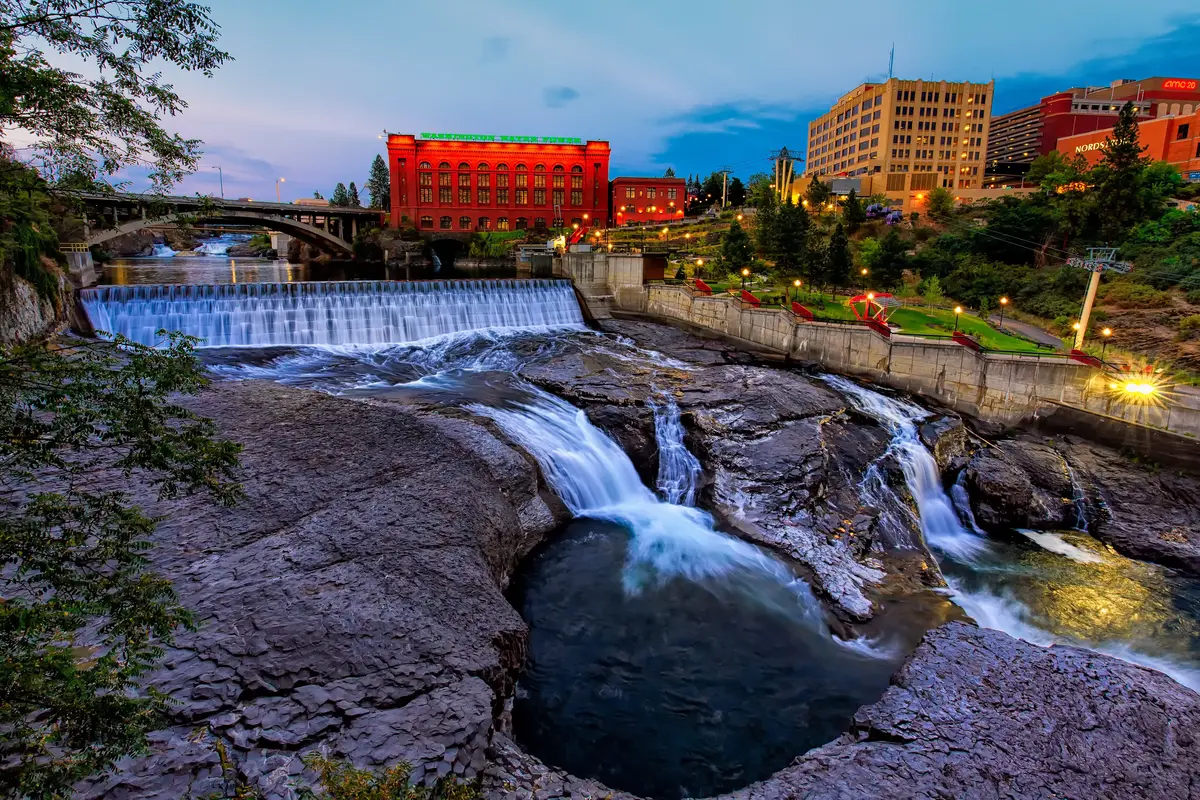
Mount Spokane State Park is 23 miles northeast of the city in the Selkirk Mountains. At 12,444 acres, it is Washington's largest state park. The ski area operates on the mountain's upper flanks, with trails reaching elevations up to 5,880 feet. It recorded 550,921 visitors in 2024 — a mix of skiers, snowshoers, and summer hikers who return when the trails are clear.
This is not a destination resort. There's no ski village, no slope-side lodging strip, no lift-ticket prices that require a second mortgage. For families who want access to a real ski mountain without the resort premium, the proximity to Mount Spokane is one of Spokane's more quietly significant practical advantages. The drive from most South Hill neighborhoods runs under 40 minutes.
Summer hiking on the mountain draws people who want elevation gain without committing to a full backcountry day — the trails are well-marked, the views extend into Idaho on clear days, and the ponderosa pine coverage at lower elevations gives way to open subalpine terrain near the summit.
The Parks System by Season
| Season | What Locals Are Doing | Where |
|---|---|---|
| Spring (Apr–May) | Lilac and rose viewing, trail running resumes, Centennial Trail cycling | Manito Park, Centennial Trail |
| Early Summer (Jun–Jul) | Riverfront Park fountains, kayaking the Spokane River, Centennial Trail to Idaho | Riverfront Park, river launches west of downtown |
| Late Summer (Aug–Sep) | Hiking Mount Spokane, evening pavilion events, ATV trails at Riverside | Mount Spokane, Riverside State Park, Gesa Pavilion |
| Fall (Oct–Nov) | Trail running in color, pine forest walks at Riverside, Finch Arboretum foliage | Riverside State Park, Finch Arboretum, Centennial Trail |
| Winter (Dec–Mar) | Skiing Mount Spokane, sledding at Manito, ice skating on Mirror Pond | Mount Spokane, Manito Park |
Finch Arboretum: The Underrated One
Most relocation guides skip Finch Arboretum entirely. It's a mistake. The 65-acre arboretum on the west side holds over 2,000 labeled trees and shrubs, with a half-mile loop that most people can walk in 20 minutes or turn into an hour with a plant ID app. It's quieter than Manito, rarely crowded, and genuinely lovely in October when the maples turn.
What People Don't Expect
Newcomers who move here in summer are occasionally blindsided by smoke season. Wildfire smoke from eastern Washington, Idaho, and Montana regularly settles into the Spokane basin from late July through September, driven by the bowl-shaped geography. On heavy smoke days, air quality pushes into unhealthy ranges and outdoor recreation effectively stops. Most long-term residents track the AirNow index the same way others track rain forecasts. It's a real seasonal constraint on the outdoor lifestyle that the city's marketing materials don't lead with — but that regular residents have genuinely adapted to.
The broader picture remains: for a city of this size, Spokane's combination of in-city parks, a designated trail state park, a wilderness preserve within nine miles, and a ski mountain within 40 makes the outdoor infrastructure here genuinely difficult to match at a comparable price point anywhere in the Pacific Northwest.
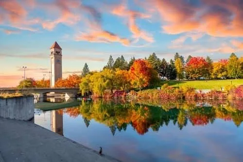
Local Expert Takeaway: Spokane's parks aren't an afterthought to its real estate story — they're central to it. The Olmsted Brothers-designed system gives the city a green infrastructure most comparably priced cities in the West simply don't have. Riverfront Park and Spokane Falls are genuinely world-class anchors in the downtown core. Manito Park functions as a free daily amenity for South Hill neighborhoods. The Centennial Trail connects the city end-to-end and continues into Idaho without a gap. Riverside State Park and Mount Spokane put wilderness and skiing within a 30-to-40-minute drive. The one honest caveat: plan your late-summer calendar around air quality forecasts, not just the weekend weather.
Quick Takeaways & FAQs
✅ Spokane manages over 4,100 acres of parks across 87+ sites — anchored by a parks master plan originally drawn by the Olmsted Brothers, the same firm behind Central Park.
⚠️ Wildfire smoke from late July through September is a real and recurring constraint on outdoor recreation; heavy smoke days can push air quality into unhealthy ranges for days at a stretch.
📍 The Centennial Trail's eastern segment was completely resurfaced in 2024 — 14 freshly paved miles from the Idaho border to Millwood — making it the best condition it's been in over 30 years.
Is the Spokane River Centennial Trail good for daily commuting by bike?
Is Manito Park really free, or are there fees for certain areas?
How far is Mount Spokane from the city, and is the ski area worth it for families?
Does wildfire smoke actually affect outdoor recreation in Spokane?
What is Riverside State Park, and how does it compare to just using city parks?
Moving to Washington?
Tell us what you need help with and we'll connect you with local resources.
