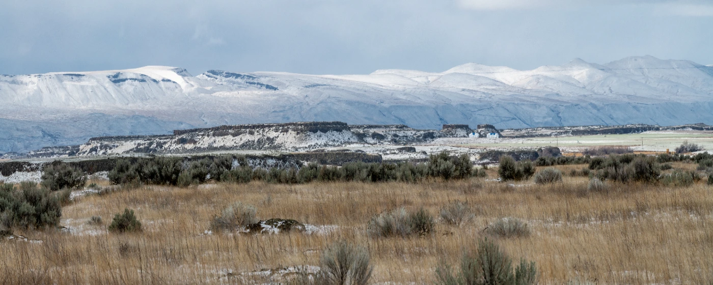
Most people moving to Othello expect a small farm town with a couple of ball fields. What they don't expect is to be living twenty minutes from one of the most geologically dramatic landscapes in North America. The Columbia National Wildlife Refuge sits less than ten miles northwest of downtown, and the Drumheller Channels National Natural Landmark — carved by Ice Age floods of almost unimaginable scale — is just a short drive up McManamon Road. For a city of fewer than 9,000 people, the access to raw, federally protected outdoor space is genuinely unusual.
Daily recreation inside city limits is anchored by Lions Park on Pine Street, Othello's largest park by a wide margin, and Pioneer Park at Main Street between 3rd and 4th Avenues, the small downtown greenspace that has been here since 1912. These two parks do the heavy lifting for youth sports leagues, pickup basketball, and community events — see the schools page for a look at organized youth sports programs. The seasonal rhythms here run differently than most Pacific Northwest cities: spring migration, not ski season, is the big outdoor event, and if you move here without knowing about the Sandhill Crane Festival in March, your first spring will be a pleasant surprise.
Within a thirty-minute drive, Potholes Reservoir adds 28,000 acres of open water for boating, fishing, and paddling — a day-trip option that most residents end up using far more than they anticipated when they first arrived. AllTrails lists nine trails in the Othello area alone, ranging from interpretive loops at the wildlife refuge to longer coulee routes through the scablands. The outdoor options here don't look impressive on a map of the whole state; they look impressive once you're standing in them.
Whether you're moving here from the wet side of the Cascades and wondering what outdoor life looks like in the Columbia Basin, or you're comparing Othello to Moses Lake and trying to understand the lifestyle differences, the sections below cover Othello's signature parks, the natural landmarks on your doorstep, the trail network, and the seasonal recreation calendar that shapes the year here.
Lions Park and Pioneer Park: What Daily Recreation Looks Like
Lions Park is the kind of facility that surprises people who assume a city this size can only support a couple of grass fields. The complex on Pine Street includes 4 lighted tennis courts, 2 full-sized lighted basketball courts, a street hockey rink, a handball wall, and an arboretum — all within the same footprint.
The Dan Dever Memorial Skate Park inside Lions Park is a genuine draw. At 6,000 square feet, it features a 7.5-foot bowl, bank ramp, grind rail, and a double stair set — specs that would hold their own in a city three times Othello's size. The Iron Horse Playground keeps younger kids occupied while older siblings skate.
The Fourth of July at Lions Park is the civic event of the year. The city shuts things down properly: a parade, food vendors, car shows, and basketball, soccer, and volleyball tournaments that draw teams from across Adams County. If you want to meet your neighbors fast, this is where it happens.
Pioneer Park: Small but Specific
Pioneer Park covers only one acre, but it carries a lot of local history in that acre. Established in 1912, the greenspace on Main Street hosts the Othello Farmers Market and has a mounted 1950s T-33A jet trainer on display — a nod to the city's ties to a former nearby air base that most newcomers walk past twice before they actually stop to read the placard.
The gazebo and picnic tables make it a genuinely pleasant midday stop. Don't expect trails or athletic facilities — this is a neighborhood square, not a sports complex. What it does offer is the farmers market: local produce from Columbia Basin farms, which is not a small thing in a region that produces a significant share of the nation's potatoes.
| Park | Location | Key Amenities | Best For |
|---|---|---|---|
| Lions Park | Pine Street | Skate park, tennis, basketball, hockey rink, playground, arboretum | Families Active |
| Pioneer Park | Main St, 3rd–4th Ave | Gazebo, picnic tables, farmers market, historic jet display | Walkable Quiet |
| Lions Park Athletic Complex | Pine Street (within Lions Park) | Multi-sport courts, tournament fields, lighted facilities | Families League Play |
Between the two parks, you have most daily recreation needs covered within a short drive of any neighborhood in the city.
Columbia National Wildlife Refuge: The Backyard You Didn't Expect
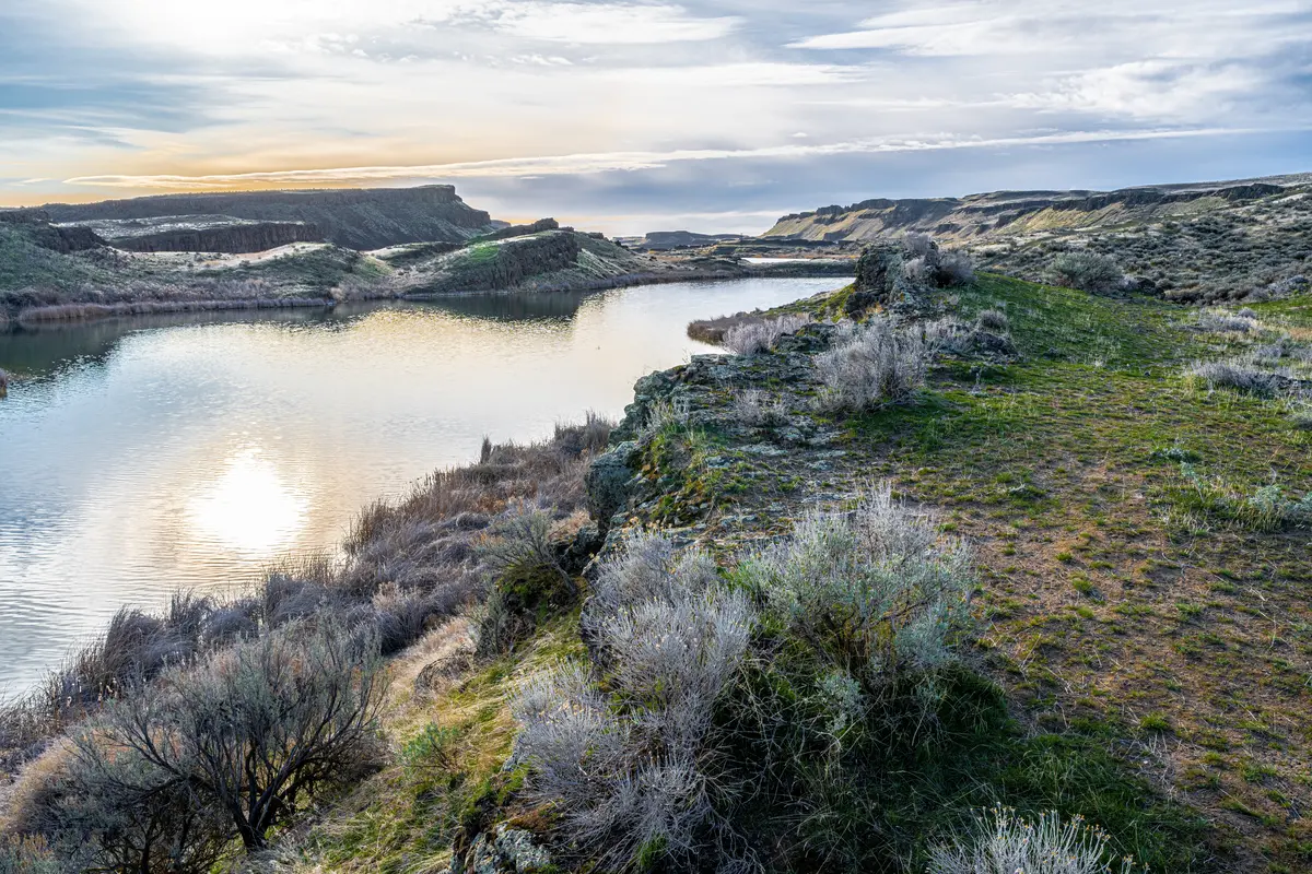
Nearly 30,000 acres of rugged canyon, sagebrush grassland, and open water sit less than ten miles northwest of Othello — managed by the U.S. Fish & Wildlife Service, free to access, and almost always uncrowded. The Columbia National Wildlife Refuge is the outdoor anchor of living here, and many residents take months to realize how much is actually out there.
Fishing the Refuge Lakes
The refuge contains 145 acres of ponds and 841 acres of lakes. Rainbow trout, cutthroat trout, and brown trout share water with largemouth bass, black crappie, yellow perch, and sunfish — a range that keeps both fly anglers and spin fishers coming back through the season. A Washington state fishing license is required; the refuge's Fish & Wildlife staff can point you toward which water is producing on a given week.
Hiking the Interpretive Trails
The refuge's interpretive trail system offers loops of 1.0, 1.8, and 3.0 miles, combinable for up to 5.8 miles of total hiking. The terrain is high desert: basalt outcrops, sagebrush, and unexpected views down into the scabland channels. These aren't destination hikes with dramatic elevation gain — they're the kind of trails you do on a Tuesday morning before work because they're fifteen minutes from your front door.
Birding on the Pacific Flyway
The Columbia Basin sits on the Pacific Flyway, the primary waterfowl migration corridor along the western United States. The refuge serves as a wintering area for more than 100,000 ducks and Canada geese, and March through April is when the sheer volume of birds becomes something you have to see to believe. The Othello Sandhill Crane Festival, held each March at and around the refuge, brings in birders from across the region for guided tours, lectures, and field activities focused on the lesser sandhill crane migration. If you're moving here in the fall or winter, mark that festival weekend on your calendar now — it's one of those local events that reframes how you think about where you live.
One honest note: the refuge is a wildlife management area first. Facilities are minimal. Cell service is intermittent. Bring water, a paper map or downloaded offline route, and expect unpaved roads to some of the lake access points.
Drumheller Channels and the Scablands: Geology You Can Walk Through
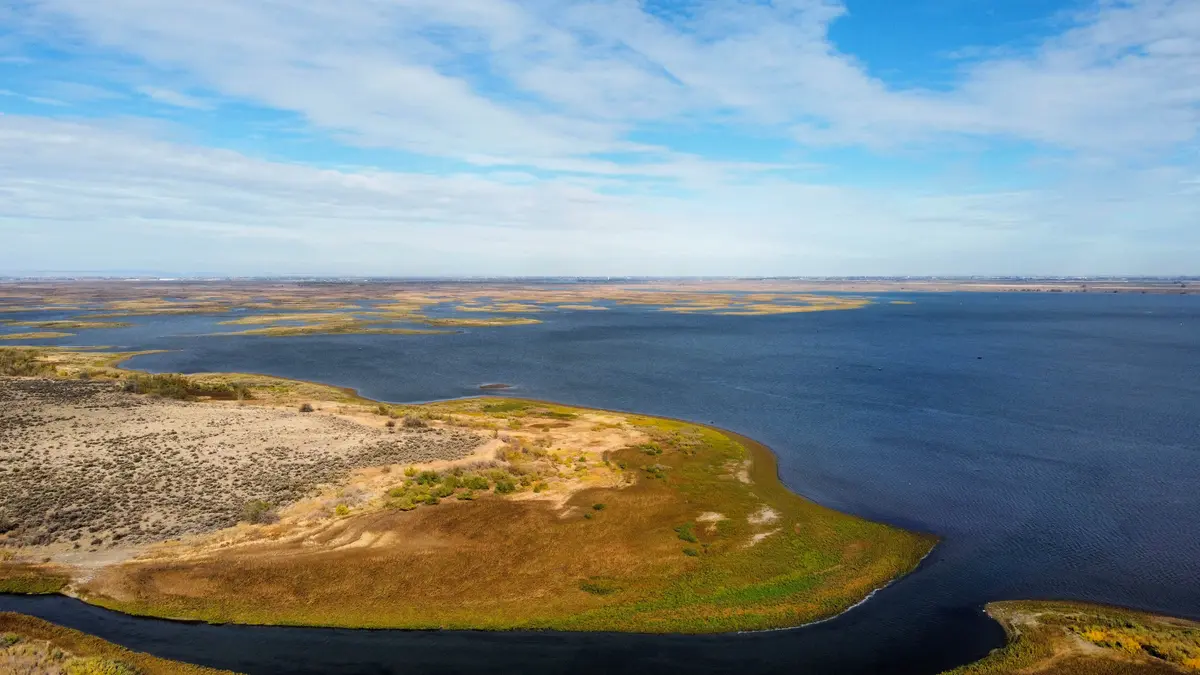
About 5 miles northwest of Othello via McManamon Road and Morgan Lake Road, the Drumheller Channels National Natural Landmark offers something genuinely rare: a landscape the National Park Service designated in 1986 as the most significant example of basalt butte-and-basin Channeled Scablands on the Columbia Plateau. That designation sounds academic until you're standing in it.
What You're Actually Looking At
The landscape is hundreds of isolated, steep-sided basalt buttes surrounded by a braided network of channels — all but one currently dry — carved by the catastrophic Missoula Floods during the last Ice Age. When glacial lake Missoula breached its ice dam, water moved across this plateau at volumes that are difficult to comprehend even now. The channels you walk through are the scars.
A viewpoint pullout off West McManamon Road, roughly 10 miles from town, provides the best orientation: informational placards explain the flood geology, and hiking trails branch from the viewing area down into the channels themselves. The placards are worth reading slowly — the scale of what happened here doesn't click immediately.
Practical Access
This is not a developed recreation area with a trailhead parking lot and a fee station. The access roads are passable by most vehicles in dry conditions, but after rain or snow the clay-heavy soil can get difficult quickly. Go on a clear day. Wear sturdy footwear — the basalt is sharp and uneven. Bring your own water; there are no facilities at the viewpoint.
Most Othello residents who make the drive once end up going back repeatedly, often bringing out-of-town guests. It photographs well, it's free, and it's genuinely unlike anything else in the state. The fact that it's effectively in your backyard is one of those living-here advantages that doesn't show up in any relocation checklist.
| Site | Distance from Othello | Access Road | Designation | Key Feature | Facilities |
|---|---|---|---|---|---|
| Drumheller Channels viewpoint | ~10 miles | West McManamon Road | National Natural Landmark (NPS, 1986) | Panoramic scablands vista, interpretive placards | Pullout only — no restrooms |
| Drumheller Channels trails | ~10 miles | West McManamon Road | Same landmark area | Hiking through dry flood channels and buttes | None |
| Columbia NWR trailheads | ~8–12 miles | Various refuge roads | U.S. Fish & Wildlife Refuge | 1.0–3.0 mi interpretive loops, wildlife viewing | Minimal — check refuge website |
| Columbia NWR lakes | ~8–12 miles | Unpaved refuge roads | U.S. Fish & Wildlife Refuge | Fishing: trout, bass, crappie, perch | Minimal |
Road conditions vary seasonally — check with the U.S. Fish & Wildlife Service office before visiting in winter or early spring.
Looking to buy in Othello? Estimate your payment.
Enter your numbers to see an estimated monthly mortgage payment.
Estimate only. Excludes HOA fees and mortgage insurance. The interest rate above is a starting point, not a quoted rate — replace it with your own to see real numbers. Insurance is a flat placeholder, not a Othello quote.
Trails, Water, and Seasonal Recreation Beyond the City Limits
The nine trails AllTrails currently lists for the Othello area (updated June 2025) give a sense of the range available within a reasonable drive. The Frog Lake Trail and the Upper Goose Lake route from Frog Lake Trailhead are the most frequently mentioned by local hikers. The Blythe Lake and Coulee Trail covers different terrain — longer and more open — while the Seep Lakes Wildlife Area Trails and the Marsh Interpretive Trail focus on wetland habitat that's especially rewarding during migration season.
Potholes Reservoir: The Thirty-Minute Escape
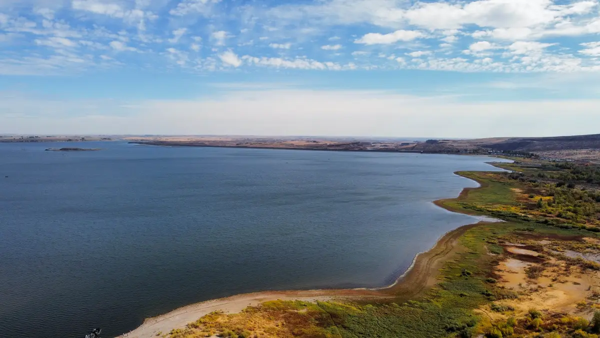
Potholes Reservoir is a 28,000-acre man-made lake about thirty minutes from Othello, and it does a lot of work for local families through the summer. Waterskiing, paddleboarding, kayaking, and fishing are all viable from the same access point. Three miles of hiking trails run adjacent to the water. The Mardon Resort adjacent to the reservoir offers a marina, RV park, motel, and a bar and grill — useful to know when you're planning a full-day trip rather than a quick paddle.
One thing that surprises newcomers: summer weekends at Potholes get genuinely busy. Memorial Day through Labor Day, the boat launch can have real wait times. If you want the reservoir to yourself, Tuesday and Wednesday mornings are a different experience entirely.
The Seasonal Calendar
| Season | Primary Activity | Where | Notes |
|---|---|---|---|
| March | Sandhill crane migration / birding festival | Columbia NWR | Annual festival — check FWS refuge site for dates |
| March–April | Waterfowl migration viewing | Columbia NWR | 100,000+ ducks and geese; peak Pacific Flyway traffic |
| Spring–Fall | Fishing | Columbia NWR lakes, Potholes Reservoir | WA fishing license required; multiple species |
| Summer | Boating, paddling, waterskiing | Potholes Reservoir | Weekends get crowded; weekday mornings are ideal |
| Summer | Farmers market, outdoor courts | Pioneer Park, Lions Park | Weekly market; tournaments at Lions most weekends |
| July 4th | Festival — parade, car show, tournaments | Lions Park | Largest single civic event of the year |
| Year-round | Scablands hiking | Drumheller Channels | Avoid after rain; best in spring and fall for temperatures |
| Year-round | Interpretive trail hiking | Columbia NWR | Up to 5.8 miles combinable; bring water |
After a coffee from Ironworks Cafe & Market on S Broadway Avenue, the drive out to the refuge or the channels takes less time than the average Seattle commute to downtown. That proximity — wildlife refuge and geological landmark within a twenty-minute drive of a cup of coffee — is the clearest way to describe what outdoor recreation access actually looks like from inside Othello.
Local Expert Takeaway: The outdoor story in Othello isn't about the city parks — it's about what's just outside city limits. The Columbia National Wildlife Refuge and the Drumheller Channels National Natural Landmark are within ten miles of downtown, free to access, and rarely crowded. Most people moving here don't fully appreciate this until they've made a few drives out McManamon Road and realized they're standing in something genuinely world-class. Inside town, Lions Park handles daily recreation well, and the Dan Dever Memorial Skate Park at 6,000 square feet is a real facility. The seasonal anchor is the Sandhill Crane Festival each March — if you're here in spring, don't skip it.
Quick Takeaways & FAQs
✅ The Columbia National Wildlife Refuge — nearly 30,000 acres of canyon, lakes, and sagebrush — sits less than ten miles northwest of downtown Othello and is free to access year-round.
⚠️ Outdoor facilities inside city limits are limited beyond Lions Park and Pioneer Park — if you want developed trails, playgrounds, or swimming pools in walking distance of your house, Othello will require a short drive.
📍 The Sandhill Crane Festival in March draws birders from across the region to the Columbia NWR — it's the clearest sign that this small farm city punches well above its weight as a wildlife-viewing destination.
Is the Columbia National Wildlife Refuge free to visit from Othello?
When is the best time to see sandhill cranes near Othello?
What trails are available for hiking near Othello?
What is there to do at Lions Park in Othello?
How far is Potholes Reservoir from Othello, and what can you do there?
Moving to Washington?
Tell us what you need help with and we'll connect you with local resources.
