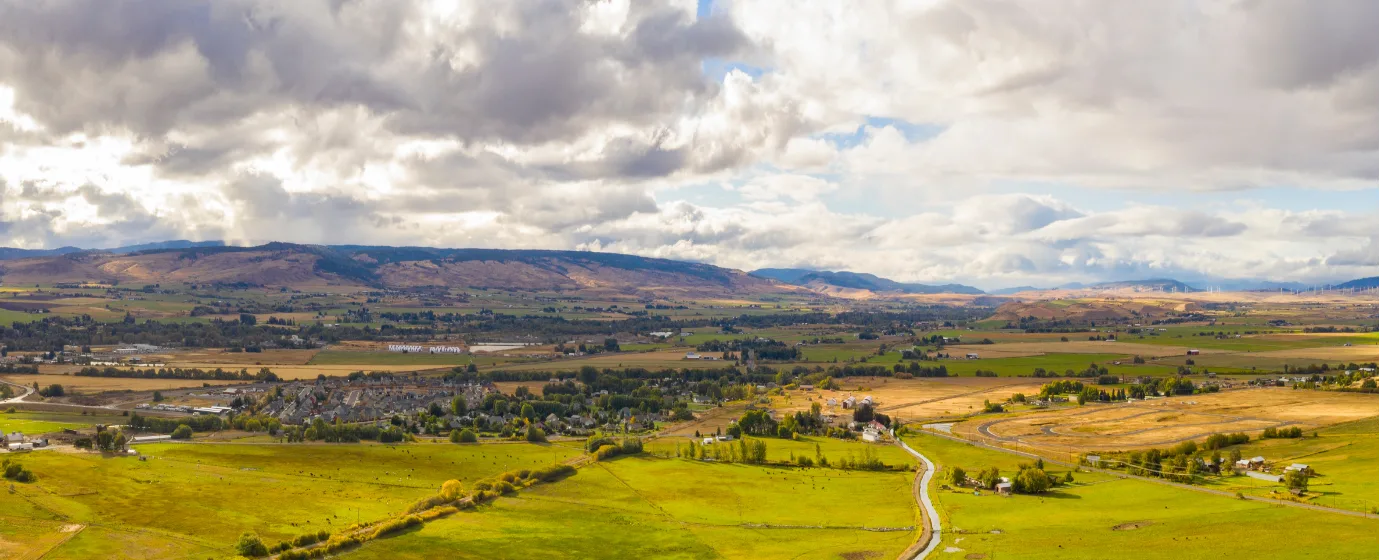
Most people researching Ellensburg focus on Central Washington University or the commute to Yakima. What they underestimate is the outdoor infrastructure sitting right outside the city limits. Within a ten-minute drive, you can walk across a pedestrian suspension bridge over the Yakima River, watch bighorn sheep pick their way down basalt cliffs, or float a Blue Ribbon trout fishery through a canyon that few people outside the Pacific Northwest even know exists.
The city itself maintains 20 parks across more than 230 acres — a figure that's large relative to a population of around 21,000. But the headline asset is what surrounds Ellensburg, not just what's inside it. The Yakima River Canyon Scenic Byway (Highway 821) begins at the city's southern edge, and the Bureau of Land Management manages over 9,000 acres of canyon land with five developed river-access sites that stay open year-round — a meaningful advantage in a state where most high-country recreation shuts down for five months every winter.
Day-to-day life here runs on trails, river access, and open space in a way that feels less like a recreation amenity and more like a baseline expectation. Dog owners use the off-leash area at Irene Rinehart Riverfront Park most mornings. Fly-fishing regulars are on the water by September when the canyon's low flows arrive. The 4.8-mile bike loop connecting N. Alder Park to Central Washington University via the 7th Avenue Bike Boulevard is a commuter route as much as a recreation trail.
Whether you're considering a move or just getting oriented, the sections below cover Ellensburg's signature parks, the trail network inside city limits, water and canyon recreation in the Yakima River Canyon, and the seasonal rhythms that shape how people actually spend time outdoors here.
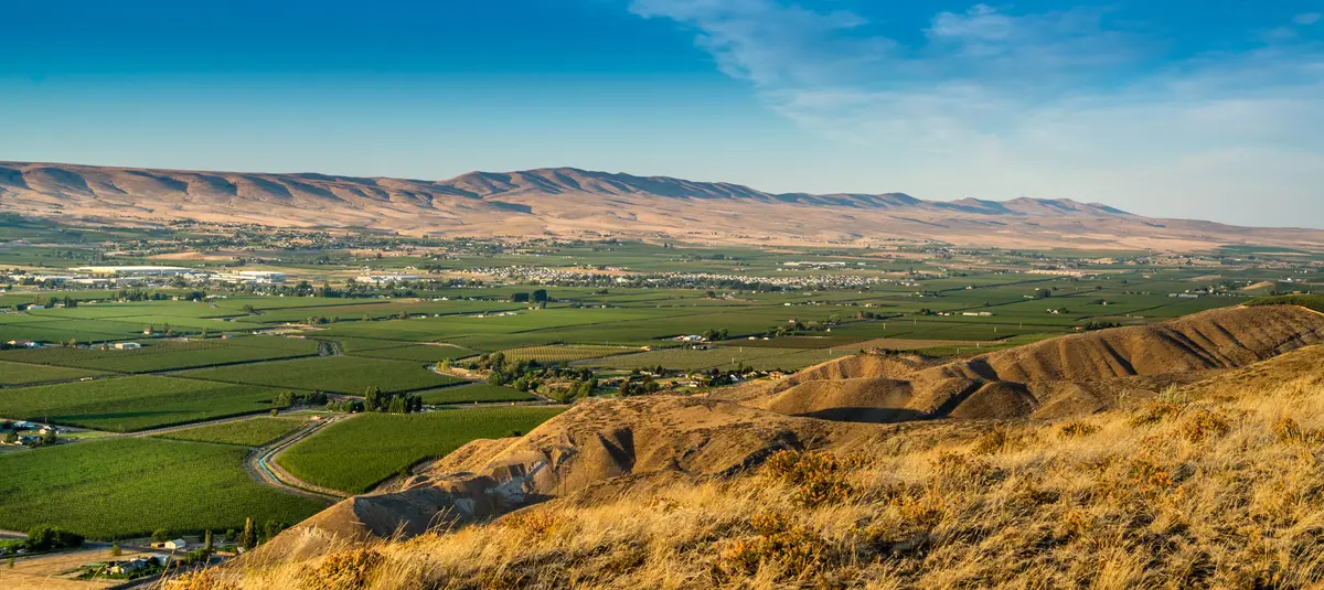
Irene Rinehart Riverfront Park and Olmstead Place: The Two Anchors
Ellensburg's two most-used natural spaces sit in opposite directions from downtown and serve entirely different purposes — but together they define what outdoor life in the city actually looks like.
Irene Rinehart Riverfront Park
At 117 acres along the Yakima River at 1081 Umptanum Rd, Irene Rinehart is the city's regional park in the truest sense. Admission is free, parking is ample, and the facilities cover an unusually wide range: approximately 2.2 miles of hiking trails, a fenced off-leash dog area with direct river access, a disc golf course, sand volleyball, a boat launch, and river swimming areas that fill up fast on July afternoons.
What most newcomers don't expect is the wildlife. Beavers are regularly spotted beneath the I-90 overpass section of the river corridor trail — not a rumor, just a consistently reported fact from locals who walk the trail early. The Kittitas Audubon Society runs a First Saturday Birdwalk here at 8 a.m. every month, which tells you something about the habitat quality along this stretch of river.
The disc golf course draws a consistent crowd of CWU students and locals on weekday afternoons. If you have a dog, the fenced water-access area is one of the more functional off-leash setups in the region — the river access is gradual and safe, not a steep bank drop.
Olmstead Place Historical State Park
Four miles east of downtown at 921 N Ferguson Rd, Olmstead Place is a 217-acre day-use park that preserves a pioneer homestead first settled in 1875 and listed on the National Register of Historic Places. The original log cabin, the 1908 farmhouse with intact family furnishings, a reconstructed Seaton Cabin schoolhouse, and a restored historic garden are all on-site.
The 0.75-mile Altapes Creek Interpretive Trail (also called the Coleman Creek trail) runs through the property — short enough for young kids, interesting enough for adults who want context for the agricultural history of the Kittitas Valley. From Memorial Day through Labor Day, free guided tours run noon to 4 p.m. on weekends.
A Discover Pass is required for entry. Hours shift seasonally: 6:30 a.m. to dusk from April through September, 8 a.m. to dusk from October through March. There is no camping.
Best for: Dog owners and families at Irene Rinehart; history-minded hikers and weekend afternoon visitors at Olmstead Place.Ellensburg's City Trail Network: Getting Around on Foot and Bike
Twenty parks and over 230 acres of developed green space sounds like a lot for a city this size — and it is, but the more useful number is the trail mileage that connects them. The city's official trail maps outline walking and biking routes ranging from 1.67 to 7.5 miles, built around a spine of connected corridors rather than isolated dead-end paths.
The Bike Loop and Boulevard
The most-used route is a 4.8-mile loop connecting N. Alder Park, the P2C trail, Central Washington University, and the 7th Avenue Bike Boulevard. CWU students use it as a genuine commute route; parents and families use it on weekend mornings. It's flat enough to be accessible and long enough to be a real workout if you want one.
The 7th Avenue Bike Boulevard is a dedicated low-traffic corridor — not a painted-stripe bike lane on a busy road, but a street designed to prioritize bicycle movement. For a city of Ellensburg's size, that's a meaningful infrastructure investment.
What's Missing
The city trail system is good within the urban core but doesn't extend deeply into the surrounding hills. If technical mountain biking or long singletrack runs are what you're after, you'll be driving south into the Yakima River Canyon BLM lands or west toward the Cle Elum area. The city's 2026–2032 Parks, Recreation, Open Space (PROS) and Sustainable Funding Plan — approved for development in June 2025 — is specifically addressing trail corridor acquisition and connection, so expansion is on the official agenda, but it's a multi-year process.
| Route | Distance | Type | Highlights |
|---|---|---|---|
| 4.8-Mile Bike Loop | 4.8 miles | Paved / multi-use | N. Alder Park → P2C Trail → CWU → 7th Ave Blvd |
| Irene Rinehart Trail Network | ~2.2 miles | Natural surface | River corridor, wildlife, off-leash dog access |
| Olmstead Interpretive Trail | 0.75 miles | Natural surface | Historic homestead, creek, family-friendly |
| City Short Loop (varied) | 1.67 miles | Paved / surface varies | Neighborhood connector, accessible entry point |
| City Long Route | 7.5 miles | Mixed surface | Longest mapped city route; links multiple parks |
| 7th Avenue Bike Boulevard | Partial loop segment | Dedicated low-traffic road | Primary cycling infrastructure corridor |
After a ride, Whipsaw Brewing on N Wenas St is the obvious stop — a local taproom within reasonable distance of the trail system for post-ride pints.
The Yakima River Canyon: Ellensburg's Backyard Wilderness
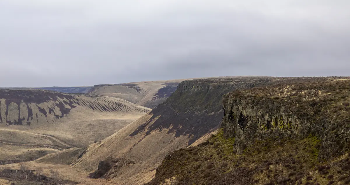
Most cities this size don't have direct access to a 27-mile BLM-managed river canyon with basalt cliffs rising more than 2,000 feet. Ellensburg does — and the canyon begins at the city's southern edge along Highway 821, the Yakima River Canyon Scenic Byway.
What the Canyon Actually Offers
The Bureau of Land Management manages over 9,000 acres of canyon land and operates five developed river-access sites: Bighorn, Umtanum, Lmuma Creek, Big Pines, and Roza. All five are open year-round. That last detail matters — unlike most high-elevation Washington recreation, the canyon byway doesn't typically close in winter, so access to trails, fishing, and birdwatching runs through all twelve months.
The canyon holds the densest concentration of nesting hawks, eagles, and falcons in Washington state. For birders, that's a serious claim. For everyone else, it means that any afternoon drive down Highway 821 will produce raptors on the canyon walls in a way that stops being surprising only after you've lived here a while.
Umtanum: The Spot Locals Know Best
The Umtanum Recreation Site is where most Ellensburg regulars spend their canyon time. A pedestrian suspension bridge — the only one across the Yakima River in the canyon — connects to the Umtanum Creek Canyon Trail, a 6.5-mile out-and-back that climbs into a side canyon away from the road noise. The Umtanum Ridge Crest Trail branches off for those who want elevation gain and wider views.
Bighorn sheep sightings are most consistent at Umtanum, particularly on the basalt cliffs above the swinging bridge. If you're going to see one, this is where it happens.
Big Pines: Camping and Float Access
Big Pines is the BLM's largest canyon recreation site — picnic tables, fire rings, vault toilets, and a non-motorized river put-in and takeout for floaters. Walk-in and group campsites are reservable through recreation.gov. Bring everything you need: no potable water, no hookups, and cell service drops out reliably around milepost 17 on Highway 821. That last fact trips up newcomers every summer — a full water supply and downloaded offline maps are not optional in the canyon.
Fishing: A Blue Ribbon Designation That Actually Means Something
The Yakima River Canyon carries a Blue Ribbon trout fishery designation, which in practical terms means the fish population density and size are managed at a higher standard than most Washington waterways. Walk-and-wade fishing is best September through May during low flows. From May through August, high water brings major insect hatches — dry-fly season for those who plan around it. Float fishing from a drift boat or raft is productive year-round.
Ellensburg functions as the primary staging point for canyon fishing trips: the last stop for supplies, the place you overnight before an early wade-in. That positioning shapes a small but consistent fishing culture in town.
Looking to buy in Ellensburg? Estimate your payment.
Enter your numbers to see an estimated monthly mortgage payment.
Estimate only. Excludes HOA fees and mortgage insurance. The interest rate above is a starting point, not a quoted rate — replace it with your own to see real numbers. Insurance is a flat placeholder, not a Ellensburg quote.
Seasonal Recreation: What Changes by Month in Ellensburg
Ellensburg sits in the rain shadow of the Cascades, which means roughly 300 days of sunshine a year and summer temperatures that regularly push into the 90s. That combination shapes recreation in ways that relocating newcomers from western Washington almost universally underestimate.
Spring: The Canyon Wakes Up
March and April bring wildflower bloom to the canyon walls and consistent raptor activity as nesting season opens. The Yakima River's spring runoff typically peaks in May, which closes walk-and-wade fishing but opens prime float season. This is when the canyon transitions from the quiet of winter to its busiest stretch of the year — if you want solitude at Umtanum or Big Pines, April weekdays are better than any May weekend.
Summer: Heat, Crowds, and the River
July is Ellensburg's peak outdoor month and its most demanding. Daytime temperatures in the high 90s push most serious hiking to early mornings. Irene Rinehart Riverfront Park becomes the city's primary relief valve — river swimming, shade, and the off-leash dog area draw consistent daily crowds by late June.
The canyon in midsummer is beautiful but unforgiving. No shade for miles on the exposed ridge trails, no drinking water at any BLM site, no cell service after milepost 17. People underestimate this every year. Starting any canyon hike after 9 a.m. in July is a decision you'll notice by noon.
Fall: The Best Season Nobody Talks About
September through November is when Ellensburg earns the loyalty of people who've lived here more than two years. Walk-and-wade trout fishing returns to its best conditions as flows drop. The canyon walls shift color. Temperatures cool into the 60s and 70s while most of Washington is already dealing with rain. The Kittitas Valley turns golden with harvest, and the crowds that filled the canyon in July largely disappear.
The First Saturday Birdwalk at Irene Rinehart — organized by the Kittitas Audubon Society at 8 a.m. each month — draws some of its best attendance in October and November when migrating species move through the river corridor.
Winter: Quieter Than You'd Expect
Winter doesn't shut Ellensburg's outdoor access down the way it does for higher-elevation Washington communities. The canyon byway stays open. Irene Rinehart is hikeable year-round. Olmstead Place keeps its gates open 8 a.m. to dusk. For anyone who moved from Seattle expecting months of trail closures, the year-round usability of the canyon is one of the more welcome surprises of living here.
| Season | Best Activity | Peak Spots | Watch Out For |
|---|---|---|---|
| Spring (Mar–May) | Birding, canyon wildflowers, floating | Umtanum, Irene Rinehart | High water closes wade fishing May–Aug |
| Early Summer (Jun) | Dry-fly fishing, hiking before 9 a.m. | Yakima River Canyon BLM sites | Heat ramps up fast; bring full water supply |
| Peak Summer (Jul–Aug) | River swimming, disc golf, volleyball | Irene Rinehart Riverfront Park | 90°F+ temps; canyon trails exposed midday |
| Fall (Sep–Nov) | Walk-and-wade trout fishing, hiking | Canyon BLM sites, Olmstead Place | Crowds gone; book Big Pines early in Sept |
| Winter (Dec–Feb) | Birdwatching, quiet canyon walks | Irene Rinehart, Umtanum | No potable water at canyon sites year-round |
Youth sports and structured kids' programs round out what families do here in every season — for a full breakdown, see the Ellensburg schools page.
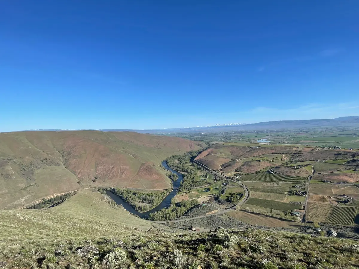
Local Expert Takeaway: The canyon is the thing nobody warns you about before you move here. You hear about CWU, you hear about the rodeo, and then six months in you realize you've been driving south on Highway 821 every other weekend — hiking Umtanum Creek, fishing the Blue Ribbon water at Big Pines, or just doing the drive because the basalt walls and raptors are that good. Pair that with Irene Rinehart Riverfront Park's free year-round access and you have a recreational baseline that genuinely punches above Ellensburg's size. The catch: summer canyon hikes demand an early start, a full water supply, and no assumption of cell service past milepost 17. The people who treat the canyon as a casual afternoon destination learn that lesson once.
Quick Takeaways & FAQs
✅ Ellensburg sits at the northern gateway to the Yakima River Canyon, a 27-mile BLM-managed corridor with a Blue Ribbon trout fishery and the densest nesting raptor population in Washington state — accessible year-round.
⚠️ Summer canyon hiking demands preparation: no potable water, no cell service after milepost 17 on Hwy 821, and exposed ridge trails that become dangerous after 9 a.m. on 90°F+ July days.
📍 The Kittitas Audubon Society runs a First Saturday Birdwalk at Irene Rinehart Riverfront Park at 8 a.m. every month — one of the more reliable ways newcomers actually meet longtime Ellensburg residents.
Is Irene Rinehart Riverfront Park free to use?
Can you camp in the Yakima River Canyon near Ellensburg?
When is the best time to fish the Yakima River Canyon?
Does Olmstead Place Historical State Park require a fee?
Are there good hiking trails accessible directly from Ellensburg without driving far?
Moving to Washington?
Tell us what you need help with and we'll connect you with local resources.
