San Marcos has a geographic advantage that almost no other Texas city can claim: a river that never stops flowing and never changes temperature. The San Marcos River emerges from more than 200 artesian springs fed by the Edwards Aquifer, and the water holds a constant 72 degrees year-round. That single fact reshapes daily life here in ways that newcomers don't fully appreciate until their first February swim. Most Texas cities talk about outdoor recreation. San Marcos has been built around it for generations.
The city of 77,830 sits at the edge of the Hill Country, which means the landscape switches quickly from river bottomland to canyon bluffs and oak-juniper uplands within a few miles. Texas State University's campus runs along the riverbank, which is why Sewell Park draws students, locals, and visiting families to the same stretch of water on any warm afternoon. The outdoor life here isn't a weekend amenity — for a lot of residents, it's the whole reason they came.
What surprises people after six months is how much of this is free, or close to it. The river itself costs nothing to enter. Purgatory Creek Natural Area's 12-plus miles of trails are free to walk. The parks that do charge — San Marcos City Park introduced paid parking for non-residents in July 2025, and Rio Vista Park runs a managed-access system during peak summer — are structured so that city residents pay less or nothing. That's a meaningful benefit when you're deciding whether the outdoor scene here is something you'll actually use, or something you'll drive past.
Whether you're considering a move or already under contract, the sections below cover San Marcos's signature parks, its river system, the trail network at Purgatory Creek, Wonder World Cave, and what seasonal recreation here really looks like day to day.
The San Marcos River: What Makes It Unlike Any Other Texas River
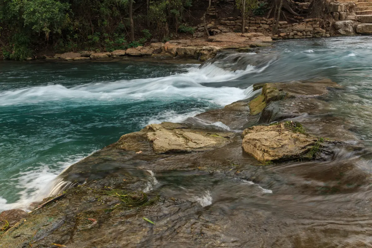
The San Marcos River doesn't behave like a normal Texas waterway. It doesn't run brown after a storm, it doesn't drop to a trickle in August, and it doesn't close for cold weather. Because it emerges from the Edwards Aquifer through hundreds of springs right in the city center, the temperature stays at 72 degrees whether it's January or July — which means tubing season is essentially year-round for anyone willing to get in.
The classic float runs from San Marcos City Park downstream to Rio Vista Park. The trip takes roughly an hour depending on flow rate. Tubers can bring their own gear or rent from the Lions Club, the only on-river outfitter operating within city limits. It's a deliberately low-key setup — no shuttle fleets, no massive outfitter complex — which keeps the experience more local than what you'd find at heavily commercialized rivers nearby.
Rio Vista Park, at the downstream end of the float, is where the river drops over a low dam and creates a natural rapid that swimmers and kayakers work repeatedly. It's become the social center of the river during summer. The city responds to the crowds with a managed-access system running from Memorial Day weekend through Labor Day weekend, with staffed entry points, temporary fencing, and Park Ambassadors who collect fees from out-of-area visitors. If you live here with a San Marcos address, the structure of the system works in your favor.
The paid parking change at San Marcos City Park, which took effect July 1, 2025, follows the same logic. Non-residents pay $5 for up to an hour, $10 for up to two hours, and $15 for three hours or a full day. City residents with current vehicle registration park free. It's a modest but real advantage for people who use the river regularly — and the people who use it regularly are largely the people who decided to live here because of it.
Spring Lake and the Meadows Center
At the headwaters, where the springs actually emerge, Spring Lake sits on the Texas State University campus and is managed by the Meadows Center for Water and the Environment. The springs feeding this lake have never stopped flowing in recorded history. That's not marketing language — it's a geological fact that makes Spring Lake one of the most significant aquifer discharge points in North America.
The Meadows Center has offered glass-bottom boat tours since 1945, letting passengers look down through the hull at the springs bubbling up from the aquifer below. The tours run about 30 minutes. Beyond the boats, the center offers guided kayak and stand-up paddleboard tours, snorkel education programs, nighttime LED clear-kayak tours on the dark water, and a Wetlands Boardwalk through the riparian habitat along the edge of the lake. For families new to San Marcos, the glass-bottom boat is usually the first introduction to what this water system actually is — and it tends to make an impression.
Sewell Park and the River Parks System
Sewell Park is the part of the river that residents use without thinking much about it. Six acres of grassy riverbank on the Texas State University campus, free to the public, with stair access directly into the water for swimming and snorkeling. There's a basketball court and two sand volleyball courts on the lawn above the bank, plus picnic and barbecue areas that stay busy on weekends throughout the warm months.
The on-campus Outdoor Center rents kayaks and paddleboards, which gives residents another option beyond the Lions Club float route. Sewell Park sits upstream of the City Park-to-Rio Vista float, making it a quieter and often less crowded entry point into the river system. Families with younger children tend to gravitate here for that reason — the water is clear enough to see the bottom and gentle enough for kids who aren't quite ready for the Rio Vista rapids.
What the river parks system as a whole offers is unusual for a city this size: a continuous corridor of accessible water running through the middle of town, anchored by distinct parks at different points along the route. Sewell Park for casual daily use. San Marcos City Park for the launch point of the main float. Rio Vista Park for the energetic end of the run. Spring Lake and the Meadows Center for something quieter and more educational. Each one draws a slightly different crowd, and all of them are within a few miles of each other.
What to Know Before You Move Here
The honest friction moment: summer weekends at Rio Vista Park are genuinely crowded. The managed-access system helps, but it doesn't eliminate the lines or the noise. Locals who want a peaceful river experience on a Saturday in July have figured out that Sewell Park or the upstream stretches near Spring Lake are the better call. The people who get frustrated are usually those who expected a quiet nature experience and arrived at Rio Vista at noon on the Fourth of July. That's not the park's fault — it's just not the same park on that day.
The parks page for San Marcos's neighborhoods shows which parts of the city sit closest to river access, which matters more than most buyers realize until they're actually living here and factoring a river walk into their daily routine.

Purgatory Creek Natural Area: Hill Country Trails Inside City Limits
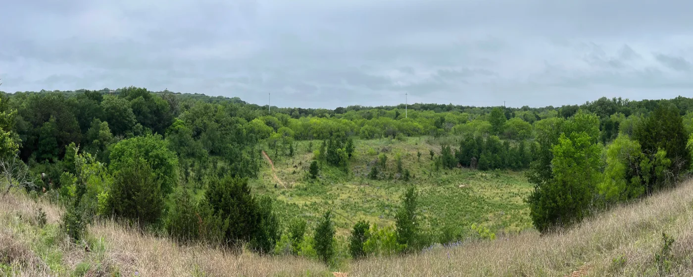
Purgatory Creek Natural Area is the other pillar of San Marcos outdoor life — and it's a genuinely different experience from the river parks. Where the river system is social and water-centered, Purgatory Creek is rugged, quiet, and feels considerably larger than 570 acres once you're inside it.
The trail network covers more than 12 miles through terrain that shifts between upland meadows, dense juniper thickets, and canyon bluffs that rise up to 40 feet above the creek bed. Champion oak trees mark some of the older sections of the preserve. Trail runners and mountain bikers use the system heavily on weekday mornings, and hikers tend to have more of it to themselves than the acreage would suggest — it's one of those places that feels underused relative to how good it actually is.
| Feature | Detail |
|---|---|
| Total acreage | 570 acres |
| Trail mileage | More than 12 miles |
| Terrain types | Upland meadow, canyon bluffs, juniper thicket, creek bottom |
| Max bluff height | Up to 40 feet |
| Permitted uses | Hiking, trail running, mountain biking |
| Wildlife habitat | Golden-cheeked warbler, black-capped vireo (federally listed) |
| Seasonal closures | Some trail segments close during nesting periods |
| Admission | Free |
The wildlife aspect is something trail users need to understand before they go: several sections of the natural area serve as protected habitat for golden-cheeked warblers and black-capped vireos, both of which are federally listed species. When nesting season arrives, certain trail segments close. The closures are temporary and clearly posted, but if you're planning a specific loop and haven't checked recent conditions, you may find a section gated. It's a small inconvenience for the protection of two birds that nest almost exclusively in mature Ashe juniper habitat — the kind of terrain Purgatory Creek has in abundance.
Why This Trail System Matters for Buyers
For people relocating from cities with more developed trail infrastructure, Purgatory Creek's 12-plus miles will feel like a significant asset. It's not a paved greenway or a groomed rail trail — it's actual Hill Country terrain, with elevation change and technical sections that mountain bikers seek out deliberately. The fact that it sits within city limits, costs nothing to use, and connects to the broader greenway network makes it one of the better free outdoor amenities of any Texas city in this population range.
Residents in the western and northwestern parts of the city tend to have the shortest drive to the main trailheads. If trail access is a deciding factor in your neighborhood search, the neighborhoods guide breaks down which areas sit closest to the natural area.
Looking to buy in San Marcos? Estimate your payment.
Enter your numbers to see an estimated monthly mortgage payment.
Estimate only. Excludes HOA fees and mortgage insurance. The interest rate above is a starting point, not a quoted rate — replace it with your own to see real numbers. Insurance is a flat placeholder, not a San Marcos quote.
Wonder World Cave, Seasonal Recreation, and What Life Here Actually Looks Like
Wonder World Cave & Adventure Park occupies a specific and unusual place in San Marcos's outdoor landscape. It's a commercial attraction, not a free public park — but it's one worth knowing about, because nothing else like it exists in the region. The cave opened to visitors in 1903, making it Texas's first commercial show cave. More specifically, it's the only earthquake-formed cave open for public viewing in the United States, created by movement along the Balcones Fault Line that runs beneath this part of Texas.
The cave tour is the centerpiece, but the park also includes an anti-gravity house, an observation tower with views across the city and surrounding Hill Country, and a train ride to a wildlife petting area where visitors can feed deer, emus, and other animals. For families with young children new to San Marcos, it's one of the first local outings that makes the city feel like somewhere with real character rather than just a college town with a nice river. It tends to be a regular destination for visiting grandparents.
The Seasonal Reality
San Marcos gets 232 sunny days a year, which is enough to make outdoor recreation genuinely year-round here. The river's constant temperature eliminates the seasonal ceiling that limits swimming in most Texas cities. Winter afternoons on the river are common, if not crowded. Purgatory Creek in February is often at its best — the cedar is fragrant after rain and the trails are significantly less populated than in summer.
Summer is the honest challenge. The river parks fill up. Parking at City Park costs non-residents real money by mid-morning. Rio Vista gets loud. The heat from late June through August is genuine Central Texas heat, and anyone relocating from a temperate climate needs to account for it. Locals adapt by going early — a 7 a.m. run at Purgatory Creek or a morning float before noon are how the outdoor habits of longtime residents are actually structured.
The Blanco River access at Five Mile Dam offers a quieter alternative when the main river parks are at capacity. It's a different body of water — the Blanco is less spring-fed and more seasonally variable than the San Marcos River — but it draws a local crowd that tends to prefer the lower profile.
Youth Programs and Active UIL Athletics
San Marcos Consolidated ISD runs active UIL athletics programs across its campuses, and youth sports through the city's parks and recreation department keep the fields and gyms busy on weekends throughout the school year. For a full picture of youth programs and school-based activities, the schools page covers the district in detail. The outdoor infrastructure here — the trails, the river, the natural area — tends to shape how families spend time together outside of organized programs, which is part of why the parks system matters as much as it does to buyers with school-age children.
Local Expert Takeaway: The San Marcos River is not a seasonal amenity — it runs at 72 degrees in January and July alike, and residents who build their weekly routine around it (a morning float, an evening walk along Sewell Park's bank, a quick snorkel at Spring Lake) are the ones who feel most at home here. The trick is learning the difference between a Tuesday at Rio Vista and a Saturday in August. Purgatory Creek Natural Area handles the overflow when the river parks are packed — 570 acres of free Hill Country terrain within city limits is a resource most Texas cities don't have, and the trail runners who discovered it a few years ago are not eager to advertise it.
Quick Takeaways & FAQs
✅ The San Marcos River stays at 72 degrees year-round, making it genuinely swimmable in every season — a rare advantage in Central Texas.
⚠️ Summer weekends at Rio Vista Park get crowded and loud; locals time their visits early or shift to Sewell Park and Purgatory Creek when they want space.
📍 City residents park free at San Marcos City Park with vehicle registration — a real benefit for anyone who uses the river regularly, after the July 2025 paid-parking policy took effect for non-residents.
Can you swim in the San Marcos River in winter?
Is tubing on the San Marcos River free?
How long is the tube float on the San Marcos River?
Are the trails at Purgatory Creek Natural Area suitable for mountain biking?
What is the Meadows Center, and is it open to the public?
Moving to Texas?
Tell us what you need help with and we'll connect you with local resources.
