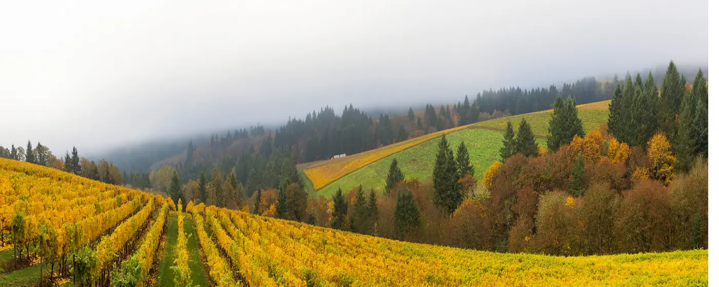
Most cities this size — Dundee has a population of 3,200 — offer a couple of playgrounds and maybe a soccer field. Dundee offers something that cities ten times larger spend decades trying to build: a park system that opens directly into working vineyard land, forested hillside trails, and a navigable river, all within a short drive of each other. The Chehalem Mountains rise immediately behind town, the Willamette River runs along the valley floor below, and the Dundee Hills AVA frames the western slopes in Pinot Noir rows that double as scenery on a morning walk.
That geography is not incidental to daily life here — it shapes it. Families at Billick Park can watch a softball game from the same picnic table where they'll spot red-tailed hawks circling the ridge. Hikers on Harvey Creek Trail move through Douglas-fir canopy and come out to vineyard panoramas in the space of a mile and a half. It's a genuinely unusual combination, and it's one of the clearest reasons people who move here from larger Oregon cities say they didn't expect to feel this connected to the outdoors in a town so small.
The honest caveat: Dundee's trail network is still growing. The Chehalem Park and Recreation District (CPRD) has mapped an ambitious system of connecting corridors through town, but funding to build them out is still being sought. What exists today is excellent; what's planned would be transformative. Buyers who want to live somewhere the infrastructure is already complete should weigh that. Those who want to get in before the trail network closes the loop between neighborhoods, vineyards, and the park may find the timing exactly right.
The sections below cover Dundee's signature park, the hiking trails above and around town, the water recreation available on the Willamette, and the broader network of nearby outdoor assets that round out daily and weekend life here.
Billick Park: The Community Anchor
Every small city has one park that functions as its civic living room. In Dundee, that's Billick Park — the oldest park in the city and the one managed jointly by the Chehalem Park and Recreation District. It's where youth soccer and softball happen, where kids graduate from the playground to the skate park, and where a covered picnic area fills up on summer weekends.
What's Actually There
The facility list at Billick is longer than you'd expect for a city of 3,200. A basketball court, tennis courts, horseshoe pits, a skate park, a playground, soccer and softball fields, restrooms, and a covered gathering area are all on-site. The paved walking trail that loops the park's perimeter — circling the baseball fields, the skatepark, the tennis courts, and the playground — is one of the details that matters most to families with strollers and anyone with mobility considerations, because it's fully accessible.
That loop trail isn't a destination hike. It's a neighborhood amenity, the kind you use on a Tuesday evening when you need thirty minutes of movement and want to stay close to home. In a city where getting anywhere meaningful otherwise requires a car, that matters more than it sounds.
The CPRD Connection
CPRD manages Billick Park as part of a broader Yamhill County network, which means Dundee residents also have access to additional facilities centered near Newberg — including a disc golf course, a larger skatepark, an American BMX Association track, and a dog park. Those aren't in Dundee, but they're close enough that they function as extensions of the local system rather than distant amenities.
What CPRD is actively working toward is a connected trail network through Dundee itself. Four corridors are planned: the Pinot Noir Trail (2.81 miles, running east-west from east Dundee through Billick Park and past several vineyards), the Billick Trail (1.13 miles, connecting surrounding neighborhoods to the park from the north-south axis), the Pacific Dogwood Trail (0.90 miles), and the Marionberry Loop Trail (0.61 miles). Together they'd stitch the neighborhoods, park, and vineyard edges into a walkable system. Funding is still being sought, which means timelines are genuinely uncertain — but the network is designed, and the corridors are identified.
Best for: Families Everyday useTrails Above Town: Harvey Creek, Worden Hill, and Beyond
The Dundee Hills are the thing newcomers either didn't expect or didn't fully appreciate until they lived here. The ridge above town isn't a distant backdrop — it's walkable from the upper neighborhoods, and the trails that run through it deliver the kind of mid-week forest reset that sends people to state parks on weekends in other cities.
Harvey Creek Trail
Harvey Creek Trail is the signature local hike: approximately 1.2 to 1.5 miles with 305 feet of elevation gain, accessible from the Dundee Hills above town. The route winds through Douglas-fir and big-leaf maple forest before opening to vineyard views, crosses a bridge over a shallow creek, and reaches several viewpoints with benches placed for the panorama. From the upper section near the Dundee Pioneer Cemetery trailhead, on a clear day you can see west across the Willamette Valley all the way toward Mount Jefferson.
The creek itself — shallow and slow-moving — is the kind of detail parents remember after the first visit: kids wade in it on warm afternoons, and the bridge crossing makes it feel like a real trail adventure even for young hikers. This is a genuinely family-usable trail, not just a fitness loop for the serious hiker.
Worden Hill Trail
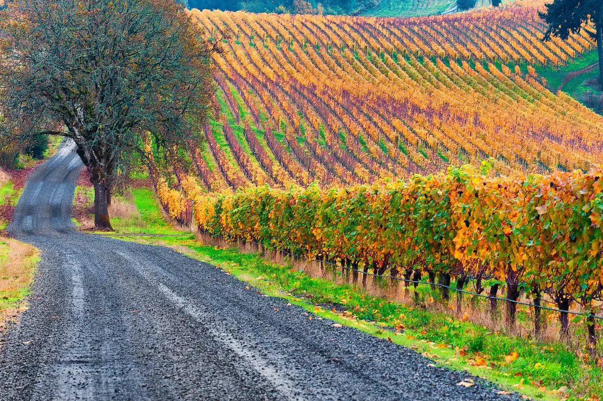
Worden Hill Trail operates differently from Harvey Creek — it's a wine-country walking and cycling corridor rather than a forested nature trail, running through the Dundee Hills AVA and past the area's Pinot Noir producers. Think vine rows on either side, gravel underfoot in places, and the Red Hills rolling in every direction. It's the trail you take when you want scenery that is specifically and only available in this corner of the Willamette Valley.
The corridor is also passable by bicycle, which makes it useful for anyone who wants to cover more ground between vineyard visits. It's not a maintained state trail with wayfinding signs at every junction — plan accordingly and check current conditions before heading out.
Bald Peak State Scenic Viewpoint
Bald Peak State Scenic Viewpoint sits atop the Chehalem Mountains at 1,629 feet — the highest point in the Willamette Valley. The 26-acre Oregon State Parks day-use site offers short walking paths and picnic areas, but the reason people make the drive is the view: Mount Hood to the east, the Coast Range to the west, and the Cascade Range spreading across the horizon on a clear day. There's no drinking water on site, so bring your own.
This one requires a drive rather than a walk from town, but it's the kind of payoff that makes the effort feel like nothing. On a clear October morning after the first rains of fall, the visibility is extraordinary.
Best for: Nature Views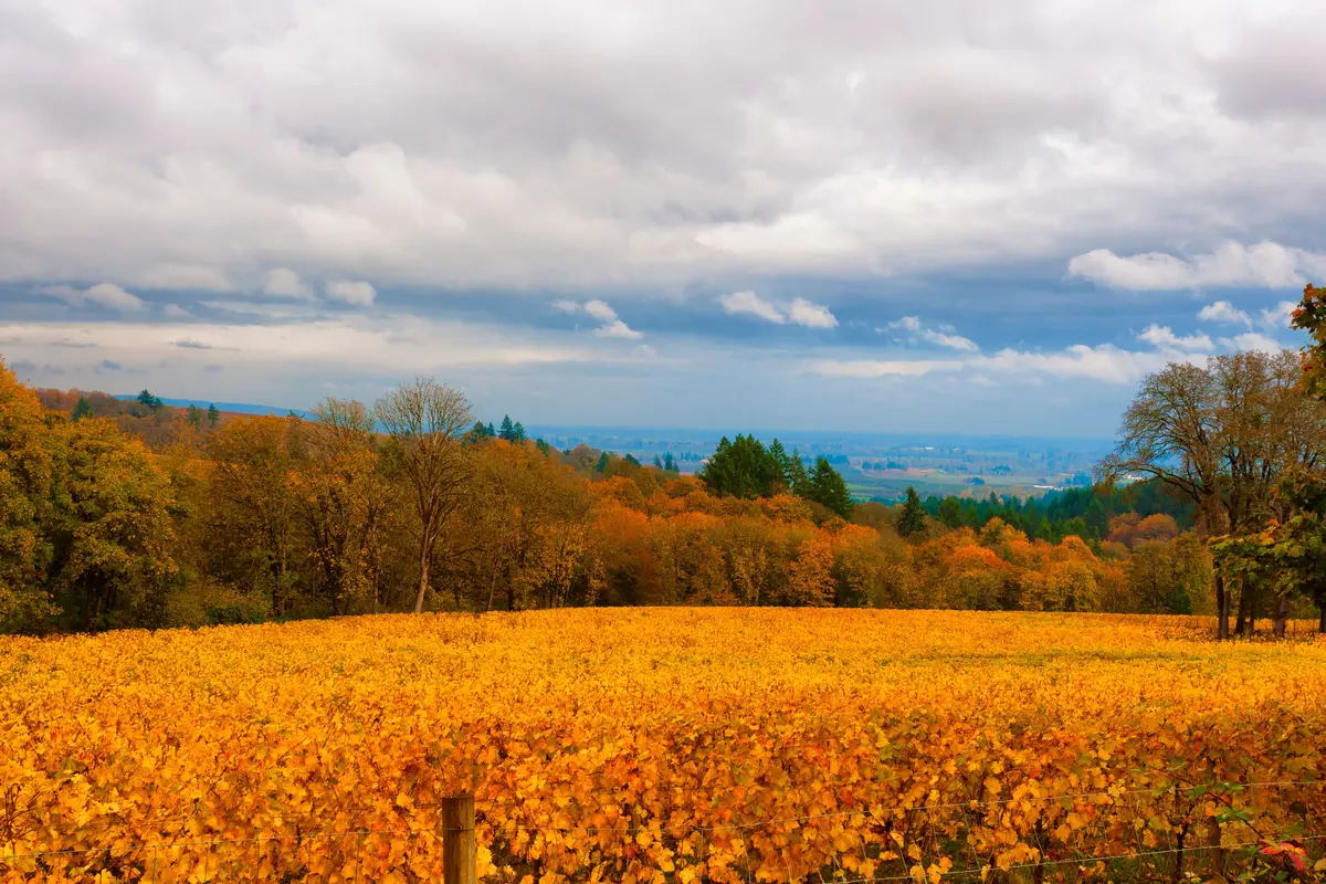
Water Recreation: The Willamette River and Rogers Landing
The Willamette River runs along the valley floor below Dundee, and Rogers Landing County Park — on the river near Dundee — is the primary access point for anyone who wants to get on the water. It's a Yamhill County park, not a city facility, and it sits near the Dundee-Newberg border rather than squarely within the city — but for residents, the proximity makes it effectively the local river ramp.
What Rogers Landing Offers
The park provides a three-lane boat launch and a separate kayak and canoe launch, making it functional for everything from powerboats to paddlecraft. Water skiing and fishing are both viable uses. Rogers Landing is also a designated stop on the Willamette River Water Trail, which means paddlers moving through the region have a reference point and a launch option here.
Spring fishing is the seasonal draw that brings anglers back reliably. Near Ash Island just south of the park, salmon runs attract fishers looking for a productive Willamette stretch. The wildlife watching is equally consistent: blue heron, osprey, kingfishers, and migrating geese move through the area, and a quiet morning on the water can feel more like a birding expedition than a recreational outing.
What to Know Before You Go
Rogers Landing is a day-use county park, not a full-service marina. There are no rentals on-site — bring your own gear. For kayak and canoe paddlers, the separate launch point is a genuine convenience that keeps smaller craft out of the way of the boat ramp traffic, which matters on a busy weekend when the three-lane ramp is in active use.
The river section near Dundee is calm enough for beginner paddlers in typical conditions, but the Willamette's flow varies significantly by season. Spring levels run high and fast; late summer is the easier window for casual paddling. Anyone newer to river paddling should check conditions before launching.
Best for: Nature FamiliesLooking to buy in Dundee? Estimate your payment.
Enter your numbers to see an estimated monthly mortgage payment.
Estimate only. Excludes HOA fees and mortgage insurance. The interest rate above is a starting point, not a quoted rate — replace it with your own to see real numbers. Insurance is a flat placeholder, not a Dundee quote.
The Wider Network: Chehalem Ridge and Seasonal Recreation
Living in Dundee means living inside a regional outdoor system that extends well beyond the city's own parks. The Chehalem Mountains form a wall of accessible land to the north and east, and Metro's investment in that corridor has given residents of this corner of Yamhill County something genuinely significant: Chehalem Ridge Nature Park.
Chehalem Ridge Nature Park
Opened in 2021, Chehalem Ridge Nature Park covers 1,260 acres in the Chehalem Mountains and is managed by Oregon Metro as the largest Metro park on the west side of greater Portland. Over 10 miles of multi-use trails accommodate hikers, mountain bikers, and equestrians. Two large covered picnic shelters with wheelchair-accessible tables make it a realistic option for group outings, not just solo trail runs.
The habitat diversity here is what makes it worth returning to across seasons. Oregon white oaks and Pacific madrone trees characterize the open upland areas; shrubby zones support deer, coyotes, and a wide range of birds. From multiple vantage points on the ridge, the views stretch across the Tualatin Valley toward the Coast Range — a different perspective on the same landscape that the Dundee Hills trail system shows from the other direction.
Seasonal Rhythms
Dundee has 153 sunny days a year — below what Oregon tourism literature typically advertises for the Willamette Valley, and an honest number worth knowing. The dry window from June through September is when the outdoor system here really opens up: trails are clear, the river is paddleable, vineyards are in active use, and the Harvey Creek wading hole works exactly as advertised.
Fall is the season most residents say they didn't expect to love as much as they do. Harvest in the Dundee Hills AVA runs from roughly late September into October, and the combination of vine color, cooler air, and reduced tourist traffic on the trails makes October the local favorite for walking Worden Hill or driving up to Bald Peak. The crowds that fill OR-99W in summer thin out, and the hills belong more to the people who live here.
Winter is genuinely wet and gray, and anyone moving from a sunnier climate should know that upfront. The Chehalem Mountains can see snow at elevation, which makes Bald Peak occasionally inaccessible and turns Chehalem Ridge into a muddy proposition. Billick Park's paved loop is one of the few outdoor amenities that stays usable year-round without requiring trail-appropriate footwear or a weather window.
For youth sports and structured kids' activities tied to the school system, the Dundee schools page covers what the Newberg School District offers through its programs.
Best for: Nature Views Privacy
Local Expert Takeaway: Dundee's outdoor life is defined by its geography more than its park budget. Harvey Creek Trail delivers a legitimate forested hike with vineyard views in under two miles — starting from the Dundee Hills neighborhoods above town. Worden Hill Trail runs through the Red Hills AVA in a way no trail anywhere else in Oregon does. Rogers Landing gets you onto the Willamette quickly. And Chehalem Ridge, just over the mountains, adds ten miles of multi-use trails that most people moving to the Portland suburbs would drive past this city to reach. The gap right now is connectivity: the planned CPRD trail network would link east Dundee to Billick Park to the vineyard edge on foot, but it isn't funded yet. Buy in a neighborhood that will sit near the Pinot Noir Trail corridor and you're positioned for the version of Dundee that's coming, not just the one that exists today.
Quick Takeaways & FAQs
✅ Harvey Creek Trail offers 305 feet of elevation gain through Douglas-fir forest with vineyard views and a kid-friendly creek crossing — all accessible from the Dundee Hills neighborhoods above town.
⚠️ CPRD's planned trail network — including the 2.81-mile Pinot Noir Trail corridor — is designed but not yet funded, meaning the connected walkable system residents want is still years away.
📍 Rogers Landing on the Willamette River provides a three-lane boat ramp and a separate kayak launch, plus reliable spring salmon fishing near Ash Island — a county park effectively serving as Dundee's river access point.
What are the best parks in Dundee, Oregon?
Is Harvey Creek Trail suitable for kids and beginners?
Can I kayak or fish on the Willamette River near Dundee?
What is Worden Hill Trail and who is it for?
Are there trails near Dundee for mountain biking or horseback riding?
Moving to Oregon?
Tell us what you need help with and we'll connect you with local resources.
