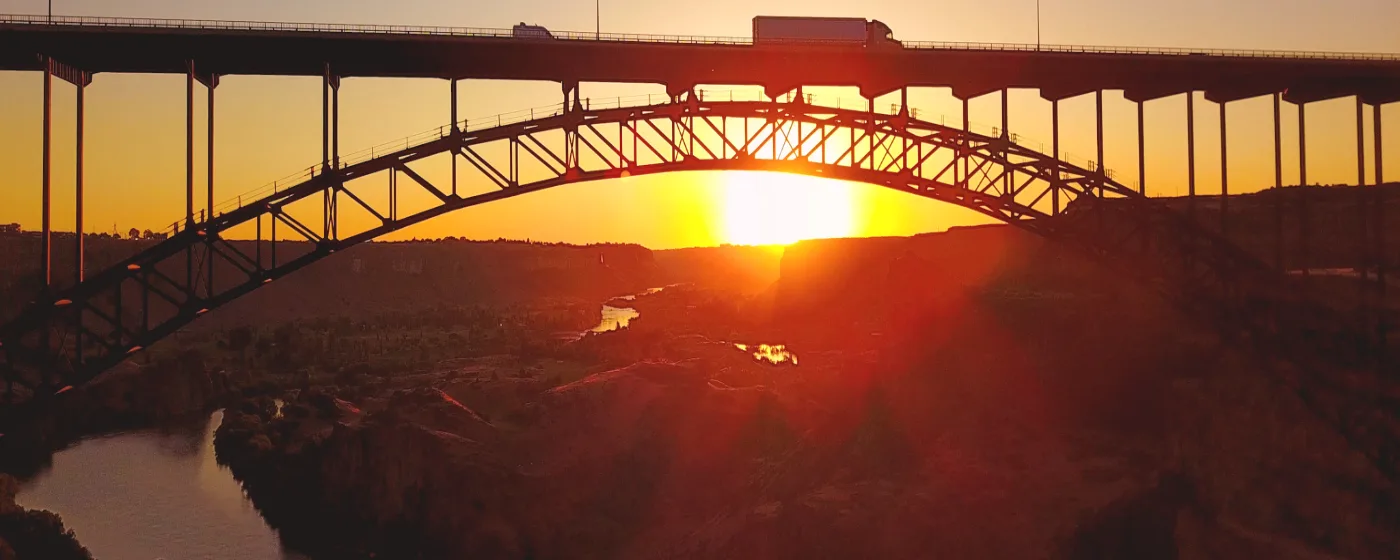
Most cities have a park. Twin Falls has a canyon. The Snake River Canyon — formed by ancient basalt lava flows, dropping to approximately 500 feet at its deepest point and stretching more than fifty miles — is the physical fact that shapes outdoor life here in ways no other Idaho city can claim. You don't have to drive to find nature on the weekends. It is literally at the edge of town, visible from the rim road, audible from neighborhoods like Canyon Rim and Grandview Drive when spring runoff is running hard.
What surprises people after six months here is how much they use these places on ordinary Tuesdays. The Canyon Rim Trail is a before-work run for thousands of residents, not a special-occasion hike. Dierkes Lake fills up on summer weekday afternoons with kids out of school. Shoshone Falls draws visitors from across the Pacific Northwest, but locals tend to show up in early April just after the gates reopen — before the tour buses arrive — when the Snake River is still swollen with snowmelt and the falls are genuinely deafening. That rhythm, between destination-worthy scenery and everyday accessibility, is what makes Twin Falls's park system unusual for a city of roughly 55,000 people.
The cost to access it all is deliberately low. The city and county have built a system where a $5-per-vehicle day pass or a $25 season pass unlocks the Shoshone Falls and Dierkes Lake complex, plus the Canyon Rim Trail — an arrangement that reflects how central these spaces are to daily life here, not just tourism. For families comparing quality-of-life metrics against other Idaho cities, that access point is hard to overstate.
Whether you're weighing a move to Twin Falls or already have the U-Haul reserved, this guide covers the signature parks, the trail system, the water recreation, and the seasonal patterns that define outdoor life here — so you know exactly what you're getting before your first spring arrives.
Shoshone Falls and Dierkes Lake: The Park Complex Locals Treat as a Backyard
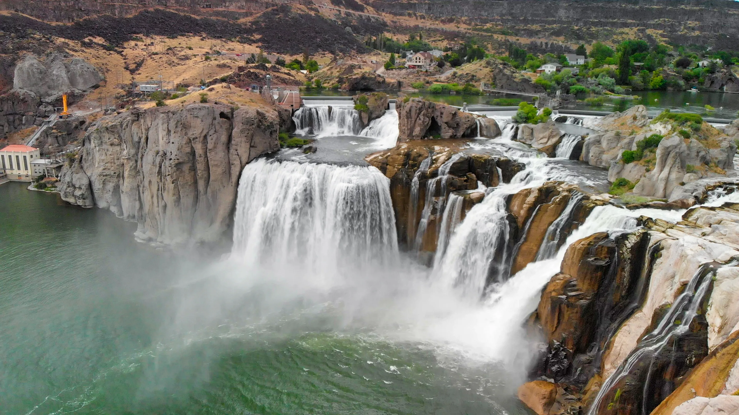
Shoshone Falls drops 212 feet — taller than Niagara Falls — across a 900-foot-wide curtain of water on the Snake River, approximately 5 miles east of downtown Twin Falls. The nickname 'Niagara of the West' gets used freely in tourism copy, but standing on the observation deck in April when the river is at peak flow, the comparison undersells it.
The park closed in October 2024 for a roughly $3 million road-and-guardrail renovation funded through state and local fiscal-recovery funds. It reopened in April 2025. The infrastructure is now in better shape than it has been in years, which matters if you're moving here with the assumption you'll use it regularly — you will.
What the Entry Fee Actually Covers
The $5 per-vehicle fee, charged from approximately March 30 through September, covers access to the entire Shoshone Falls and Dierkes Lake complex plus the Canyon Rim Trail for the day. A $25 season pass covers the full run from opening day through September. Winter access to the canyon and trail is free. For a household that visits a dozen times in a season — which is not unusual for families with school-age kids — the season pass pays for itself on the second trip.
Dierkes Lake: The Underrated Half of the Complex
Dierkes Lake sits within a 191-acre park carved into the Snake River Canyon, about 5 miles east of downtown. It was originally a blind canyon discovered in 1907 by John Dierke, a German immigrant working for Idaho Power, and sold to the city in 1969.
The lake is stocked with bluegill and trout, making it a genuine fishing spot rather than a scenic backdrop. Lifeguards are on duty from June through August at designated swimming areas, there is a diving board, volleyball courts, and picnic shelters. Non-motorized watercraft — kayaks and canoes — are allowed on the water. A 1.7-mile unpaved loop trail circles the lake and is manageable for most fitness levels, including families with young children.
| Feature | Details |
|---|---|
| Shoshone Falls height | 212 feet (taller than Niagara Falls) |
| Falls width | 900 feet across the Snake River |
| Dierkes Lake park size | 191 acres within the Snake River Canyon |
| Lake loop trail | 1.7 miles, unpaved, suitable for families |
| Swimming season | Lifeguards on duty June – August |
| Watercraft | Non-motorized only (kayaks, canoes) |
| Day pass (March 30 – September) | $5 per vehicle |
| Season pass | $25, covers full season |
| Winter access | Free |
The honest catch: Shoshone Falls is highly seasonal and irrigation-dependent. By late summer, when upstream agriculture draws heavily from the Snake River, the falls can slow to a fraction of their spring volume. If you arrive in August expecting the April roar, you may be underwhelmed. Spring — late March through May — is when the falls justify every photo you've seen of them.
The Snake River Canyon Rim Trail: Twin Falls's Everyday Outdoor Corridor
The Canyon Rim Trail is what turns the Snake River Canyon from a destination into a daily habit. The developed, paved, multi-use trail system runs more than 10 miles along the canyon's south rim — Visit Idaho reports the developed trail network at 10-plus miles, while AllTrails measures the full out-and-back route at 11.4 miles. The terrain is mostly flat with slight elevation changes, which means it works for strollers, casual cyclists, early-morning joggers, and anyone who wants a view without a technical climb.
Access Points That Matter
The Twin Falls Visitor Center is the most convenient starting point if you're new and want parking and trail maps in one stop. Shoshone Falls Park also serves as a trailhead, connecting the rim trail to the falls complex under a single $5 day pass. The trail passes directly under the Perrine Bridge, which is its own spectacle — looking up at a 486-foot bridge from below changes your sense of scale entirely.
The Perrine Bridge Platform
The Perrine Bridge spans 1,500 feet across the canyon and stands 486 feet above the Snake River. It is the only site in the United States where BASE jumping is permitted year-round without a permit. Jumpers leave from a platform on the bridge and land on the canyon-floor hiking path below — the same path you are walking on. On a busy weekend afternoon, you may see multiple jumps within an hour. For new residents, this is one of those things nobody thinks to mention in advance, and then becomes a story you tell everyone back home.
The Evel Knievel connection adds another layer of canyon history: the site of his 1974 steam-powered skycycle jump attempt is visible along the south rim, roughly 3 miles from the Visitor Center. It did not go well for Knievel, but the canyon wall is still there, and locals point it out on rim runs like a landmark.
Who Uses the Trail and When
Canyon Rim regulars tend to run or ride in the early morning, particularly in summer when midday temperatures push into the high 90s. The trail is exposed — there is almost no shade along the rim — so an 8 a.m. start is noticeably more comfortable than a noon start from late June through August. Early evenings in spring and fall are the most crowded, with the golden-hour canyon light drawing both locals and visitors. If you are moving to any of the rim-adjacent neighborhoods, expect to become a regular whether you planned to or not.
Centennial Waterfront Park and the Mogensen Trail: The Canyon Floor Experience
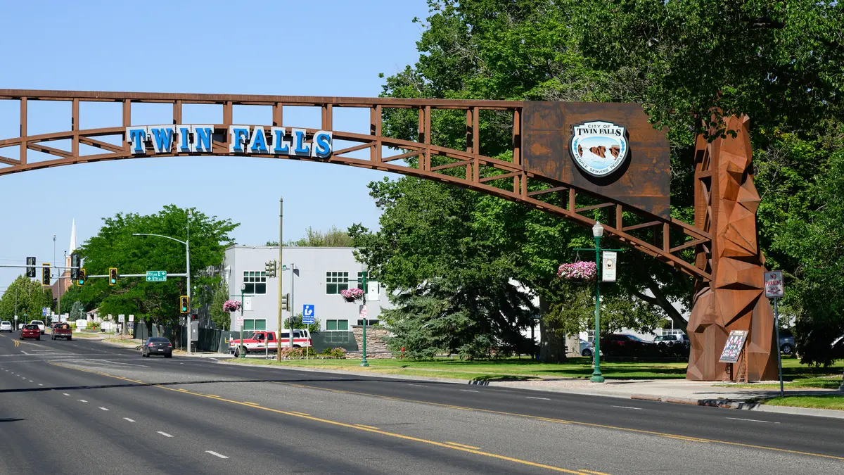
Getting down into the canyon — not just along its edge — is a different experience entirely. Centennial Waterfront Park sits at the base of the Snake River Canyon, just west of the Perrine Bridge, donated to Twin Falls County by the Twin Falls Rotary Club and dedicated on September 30, 1992. It is one of the quieter spots in the park system, less visited than the rim trail above and significantly less crowded than Shoshone Falls.
The park has both motorized and non-motorized boat launches on the Snake River, picnic shelters with BBQ grills, a playground, and direct views up to Perrine Coulee Falls and the Perrine Bridge overhead. It functions as the practical boat-launch hub for Snake River recreation west of the falls complex.
The Mogensen Trail: The Locals' Favorite Walk
The Mogensen Trail departs from a pullout just before Centennial Waterfront Park, follows the Snake River for just over 2 miles, passes directly under the Perrine Bridge, and ends at the BASE jumpers' landing zone. This is the trail where you can stand at river level and watch someone exit 486 feet above you, freefall for several seconds, and deploy a parachute roughly 200 feet over your head. It is not subtle.
For residents who have walked the rim trail a hundred times, the Mogensen offers a fundamentally different perspective on the same geography — canyon walls rising above you instead of dropping away below. The trail surface is natural rather than paved, and the route is shadowed for stretches in the morning and evening when the canyon walls block direct sun. In summer, that shade makes it more comfortable than the exposed rim trail during the middle of the day.
| Trail / Park | Location | Distance / Size | Surface | Best For |
|---|---|---|---|---|
| Canyon Rim Trail | South rim, Twin Falls Visitor Center to Shoshone Falls | 10+ miles developed; 11.4-mi out-and-back | Paved | Walkable Families |
| Mogensen Trail | Canyon floor, Centennial Park to BASE landing zone | ~2 miles one-way | Natural / unpaved | Nature Views |
| Dierkes Lake Loop | Snake River Canyon, 5 mi east of downtown | 1.7-mile loop | Unpaved | Families Nature |
| Centennial Waterfront Park | Canyon base, west of Perrine Bridge | Park / launch facility | N/A | Nature Quiet |
One thing to know before you drive to Centennial Park for the first time: the road down into the canyon is steep and narrow. It is entirely manageable, but if you are towing a large boat trailer, practice the descent mentally before you commit to it on a busy Saturday morning.
Looking to buy in Twin Falls? Estimate your payment.
Enter your numbers to see an estimated monthly mortgage payment.
Estimate only. Excludes HOA fees and mortgage insurance. The interest rate above is a starting point, not a quoted rate — replace it with your own to see real numbers. Insurance is a flat placeholder, not a Twin Falls quote.
Seasonal Recreation: What Each Season Actually Looks Like in Twin Falls
Twin Falls sits at roughly 3,700 feet in elevation, which means four distinct seasons and a summer that is legitimately hot rather than merely warm. Planning your outdoor life around the seasonal calendar here matters more than it does in lower-elevation Idaho cities.
Spring (March – May): Peak Falls Season
The park complex reopens around March 30 each year, and the first weeks of April are the sweet spot for Shoshone Falls. Snowmelt from the Sawtooth and Pioneer ranges sends maximum volume down the Snake River before upstream irrigation draws begin in earnest. The falls are at their loudest and most photogenic, the crowds are manageable before summer school breaks, and temperatures in the 50s and 60s make rim hiking genuinely pleasant. This is also when wildflowers appear along the canyon walls and the canyon bottom shows the most green.
Summer (June – August): Water and Heat Management
Dierkes Lake becomes the primary summer destination for families, with lifeguards on duty and the lake's swimming areas filling on hot afternoons. Kayaks and canoes on the lake offer shade-optional time on the water. Early morning on the Canyon Rim Trail is the preferred local window — by 10 a.m. in July, the exposed south rim is punishing. After-work hours on the trail pick back up after 6 p.m. as the canyon walls begin to shade the lower sections.
Fall (September – November): The Underappreciated Season
September is when the park fees end and the trail system quiets down. The canyon light in October is exceptional — lower angle, warmer tone — and temperatures drop into a comfortable hiking range. The falls run lower by fall, but the canyon itself is at its most peaceful. Local cyclists tend to move their long rides to fall as summer heat fades. This is also when the BASE jumping community picks up activity, with cooler air making jump conditions more predictable.
Winter (December – February): Free Access, Limited Crowds
Winter access to the canyon and the rim trail is free. The trail is paved and generally passable, though ice can form in shaded sections near the canyon edge — trail shoes with traction are a practical investment for December through February. Shoshone Falls continues to flow in winter, and viewing it in a cold, nearly empty canyon is a genuinely different experience from the spring crowds. Snowfall in Twin Falls proper is moderate — the city sits in a high desert basin — but the canyon amplifies wind, so layer accordingly.
For youth sports and organized recreational programs beyond the trail and park system, the Twin Falls schools page covers youth activity options through the district and surrounding community organizations.
Local Expert Takeaway: Twin Falls's outdoor recreation system is anchored by one geographic fact that no other Idaho city its size can match: a 500-foot canyon running along the edge of town, with a waterfall taller than Niagara, a year-round BASE jumping bridge, a stocked lake with lifeguards, and more than 10 miles of paved multi-use trail — all accessible for $25 a season or $5 a visit. The catch is that Shoshone Falls peaks in April and can disappoint by August, and summer hiking requires an early start or an evening return. Get the season pass on your first visit, do the Mogensen Trail on your second, and plan your first Shoshone Falls trip for the first week of April before the irrigation draw kicks in.
Quick Takeaways & FAQs
✅ The $25 season pass to the Shoshone Falls and Dierkes Lake complex is among the best recreation values in Idaho — covering a 212-foot waterfall, a stocked swimming lake with lifeguards, and 10-plus miles of paved canyon trail from a single purchase.
⚠️ Shoshone Falls is highly seasonal: peak flow runs late March through May, and by August the falls can slow to a trickle as upstream irrigation draws pull from the Snake River — timing your visit matters.
📍 The Perrine Bridge is the only site in the United States where BASE jumping is legal year-round without a permit, and the Mogensen Trail puts you at the landing zone — close enough to hear the parachute deploy overhead.
How much does it cost to visit Shoshone Falls in Twin Falls?
When is the best time of year to see Shoshone Falls at full flow?
Can you swim at Dierkes Lake?
How long is the Snake River Canyon Rim Trail in Twin Falls?
Is BASE jumping at the Perrine Bridge in Twin Falls open to the public?
Moving to Idaho?
Tell us what you need help with and we'll connect you with local resources.
