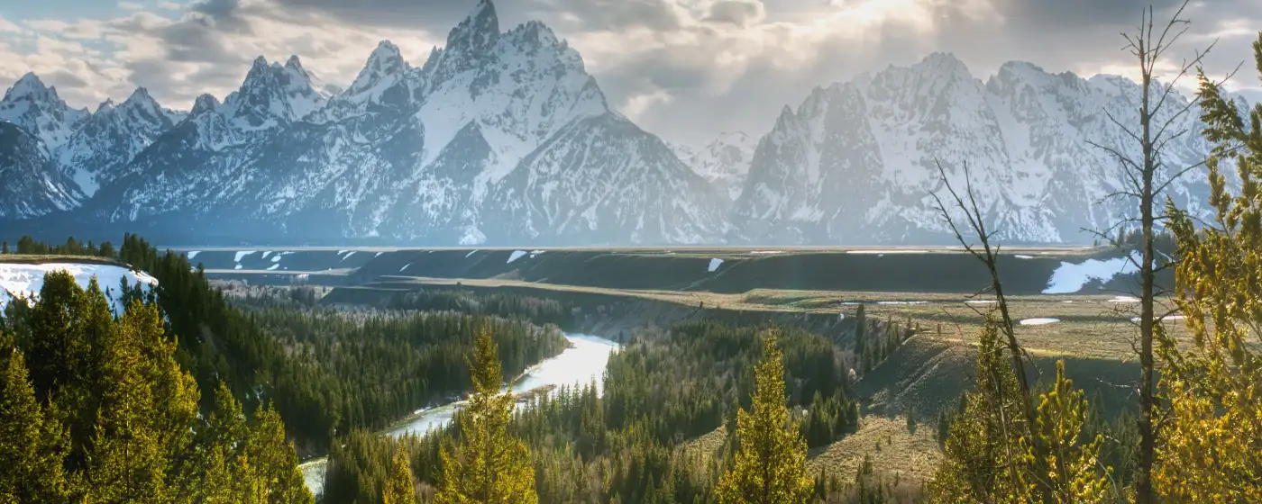
Most people who move to Fruitland from a larger metro expect a quiet bedroom community and not much else. What they don't expect is to walk from their backyard neighborhood to a riverbank where bald eagles perch in the cottonwoods. Two rivers — the Snake and the Payette — form the western and northern edges of the city, and that geography shapes daily life here in ways that go well beyond scenery. This isn't a city that happens to be near water; the water is inside the city limits, and residents with boats or kayaks launch from a public ramp that's a short drive from downtown.
Fruitland is a small city of roughly 7,560 people in Payette County, sitting at the confluence of two of southern Idaho's most significant rivers. The Snake River waterfront and the Payette River corridor give residents fishing for bass, trout, and catfish without leaving city limits, plus calm stretches for water-skiing and paddling. When locals want whitewater, the Main Payette upstream — a BLM-managed corridor offering Class II–III rapids — is a realistic day trip. The park system is modest in size but deliberately positioned near the water, and city planning documents already show greenway concepts that would eventually link downtown, neighborhoods, and both rivers by trail.
The outdoor calendar here follows the agricultural rhythms of the Treasure Valley as much as any recreation schedule. Summer means river days, splash pads at Crestview Park and Fruitland Community Park, and softball leagues at Mesa Park on North Pennsylvania Avenue. Fall pulls families out to AC&D Farms for apple and peach picking — the kind of seasonal tradition that doesn't need a marketing campaign because it's just what people do here. The 1,066-acre Payette River Wildlife Management Area draws hunters and birders through autumn and into winter, and the Weiser River Trail, a rail-to-trail conversion a short drive north, offers year-round hiking, biking, and horseback riding on flat converted rail bed.
Whether you're moving here from Ontario just across the Oregon line, relocating from the Boise area, or researching from out of state, the sections below break down Fruitland's parks by name and address, the river access that sets this city apart, the trail options nearby, and the seasonal rhythms that define outdoor life here through the year.
Fruitland's City Parks: What's Here and Where to Find Them
Four distinct parks serve Fruitland's roughly 7,560 residents, each with a different personality and a different primary use. Knowing which is which saves you time — and tells you a lot about how the city has invested in public space.
Fruitland Community Park — The Downtown Anchor
At 505 SW 3rd Street, Fruitland Community Park is the city's social center. The entrance structure is modeled after the bell tower of the original public school that once occupied this site — a detail that locals mention with quiet pride and newcomers rarely notice until someone points it out.
The amenities are well-suited to families with younger kids: a play area, a splash pad that runs through summer, two gazebos, horseshoe pits, picnic tables, and restrooms. It's the park where you'll see birthday parties on a Saturday afternoon and a pickup horseshoe game on a weeknight.
Mesa Park — The Athletic Hub
Mesa Park, at 1200 N Pennsylvania Avenue, is where competitive and organized recreation happens. Softball fields, tennis courts, a basketball court, a concession stand, and a picnic shelter make this the city's primary athletic complex. It also hosts the Payette County Recreation District, which means youth leagues and adult programs run out of this location throughout the season. Youth sports programming details are covered on the schools and activities page.
Crestview Park — The Westside Neighborhood Park
Crestview Park at 805 SW 8th Street serves the western residential areas with a play area, splash pad, a covered shelter, and restrooms. The more interesting thing about Crestview is what's coming: city plans call for adding a skate park, additional trees and seating, and — most significantly — a trail connection to the Snake River roughly 500 yards to the west.
That planned trail link is the detail to watch. Once built, Crestview becomes a connector between a neighborhood park and actual river access, which changes how residents in that part of the city experience both spaces.
Payette River Sports Complex — Room to Grow
The Payette River Sports Complex at 1400 NW 6th Avenue is the newest and least developed of the four. Adjacent to the city's water treatment plant, it currently offers open recreation space, a playground, a covered shelter, picnic tables, and restrooms. Think of it as the park the city is building toward rather than the park it's arrived at. The location alongside the Payette River corridor gives it long-term potential that the current amenities don't yet reflect.
| Park | Address | Key Amenities | Best For |
|---|---|---|---|
| Fruitland Community Park | 505 SW 3rd St | Splash pad, gazebos, horseshoe pits, play area | Families Walkable |
| Mesa Park | 1200 N Pennsylvania Ave | Softball, tennis, basketball, concession stand | Families Leagues |
| Crestview Park | 805 SW 8th St | Splash pad, covered shelter; trail to Snake River planned | Families Nature |
| Payette River Sports Complex | 1400 NW 6th Ave | Open recreation, playground, shelter, picnic tables | Nature Quiet |
| Rudy Park | Payette River edge | Public boat launch — city's primary river-access ramp | Nature Views |
Rudy Park deserves its own mention: it sits on the edge of the Payette River and holds the city's only public boat ramp, making it the launch point for everything from a calm float to a fishing morning.
River Access: The Snake and Payette at Your Doorstep
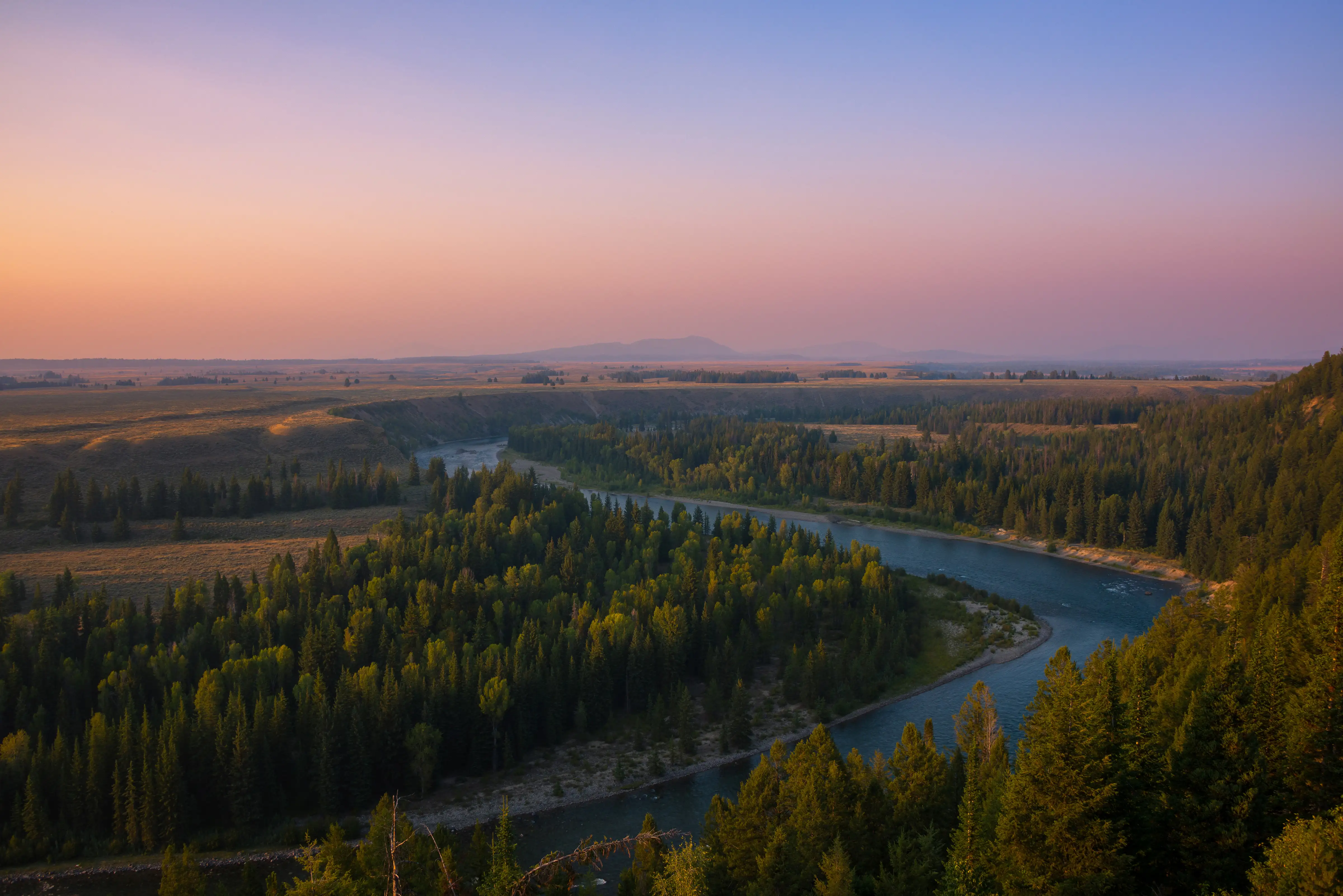
Very few cities Fruitland's size can say that two separate rivers touch their city limits. The Snake River runs along the western edge, and the Payette meets it from the north — both within reach of most neighborhoods without getting on a highway.
What the Snake River Offers
The Snake here is wide, calmer than its canyon sections further east, and well-suited to a range of water activities. Bass, trout, and catfish are the primary catches, and you'll find anglers working the banks on weekday mornings and weekend afternoons year-round. Water-skiing and open boating are realistic on calmer stretches — this is not whitewater territory, which is exactly what makes it accessible for families with ski boats.
Eagles and great blue herons frequent the cottonwood-lined banks near town. If you move to the Rivers Edge neighborhood or anywhere in the western part of Fruitland, river wildlife becomes part of your daily view rather than a destination.
The Payette River — Calm and Wild, Depending on Where You Go
In-city, the Payette is the calmer of the two rivers — good for flatwater kayaking, fishing, and launching from Rudy Park's boat ramp. The character changes significantly once you head upstream.
The Main Payette upstream from Fruitland — managed jointly by the Bureau of Land Management and the U.S. Forest Service — runs Class II–III rapids and is a legitimate day-trip option for paddlers willing to make the drive. It's the kind of whitewater run that Boise residents plan around; from Fruitland, you're actually closer to the put-in. That's a geographic advantage most new residents discover about six months after moving here.
The 1,066-Acre Wildlife Management Area
The Payette River Wildlife Management Area is a 1,066-acre patchwork of river islands and shoreline parcels near Fruitland that functions as public hunting and wildlife-viewing land. Waterfowl hunters use it in fall and winter. Birders come for the eagles, herons, and migratory species that move through the Snake-Payette confluence corridor. It's not a groomed park with a trailhead sign — it's working public land, and the people who use it tend to know exactly where they're going.
The confluence of two rivers in a small city is the kind of outdoor asset that doesn't show up in a park amenities list but shapes why people who move here don't leave.
Trails and Beyond: Getting Out of Town Without Going Far
Fruitland's in-city trail network is still developing — the planned greenway connections between downtown, neighborhoods, and both rivers exist on paper more than on the ground right now. That's honest. But the trail options within a short drive are genuinely strong, and the city's planning trajectory points toward improving on-foot connectivity over the next several years.
The Weiser River Trail
The Weiser River Trail is the most accessible extended trail option for Fruitland residents. A rail-to-trail conversion running north of town, it offers multi-use mileage for hiking, cycling, and horseback riding on a relatively flat converted rail bed that follows the Weiser River. It draws a mix of casual walkers, cyclists doing longer rides, and equestrians — not a narrow single-track experience, but a wide, accessible corridor that works for almost any fitness level or age group.
On a weekend morning, the drive to the trailhead is short enough that it doesn't feel like an expedition. Locals who want a long bike ride without navigating Treasure Valley traffic tend to make this a regular habit.
What's Coming Inside City Limits
Fruitland's city planning documents outline a long-term greenway vision: multi-use paths connecting downtown to the Snake River and Payette River corridors, with neighborhood trail links that would eventually let residents in areas like Crestview or Hidden Meadows reach the water on foot or by bike. The Crestview Park trail connection to the Snake River — roughly 500 yards to the west — is the most near-term piece of that puzzle.
None of this is built yet, and timelines for small-city infrastructure projects can shift. But the intent is clear, and it matters when you're thinking about where Fruitland is headed as an outdoor-recreation community versus where it stands today.
The Honest Gap
If you're moving from a city with a developed urban trail network — the Boise River Greenbelt, for example — Fruitland's current on-foot connectivity will feel limited. The rivers are close, but reaching them on foot from most neighborhoods still means navigating surface streets. That gap is real, and it's worth factoring in if walkable river access is high on your priority list. The planned improvements address it, but planned is not the same as built.
Looking to buy in Fruitland? Estimate your payment.
Enter your numbers to see an estimated monthly mortgage payment.
Estimate only. Excludes HOA fees and mortgage insurance. The interest rate above is a starting point, not a quoted rate — replace it with your own to see real numbers. Insurance is a flat placeholder, not a Fruitland quote.
Seasonal Recreation: How the Outdoor Year Unfolds in Fruitland
Fruitland's outdoor calendar is shaped by three things: the rivers, the agricultural land surrounding the city, and the high-desert climate of the western Treasure Valley. Each season has a distinct character.
Spring and Summer — River Season
By late May, the Snake River is warm enough for water-skiing and tubing, and families with boats are launching from Rudy Park on weekend mornings. Splash pads at Fruitland Community Park and Crestview Park open for the season, and Mesa Park's softball fields fill with league play through June, July, and August. Summer evenings tend to gather people at the park gazebos — it's genuinely cooler near the river than inland, and that matters when July temperatures push past 95 degrees.
For paddlers, late spring is the best window for the Payette River's whitewater runs upstream. Snowmelt from the mountains keeps flows up through May and into June, which is when the upper Payette corridor is at its most rewarding for intermediate kayakers and rafters.
Fall — Harvest and Hunting Season
September and October shift the outdoor focus toward two things: the farm stands and the wildlife management area. AC&D Farms and the seasonal fruit stands near Fruitland put out apples, peaches, plums, and cherries through harvest, and apple-picking in particular draws families from across Payette County. It's a low-key tradition — no hayride tourism apparatus, just a working orchard during its busiest weeks.
The Payette River Wildlife Management Area comes alive in fall. Waterfowl hunting opens the area to a different kind of user, and birders follow migratory species moving through the Snake-Payette confluence. Eagles that summer further north start appearing along the riverbanks with regularity by October.
Winter and Early Spring — Quieter but Not Empty
Fruitland doesn't get the snowfall that would support Nordic skiing or snowshoeing in town — winters are cold but relatively dry compared to northern Idaho. The parks stay accessible through most of winter, and the river corridor offers a genuinely peaceful setting for a cold-morning walk when the cottonwoods are bare and the water level is low. Anglers fish the Snake year-round, though the season slows considerably.
Residents who want mountain recreation in winter are looking at a longer drive — McCall and the Brundage Mountain area are the closest destinations for downhill skiing. The flip side of that distance is that Fruitland's mild winters keep the local outdoor infrastructure usable almost year-round in ways that snowier Idaho cities can't match.
| Season | Primary Activity | Where It Happens | Notes |
|---|---|---|---|
| Spring (Apr–May) | Whitewater paddling, fishing | Payette River upstream; Snake River banks | Best window for upper Payette flows; snowmelt keeps levels high |
| Early Summer (Jun) | Softball leagues, splash pads open | Mesa Park; Fruitland Community Park; Crestview Park | League registration through Payette County Recreation District |
| Peak Summer (Jul–Aug) | Boating, water-skiing, river fishing | Snake River; Rudy Park boat launch | Launch from Rudy Park; evenings cooler near water |
| Early Fall (Sep) | Apple and peach picking | AC&D Farms and seasonal stands near Fruitland | Apples, peaches, plums, cherries in season |
| Fall (Oct–Nov) | Waterfowl hunting, birding | Payette River Wildlife Management Area (1,066 acres) | Eagles and herons along Snake River banks |
| Winter (Dec–Mar) | Cold-weather fishing, walking trails | Snake River corridor; Weiser River Trail | Mild winters keep most parks accessible year-round |
The through-line across every season is the rivers. Whether it's a summer ski run on the Snake, a fall morning at the wildlife management area, or a January walk along the Payette corridor, water defines what outdoor life looks like here in ways that most Treasure Valley cities — including several larger ones — simply don't have.
Local Expert Takeaway: Fruitland's parks system is modest and still maturing, but the river geography makes up for it in ways that a longer amenity list at a landlocked park couldn't. The city's primary play areas — Fruitland Community Park at 505 SW 3rd Street and Crestview Park on SW 8th — handle daily family use, while Mesa Park on Pennsylvania Avenue runs the organized athletics through the Payette County Recreation District. The real outdoor identity of this city sits at Rudy Park's boat ramp on the Payette and along the Snake River waterfront — two rivers inside city limits is an asset most small cities in the Treasure Valley don't have. The planned trail connection from Crestview Park to the Snake is the infrastructure project worth tracking, because once it's built, it changes the walkability equation for the entire western side of town.
Quick Takeaways & FAQs
✅ Two rivers — the Snake and the Payette — both touch Fruitland's city limits, giving residents in-city access to fishing, boating, and wildlife viewing that most similarly sized Idaho cities can't match.
⚠️ Fruitland's on-foot trail network inside city limits is still developing, and residents accustomed to a connected urban greenway will find the current connectivity limited until planned trail links to the rivers are built.
📍 The entrance to Fruitland Community Park at 505 SW 3rd Street is modeled after the bell tower of the city's original school — a small historical detail that tells you this park was built with intention, not just necessity.
Where can I fish in Fruitland, Idaho?
Is there a boat launch in Fruitland?
Does Fruitland have a splash pad for kids?
Are there hiking or biking trails near Fruitland, Idaho?
What outdoor activities are available near Fruitland in the fall?
Moving to Idaho?
Tell us what you need help with and we'll connect you with local resources.
