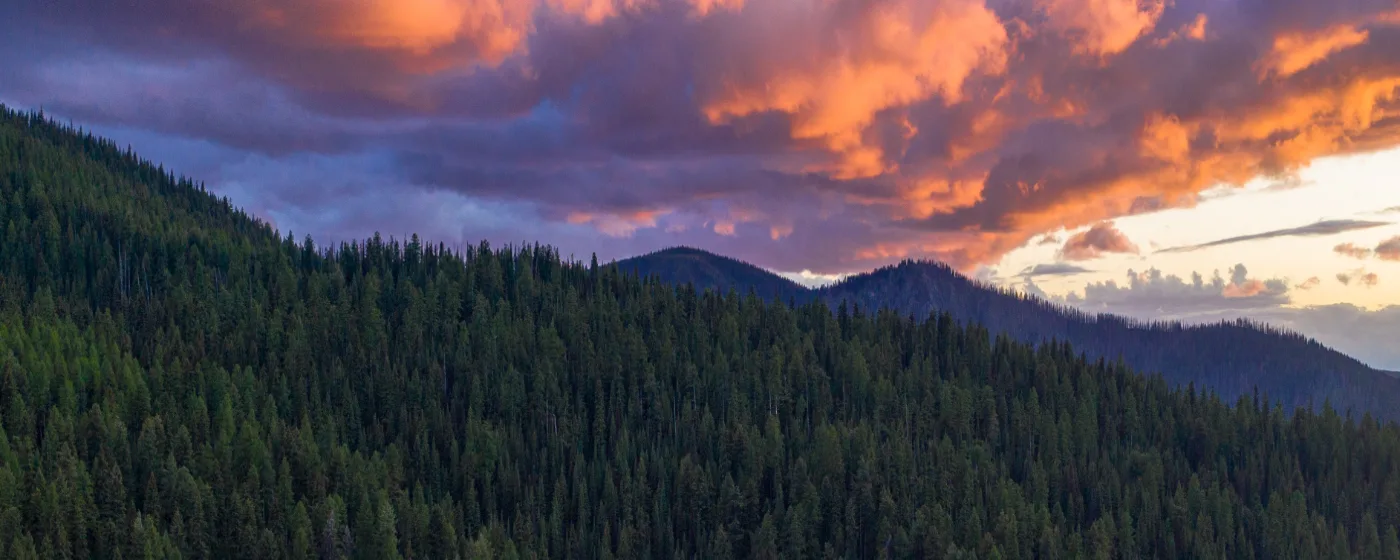
Most towns of 3,200 people don't have a dam taller than the Hoover Dam sitting five miles from their front door. Orofino does. Dworshak Dam, at 717 feet, is the highest straight-axis concrete gravity dam in North America, and the 54-mile reservoir it created is the physical spine of outdoor life here. Add the Clearwater River running through town, roughly 70 percent of Clearwater County classified as public land, and a ranger district office for the Nez Perce-Clearwater National Forests right in the city limits, and you start to understand why people who move to Orofino from larger cities describe the access as almost disorienting — the kind of thing that takes a few months to fully sink in.
The outdoor calendar here runs twelve months. Summer means boating and water-skiing on Dworshak Reservoir, float trips on the Clearwater, and family evenings at Orofino City Park on Wisconsin Street, where a splash pad and riverfront picnic shelters fill up on hot July afternoons. Fall brings steelhead season on the North Fork of the Clearwater — Orofino markets itself as the steelhead capital of the world, a community claim rooted in genuine fishery reputation — and the Lumberjack Days Festival draws the county together for a weekend. Winter closes the lake campgrounds but opens the national forest to snowshoers and cross-country skiers on over 1,400 miles of maintained trails. Spring thaw starts the whole cycle again, often with kokanee salmon running and wildflowers covering the canyon walls.
The scale of what's available here is the surprise. A town this size in most of Idaho would have a city park and maybe a trailhead. Orofino has an $850-acre state park with three distinct units, a free National Park Service site commemorating the Lewis and Clark expedition, and a 72-acre adventure park currently under development on the hillside directly across from downtown — including a disc golf course designed by world-champion course designer John Houck, zip lines, and a whitewater kayak park. Families researching the area can find information on youth sports and activities through the local district on the schools page.
Whether you're drawn by the fishing, the reservoir, the trails, or just the idea of public land in every direction, the sections below break down Orofino's signature parks, water recreation, trail systems, and the seasonal rhythms that shape daily outdoor life here.
Dworshak Dam, Reservoir, and State Park
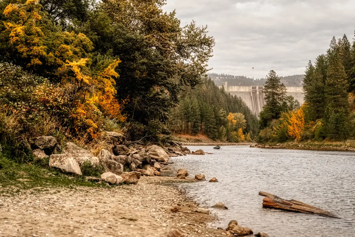
Five miles west of downtown on Highway 7, Dworshak Dam stops conversation every time someone sees it for the first time. At 717 feet, it is the tallest straight-axis concrete gravity dam in North America — a scale that photographs do not prepare you for. The visitor center is open year-round, and guided tours run through summer months, making it a legitimate destination rather than just a backdrop.
The reservoir it created stretches 54 miles northeast through the canyon, and that length is the point. You can spend an entire weekend on Dworshak Reservoir without covering the same water twice. Boating, water-skiing, swimming, and camping are all available, and the fishing is serious: the reservoir is open year-round and holds kokanee salmon and smallmouth bass in numbers that draw anglers from across the Pacific Northwest.
Dworshak State Park runs along the western shore and covers 850 acres across three separate units. Freeman Creek is the most developed, with full camping facilities. Three Meadows Group Camp handles larger gatherings. Big Eddy Lodge and Marina is the closest unit to the dam and the hub for boating access. All three offer the core mix of camping, fishing, hiking, and waterfront access that makes the park worth planning around rather than treating as an afterthought.
Dent Acres: The Reservoir's Northern Anchor
Seventeen miles up the North Fork, Dent Bridge crosses the reservoir at 140 feet above the water — a span of 1,050 feet, completed in 1971 and still one of the more striking pieces of infrastructure in this part of Idaho. Dent Acres park sits nearby and offers 50 RV, camping, and day-use sites with a boat ramp and playground. It's the launch point for anyone exploring the upper reservoir and far enough from the main boat traffic that it feels like a different trip entirely.
| Feature | Detail |
|---|---|
| Dam height | 717 feet (tallest straight-axis dam in North America) |
| Reservoir length | 54 miles |
| State park acreage | 850 acres, 3 units |
| State park units | Freeman Creek, Three Meadows Group Camp, Big Eddy Lodge & Marina |
| Dent Bridge span | 1,050 feet main span, 1,542 feet total length |
| Dent Acres sites | 50 RV/camping/day-use with boat ramp |
| Fishing species | Kokanee salmon, smallmouth bass (year-round) |
| Visitor center | Open year-round; guided tours in summer |
Worth noting: the Dworshak National Fish Hatchery sits adjacent to the dam and holds the distinction of being the largest steelhead trout hatchery in the world. It's open for self-guided visits and gives context to why the Clearwater fishery is what it is.
The Clearwater River and In-Town Recreation
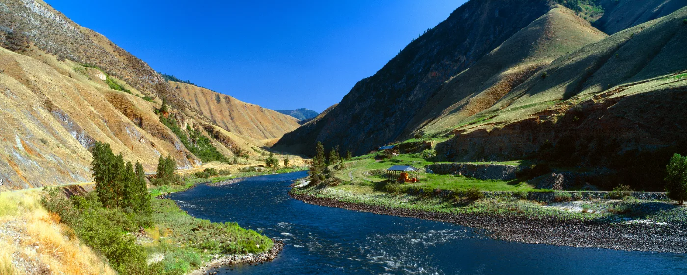
The Clearwater River runs right through Orofino, and the access is immediate — no driving required for most residents. Beaches along US Highways 12 and 7 between Greer and Ahsahka offer entry points for swimming, kayaking, and float trips. On summer weekends, you'll find people on the water in everything from inflatable rafts to proper kayaks, and the pace of the river through this stretch is manageable for families.
The North Fork of the Clearwater is a different proposition. This is where the fly-fishing gets serious. Steelhead runs on the North Fork draw anglers from across the country in fall, and the reputation is earned — the combination of cold, clear water and the proximity of the national fish hatchery supports a fishery that keeps guides and sporting goods businesses in the region alive year-round. If you're moving to Orofino and you fish, this is the detail that matters most.
Orofino City Park: The Community Living Room
At 155 Wisconsin Street, Orofino City Park sits right alongside the Clearwater and functions as the community's central gathering space from Memorial Day through Labor Day. The splash pad is the draw for families with younger kids, and on a 95-degree August afternoon — Orofino runs hot in summer — it stays busy from mid-morning through dinnertime. Basketball courts, volleyball, picnic shelters with cabanas, and restrooms round out the facility.
This is where the 4th of July fireworks happen, where the Rotary BBQ sets up, and where parents end up after outdoor activities wind down on summer evenings. If you have kids under twelve and you're trying to picture what weekday afternoons look like in Orofino, this park is the answer most of the year. After a day on the water, a casual stop along Johnson Avenue fits naturally into the post-recreation routine.
Canoe Camp and the Lewis and Clark Connection
Four miles west of town on US Highway 12, Canoe Camp is managed by the National Park Service as part of Nez Perce National Historical Park. This 4.1-acre site is where the Lewis and Clark Corps of Discovery, working alongside the Nez Perce, carved five dugout canoes in twelve days in the fall of 1805 to continue their journey west. A short interpretive trail, signage, a model dugout canoe, and restrooms make it a genuine stop rather than a roadside marker. Admission is free.
Most people moving to Orofino walk Canoe Camp once in their first month and then stop thinking of it as a tourist attraction. It becomes a place you bring visitors, a short trail for a weekday evening, and a piece of local identity that distinguishes this particular bend in the river from anywhere else in Idaho.
Trails, National Forest, and the Orofino Adventure Park
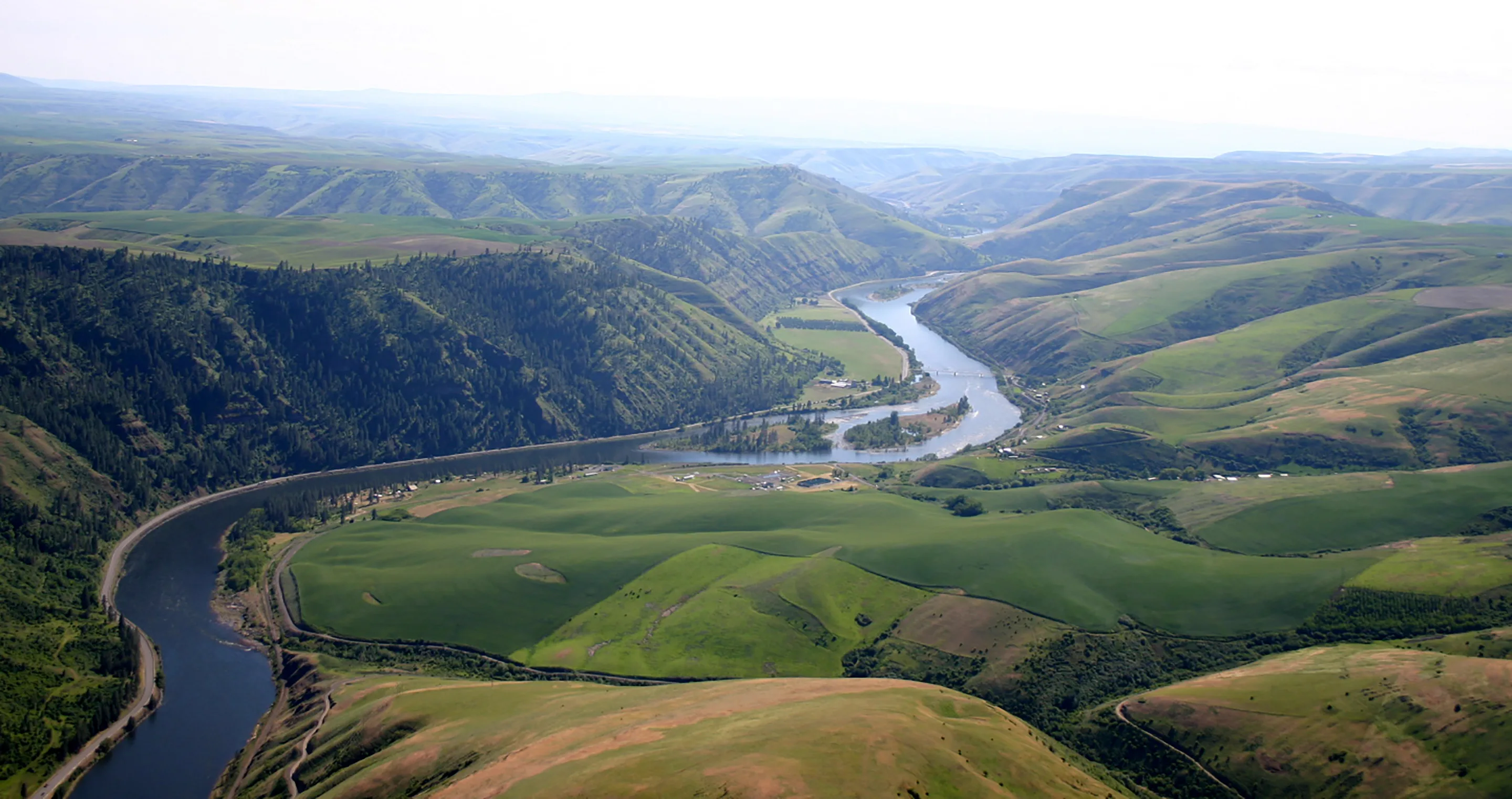
Roughly 70 percent of Clearwater County is public land, and a meaningful portion of it is maintained trail. The Nez Perce-Clearwater National Forests encompass over 1,400 miles of trail accessible to hikers, stock, mountain bikes, motorcycles, and ATVs — a range that matters because it means the trail system accommodates serious backpackers and casual day hikers on the same network. The North Fork Ranger Station and Visitor Center sits in town, which means questions about conditions, permits, and access points can be answered without a long drive.
Winter doesn't shut the forest down. Snowshoeing and cross-country skiing are viable through the colder months on the same trail corridors that serve summer users. The canyon elevation around Orofino is low enough that the town itself rarely buries under deep snow, but drive thirty minutes into the national forest and the conditions shift substantially.
The Orofino Adventure Park: What's Coming
The most significant recreation development in the area is still under construction as of mid-2025: a 72-acre Orofino Adventure Park on the hillside directly across from downtown. The scope is ambitious for a town this size — a disc golf course designed by world-champion course designer John Houck, an aerial challenge course with zip lines, a whitewater kayak park on the Clearwater, and a connected system of hiking and biking trails. If the project delivers on its timeline, it will put a genuine regional draw within walking distance of downtown.
The whitewater kayak park element is particularly notable because it would use the Clearwater River itself as infrastructure, not just a backdrop. Orofino is betting that outdoor recreation is its economic engine, and the Adventure Park is the most concrete expression of that bet. Confirm current construction status before planning a visit, as timelines for projects of this scope do shift.
| Recreation Area | Type | Access Season | Notable Feature |
|---|---|---|---|
| Nez Perce-Clearwater National Forests | Hiking, biking, ATV, stock | Year-round | 1,400+ miles of maintained trail |
| Dworshak State Park (Freeman Creek) | Camping, hiking, swimming | Seasonal (spring–fall) | Full campground with water access |
| Dworshak State Park (Big Eddy) | Boating, fishing, camping | Seasonal | Lodge and marina near dam |
| Dent Acres | Camping, boating, day use | Seasonal | 50 sites, upper reservoir access |
| Canoe Camp | Interpretive trail, history | Year-round | Free NPS site; Lewis & Clark history |
| Orofino City Park | Family recreation | Year-round (splash pad seasonal) | Splash pad, river access, courts |
| Orofino Adventure Park | Disc golf, zip lines, kayak park | Under development (2025) | 72 acres; world-champion designed disc golf |
The ranger district office in Orofino is the practical starting point for planning any backcountry access — staff there know current trail conditions and can point you toward routes that match your ability level and the season.
Looking to buy in Orofino? Estimate your payment.
Enter your numbers to see an estimated monthly mortgage payment.
Estimate only. Excludes HOA fees and mortgage insurance. The interest rate above is a starting point, not a quoted rate — replace it with your own to see real numbers. Insurance is a flat placeholder, not a Orofino quote.
Seasonal Recreation Calendar and What Locals Know
People who have lived in Orofino for a few years develop a rhythm that outsiders miss entirely. The reservoir hits peak water levels in late spring and early summer, which is when the boat launches at Big Eddy and Dent Acres get competitive on weekend mornings. If you're launching by 7 a.m. you'll have your pick of the water. Show up at 10 on a Saturday in July and you're waiting in line.
Fall is the season most locals consider the best-kept secret. Steelhead run on the North Fork from late September through November, the canyon turns color, and the crowds that filled the reservoir through summer disappear almost overnight. The Lumberjack Days Festival — a community staple each fall — draws a regional crowd for a weekend and marks the unofficial end of high-season recreation before the quieter winter months settle in.
Summer Heat and Where People Actually Go
Orofino sits in a river canyon at low elevation, and summers are genuinely hot — regularly pushing into the mid-90s and occasionally past 100°F. That heat is the reason Orofino City Park's splash pad stays packed, and it's the reason the reservoir is not just recreational but functional for residents who don't have pools. First-time buyers sometimes underestimate this. A house with shade trees and proximity to water access matters more here than in parts of Idaho where summer highs run ten degrees cooler.
What surprises most people after six months in Orofino is how the public land changes how they spend time. The instinct when you first arrive is to drive to the reservoir or a trailhead as a planned outing. Within a season, most residents are doing it the way locals have for decades — spontaneously, on a Tuesday, because the river is ten minutes away and the evening light is good. That shift is the thing nobody warned them about, and it's the detail that tends to keep people here longer than they originally planned.
Why Some People Leave
Honest answer: the winter quiet is real. From roughly December through February, the reservoir campgrounds are closed, daylight is short, and the town's small commercial strip offers limited variety. People who move from larger cities sometimes find that the recreation calendar they loved from April through November doesn't fully compensate for a January with few options. If indoor amenities, restaurant variety, and cultural programming matter to you, Lewiston — about 50 miles southwest — becomes your practical social hub for several months of the year, and the drive adds up.
The Clearwater County Fair each summer and the 4th of July fireworks at City Park are the anchors of a community events calendar that leans heavily on outdoor and seasonal programming. That's not a criticism — it's what the community is — but it is worth understanding before you move here expecting year-round event density.
Local Expert Takeaway: Orofino's outdoor access is not a feature — it's the whole premise. A 54-mile reservoir five miles from downtown, a river running through town with free public beach access, 1,400-plus miles of national forest trail, and a free National Park Service site on US 12 would be anchor attractions in a city ten times this size. The practical upside for residents is genuine spontaneity: a Tuesday evening float on the Clearwater, a Saturday morning launch at Big Eddy before the crowds arrive, or a fall steelhead trip on the North Fork without fighting for parking. The catch is that winter strips the calendar down to the bare essentials, and residents who don't ski or snowshoe often find themselves making a lot of trips to Lewiston by February. Come for the summer and fall; make peace with the winter before you sign anything.
Quick Takeaways & FAQs
✅ Dworshak Reservoir — a 54-mile lake created by the tallest straight-axis dam in North America — sits five miles from downtown and anchors year-round recreation from boating and water-skiing to kokanee salmon fishing.
⚠️ Winters are genuinely quiet: reservoir campgrounds close, the events calendar thins out, and residents who don't ski or snowshoe tend to rely on Lewiston for variety from December through February.
📍 Canoe Camp, four miles west on US Highway 12, is a free National Park Service site where Lewis and Clark carved five dugout canoes with Nez Perce help in 1805 — a short interpretive trail that most new residents discover in their first week and return to for years.
Is Dworshak Reservoir good for swimming, or is it primarily a fishing and boating lake?
What is the Dworshak National Fish Hatchery, and can visitors tour it?
Are the Clearwater National Forest trails near Orofino appropriate for beginner hikers, or are they mostly backcountry routes?
When is the best time of year to visit Dworshak State Park for camping?
What is the Orofino Adventure Park, and when will it open?
Moving to Idaho?
Tell us what you need help with and we'll connect you with local resources.
