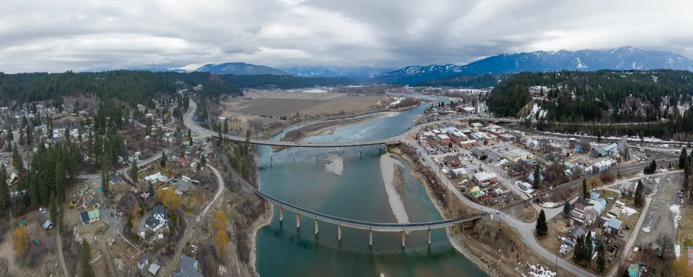
People who move to Bonners Ferry from bigger Idaho cities expecting a trade-off — give up amenities, gain affordability — are usually surprised by month three. The surprise isn't what's missing. It's what's sitting five miles from downtown: 2,774 acres of federally protected wildlife habitat, a river running right through town, and a trail network built by locals who got tired of waiting for someone else to build it. Bonners Ferry sits along U.S. Highway 95 in Boundary County, pressed between the Selkirk Mountains to the west and the Cabinet Mountains to the east, with the Kootenai River threading through the valley floor. That geography isn't scenic backdrop — it's infrastructure for how people here spend their weekends.
Outdoor recreation is the connective tissue of daily life in this community of roughly 2,700 people. The Kootenai National Wildlife Refuge draws birders, hunters, and wildlife photographers from across the Pacific Northwest. The 9B Trails nonprofit has been quietly building a mountain bike and hiking network on private land just outside town, with two separate systems already open year-round. And the Kootenai River itself offers everything from flat-water paddling in the valley to canyon-stretch whitewater upstream toward Montana. Beyond the immediate surroundings, approximately half a million acres of public lands and 350 miles of trails spread into the mountains — meaning a long weekend of backcountry exploration rarely requires driving more than forty minutes.
What the recreation scene here does NOT offer is the groomed, amenity-rich park infrastructure of a larger city. Boundary County Parks and Recreation operates on volunteer power out of its office on 5th Street, and urban-style amenities like lit running paths or maintained sports complexes are limited. Youth sports and organized activities do exist — see the full picture on the schools page — but if your vision of recreation is a Saturday farmer's market followed by a paved riverside promenade, Bonners Ferry will ask you to recalibrate. If your vision is a bald eagle overhead and your kayak in the water by 8 a.m., you're in the right place.
The sections below cover the Kootenai National Wildlife Refuge in detail, the 9B Trails network, the Kootenai River for paddlers and anglers, and the backcountry routes — including Beehive Lakes and Roman Nose Lakes — that locals treat as their own backyard.
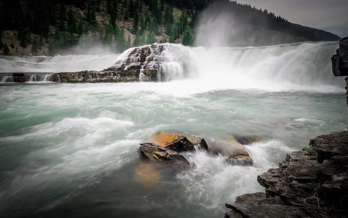
Kootenai National Wildlife Refuge: The Anchor of Outdoor Life Here
Five miles west of downtown on Westside Road, the Kootenai National Wildlife Refuge is the kind of place most cities would build a highway to reach. Here, it's a short drive from the Main Street corridor — so close that some residents bike to the entrance in warmer months.
The refuge covers 2,774 acres at the foot of the Selkirks, with the Kootenai River defining its eastern boundary. It supports over 220 bird species and 22 fish species, and on any given morning you might log moose in the marsh, bald eagles on the cottonwoods, and a northern pintail squadron moving over the wetlands. Elk, deer, bear, and river otter round out what's possible here without a long drive or a backcountry permit.
The Trails
Four named trails cover the refuge's range of terrain. The Chickadee Trail is a short paved loop through riparian habitat near refuge headquarters — accessible for wheelchairs and strollers, and genuinely worth doing even for experienced hikers during spring migration. The Deep Creek Trail runs along an elevated berm above the wetlands, offering eye-level views of ducks and shorebirds without disturbing nesting areas.
For something more physical, the Ole Humpback Trail climbs through ponderosa and lodgepole pine forest — singletrack that gives you the ridge perspective most visitors don't find. A fourth trail leads to Myrtle Falls, a destination that earns its reputation in early summer when snowmelt has the falls running hard.
The Closure You Need to Know About
An ongoing Floodplain Reconnection Project — a significant habitat restoration effort — has temporarily closed the 4.5-mile Auto Tour Route, the east parking lot, and portions of the Deep Creek Trail. This is not a minor inconvenience: the auto tour was historically one of the refuge's signature experiences, especially for families and non-hikers. Before you drive out, check current conditions at fws.gov/refuge/kootenai directly. The project is expected to improve the refuge significantly when complete — the temporary closure is the cost of that improvement.
Hunting is also permitted at the refuge for waterfowl, big game, and upland birds, which surprises some newcomers. The Environmental Education Center and picnic area with restrooms make this a reasonable half-day destination for families, even without the auto tour temporarily operational.
Best for: birders, wildlife photographers, casual hikers, families with younger children, hunters in season.
9B Trails: The Local-Built Network You Won't Find on Tourist Maps
The 9B Trails nonprofit is the kind of organization that only exists because someone got frustrated enough to do something about it. Founded and run by community volunteers, 9B operates two separate non-motorized trail systems on the outskirts of Bonners Ferry — both open year-round, free to use, and genuinely worth seeking out.
Enchanted Forest
The Enchanted Forest system sits on 1,100 acres of private land acquired in 2018, with a primary trailhead at 322 Hoot Owl Road. The nonprofit's build-out plan targets 25-plus miles of trail across the property; the current connected mileage at the Hoot Owl trailhead is growing as trail crews add more routes. What's already there covers mountain biking, hiking, trail running, snowshoeing, and Nordic skiing — the same trail network serving completely different communities across all four seasons.
The terrain leans forested singletrack with enough elevation variation to keep mountain bikers engaged without demanding expert-level technical skills. It's the kind of trail system where a fit beginner and an experienced rider can both leave satisfied, which is rare at this scale in a town this size.
Section 16
The Section 16 system — trailhead at 1099 Kootenai Trail Road in Paradise Valley — is smaller at 11-plus miles planned, but the setting is distinct. The trailhead overlooks Mirror Lake Golf Course with open views of the Kootenai Valley spread out below. For Nordic skiing and snowshoeing in winter, the valley-floor perspective makes Section 16 the more scenic of the two systems.
What surprises people who move here from larger cities is that both systems exist at all. A nonprofit-built trail network of this scale, on secured private land, open to everyone at no cost, would be a selling point for a city ten times Bonners Ferry's size. After six months here, most outdoor-focused residents say 9B Trails is the thing they mention first when someone asks what they didn't expect to find.
| System | Trailhead Address | Planned Miles | Best Season | Primary Uses |
|---|---|---|---|---|
| Enchanted Forest | 322 Hoot Owl Rd | 25+ miles | Year-round | Mountain biking, hiking, trail running, Nordic skiing |
| Section 16 | 1099 Kootenai Trail Rd | 11+ miles | Year-round | Hiking, snowshoeing, Nordic skiing, trail running |
Both systems are managed entirely by volunteers — which means they improve as the community invests in them, and they depend on that same community to stay maintained. Supporting 9B Trails, whether through volunteer trail days or direct donation, is how locals keep access free.
Best for: mountain bikers, trail runners, Nordic skiers, anyone wanting a genuine local trail experience rather than a managed park.
The Kootenai River: Paddling, Fishing, and the Seasonal Rhythms of the Water
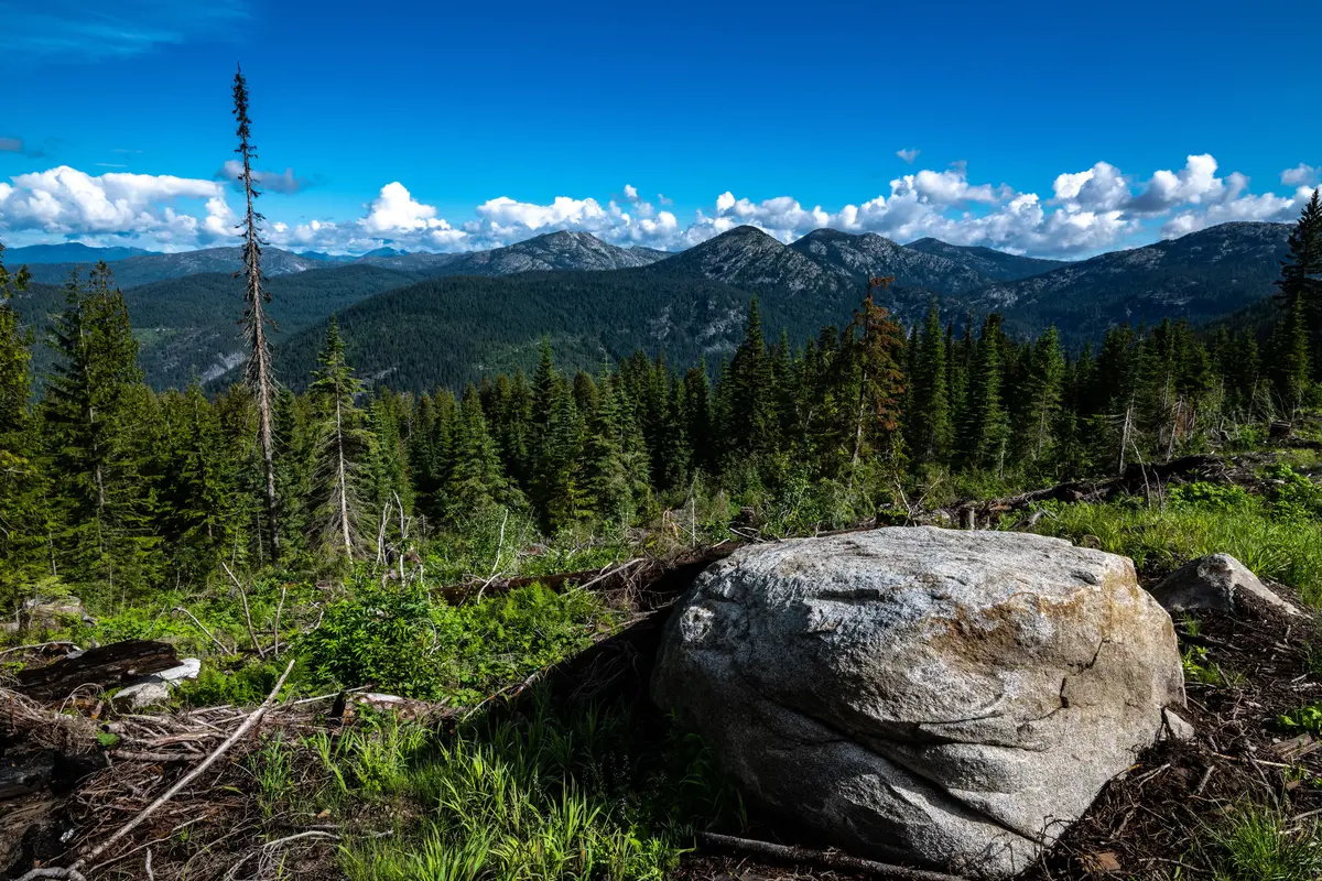
The Kootenai River isn't just scenery from the bridge on U.S. 95 — it's an active recreation corridor that changes character depending on where and when you're on it.
Paddling: Two Very Different Rivers
Idaho's 66 miles of the Kootenai split into two distinct experiences. The 47-mile section running from Porthill south to Bonners Ferry is wide, slow-moving, and genuinely beginner-friendly — the kind of flatwater paddling where you can stop paddling and just watch the marsh edges slide by. Families with children learn to kayak here.
Upstream from Bonners Ferry, the river enters a 19-mile canyon stretch toward the Montana border. Rafters, canoeists, and more experienced kayakers favor this section for its gradient and scenery. One thing every paddler on the Kootenai needs to know: river levels are controlled by Libby Dam in Montana, and they can change quickly. Check current flows before you put in — this is not a technicality, it's a genuine safety consideration.
Fishing: A River Worth Taking Seriously
The Kootenai above Bonners Ferry supports rainbow trout, cutthroat trout, bull trout, brook trout, and mountain whitefish. Those alone would make it a solid fishery. What makes it genuinely notable is the presence of white sturgeon and native Kootenai River burbot — two rare species that few Idaho rivers can claim. Trout fishing quality has improved in recent years through an active partnership between Idaho Fish and Game and the Kootenai Tribe of Idaho, which has a vested interest in the river's long-term health.
Fall is when the river gets the most attention from anglers — the whitefish run draws locals who know the timing, and the cutthroat fishing holds through October. Most serious fishing here happens from a drift boat or a raft rather than from the bank, which is worth knowing before you gear up.
Best for: kayakers and canoeists of all skill levels, trout and whitefish anglers, anyone wanting rare-species fishing without driving to a destination fishery.
Looking to buy in Bonners Ferry? Estimate your payment.
Enter your numbers to see an estimated monthly mortgage payment.
Estimate only. Excludes HOA fees and mortgage insurance. The interest rate above is a starting point, not a quoted rate — replace it with your own to see real numbers. Insurance is a flat placeholder, not a Bonners Ferry quote.
Backcountry Trails, Annual Events, and What Else the Mountains Offer
AllTrails lists 33 trails in the Bonners Ferry area — but that number understates the real scope of what's accessible. The surrounding mountains hold approximately half a million acres of public land and 350 miles of hiking and biking routes, which means Bonners Ferry functions as a base camp more than a destination in its own right.
The Signature Backcountry Routes
Beehive Lakes is the most-reviewed difficult trail in the area — rated 4.7 stars across 680 AllTrails reviews — and the ratings reflect real quality. The climb into the Selkirks rewards with subalpine lake scenery that draws repeat visitors every July and August when the snow has cleared the upper approaches.
Roman Nose Lakes is the go-to for overnight trips, with 579 AllTrails reviews at the same 4.7-star rating. It's the trail that local parents bring their kids on for a first backpacking experience, which tells you something about both its accessibility and its scenery. The camping at the upper lakes is the kind that makes people stop complaining about how far from a city they are.
The practical reality: most of these backcountry routes require a drive from town before you even reach the trailhead. That's not a deterrent for people who move here specifically for this access — it's part of the rhythm. Pack Thursday evening, out the door early Friday morning, camp set by noon. That's a normal weekend for a meaningful portion of Bonners Ferry's outdoor community.
Annual Events and Community Recreation
The Boundary County Fairgrounds, located immediately west of downtown, anchors the local events calendar. The Kootenai River Rodeo is the marquee summer event — the kind of community gathering where you'll meet more of your neighbors in one afternoon than in six months of casual encounters. Motocross events at the fairgrounds draw a different crowd but the same community energy.
Boundary County Parks and Recreation coordinates youth sports and parks programming across the county from its office on 5th Street, run entirely by community volunteers. This is worth understanding before you arrive expecting a city parks department: the infrastructure here is real but lean, built on people who show up rather than on budget line items.
| Recreation Type | Where to Start | Best Season | Difficulty Range |
|---|---|---|---|
| Wildlife viewing | Kootenai NWR, Westside Rd | Spring / Fall migration | Easy |
| Mountain biking | Enchanted Forest, Hoot Owl Rd | May – October | Beginner to intermediate |
| Nordic skiing / snowshoe | Section 16, Kootenai Trail Rd | December – March | Easy to moderate |
| Flatwater paddling | Kootenai River, Bonners Ferry reach | Late spring – early fall | Beginner |
| Canyon kayaking / rafting | Kootenai River canyon, upstream | Summer | Intermediate to advanced |
| Backcountry hiking | Beehive Lakes trailhead | July – September | Difficult |
| Overnight backpacking | Roman Nose Lakes trailhead | July – September | Moderate to difficult |
| Fishing | Kootenai River upstream of town | Year-round (fall peaks) | All levels |
The honest read on Bonners Ferry's recreation scene: the raw assets are exceptional. The managed infrastructure is minimal. That gap is either a feature or a frustration, depending entirely on what you're looking for.
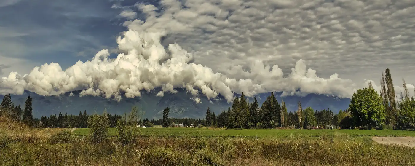
Local Expert Takeaway: The Kootenai National Wildlife Refuge and the 9B Trails network together give Bonners Ferry an outdoor recreation foundation that most towns its size don't come close to matching. The catch — and it's a real one — is that the Floodplain Reconnection Project has temporarily closed the refuge's auto tour route and parts of the Deep Creek Trail, so check fws.gov before driving out. For the 9B systems, park at the Hoot Owl Road trailhead for Enchanted Forest or at Kootenai Trail Road in Paradise Valley for Section 16 — both are free, open year-round, and genuinely well-built. On the river, the flatwater stretch through town is forgiving for beginners; the canyon upstream is not. The backcountry above town — Beehive Lakes and Roman Nose Lakes specifically — is where people who move here for the outdoors eventually spend most of their summer weekends.
Quick Takeaways & FAQs
✅ The Kootenai National Wildlife Refuge — 2,774 acres of Selkirk Mountain habitat just five miles west of downtown — puts world-class bird watching and wildlife photography within a short drive of any address in town.
⚠️ Managed park infrastructure is lean and volunteer-operated; if you're expecting a city parks department with maintained athletic complexes, Bonners Ferry will require an adjustment.
📍 The 9B Trails nonprofit has secured 1,100 acres for the Enchanted Forest system on Hoot Owl Road — a community-built trail network open year-round at no cost, which is genuinely unusual for a town of 2,700 people.
Is the Kootenai National Wildlife Refuge auto tour currently open?
What trails near Bonners Ferry are best for beginners?
Can you kayak or canoe the Kootenai River near Bonners Ferry?
What are the best backcountry hikes near Bonners Ferry?
What kind of fish can you catch in the Kootenai River near Bonners Ferry?
Moving to Idaho?
Tell us what you need help with and we'll connect you with local resources.
