
Most people who move to Signal Mountain from Chattanooga say the same thing after a few weekends: they had no idea how much was out here. The mountain's 8,824 residents live within walking or biking distance of more than 600 acres of parkland — a figure that doesn't count the tens of thousands of acres in Prentice Cooper State Forest pressing against the town's northern edge. This isn't a suburb that happened to put in a nice greenway. Outdoor recreation is woven into the physical structure of the place in a way that actively shapes who moves here and who stays.
The outdoor inventory runs deeper than the headline landmarks. Signal Point anchors the southern terminus of the Justin P. Wilson Cumberland Trail State Park — Tennessee's only linear state park — and connects directly to the Rainbow Lake Wilderness Area, which the town owns outright. Eighteen miles of maintained trails loop from Shackleford Ridge Park through Prentice Cooper State Forest. The town runs four seasonal recreation programs year-round, maintains six lighted tennis courts, and hosts an outdoor summer musical in the amphitheater behind Town Hall. For a community of fewer than 9,000 people, the depth of the program is genuinely unusual.
The trade-off is real: Signal Mountain sits atop a plateau, and almost everything else — grocery runs, school drop-off to Hamilton County schools, the commute that takes about 20 minutes to Chattanooga — involves descending and ascending the mountain. But for families and individuals who want that commute to end at a trailhead rather than a cul-de-sac, the setup is hard to beat. Homes here carry a typical price of $634,620 (Zillow Home Value Index, August 2026); for that, you get a property that most buyers in the flatlands below would consider disproportionately close to real wilderness.
The sections below cover Signal Mountain's signature parks and overlooks, the trail network in detail, water access and seasonal recreation, and the organized sports and community programs that fill out daily life on the mountain.
Signal Point, Edwards Point & the Cumberland Trail Corridor
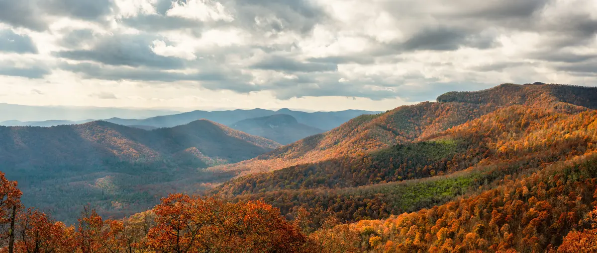
Signal Point is where Signal Mountain's identity comes into sharp focus. The overlook sits inside Chickamauga and Chattanooga National Military Park — Union forces used it during the Civil War to relay messages via a signaling system that gave the mountain its name — and it also serves as the southernmost trailhead of the Justin P. Wilson Cumberland Trail State Park, designated in 1998 and running through 11 counties. Two major affiliations, one stunning perch above the Tennessee River Gorge.
Standing at the Signal Point overlook, you get an unobstructed panorama of the Tennessee River, Moccasin Bend, and the Chattanooga skyline below. It takes about five minutes to reach from the parking area, which means visitors and locals alike use it as a quick reset — a Tuesday-after-work destination as much as a weekend hike.
The Signal Point to Edwards Point Route
The serious hike runs approximately 2.5 miles one way to Edwards Point, roughly 5 miles round-trip. The trail descends from Signal Point into Middle Creek Gorge, passes through the Rainbow Lake Wilderness Area, crosses into Prentice Cooper State Forest, and follows the rim of the plateau with repeated Tennessee River Gorge views. The route is well-defined but involves real elevation change — this is not a flat greenway stroll.
Julia Falls Overlook arrives less than half a mile from the trailhead, making it accessible even for those not doing the full out-and-back. From the overlook, you can see across Middle Creek Gorge to the 95-foot Julia Falls on the far side. There is no safe trail to the falls themselves, so the overlook is the destination. Wet-weather visits deliver the full effect; in dry stretches the falls quiet down considerably. That's the seasonal quirk most first-timers don't expect — plan your visit after rainfall.
Further along the route, Lockhart's Arch and the plateau-rim views toward Edwards Point reward hikers who push through to the end. Edwards Point itself delivers a quieter, less-photographed version of the gorge vista — fewer crowds than Signal Point, more sense of having earned the view.
| Destination | Distance from Signal Point | Difficulty | Key Feature |
|---|---|---|---|
| Julia Falls Overlook | < 0.5 mi one way | Easy–Moderate | Views of 95-ft wet-weather waterfall |
| Lockhart's Arch | ~1.5 mi one way | Moderate | Natural stone arch on plateau rim |
| Edwards Point | ~2.5 mi one way | Moderate | Gorge overlook, quieter than Signal Point |
| Signal Point overlook | Trailhead (parking area) | Easy | River, Moccasin Bend, Chattanooga skyline |
The Cumberland Trail corridor is the spine of outdoor life here, and no other single feature does more to define what it means to live on this mountain.
Rainbow Lake, the Trail Network & Town Wilderness Areas
Rainbow Lake was built in 1916 as part of what was then the Signal Mountain Hotel — now Alexian Village — and it has anchored the mountain's outdoor identity ever since. The town owns the Rainbow Lake Wilderness Area outright, which places a genuine piece of protected backcountry inside municipal limits in a way that almost no comparably-sized Tennessee community can claim.
The Rainbow Lake and Bee Branch Trail Loop
The loop covering Rainbow Lake and Bee Branch Trail runs 2.2 miles with 341 feet of elevation gain, rated moderate. The centerpiece is a 100-foot-long suspension bridge over Middle Creek — the kind of feature that makes this trail genuinely memorable rather than a checkbox hike. It's a popular destination for families with kids old enough for uneven terrain, and on weekend mornings the parking area fills early.
One honest note: the suspension bridge and the lake's scenic character mean this trail sees more foot traffic than anywhere else on the mountain. If solitude is the goal, the Shackleford Ridge Park connections into Prentice Cooper State Forest deliver more of it.
18 Miles of Town Trails and Prentice Cooper Connections
The town maintains 18 miles of trails that loop from Shackleford Ridge Park through Prentice Cooper State Forest and tie back to the town parks system. Prentice Cooper State Forest itself — pressing directly against Signal Mountain's northern boundary — adds substantially more mileage for hiking, trail running, and mountain biking. The two systems operate as a continuum rather than separate destinations.
Trail runners use the mountain's network year-round. The elevation changes that make certain trails challenging for casual hikers are exactly what draws the running community. Signal Mountain has 209 sunny days a year, which means the trail system is genuinely usable through most of fall and winter — a real advantage over lower-elevation parks that turn muddy and stay that way.
| Area | Type | Character | Best For |
|---|---|---|---|
| Rainbow Lake Wilderness Area | Town-owned wilderness | Forested gorge, suspension bridge, lake | Families Nature |
| Shackleford Ridge Park | Town park / trailhead | Ridgeline access, forest loops | Nature Quiet |
| Prentice Cooper State Forest | State forest | Mountain biking, trail running, extended hiking | Nature Views |
| Signal Point / Cumberland Trail | National Military Park / State Park | Gorge rim, overlooks, waterfall views | Views Nature |
| Falling Water Falls | Natural area | Waterfall destination | Nature Families |
For neighborhood-level access to the trail network, proximity to Shackleford Ridge or the Signal Point trailhead varies meaningfully by where on the mountain you land.

Organized Sports, Courts & Community Recreation
The outdoor wilderness gets all the attention from people researching Signal Mountain from the outside. What surprises most newcomers after six months is how active the organized recreation scene is — the town runs four seasonal programs covering a range that most towns twice this size would consider adequate.
Youth and Adult Sports Programs
The Recreation Department operates multiple baseball fields for youth leagues and softball fields covering girls' leagues and adult slow-pitch. Additional youth and adult offerings include basketball, swimming, gymnastics, flag football, lacrosse, and tennis. For families moving here with school-age children, the overlap between the town's recreation programming and Hamilton County Schools athletic activities creates a genuinely deep calendar.
Youth sports here carry a community-building weight that's easy to underestimate before you arrive. The baseball fields behind Town Hall are where a significant share of the social fabric gets built on weekday evenings through spring and summer — parents standing along the fence, kids running the bases, the informal conversations that become the reason people stay for a decade.
Tennis, Pickleball & Courts
Six lighted tennis courts at the Town Hall complex require reservations and also accommodate pickleball. Althaus Park adds additional courts available on a first-come, first-served basis with pickleball options as well. For a town of fewer than 9,000 residents, having two distinct court facilities speaks to how seriously the community takes organized play.
Golf and the Arts
Signal Mountain Golf and Country Club has operated as a private 18-hole course since 1922. The course stretches approximately 6,100 to 6,148 yards at a par of 71, with a driving range, putting green, chipping area, and a clubhouse with dining. It's a membership-based facility — not a public drop-in amenity — but it has been part of the mountain's character for over a century.
The Signal Mountain Playhouse presents two productions each year, including an outdoor summer musical performed in the natural amphitheater behind Town Hall. The outdoor musical is the kind of only-here detail that reflects what the community values: open air, a mountain setting, a shared gathering that doesn't require driving down the mountain to find.
Looking to buy in Signal Mountain? Estimate your payment.
Enter your numbers to see an estimated monthly mortgage payment.
Estimate only. Excludes HOA fees and mortgage insurance. The interest rate above is a starting point, not a quoted rate — replace it with your own to see real numbers. Insurance is a flat placeholder, not a Signal Mountain quote.
Beyond the Monthly Mortgage Payment — What to Factor In
- The property tax rate above — The 0.56% used in the estimate is the median effective rate — tax actually paid as a share of market value — published by Ownwell, 2026. Half of local homes pay more and half pay less: your own bill depends on that property's assessed value and any exemptions it qualifies for, which can differ a lot from its market price. Confirm with the Hamilton County assessor before you budget.
- Total cost of ownership — Your monthly mortgage payment is just the baseline. Depending on the specific city, county, and service district, homeownership costs also include local utility fees, municipal surcharges, and special assessments (such as water, sewer, storm drainage, or local energy taxes) that vary by location.
- Independent due diligence — Because these recurring local costs and municipal fees change depending on the exact property address, buyers must research them independently during their transaction process.
Tax laws, local municipal fees, and utility costs change frequently and individual situations vary. This page is general information, not tax or legal advice — always consult a qualified tax professional, CPA, or local municipal offices for personalized guidance.
Seasonal Recreation & What Living Here Actually Feels Like
Signal Mountain's recreation calendar doesn't have an off-season in any meaningful sense, but it does shift. Spring through fall concentrates the heavy trail use — the Cumberland Trail corridor gets real foot traffic from visitors as much as residents, and Signal Point parking can fill on peak weekend mornings. If you live here and want Signal Point to yourself, a weekday morning in November is the answer nobody outside the community tells you about.
What the 600 Acres Actually Means Day to Day
More than 600 acres of town-managed parks and natural areas across a community of 8,824 people works out to an unusually high ratio of protected land per resident. In practical terms, it means you are rarely more than a few minutes from a trailhead. The network is connected enough that residents run errands and make loops between parks without retracing the same path twice — a quality of trail infrastructure that develops over decades and can't be replicated quickly.
Mountain biking in Prentice Cooper State Forest draws riders from across the Chattanooga area, which means the trails north of town see a mixed local-and-visitor user base on weekends. That's worth knowing before assuming every trail is a quiet neighborhood amenity — some of it is regional destination riding.
The Honest Trade-Off
All of this comes with an elevation tax. Getting to Chattanooga for a concert, a medical appointment, or a dinner reservation means descending the mountain and climbing back up. The practical reality is that recreation here is largely self-contained by design. Residents who want spontaneous access to urban amenities find that constraint more wearing than they expected after the first year.
What you're getting is a town that has genuinely organized itself around outdoor life. The trail connections, the seasonal programs, the town-owned wilderness area, the amphitheater in the park — these are civic decisions made over many decades by a community that wanted the outdoor character preserved. For the buyer who is specifically looking for that, Signal Mountain is not a compromise. See the full cost of living breakdown to understand what that infrastructure costs to live near.
| Recreation Type | Facility / Location | Notes |
|---|---|---|
| Hiking / trail running | Cumberland Trail, Rainbow Lake, Shackleford Ridge, Prentice Cooper | Year-round; peak spring–fall |
| Mountain biking | Prentice Cooper State Forest | Year-round; regional draw on weekends |
| Youth baseball | Town ballfields | Seasonal leagues, multiple age divisions |
| Youth/adult softball | Town softball fields | Girls' youth leagues and adult slow-pitch |
| Tennis / pickleball | Town Hall courts (6 lighted) and Althaus Park | Reservations at Town Hall; first-come at Althaus |
| Golf | Signal Mountain Golf and Country Club (private, est. 1922) | Member access; 18 holes, par 71 |
| Outdoor theatre | Town Hall amphitheater | Summer outdoor musical, Signal Mountain Playhouse |
| Multi-sport youth programs | Town Recreation Department | Four seasonal sessions; basketball, gymnastics, lacrosse, flag football, swimming |
Local Expert Takeaway: Signal Mountain's outdoor infrastructure is the real answer to why people pay a premium to live here. The Signal Point to Edwards Point corridor, the Rainbow Lake Wilderness Area, and 18 miles of town-maintained trails give residents a trailhead-level outdoor life without leaving city limits. The seasonal recreation programs and courts add organized community structure that sustains the appeal through every phase of family life. The trade-off is that the mountain's plateau location means every trip to Chattanooga — about 20 minutes down and back — is a committed round trip. Buyers who accept that constraint in exchange for what's up here almost universally say it was the right call.
Quick Takeaways & FAQs
✅ Signal Mountain maintains over 600 acres of town parks and wilderness areas, including the Rainbow Lake Wilderness Area, giving residents trail access that most communities ten times this size can't match.
⚠️ The plateau location means Signal Point and Rainbow Lake also draw weekend visitors from Chattanooga — popular trailheads get crowded on peak mornings, and Signal Point parking fills early on busy days.
📍 Signal Point serves as the southernmost trailhead of the Justin P. Wilson Cumberland Trail State Park — Tennessee's only linear state park — making it the connective anchor for the mountain's entire outdoor network.
Is the hike from Signal Point to Edwards Point good for beginners?
Are the parks and trails in Signal Mountain open to the public?
Does Signal Mountain have youth sports leagues and recreational programs?
What's the best time of year to hike the Signal Mountain trails?
Is Signal Mountain Golf and Country Club open to non-members?
Moving to Tennessee?
Tell us what you need help with and we'll connect you with local resources.
