
People moving from larger metros often assume a town of 6,019 in the Appalachian foothills will be short on things to do outdoors. Erwin dismantles that assumption fast. The Nolichucky River runs right through the valley floor, the Cherokee National Forest starts where the city ends, and the Appalachian Trail — one of the most walked footpaths on earth — crosses the river within earshot of town. Recreation here is not a weekend amenity; it's a primary reason people choose this address over anything more convenient.
What makes Erwin's outdoor picture different from neighboring mountain towns is the sheer range packed into a small radius. You can swim in a CCC-built mountain pond, raft Class IV whitewater, walk a flat paved greenway beside the river, feed rainbow trout at a working federal hatchery, and hike to a 360-degree mountain bald — all without leaving Unicoi County. The 197 sunny days a year help, though the shoulder seasons bring their own rewards: rhododendron bloom in late spring and fall color on the Unaka slopes are the two moments locals guard jealously.
One honest note before you start planning: Hurricane Helene caused flood damage along portions of the Erwin Linear Trail, and as of 2026 some sections remain temporarily closed while restoration work continues. The river and mountain trails are unaffected, but confirm current conditions on the greenway before you bring a stroller or a bike. Flood recovery is part of living in a river valley, and it's worth understanding before you move here rather than after.
The sections below cover Erwin's signature parks and forest recreation, the Nolichucky River corridor, Appalachian Trail access, and the everyday recreation scene that shapes life for residents year-round.
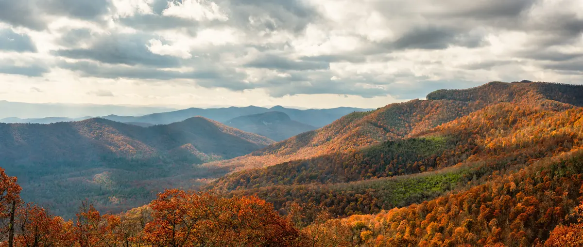
Rock Creek Park and the Cherokee National Forest
Rock Creek Recreation Area is the centerpiece of Erwin's developed outdoor infrastructure, and it earns that status. Built by the Civilian Conservation Corps in the early 1930s off TN-395 (Rock Creek Road) at roughly 2,300 feet elevation, it sits about 3.5 miles from downtown — close enough for a spontaneous afternoon trip, high enough that summer temperatures run noticeably cooler than the valley floor.
The park's signature feature is a creek-fed concrete swimming pond, ringed by tall oaks, maples, hemlocks, and masses of rhododendron. It's the kind of facility that would cost a municipality millions to build today; Erwin has it because a federal work program built it nearly a century ago. Picnic facilities, a bathhouse, and RV and tent sites round out the developed amenities.
Rock Creek Falls Trail
The trail that draws the most visitors is the Rock Creek Falls Trail: 4.3 miles round-trip, 1,092 feet of elevation gain, four water crossings, and a waterfall at the end. Hikers who've done it consistently describe it as one of the most rewarding short hikes in the region. The four creek crossings are the detail newcomers underestimate — in spring runoff or after heavy rain, they require real attention. Waterproof footwear is not optional.
Beyond the falls trail, the park connects to a rugged route into the Unaka Mountain Wilderness for hikers who want backcountry mileage, and an easy bicycle path for riders who don't. Short nature loops fill in the middle ground. The result is a single trailhead that genuinely serves multiple ability levels.
Lamar Alexander Rocky Fork State Park
About 10 miles from downtown Erwin, near the Tennessee–North Carolina state line, Lamar Alexander Rocky Fork State Park covers 2,076 acres with 10 hiking trails. It's the quieter, less-visited counterpart to Rock Creek — the kind of place where a weekday hike feels genuinely remote. For residents, having two distinct public land anchors within a short drive of town is a significant quality-of-life asset that rarely shows up in cost-of-living comparisons. For a fuller look at how Erwin's housing costs compare to that quality of life, see the cost of living page.
The Unaka Mountain Scenic Drive — Forest Service Road #230 — provides a non-hiking route to high-elevation viewpoints including Beauty Spot and the Unaka Mountain Overlook. It's the drive locals recommend to out-of-town guests who don't want to hike, and it works: the mountain balds open to views that require no explanation.
The Nolichucky River: Whitewater, Fishing, and the Gorge
The Nolichucky Gorge cuts between the Bald Mountains and the Unaka Mountains just outside Erwin, and what happens inside that gorge is what puts this river on national whitewater maps. Outfitters describe it as one of the most technical big-water runs in the South and a top-10 whitewater experience in the country. The approximately 8-mile stretch from Poplar, NC to Erwin carries more than two dozen Class II–IV rapids — fed by a natural-flow river with no dams controlling volume.
That last detail matters more than casual paddlers realize. A dam-free river means the Nolichucky runs on precipitation and snowmelt. High water after a wet spring amplifies the gorge; low summer flows can expose rock gardens that require technical reading. Local outfitters stage runs from the Erwin end, and the put-in point near the Chestoa Bridge gives day-trippers a scenic entry without driving into North Carolina.
Beyond the Rapids
Whitewater is the headline, but the Nolichucky is also a legitimate fishing river. Smallmouth bass, rock bass, black bass, catfish, crappie, musky, and trout are all present at various access points. Wildlife along the riverbanks includes deer, kingfishers, and black bears — the bear sightings are common enough that residents mention them casually, and unusual enough that newcomers are still surprised.
Kayaking and paddleboarding are both practiced on calmer stretches. The river's natural character — unaltered by impoundment — means it reads differently in different seasons, which is either an appeal or a complication depending on what you're after.
The Greenway Situation
The Erwin Linear Trail, also known as the Erwin Greenway, is a 4.3-mile paved greenway running parallel to I-26 along North Indian Creek and the Nolichucky River. Under normal conditions it passes through woodlands, natural ponds, and wetlands, making it the primary flat, accessible trail in town for walking, jogging, and biking. As of 2026, portions remain temporarily closed due to Hurricane Helene flood damage. Restoration is ongoing; check current conditions before visiting. When fully restored, it's the trail most Erwin residents use most often — proximity and flat grade matter when you're not trying to summit anything.

The Appalachian Trail and Unicoi County's Gateway Status
In 2009, the Appalachian Trail Conservancy designated Unicoi County an Appalachian Trail Gateway Community — only the fourth community to receive that distinction. It's not a marketing title; it reflects the actual geography. More than 50 miles of AT run through the county, with six trailheads providing parking access. For a town of 6,019, that's an extraordinary amount of long-distance trail within practical reach.
The section that draws the most local day-hiker traffic climbs from the Nolichucky River crossing through dense Unaka Mountain forest — steep switchbacks through rhododendron thickets and over rocky terrain. The Chestoa Bridge entry point along the river is the most accessible starting place for someone new to this stretch, offering a gradual introduction before the trail tilts upward.
Beauty Spot and the Unaka Summit
The AT trailhead off TN-395 connects to Indian Grave Gap and from there to Beauty Spot — a grassy mountain bald that sits just under two miles each way from the gap. The 360-degree views of the Appalachian ridgelines are the payoff, and on a clear day you can see Erwin in the valley below. Hikers who want more can continue another three miles to the summit of Unaka Mountain.
What locals know: Beauty Spot is exposed and windy even in summer. The views that look pastoral in photos feel genuinely alpine when a front moves through. If you're planning to bring kids or first-time hikers, the trailhead-to-Beauty-Spot segment is achievable; the Unaka summit extension is a full day. For information on youth outdoor programs and school-age activities in Erwin, the schools page has the relevant detail.
The AT as a Daily Reality
For residents, the AT's proximity changes the texture of life in a specific way: thru-hikers pass through town each year, typically in spring northbound and fall southbound. They stop for resupply, a meal, a shower. Erwin is a known trail town — which means independent outfitters, hiker-friendly businesses, and a certain kind of foot traffic that larger cities don't see. It's a minor but genuinely distinctive feature of the community.
Looking to buy in Erwin? Estimate your payment.
Enter your numbers to see an estimated monthly mortgage payment.
Estimate only. Excludes HOA fees and mortgage insurance. The interest rate above is a starting point, not a quoted rate — replace it with your own to see real numbers. Insurance is a flat placeholder, not a Erwin quote.
Beyond the Monthly Mortgage Payment — What to Factor In
- The property tax rate above — The 0.65% used in the estimate is the median effective rate — tax actually paid as a share of market value — published by Ownwell, 2026. Half of local homes pay more and half pay less: your own bill depends on that property's assessed value and any exemptions it qualifies for, which can differ a lot from its market price. Confirm with the Unicoi County assessor before you budget.
- Total cost of ownership — Your monthly mortgage payment is just the baseline. Depending on the specific city, county, and service district, homeownership costs also include local utility fees, municipal surcharges, and special assessments (such as water, sewer, storm drainage, or local energy taxes) that vary by location.
- Independent due diligence — Because these recurring local costs and municipal fees change depending on the exact property address, buyers must research them independently during their transaction process.
Tax laws, local municipal fees, and utility costs change frequently and individual situations vary. This page is general information, not tax or legal advice — always consult a qualified tax professional, CPA, or local municipal offices for personalized guidance.
Weekends and Local Favorites: The Fish Hatchery, the Farmers Market, and Everyday Erwin
The Erwin National Fish Hatchery is one of the better free family outings in the area, and it draws visitors from well beyond Unicoi County. Operated by the U.S. Fish & Wildlife Service, it produces approximately 20 million trout eggs annually. The visitor experience goes beyond watching fish: you can view and feed rainbow trout in the raceways, observe spawning procedures during peak season, and walk through pollinator gardens and past active beehives. A half-mile nature trail behind the Unicoi County Heritage Museum includes tree identification tags and wildlife-viewing spots. Birding is a notable activity on site.
It's one of those local amenities that sounds modest in description and lands differently in person. Families with young kids use it repeatedly — it's free, it's educational without announcing itself as such, and it's close. That combination is genuinely hard to find.
Where People Gather
The Erwin Farmers Market is the weekly community anchor for much of the warm season, drawing residents who want local produce and the particular social function that a good farmers market provides — running into neighbors, catching up on town news, buying something you didn't plan to buy. It's not a large market by city standards, but in a town of 6,019 it doesn't need to be.
Steel Rails Coffee House and Solo Cafe LLC are where the coffee conversation happens in Erwin. Clarence's Drive In and Dari Ace carry the local institution weight for quick food. Engle's Roadside Restaurant and Hibachi House Japanese • Hibachi fill out the sit-down end of the local dining scene, alongside Pal's Sudden Service for those who want a drive-through that's genuinely regional. These are the places Erwin residents actually use, and naming them here is more useful than gesturing at a local food scene.
The Seasonal Rhythm
Something newcomers don't anticipate: spring rhododendron bloom along the Rock Creek corridor arrives fast and peaks over a narrow window, typically late May into early June depending on elevation. Miss it by two weeks and the show is over for the year. Locals who've lived here more than one full calendar know to watch the lower-elevation bloom as a leading indicator and plan accordingly. Fall color on the Unaka ridgeline runs October into early November and is less compressed — but the best weekend for foliage and the best weekend for a crowd at Rock Creek are often the same weekend. If solitude matters to you, go on a Tuesday.
For buyers weighing Erwin's outdoor access against its housing costs, the typical home price sits at $225,434 (August 2026), noticeably below what comparable mountain access costs in Johnson City or Jonesborough. The full picture is on the cost of living page.
Local Expert Takeaway: Erwin's outdoor recreation is not a bonus feature — it's the primary reason the town punches above its weight for people who care about being outside. Rock Creek Park, the AT gateway designation, the Nolichucky Gorge, and the National Fish Hatchery are all within a few miles of each other and of town. The Erwin Linear Trail is the one piece still recovering from Hurricane Helene flood damage, so confirm current access before you count on it for a daily commute by bike or stroller. Everything else is ready.
Quick Takeaways & FAQs
✅ Unicoi County holds Appalachian Trail Gateway Community status — one of only a handful of communities ever designated that way — giving Erwin residents access to more than 50 scenic AT miles across six trailheads.
⚠️ The Erwin Linear Trail remains partially closed due to Hurricane Helene flood damage as of 2026; the flat greenway that most residents rely on for walking and biking is not yet fully restored.
📍 The Rock Creek Falls Trail features four creek crossings that demand waterproof footwear and real caution after rain — the detail most first-time visitors underestimate.
Is the Erwin Linear Trail open right now?
How hard is the Rock Creek Falls Trail?
Can beginners raft the Nolichucky Gorge?
Is the Erwin National Fish Hatchery worth visiting with kids?
How close is Erwin to the Appalachian Trail?
Moving to Tennessee?
Tell us what you need help with and we'll connect you with local resources.
