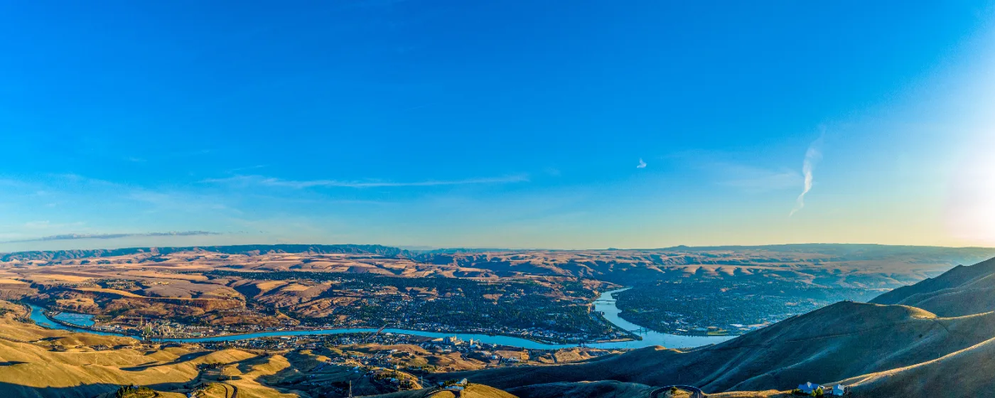
Most people picture Idaho's outdoors as high alpine — ski resorts, mountain lakes, elevation. Lewiston flips that script entirely. Sitting at just 733 feet above sea level, the lowest point in the state, this city of roughly 35,000 sits at the confluence of the Snake and Clearwater rivers, and the outdoor life here is built around water, canyon, and mild weather in a way that almost no other Idaho city can claim. Locals call it the "Banana Belt" without irony — winters here are genuinely mild, and the recreation season runs essentially year-round.
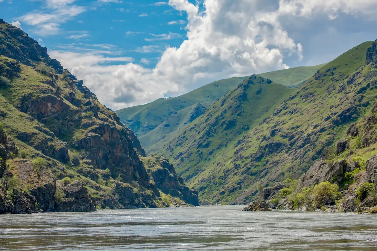
The geography does real work. To the south, the Snake River carves its way into Hells Canyon — North America's deepest river gorge — and Hells Gate State Park puts you at that canyon's doorstep from inside city limits. To the north and east, the Clearwater River bends through the valley, and a continuous paved trail system stitches both rivers together into one of the most accessible urban waterfront corridors in the Pacific Northwest. The Port of Lewiston, the most inland port on the West Coast at 465 miles from the Pacific Ocean, added Idaho's only purpose-built cruise dock in spring 2025, which signals just how seriously this confluence is being developed as a recreation and tourism hub.
The city's Parks and Recreation department manages more than 400 acres across 25 park properties, with 23 developed parks covering roughly 200 acres of that total. That footprint, paired with the mild climate and riverfront access, means families with kids, cyclists, anglers, boaters, and hikers all find something genuinely usable here — not just on weekends, but on Tuesday evenings in November. The trade-off is that Lewiston is not a mountain town; if lift-served skiing or alpine hiking is your primary recreation, you'll be driving at least an hour and a half.
Whether you're weighing a move or already committed and just figuring out where to spend your free time, the sections below cover Lewiston's signature parks, the levee trail system, water recreation on both rivers, and what the seasonal calendar actually looks like for residents.
Hells Gate State Park: Lewiston's Backyard Canyon
Hells Gate State Park is not a destination you drive to on vacation — it sits on the southern edge of Lewiston, accessible from city streets, and yet it puts you at the downstream entrance to the deepest canyon in North America. That proximity is genuinely unusual for a city this size.
The park covers 960 acres and is open year-round. At 733 feet of elevation, the climate inside the park stays mild enough that even January mornings often allow for comfortable hiking — something that would be impossible in most of Idaho's other state parks.
What's Inside the Park
The on-trail options split between paved and unpaved. The paved Lewiston Levee Parkway Trail begins at the park's day-use entrance and stretches approximately 12.3 miles along the Snake and Clearwater rivers before reaching Locomotive Park. For those who want actual canyon terrain, the Snake River loop trail is a moderate 6.2-mile route with 761 feet of elevation gain — enough to feel like a real workout without requiring technical gear or an alpine start.
The Lewis and Clark Discovery Center inside the park adds context to what you're walking through. The expedition camped in this precise stretch of river corridor, and the interpretive facility does a better-than-average job of making that feel like history rather than a museum obligation.
Camping and Marina
The campground runs 51 serviced sites with electric hookups, 29 standard sites, 3 ADA-accessible sites, and 8 cabins — a setup that works for everything from a family tent weekend to a longer stay. The marina features more than 100 slips and a boat ramp, making it the primary launch point for Snake River access and for guided jet boat trips into Hells Canyon itself.
For new residents, the practical takeaway is this: Hells Gate is where locals go on a Saturday morning when they want real nature without a road trip. The canyon views, the river, and the trail system together make it the most versatile single park in Nez Perce County.
Best for: Nature Families Views
The Lewiston Levee Trail System: 19 Miles of Paved Waterfront
The levee trail is what residents use every single day. It is flat, paved, wheelchair-accessible, and follows two rivers simultaneously — which sounds improbable until you're standing at the confluence watching the green Clearwater push into the darker Snake.
How the Numbers Break Down
The Lewiston Levee Parkway Trail — formally part of the Clearwater and Snake River National Recreation Trail — covers approximately 12.3 miles on the Lewiston side. That route starts at the Hells Gate State Park day-use entrance, runs northeast along the Snake River, bends up the Clearwater to Locomotive Park, then crosses Memorial Bridge and continues nearly 4 more miles past Goose Pasture.
The full Clearwater and Snake River Trail system, which includes the Clarkston, Washington shoreline connected by three bridges, reaches 19 miles total. You can ride from Hells Gate to Asotin without leaving the trail network — a point-to-point journey that most riders complete in under two hours at a casual pace.
What Locals Actually Use It For
Morning runners claim the river-bend section near the confluence before 7 a.m. Cyclists doing longer rides often loop across into Clarkston and back, using the bridges as checkpoints. Dog walkers, families with strollers, and wheelchair users are a consistent presence because the surface is genuinely smooth and the grade barely registers.
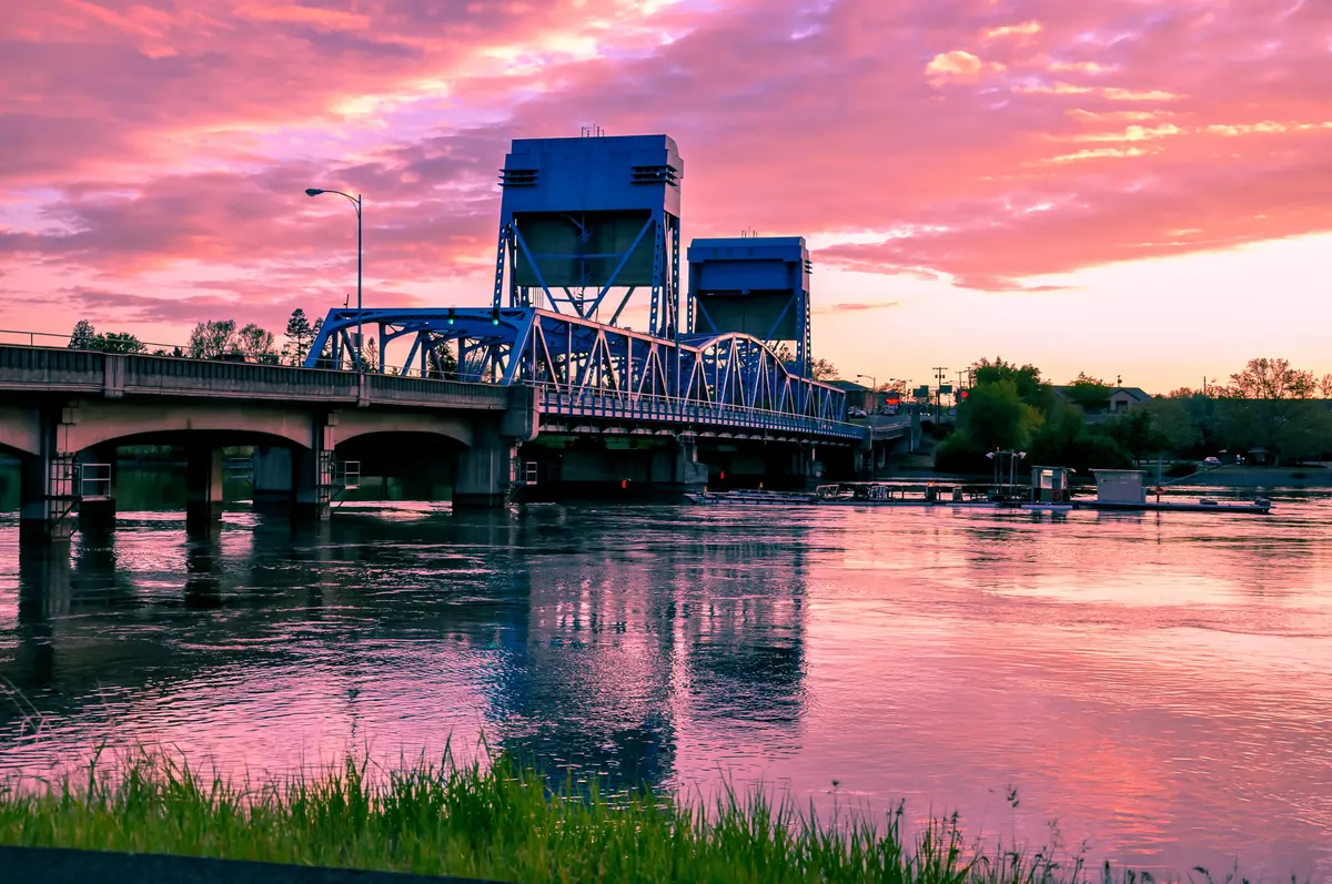
Locomotive Park, midway along the route on the Clearwater side, is a natural stopping point — there's a historic locomotive and caboose to look at, a clear trailhead marker, and a good view of Memorial Bridge before you decide whether to keep going or turn back. It's also where you'll find local families gathering on weekend afternoons, particularly when the weather tips warm in March and April.
The Lewis and Clark Layer
Interpretive plaques positioned along the Lewiston-side trail describe the Lewis and Clark expedition's passage through this corridor on the way to the Pacific coast. If you're moving here from out of state, spending an hour reading these signs on your first week gives you a real grounding in why this specific confluence matters historically — it's not just a pretty river walk.
Best for: Walkable Multi-use Families
Water Recreation on the Snake and Clearwater Rivers
Living in Lewiston means two rivers are always within a few minutes' drive. That's not a brochure line — it's a daily logistical fact that shapes how residents spend free time from April through October.
Boating and Jet Boat Access
The Hells Gate State Park marina with its 100-plus slips is the primary launch point for both recreational boating and commercial jet boat tours into Hells Canyon. Jet boat trips into the canyon are one of the signature local experiences — the canyon walls climb to over a mile high above river level, and the trip covers terrain that's inaccessible any other way. If you move here and have never done it, most long-time locals will tell you to stop waiting and book one.
The Clearwater River draws a different crowd: steelhead and salmon anglers who take the fishery very seriously. The river sees significant returns of wild steelhead, and the fishing culture in Lewiston is genuine and deep-rooted rather than recreational-tourism-adjacent.
The Port's New Riverfront Facility
In spring 2025, the Port of Lewiston and American Cruise Lines opened the Confluence Riverfront facility — Idaho's only purpose-built cruise dock — with a ribbon-cutting that marked a meaningful shift in how the riverfront is being developed. American Cruise Lines now runs its 9-day Columbia and Snake Rivers itinerary through here, with shore excursions that include jet boat canyon tours, helicopter rides, and wine tastings at Lewis-Clark Valley AVA vineyards.
Future phases currently in preliminary design include an open-air amphitheater, a multi-use community facility, a potential RV park, and fishing piers. For residents, that trajectory matters: the riverfront between Locomotive Park and the port is actively being built out as public amenity space, not just industrial infrastructure.
What to Know Before You Arrive
The Snake River current through the canyon section runs faster than it looks from the bank. Experienced paddlers launch from Hells Gate and work upriver sections, but open-water swimming is not casual here — the current and temperature demand respect. Most water recreation in the canyon happens on powered craft. On the Clearwater above the confluence, conditions are calmer and the bank access more forgiving for casual kayakers and stand-up paddleboarders.
Best for: Nature Views Fishing
Looking to buy in Lewiston? Estimate your payment.
Enter your numbers to see an estimated monthly mortgage payment.
Estimate only. Excludes HOA fees and mortgage insurance. The interest rate above is a starting point, not a quoted rate — replace it with your own to see real numbers. Insurance is a flat placeholder, not a Lewiston quote.
The City Park System and Seasonal Recreation Calendar
Lewiston's 25-park system doesn't produce one landmark destination beyond Hells Gate — instead, it distributes usable green space across neighborhoods in a way that means most residents have a park within reasonable walking distance of home.
The At-a-Glance Park Picture
| Feature | Detail |
|---|---|
| Total park properties | 25 parks, 400+ acres total |
| Developed parkland | ~200 acres across 23 parks |
| Signature state park | Hells Gate State Park (960 acres) |
| Primary paved trail | Lewiston Levee Parkway Trail (~12.3 miles) |
| Full trail network (both sides) | Clearwater and Snake River Trail (19 miles total) |
| River access points | Snake River, Clearwater River, Hells Gate marina |
| Elevation / climate type | 733 ft, mild winters — "Idaho's Banana Belt" |
| Campground capacity | 51 electric sites, 29 standard, 3 ADA, 8 cabins |
The neighborhood park network includes sports fields, playgrounds, and open lawn areas spread through the Orchards, Normal Hill, and the West End — find the full neighborhood breakdown at Lewiston's best neighborhoods guide.
How the Seasons Actually Play Out
Spring arrives early by Idaho standards — trail use picks up in late February, and by March the levee trail is busy enough on weekends that you'll want to ride before 9 a.m. to find open stretches. The Lewis-Clark Valley's position in a low-elevation canyon means spring wildflowers and green hillsides while higher-elevation Idaho is still snowbound.
Summer runs hot. The canyon acts as a heat trap in July and August, with temperatures regularly pushing past 100°F. Early mornings on the levee trail and river activities (fishing, boating) are the practical workarounds. Most locals who exercise outdoors shift to 6 a.m. start times from mid-July through August — something nobody warns newcomers about until their first week of triple-digit afternoons.
Fall is broadly considered the best outdoor season here. Temperatures drop into the 60s and 70s through October, the canyon light turns golden, and steelhead fishing on the Clearwater draws anglers from across the region. The levee trail sees some of its highest weekend use in September and October.
Winter is genuinely mild compared to the rest of Idaho. Snow sticks occasionally but rarely lingers more than a few days at this elevation. The levee trail stays passable through most of the season, and Hells Gate remains open — though campsite bookings thin out considerably from November through February.
Youth Sports and Activities
The city park system supports organized youth programming through fields, courts, and recreation facilities maintained by the parks department. For the full picture on youth sports leagues and kids' activities tied to the community, see the Lewiston schools guide.
Best for: Families All ages Nature
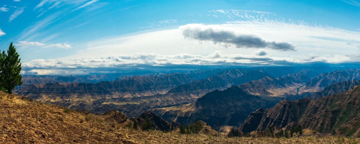
Local Expert Takeaway: Lewiston's outdoor recreation is built around two rivers and a canyon, not mountains — and that distinction is what makes the day-to-day experience genuinely different from most Idaho cities. The Lewiston Levee Parkway Trail gives residents a flat, paved, 12.3-mile waterfront route that's usable eleven months of the year. Hells Gate State Park puts one of North America's most dramatic canyons within city-limit distance. The catch that catches newcomers off guard: July and August afternoons are brutal in the canyon heat, and anyone planning to run or ride the levee in summer needs to be out by 8 a.m. or waiting until after 7 p.m. Plan your outdoor calendar around that reality and Lewiston's recreation access is genuinely hard to beat at this price point.
Quick Takeaways & FAQs
✅ Lewiston's Lewiston Levee Parkway Trail gives residents 12.3 miles of flat, paved, year-round waterfront access starting directly at Hells Gate State Park — one of the most accessible urban trail corridors in the region.
⚠️ Summer afternoons in the river canyon regularly exceed 100°F, which means outdoor recreation from mid-July through August requires an early-morning schedule or evening timing — a reality that surprises most newcomers in their first summer.
📍 The Port of Lewiston opened Idaho's only purpose-built cruise dock — the Confluence Riverfront facility — in spring 2025, with future phases planned including fishing piers and an amphitheater that will further develop the public waterfront.
Is Hells Gate State Park actually inside Lewiston city limits?
How long is the levee trail in Lewiston and is it paved?
What water recreation is available on the Snake and Clearwater rivers?
What is the best time of year for outdoor recreation in Lewiston?
Can you camp at Hells Gate State Park?
Moving to Idaho?
Tell us what you need help with and we'll connect you with local resources.
